All Photos Are Below the Travelogue Text
Click on Any Photo To Open Slide Show
To print the travelogue, right click anywhere on the page. Choose "Print" from your browser dialog box. You can choose Save to PDF in the browser print window.
Share your thoughts.
Email Dave - coxdavid55@hotmail.com
I currently am writing this from Broome, on the north-west coast of Western Australia. I last reported on Darwin and Kakadu upon my arrival in Katherine, located in the middle of the Northern Territory, at the cross-roads to travel north, south or west, with the branch going east cutting off further south. Although I found my first WiFi internet in a couple of weeks in Katherine, all service had too little band-width or restrictions for uploading my photos, until I tried the local McDonalds. It, as advertised, provides free, limitless, good-speed internet connections, and I was able to get the travelogue posted.
Katherine is nice with a compact core full of small restaurants and coffee shops. It sits on the Katherine River which runs from southern Kakadu west to the sea. Just east of Katherine is the Nitmiluk National Park which contains the awesome Katherine Gorge, which actually is a series of 9 deep gorges which channel the river within towering red cliffs. Trails run all through the southern side of the gorges. I hiked one of the short ones.
At the parking area for the boat ramps to Katherine Gorge, the surrounding tall trees simply were filled with Little Red Flying Foxes. Counting the approximate number in each tree, and the approximate number of trees, I estimated over 5,000 bats in this group. They are noisy all day, and some constantly moving to different trees and jostling neighbors. From the ridge line trail about 700 feet above, the parking area seemed to be surrounded by a forest of black dead trees.
I spent 3 days at the lovely Low Level Pass caravan park, situated a few kilometers west of town by the Katherine River where it passes under a historic low level bridge which can only be used during the dry season. At the bridge a number of herons spent their day fishing from the rocks, including a White-necked Heron and a White-faced Heron.
From Katherine I drove west to Timber Creek, the only “town” – a few buildings along the north side of the two lane highway – within the 500 kilometer stretch between Katherine and the border of Western Australia. I stayed at the Timber Creek Hotel campground along a small waterway with Freshwater Crocodiles. I arrived on a day when the camp entertainment was to walk down to the creek at 5pm and watch the owner feed an old almost toothless male croc that lives there. They then throw hunks of meat into the air for a free-wheeling aerial battle between dozens of Black Kites and one Whistling Kite which swoop faster than the eye can follow to grab the morsels. I hiked a short trail in the morning which followed the Timber Creek, and was rewarded with good flocks of Red-winged Parrots but little else. Much of the land had just been burned – this is something they do intentionally every dry season to cull out the dead grasses and undergrowth and promote good growth in the coming wet season – it is not, however, very good for birds immediately after a burn.
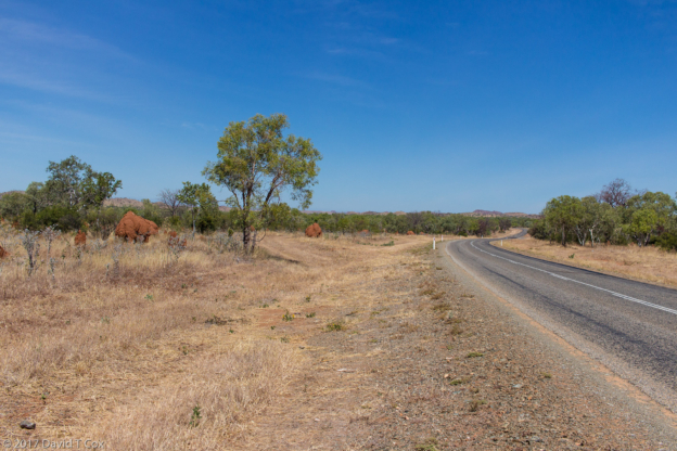
From Timber Creek I drove the 230 km. to leave the Northern Territory and enter Western Australia. How to describe entering Western Australia? First, there only are two paved roads which even connect the western 1/3 of the continent to the rest. I entered on the “Great Northern Highway,” uncertain with what it is to be compared to earn the moniker “Great.” There is no other northern highway. The entire length of the highway consists only of two lanes, with nary a passing lane, and already I have crossed 14 one-lane bridges, marked only with red signs attempting to alert drivers that speed must slow to a crawl to make sure a “road train” is not entering the other side. …
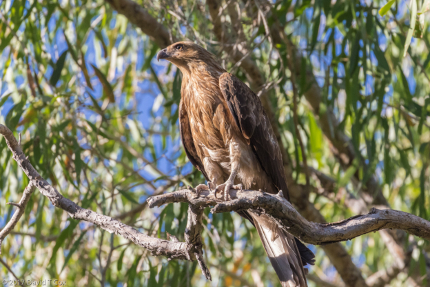
(What is a “road train?” – this is what tractors hauling semi-trailers are called – and with good reason – almost all pull 3 full trailers on the little two-lane highways, and the petrol semis haul 4 full tanker trailers. These really are massive road trains, which barrel down the narrow roads, and incidentally are responsible for the unbelievable overnight slaughter that takes place on the highway each day. In the morning one passes dozens of road-kill marsupials, providing good opportunities for photographing the massive Wedge-tailed Eagles, which patrol the roads at sun-up, along with the Black Kites, Whistling Kites, Little Eagles and Toresian Crows.)
Somewhat concerning is the fact that upon approaching each one-lane bridge the pavement is marked with dozens of 40 foot long, double-tire skid marks from the frantic stops that road-trains must have made when coming from opposite directions. I started this section mentioning that only two paved passages exist into western Australia, so I best mention now the other road, located near the southern coast, portions of which less majestically are called the South-western Highway, Coastal Highway and Eyre Highway.
Also concerning Western Australia: The northern portion, from Kununurra, at the border of the Northern Territory, stretching west over a thousand kilometers to Derby on the coast, comprises the Kimberleys, a famous area of escarpments and gorges, full of rivers, dreadfully hot year-round. The Kimberleys are very popular with Australians for taking multi-week 4-wheel drive journeys (even more people take tour companies which drive large bus like carriers built on high-clearance multi-axle-drive truck frames). The escarpments and gorges are the remnants of giant ocean reefs built during the Devonian Age of the earth, 350 million years ago. The area is famous for its limestone caves, and perhaps the best spot on earth for recovery of remnants of 350 million year old sea life. The area also features some unique plant life, the most iconic of which is the Boab trees. These grow to eventually form gigantic gnarled trunks, which can get to diameters of 4 meters (14 ft) – the trunks often balloon in the middle, and the leaves only emerge after rains. Much of the year the limbs, which rise as crooked jags from the huge trunks, are leafless, but have huge coconut sized seed pods. I have included a photo as I cannot properly describe the trees. They are closely related to the Baobab trees of Madagascar and Malawi.
What else about northern Western Australia? The strictest alcohol laws I have encountered. Purchasing wine or beer has been difficult since Darwin, and has become increasingly problematic as I have progressed. Due to issues with alcohol abuse, particularly among the aboriginals, who may have a genetic intolerance such as exists with some Native Americans, the restrictions have become much harsher in recent times. A national registry system has been implemented, and one’s identification is scanned into a special connected machine with each alcohol purchase. The amount of these purchases is severely limited each day, and the system disallows multiple purchases from different stores. For the cask-wine I buy (to avoid glass bottles), the limitation in the Northern Territory was one 2-liter box per day. In order to stock up I had to go through the process multiple days to get a few liters for the long haul through the outback. Upon entering Western Australia the casked wine simply is prohibited from sale. In Halls Creek the only take-away alcohol which can be purchased is 2.7% beer (that is half the strength of Budweiser which many already consider water). The restrictions have just gotten worse all the way to the coast, including Derby and Broome. I have been forced to survive on the strongest Australian beer I can find – 4.9%. Wine can be purchased only in glass bottles, with restrictions and at astronomical prices. Interestingly, liquor is freely available, though the prices are more than double that of the US.
At the border entering Western Australia was the strictest food quarantine I have seen. The RV in front of me, with an elderly couple, was halted for some 10 minutes, holding up a long line of vehicles forming behind me; the inspector finally emerged with two large sacks completely full of fruit, fresh produce, nuts and honey. Multiple large signs warn of the coming inspection all the way from Katherine, as well as in all guide books, and large signs in all campervan parks also advise re the coming “quarantine” upon entering WA. I had no problem foods to report, as I was well aware of the coming inspection. I do not know how that couple remained so ignorant, but it looked like they lost days-worth of fresh food stuffs.
I stopped for 3 days in the only real town between Katherine and Broome, a distance of about 1,700 kms. The town, just inside Western Australia, is Kununurra. My caravan park was in Hidden Valley just north of town, right on the border of the Mirima National Park, a very small park made up completely of very red sandstone escarpments surrounding small deep valleys. I hiked all the trails in the Park, including a couple climbing the escarpment for nice views. I got to view my first White-quilled Rock Pigeons, and a couple of Variegated Fairy Wrens, as well as the beautiful Yellow-throated Miner.
From Kununurra the drive was all through the hilly Kimberleys to the tiny community of Halls Creek where I found a dusty campervan park – the town is under perpetual water restrictions so none is wasted on green plants. Next door was the lovely Kimberley Hotel with the only real restaurant and pub in town. Here I arranged my tour of the Mimby Caves. The Mimby Caves are within a Devonian escarpment and are located within Aboriginal land. A two hour guided tour takes one through the winding bottoms of the majestic escarpments and into two limestone caves, each with ponds and running water but not much current stalactite formation. The flies are awful (of course, they are pretty much awful everywhere in the north of Australia).
Fitzroy Crossing is a tiny community at the Fitzroy River bridges (both one-lane), where I stayed at the terrific Fitzroy River Lodge campgrounds right on the banks of the river. I spent one morning hiking down river for birds, and enjoyed the Sunday evening buffet with carved roast lamb. I drove up to the Geikie Gorge National Park where I took a boat trip up into the gorge, the walls of which are the Devonian limestone escarpments. The large river has a number of Freshwater Crocodiles and some birdlife. The gorge wall views are spectacular. The parking area and tourist gazebo areas are covered during the wet season each year by up to 20 feet of flood waters.
From Fitzroy I drove the distance to reach the Northwest coast at the small dusty town of Derby, called the entrance to the Kimberleys. Derby sits by a narrow bay with the second or third highest tides in the world, at 11 meters or 36 feet. Because the bay is shallow, filled with silt from the river which enters it, at all times other than the highest of tides, which occur only a couple of times a month, the water’s edge is a few kilometers from the town.
Just a couple of hundred kilometers south and west of Derby sits Broome, on the gorgeous Roebuck Bay. Broome also has very high tides, but is surrounded by mangroves and simply is charming, though rather hot year-round. It also is unbelievably expensive. My first night I tried a Chinese restaurant in Chinatown – the cheapest dish, served a la carte without rice, soup, eggroll or anything else, was $37 (about $30 US). I have stayed at the Roebuck Bay Park right on the tip of the small peninsula which juts south into the Bay, and located right on the beach. The first evening, after dark, I had a Tawny Frogmouth (large tropical type of nightjar) landed on a post just feet from my van. With only my powerful flashlight and huge good luck I was able to get my first photo of this night bird.
I spent two mornings with a local bird guide, George Swann, driving the first day out to clay pans (permanent clay water pans) for various shore birds, including the Oriental Pratincole, the Red-headed Plover and the relatively rare Yellow Chat. The next day we slogged through mangroves (my shoes were caked with inches of white clay, with splatters up my pants and on my cameras) and swarms of sand flies for the various uncommon mangrove species, including the Mangrove Golden Whistler, the White-breasted Whistler and the Broad-billed Flycatcher. I also got some photos of a White-bellied Sea Eagle drying its wings, and a Brown Goshawk.
The trip has gone smoothly so far, but the heat has been bothersome here in the north. From Broome I will start driving south, zigzagging between the coast and inland as I aim for arrival around Perth in under 3 weeks. Later. Dave
-
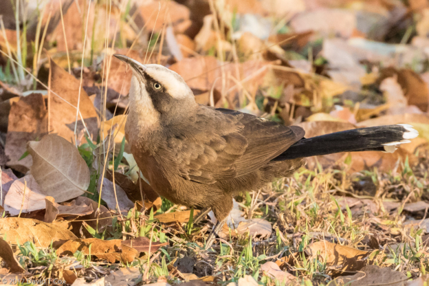
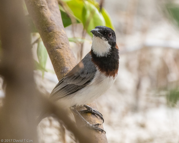
- Grey-crowned Babbler, Katherine River at Low Level Park, NT, Australia
-
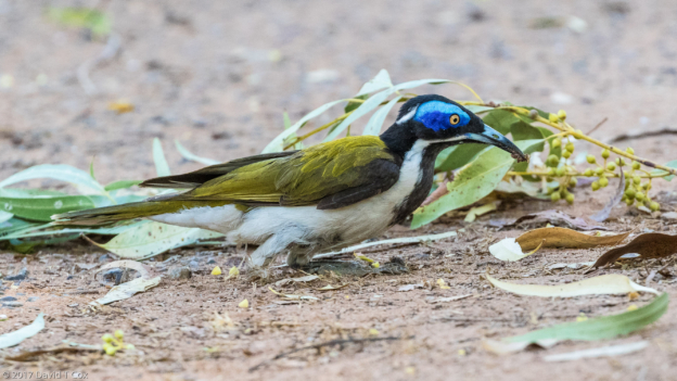
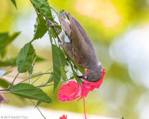
- Blue-faced Honeyeater, Holiday Park, Katherine, NT, Australia
-
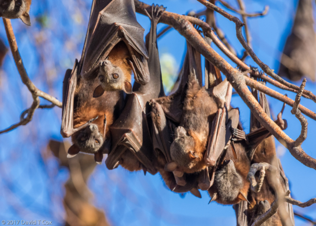
- Little-red Flying Fox, Katherine Gorge, NT, Australia
-
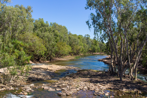
- Katherine River at Low Level Park, NT, Australia
-
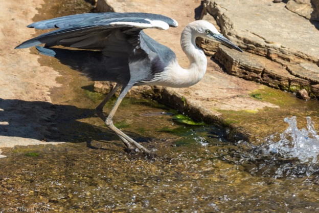
- White-necked Heron, Katherine River at Low Level Park, NT, Australia
-
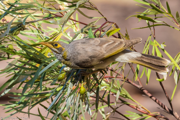
- White-gaped Honeyeater, Timber Creek Park, NT, Australia
-
- Whistling Kite, Timber Crk Campervan Park, NT, Australia
-
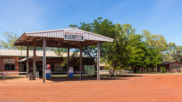
- Victoria River Roadhouse, NT, Australia
-
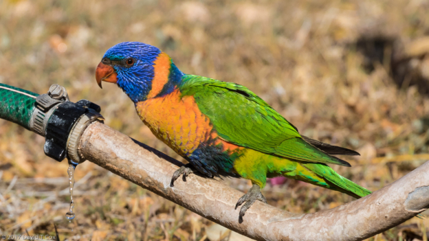
- Red Collared Lorikeet, Timber Crk Campervan Park, NT, Australia
-
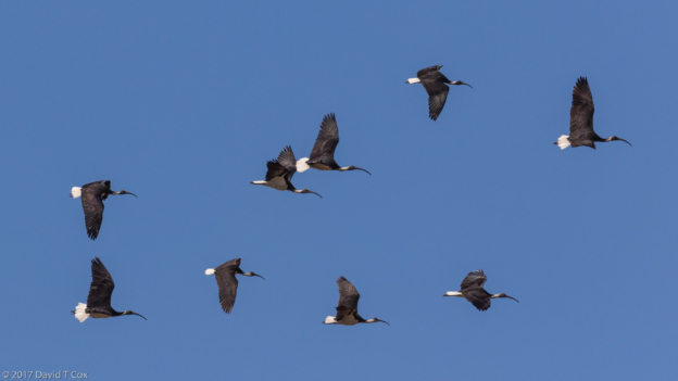
- Straw-necked Ibis, along Hwy west of Timber Crk., NT, Australia
-
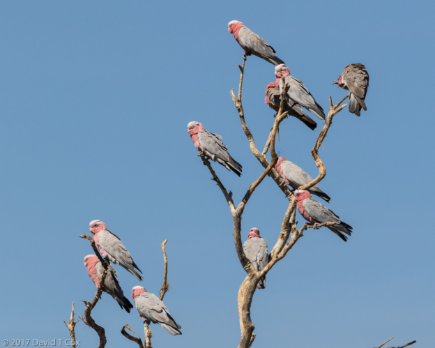
- Galah, along Hwy west of Timber Crk., NT, Australia
-
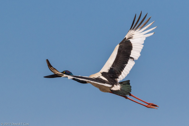
- Black-necked Stork, along Hwy west of Timber Crk., NT, Australia
-
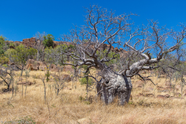
- Boab Tree along Hwy west of Timber Crk., Kimberlies in NT, Australia
-
- Yellow-throated Miner, Mirima NP, Kunurura, WA., Australia
-
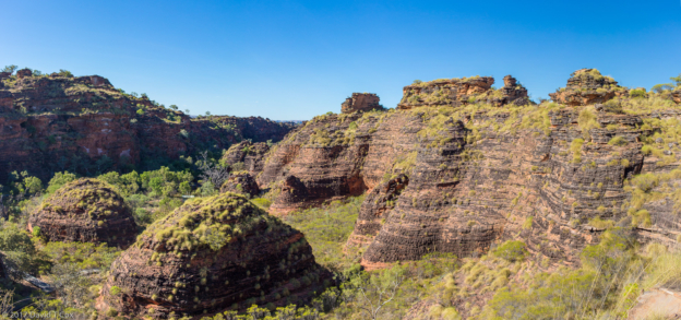
- mirima NP pano 2, Kunurura, WA., Australia
-
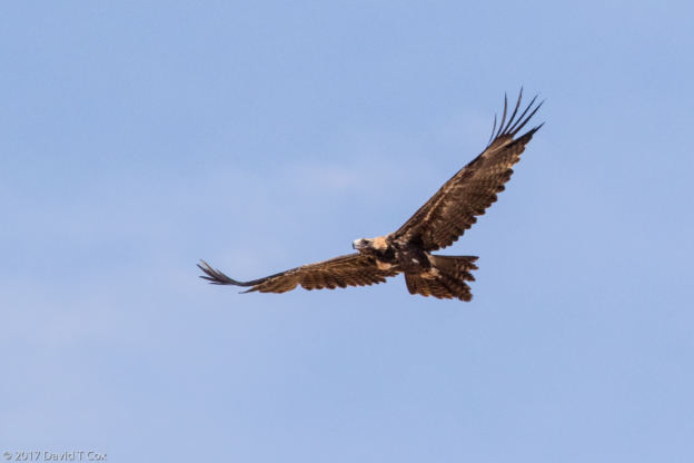
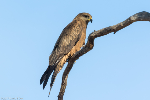
- Wedge-tailed Eagle, Hwy between Kununurra and Hall Creek, WA, Australia
-
- Hwy between Kununurra and Hall Creek, WA, Australia
-
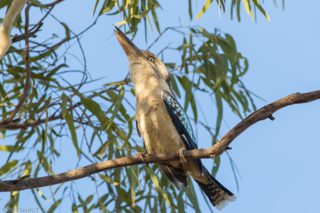
- Blue-winged Cookaburra, Halls Creek Park, WA, Australia
-
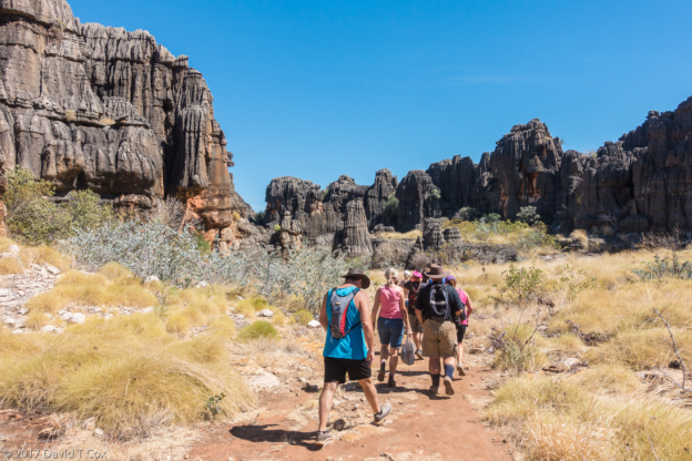
- Mimby Cave Devonian Reef, between Halls Creek and Fitzroy Crossing, WA, Australia
-
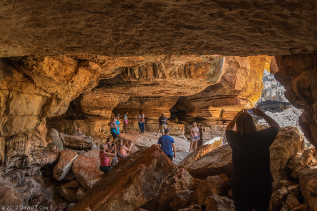
- Mimby Cave Devonian Reef, between Halls Creek and Fitzroy Crossing, WA, Australia
-
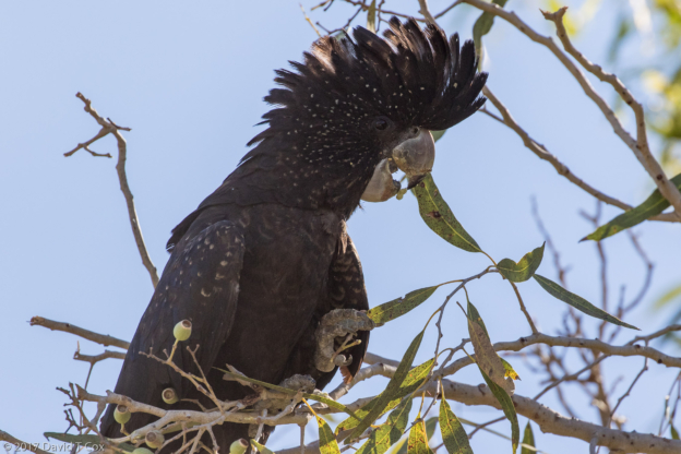
- Red-tail Black-Cockatoo, Fitzroy River Pk, Fitzroy Crossing, WA, Australia
-
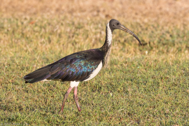
- Straw-necked Ibis, Fitzroy River Pk, Fitzroy Crossing, WA, Australia
-
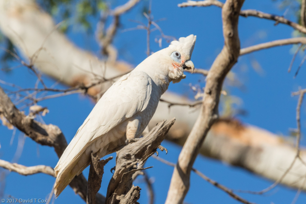
- Little Corella, Fitzroy River, Fitzroy Crossing, WA, Australia
-
- Black Kite, Fitzroy River, Fitzroy Crossing, WA, Australia
-
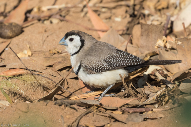
- Double-barred Finch, Fitzroy River, Fitzroy Crossing, WA, Australia
-
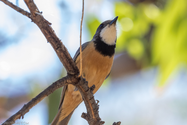
- Rufous Whistler, Fitzroy River, Fitzroy Crossing, WA, Australia
-
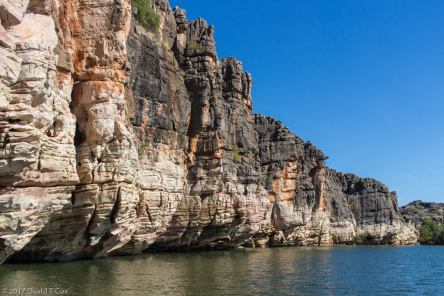
- Danggu Geikie Gorge, Fitzroy River, WA, Australia
-
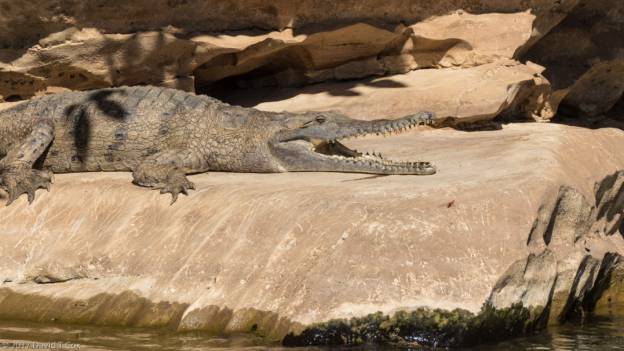
- Freshwater Crocodile, Danggu Geikie Gorge, Fitzroy River, WA, Australia
-
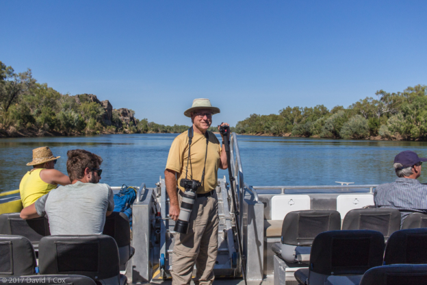
- David on boat on Fitzroy River, Danggu Geikie Gorge,, WA, Australia
-
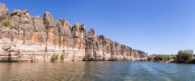
- Danggu Geikie Gorge pano 4, Fitzroy River, WA, Australia
-
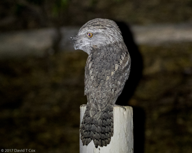
- Tawny Frogmouth, Roebuck Bay Pk., WA, Australia
-
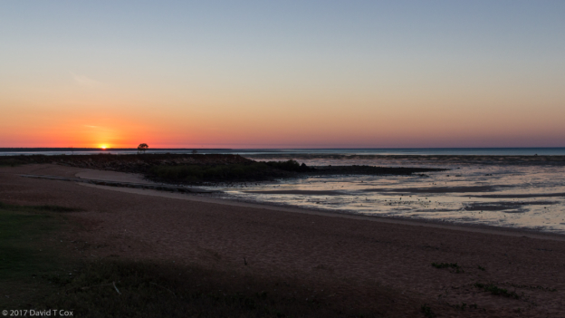
- sunrise at Roebuck Bay Pk, Broome, WA, Australia
-
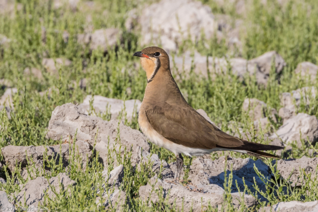
- Oriental Pratincole, Duck Lake Clay Pan, Broome w George Swann, WA, Australia
-
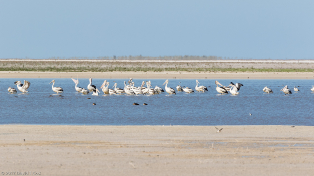
- Australian Pelican, Kidney Bean Clay Pan, Broome w George Swann, WA, Australia
-
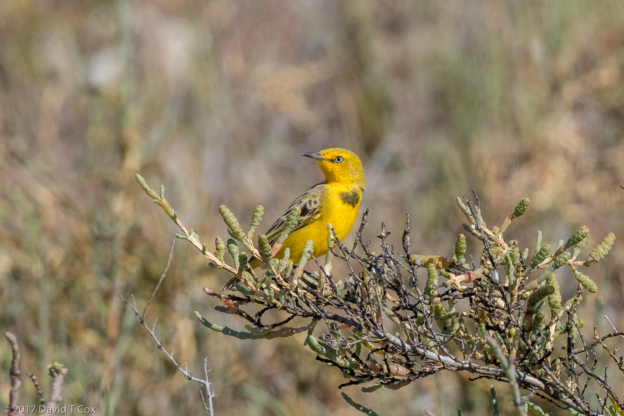
- Yellow Chat, Kidney Bean Clay Pan, Broome w George Swann, WA, Australia
-
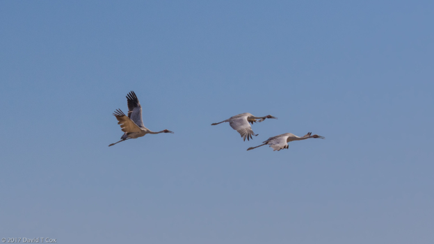
- Brolga, Kidney Bean Clay Pan, Broome w George Swann, WA, Australia
-
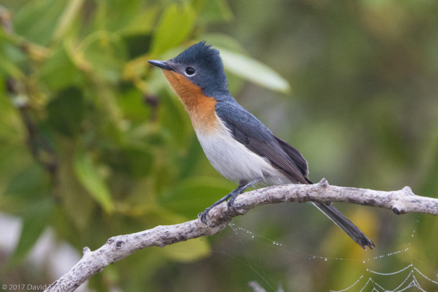
- Broad-billed Flycatcher male, with guide George Swann, mangroves east of Broome, WA, Australia
-
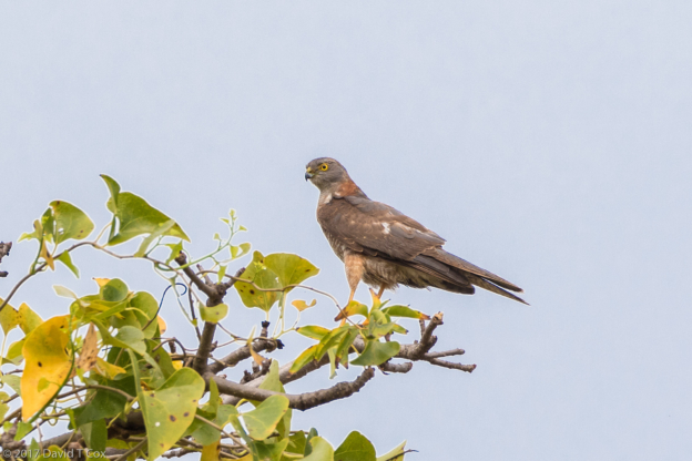
- Brown Goshawk, with guide George Swann, mangroves east of Broome, WA, Australia
-
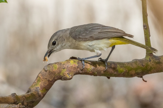
- Mangrove Golden Whistler female with insect, with guide George Swann, mangroves east of Broome, WA, Australia
-
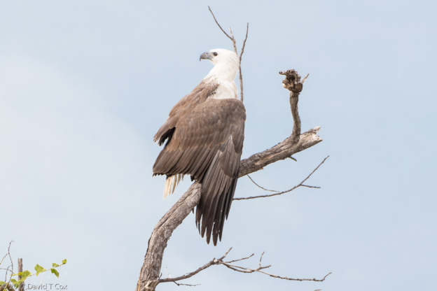
- White-bellied Sea-Eagle, with guide George Swann, mangroves east of Broome, WA, Australia
-
- White-breasted Whistler male, with guide George Swann, mangroves east of Broome, WA, Australia
To print the travelogue, right click anywhere on the page. Choose "Print" from your browser dialog box. You can choose Save to PDF in the browser print window.
Share your thoughts.
Email Dave - coxdavid55@hotmail.com