All Photos Are Below the Travelogue Text
Click on Any Photo To Open Slide Show
To print the travelogue, right click anywhere on the page. Choose "Print" from your browser dialog box. You can choose Save to PDF in the browser print window.
Share your thoughts.
Email Dave - coxdavid55@hotmail.com
I last reported from Broome where, for the second time, I had to go to a McDonalds in order to find internet with broad enough band-width to upload my photos. Internet just is not generally available at the caravan parks or restaurants outside the southeast coast, and when available, dreadfully slow or limited to a couple of MBs upload data.
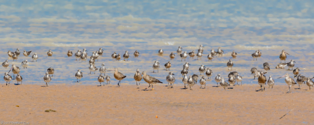
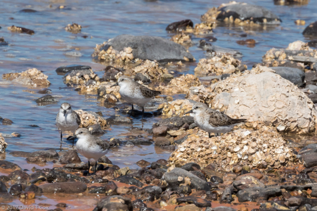
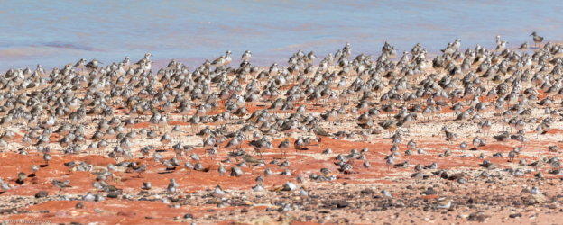
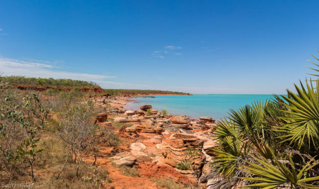
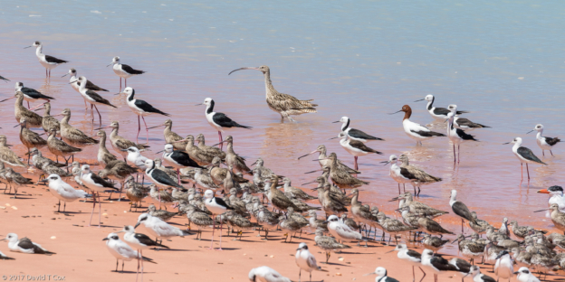
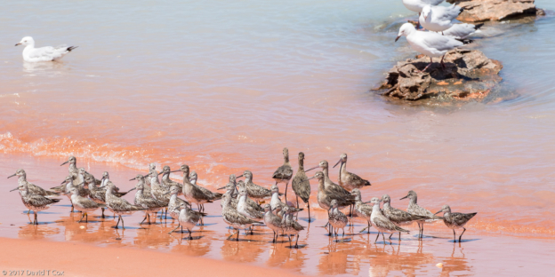
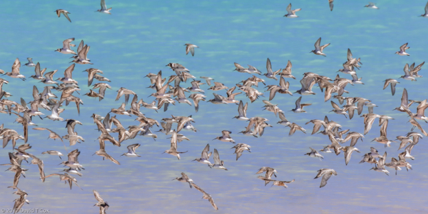
I went the next couple of days to the eastern shore of Roebuck Bay outside Broome for shorebirds. There are an almost unbelievable number of shorebirds with a huge variety of species. Photos of mixed flocks on the shore sometimes reveal 8 or 9 species packed together. I would not have been able to pick out many of the species without the help of guide George Swann.
From Broome the drive was southwest across the 600 kms of dry dusty plains to the industrial-mining town of Port Hedland. Halfway is the Sandfire Roadhouse, the first available gas in 300 kms, where they had dozens of Peafowl, the males all in breeding plumage and calling. In the morning a very large red hen (chicken) kept jumping in different campervans, going into hidden spots, trying to lay an egg – we all had to keep an eye out for it constantly.
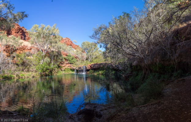
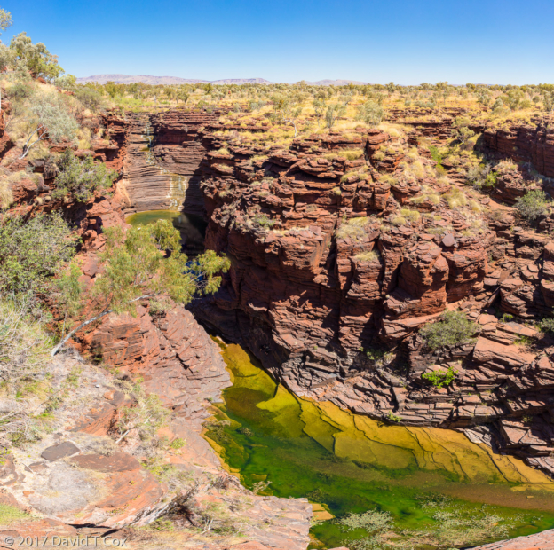
Port Hedland is the largest town in the Pilbarras, the large dry hilly area of northwestern Australia now covered with various large mining operations. Much of the iron acquired by China is mined and shipped as ore from this area. Port Hedland itself is practically all industrial and port, with a huge mountain of white salt lying just of the highway. I spent over two days driving south from Port Hedland through the central Pilbarras, and through the Karijini National Park, where red limestone gorges border the number of small rivers which cut through the area, producing numbers of small waterfalls and beautiful clear water pools for those who hike into the canyons. I spent one night in the delightful mining town of Tom Price, just outside the eastern end of the park, where I ate a huge buffet dinner in the mining worker’s cafeteria.
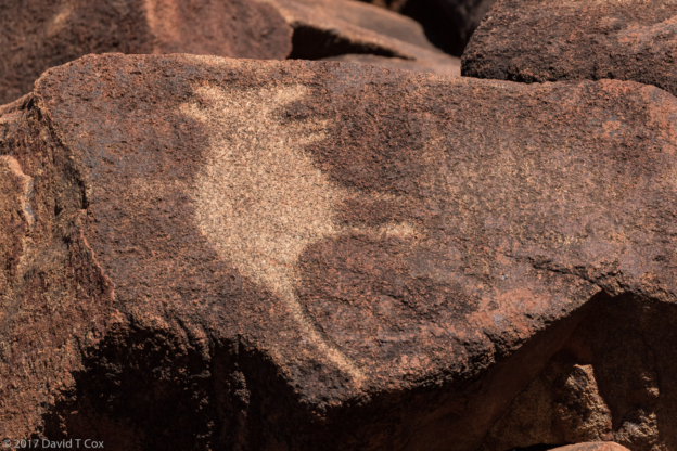
From Tom Price I back-tracked north to the coast at Dampier on the Burrup Peninsula where the tumbled giant red boulders, which cover the peninsula and offshore archipelago islands, form the canvas for the largest grouping of petroglyphs on earth – estimates put the number of petroglyphs here at between 500,000 and 1 million. The ages are unknown, but some work puts the oldest at 22,000 years, although I am skeptical of the geologic methods employed for such estimates. The etchings into the rock are generally deep, and many represent figures of animals, including apparently extincted species. Most of the petroglyphs are crude in comparison to many of those in the US southwest, such as those of the Basketmakers (Anasazi ancestors) and Fremont.
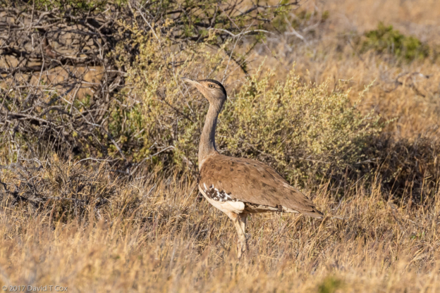
I left the Pilbarras driving further southwest to Exmouth on the peninsula surrounded by the Ningaloo Reef, a marine park. The land portion on the west side is a low ancient reef ridge of mountains forming the Cape Range National Park – the sea for a couple hundred kilometers comprises the Ningaloo Reef Marine Park – all now a World Heritage Site protecting a number of endangered land and sea creatures. In the Cape Range Park I finally obtained an opportunity for decent photos of the very elusive Australian Bustard, the largest (heaviest) flighted bird in the world, although it normally runs on the ground. I hiked up the beautiful Yardies Gorge, the only canyon in the range with year-round water, seeking unsuccessfully some rare Rock Wallabies.
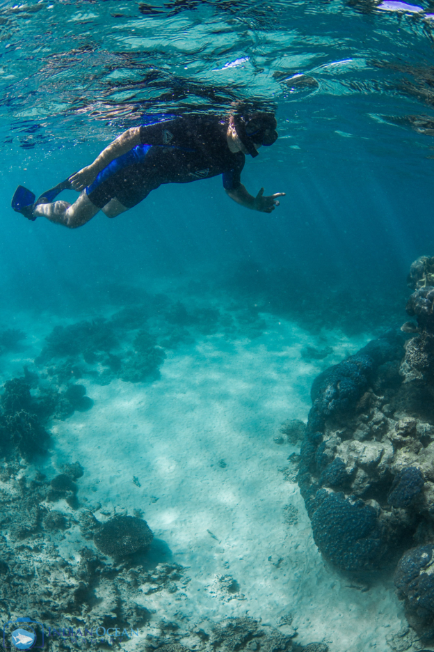
All day Sunday I spent with 19 others on the expensive Kings Ningaloo Reef Tour on the largest boat on the reef, the Magellan. It turned out to be well worth the price. We spent about 7 hours on the water, both inside, outside and over the reef. The crew provided us with shorty wet-suits (the water temperature was about 75 F. degrees inside and over the reef which is quite chilly) and snorkel gear including prescription goggle lenses for those of us desiring correction. Early morning and mid-afternoon we snorkeled over portions of the corals viewing the many species of fish; I did not find this portion of the reef nearly as colorful or impressive as the Great Barrier Reef, but still wonderful.
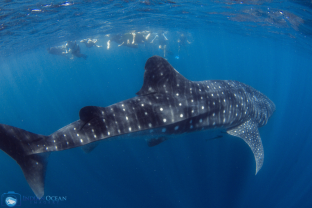
The Ningaloo Reef Marine Park is famous and World Heritage listed for a number of reasons, but is most famous with tourists for its numbers of whale sharks, the largest shark and largest fish in the world, growing to over 50 feet – the size of humpbacks. These sharks were practically unknown 50 years ago, and still almost nothing is known of their reproduction and usual annual movements. They look like giant sharks with grey-black bodies covered in large yellow-white polka dots. The heads are flattened with extremely wide mouths with which they gather plankton as they slowing swim at the surface in tropical up-welling waters. I have previously snorkeled with a large number of whale sharks over a two day period off the west coast of central Mozambique in Africa (perhaps the best location in the world). At Ningaloo the sharks normally can only be found through the winter, and they leave by the end of August, which they did this year. For three weeks no sharks were sighted, then, 2 days before my arrival, sharks showed up again.
The sharks can only easily be found or spotted from overhead, and so our tour employed, for 2 hours, a spotter aircraft overhead to call in whale shark locations. We thus encountered 4 different whale sharks and were in the water with them for several hours. With each shark encounter the boat would maneuver to a point somewhat ahead of where the shark was swimming, and we, with wet suits and snorkel gear, would hit the water in two teams; then with hand directions from a spotter on the boat, we would locate and swim with the shark. Whale sharks swim slowing and at the surface when feeding, and are quite easy to keep up with. They seem undisturbed by human followers as long as the humans don’t get directly in front or around their heads or swim below them. We were advised to stay at least 13 feet from their bodies.
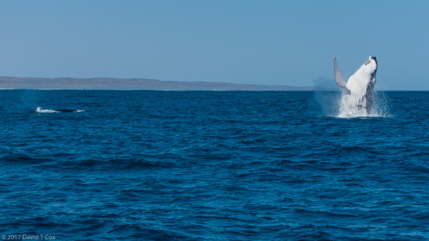
We also were blessed with encountering two separate pods of humpback whales, the first directly in front of the boat with large ones seemingly in a contest to see which could breach the best. Seeing two full-grown humpbacks, 50 feet apart, breach simultaneously is indeed awesome. We also saw sea turtles and dolphins. Proving the world is getting smaller, I met a couple of retired lawyers from Tucson on the cruise; we plan on getting together when back in Tucson.
The tour included the presence of an independent professional photographer who spent the day photographing, with stills and video, on deck and underwater, us and the wildlife. For 50 dollars I acquired jpg copies of all of his photos and video of the day – I was a little distressed I had not brought my underwater camera, but then his underwater setup was better, and I was actually visible in some of the pictures which never seems to happen when I am behind the camera.
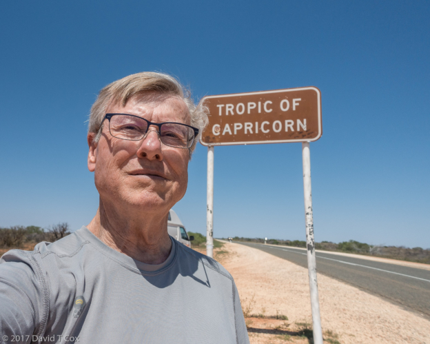
From Exmouth driving south I finally passed out of the tropics, passing the Tropic of Capricorn, and within a day the very hot weather just ceased. I spent one night in the quiet town of Carnarvon, apparently one of the vegetable/fruit capitals of Western Australia; for the first time on this trip I was surrounded by orchards and fields. Further south from Carnarvon I turned west and then back north to journey onto a very long peninsula which bounds Shark Bay; on this peninsula sits Denham, the “most westerly town” with the “most westerly hotel”, the “most westerly pub”, etc. in Australia. The huge north-facing peninsula, joined parallel by a large island to the west, are easy to spot on a map of Australia as they constitute the western tip. The entire area, including all of Shark Bay, constitutes a World Heritage Area, and is comprised of a number of National Parks and conservation areas. The southern point of the Bay contains the largest collection of the few remaining Stromatolites in the world; these are coral like build-ups created by mats of thousands of types of microbes. This was the only life on earth 3.5 billion (not million) years ago, and some of these microbes started synthesizing oxygen using sunlight, which created the atmosphere we have today, and permitted the later evolution of all life which needs oxygen for survival.
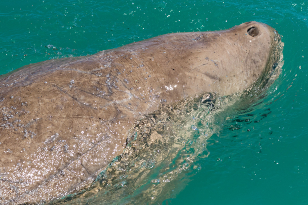
Shark Bay is shallow in much of its extent which is ideal for the growth of sea grass. This in turn supports the endangered Dugongs, relatives of the Manatees of the Americas. Shark Bay is home to 10% of the world’s population of Dugongs. I spent several hours on a cruise on the Aristocat-2, a large catamaran and the only boat in Shark Bay registered to pass into the sea grass conservation areas. We spent two hours searching for and encountering Dugongs in the shallow sea grass beds – they can be spotted from above as large brown shadows, and each normally surfaces every minute or so for air.
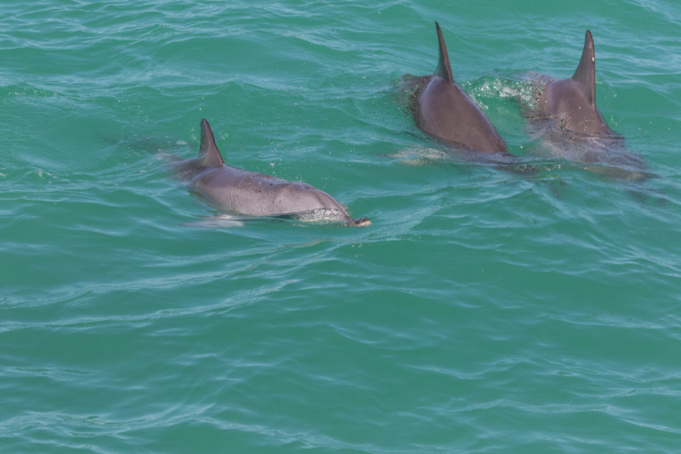
In the deeper waters were large numbers of Bottlenose Dolphins, apparently displaying mating behavior. The small docking area, with large accommodations and restaurant is known as Monkey Mia, and requires an entry payment in addition to the National Park fees – for tourists it is the best known feature of Shark Bay because 6 female dolphins have been enticed to come into the beach 3 times each morning to be fed fish by some lucky kids among the crowds of onlookers standing on water’s edge. Although the park claims it all is part of conservation and study, and the dolphins (each recognized and named) only are permitted 20% of their daily caloric requirements (so being forced to continue natural hunting), I find it all rather tasteless. There is no denying, however, that Shark Bay is exquisite as a most unusual place on earth.
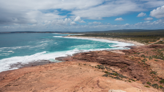
From Denham I back-tracked 130 kms to get off the peninsula, and drove on south to the Kalbarri National Park and the little seaside town of the same name. The park is spectacular this time of year for the rare and unusual wildflowers and the gorges through which runs the Murchison River. The entire day was blustery with squalls off the coast and winds whipping to 60 km/hr. I had trouble keeping my little hi-top van on the roads, and every time I would leave the car for 15 minutes to visit a gorge, I would end up getting soaked. I booked a cruise up the Murchison River, which empties into the sea at the town of Kalbarri. Mostly the cruise provided the 400 year European history of the area, with little bird or wildlife. The cliff views over the sea just south of Kalbarri are stunning.
From Kalbarri I ventured on south to Jurien Bay, a nice little seaside town. Unfortunately, after weathering almost 40 days of baking hot dry weather, I now have suffered 4 of the last 5 days with very cold sea squalls and high winds which keeps most birds, and me, under shelter. From here I will head south to Perth, the half-way point, in both distance and time, of my journey. The weather forecast for the coast looks like it will start clearing in 3 days, so I am hoping for better bird weather soon. Since Exmouth I am finally able to buy cask red wine again, gas prices are dropping, and interesting restaurants are more plentiful, so life is good, as always. Later. Dave
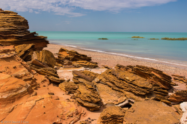
- Roebuck Bay N. side from Rd to Bird Observatory, near Broome, WA, Australia
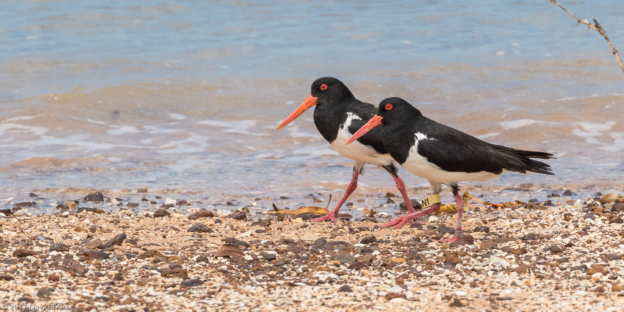
- Australian Pied Oystercatcher, Rd to Bird Observatory, Roebuck Bay N. side, near Broome, WA, Australia
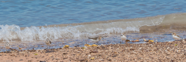
- Red-necked Stint, Red-capped PLover, Rd to Bird Observatory, Roebuck Bay N. side, near Broome, WA, Australia
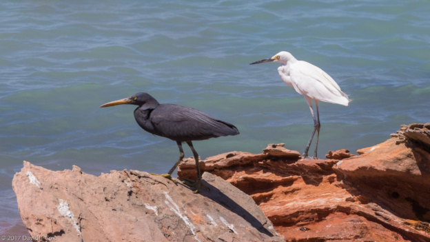
- Eastern Reef Egret and Little Egret?, Rd to Bird Observatory, Roebuck Bay N. side, near Broome, WA, Australiae, WA, Australia
- Roebuck Bay N. side from Rd to Bird Observatory, near Broome, WA, Australia
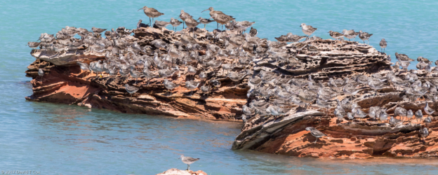
- Great Knots, Greater Sand Plover, Bar-tailed Godwit, Ruddy Turnstone, Grey-tailed Tattler, Whimbrel, plus more, Rd to Bird Observatory, Roebuck Bay N. side, near Broome, WA, Australiae, WA, Australia
- Bar-tailed Gotwit, Great Knot, Red Knot and 1Red-necked Stint , Roebuck Bay E side, with George Swann guide, Broome, WA, Australia
- Red-necked Stint, Roebuck Bay E side, with George Swann guide, Broome, WA, Australia
- Red-necked Stint, Curlew Sandpiper (downturned bill), Greater Sand Plover (big eye, stout bill), Roebuck Bay E side, with George Swann guide, Broome, WA, Australia
- Roebuck Bay pano 2, N. side from Rd to Bird Observatory, near Broome, WA, Australia
- Eastern Curlew female, Red-necked Avocet, Black-tailed Gotwit (scalloped – upturned bill), Bar-tailed Gotwit (uniform – straigt bill), Great Knot (heavily speckled breast bill slightly curved longer than head) Red Knot shorter straight bill, whiter breast w faint band, Curlew Sandpiper (short downturned bill), White-headed Stilt, Gull-billed Tern, Caspian Tern and Silver Gull, Roebuck Bay E side, with George Swann guide, Broome, WA, Australia
- Great Gnots (speckled breast, bill longer than head, slightly curved), Red Knot (smaller, lighter breast, bill shorter and straight) Bar-tailed Gotwit (uniform brown – straigt bill), Silver Gull,, Roebuck Bay E side, with George Swann guide, Broome, WA, Australia
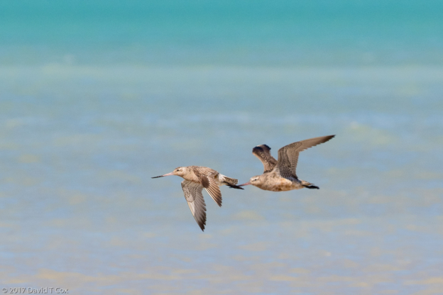
- Bar-tailed Gotwit, Roebuck Bay E side, with George Swann guide, Broome, WA, Australia
- Curlew Sandpiper (downturned bill), Terek Sandpiper (upturned bill), Greater Sand Plover (bill biggerr than Lesser), Lesser Sand Plover, Roebuck Bay E side, with George Swann guide, Broome, WA, Australia
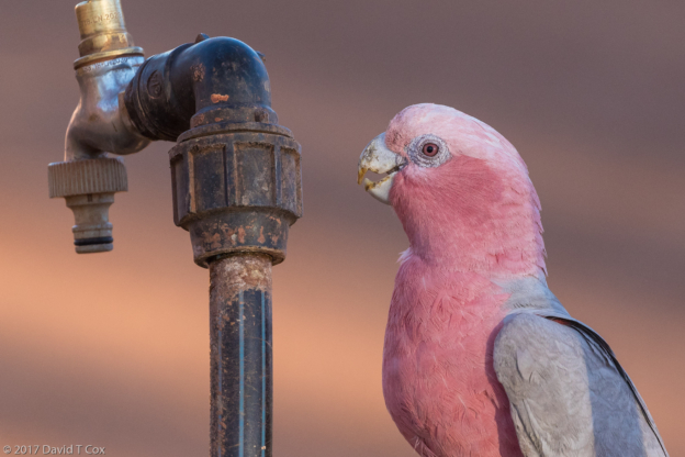
- Galah, Auski Tourist Pk, by Karijini, WA, Australia
- Fern Pool,Pano 1, Karijini NP, WA, Australia
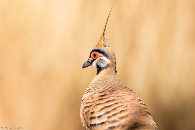
- Spinifex Pigeon, Circular Pool – Walhibindamunha, Karijini NP, WA, Australia
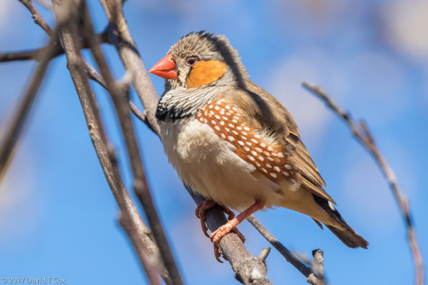
- Zebra Finch, Visitor Center, Karijini NP, WA, Australia
- Joffre Gorge – Jijingunha Pano 3, Karijini NP, WA, Australia
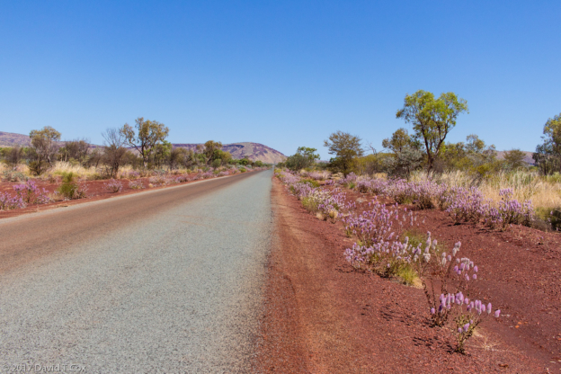
- wild flowers in Karijini NP, WA, Australia
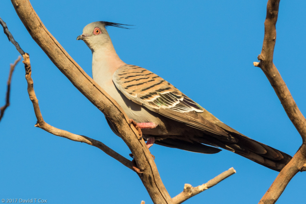
- Crested Pigeon, Fortescue River Roadhouse, Tom Price, WA, Australia
- petroglyph site Deep Gorge, Hearson’s Cove Rd, Murujuga NP, Burrup Peninsula, Dampier, WA, Australia
- Australian Bustard, Cape Range NP, Ningaloo Peninsula, WA, Australia
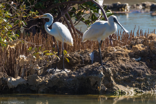
- Great Egret and Royal Spoonbill, Mangrove Bay Bird Hide, Cape Range NP, Ningaloo Marine Park, WA, Australia
- Humpback Whales, Kings Eco Tour, Ningaloo Marine Park, Exmouth, WA, Australia
- Dave snorkling on Ningaloo Reef Marine Park cruise by Kings, from Exmouth, WA, Australia
- snorkling with a Whale Shark, Ningaloo Reef Marine Park cruise by Kings, from Exmouth, WA, Australia
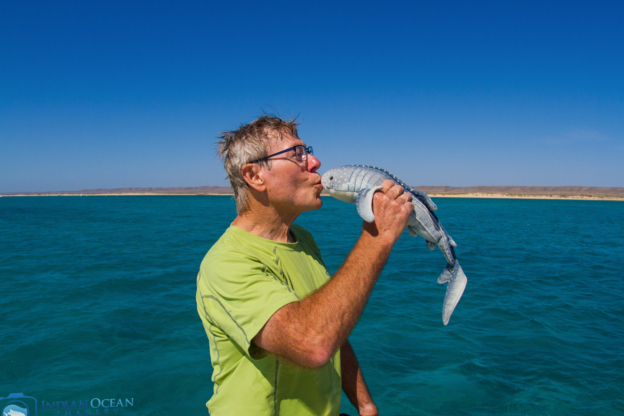
- Dave thanking Whale Shark for encounters, Ningaloo Reef Marine Park cruise by Kings, from Exmouth, WA, Australia
- Dave at Tropic of Capricorn, Hwy Coral Bay to Carnarvon, WA, Australia
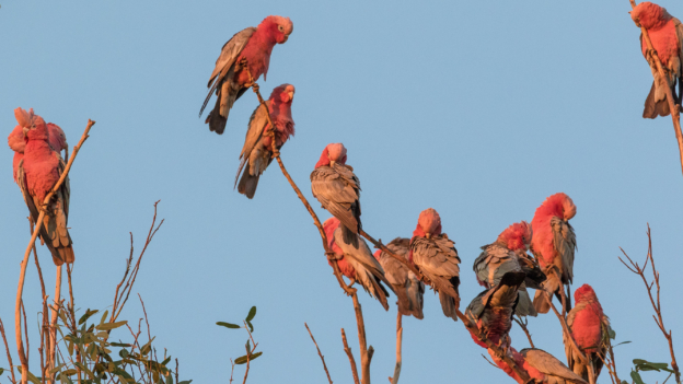
- Galah at sunrise, Carnarvon Plantation Pk, WA, Australia
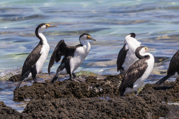
- Pied Cormorant on Stromatolites, Hamelin Pool Stromatolites, S of Denham, WA, Australia
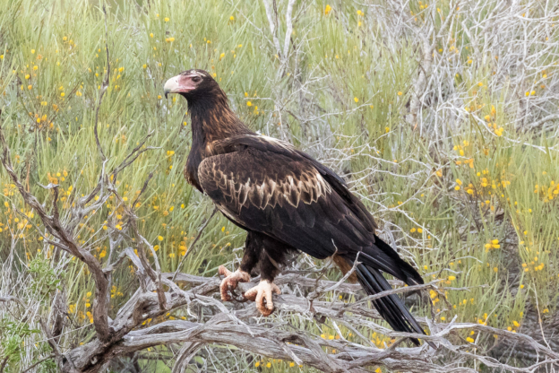
- Wedge-tailed Eagle, Hwy Denham to Monkey Mia, WA, Australia
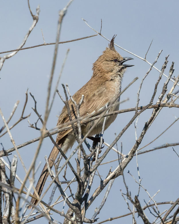
- Chiming Wedgebill, Discovery Trail,, Monkey Mia, WA, Australia
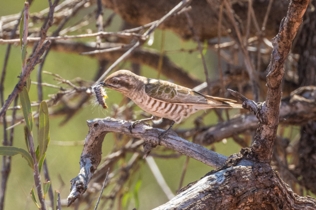
- Horsfield’s Bronze-Cuckoo w catepillar, Discovery Trail,, Monkey Mia, WA, Australia
- Dugong, Sharks Bay from Aristocat-2 catamaran, Monkey Mia, WA, Australia
- Bottlenose Dolfins, Sharks Bay from Aristocat-2 catamaran, Monkey Mia, WA, Australia
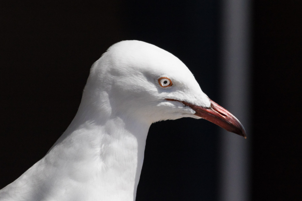
- Silver Gull, Monkey Mia, WA, Australia
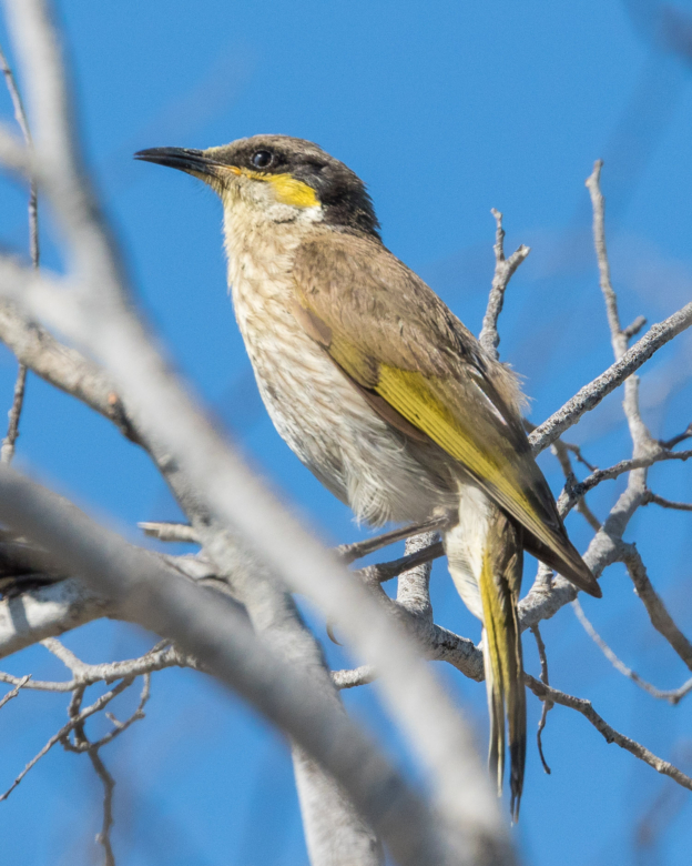
- Singing Honeyeater, Discovery Trail,, Monkey Mia, WA, Australia
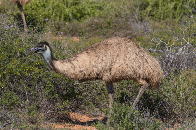
- Emu from hwy Denham to Monkey Mia, WA, Australia
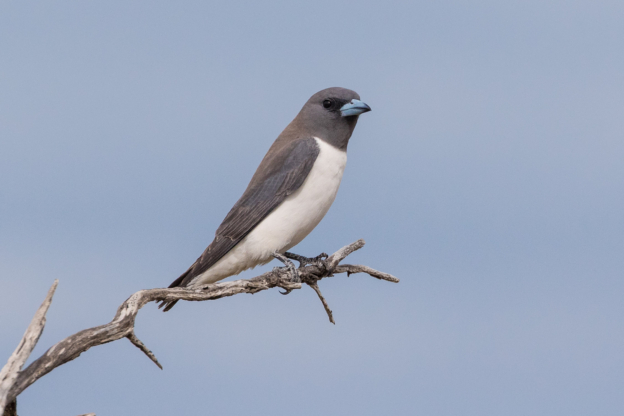
- White-breasted Wood-Swallow, Little Lagoon inlet, near Denham, WA, Australia
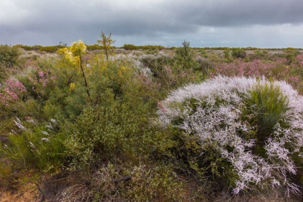
- wildflowers, Kalibarri NP, WA, Australia
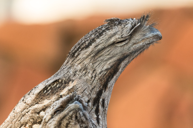
- Tawny Frogmouth ss brachypterus, Anchorage Caravan Pk, Kalbarri, WA, Australia
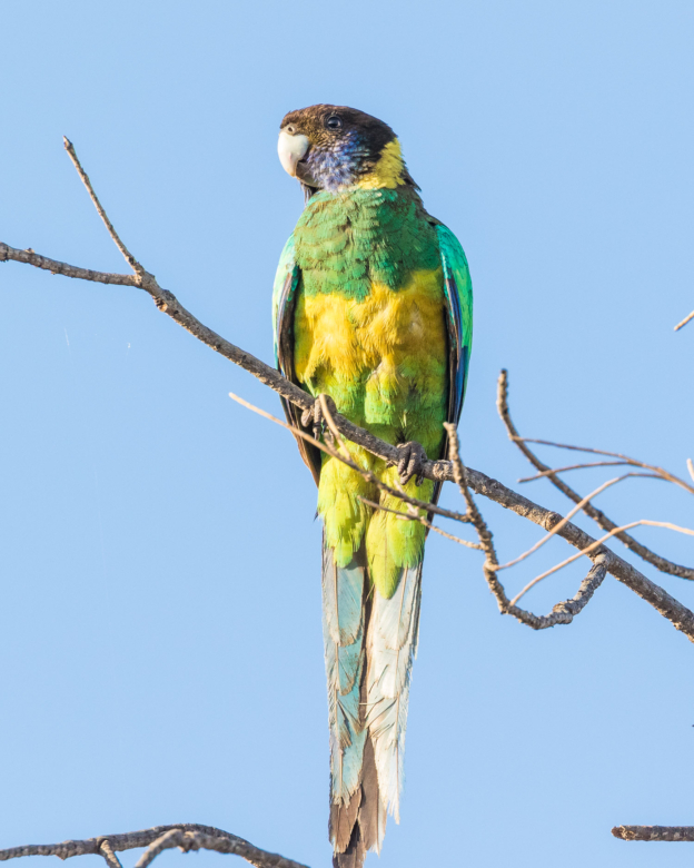
- Australian Ringneck ss zonarius, Murchison River near Ancorage Caravan Pk., Kalbarri, WA, Australia
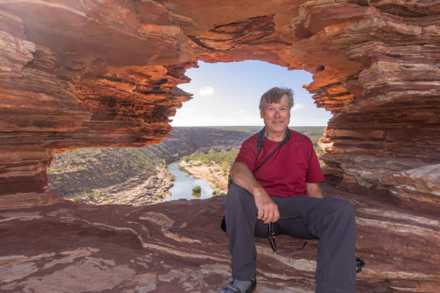
- Dave at Nature’s Window, Kalbarri NP, WA, Australia
- Sea from Red Bluff, Kalbarri cliffs, WA, Australia
To print the travelogue, right click anywhere on the page. Choose "Print" from your browser dialog box. You can choose Save to PDF in the browser print window.
Share your thoughts.
Email Dave - coxdavid55@hotmail.com
