Hello everyone. I am on the road again, literally, hauling my tiny Scamp RV north from Tucson, escaping the summer heat and seeking photo opportunities. I left just before the July 4th weekend, headed North to the Verde River Valley which runs through central Arizona below the Mogollon Rim. I always stay at the Dead Horse Ranch State Park, right on the Verde River, with its forests of cottonwood, willow and Arizona ash trees filling the wide river flood plain. Because the US women’s soccer team surprised me by walloping Germany in the semi-finals, I spent some time after arriving trying to locate a sports bar in the nearby town of Cottonwood so I could watch the third place match (Germany vs England) on Saturday the 4th, and the finals between the US and Japan on the 5th. I wound up at the Chaparral Bar, an old west relic with imported draft beer at reasonable prices, and watched the games. The US team certainly avenged their last final against Japan.
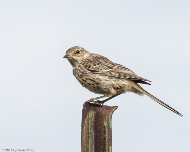
Out at the campsite I finally got some pictures, at sunrise, of the little rodents which dig all the holes in the ground around the facilities – they are Botta’s Pocket Gophers, and they only seem to come above ground to shovel dirt out of the entrance to their excavations at the crack of dawn (I had previously assumed they were ground squirrels and wondered why I never saw them). Watching the gophers up close I reminisced about Bill Murray’s titanic battle with gophers in Caddy Shack. Shortly after sun-up the gophers create a dirt plug at the entrance to close all holes, so evidence of their presence is limited to the dozens of fresh dirt mounds.
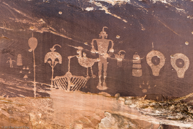
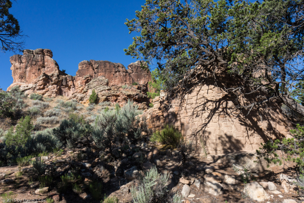
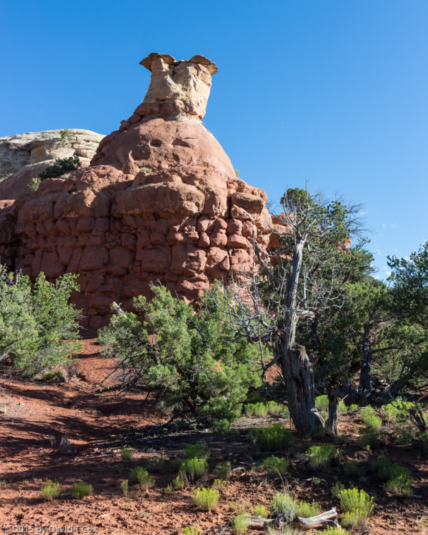
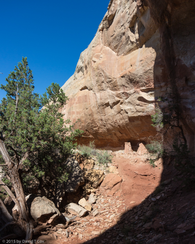
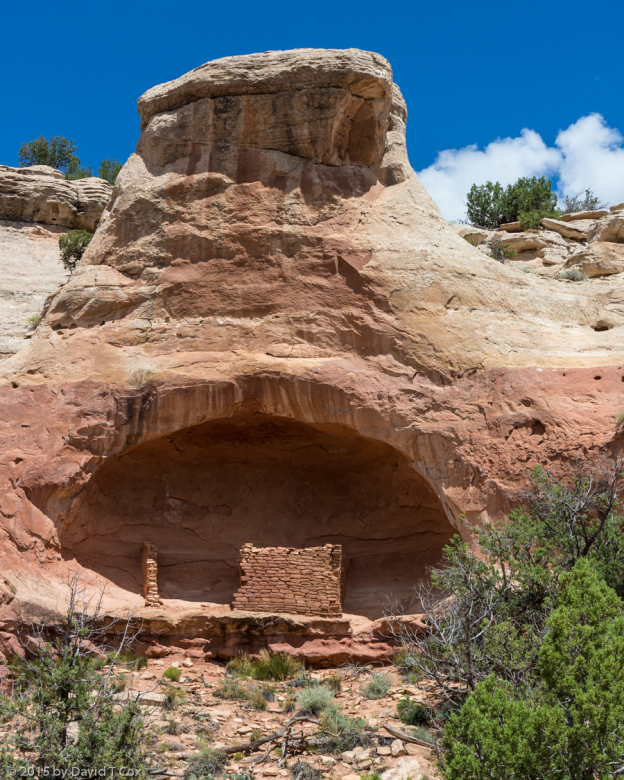
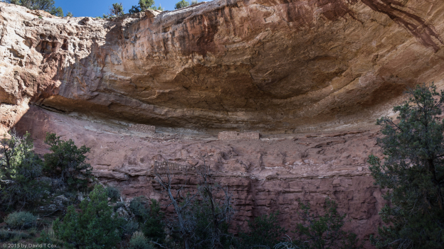
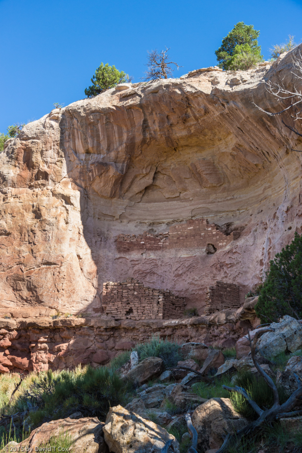
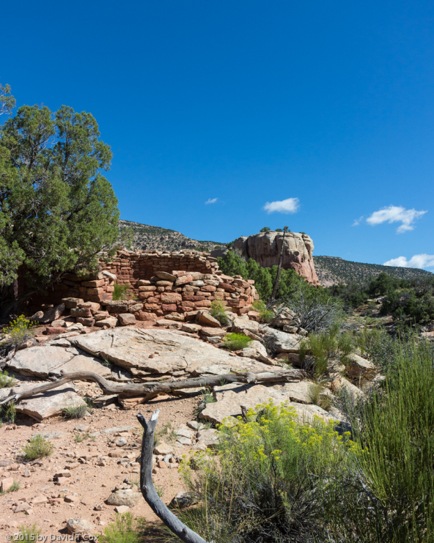
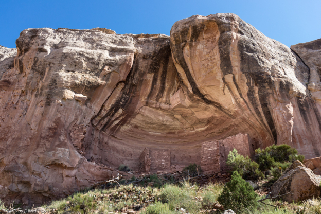
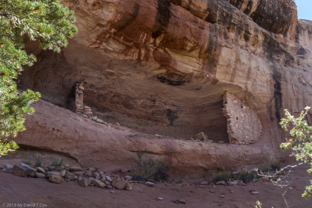
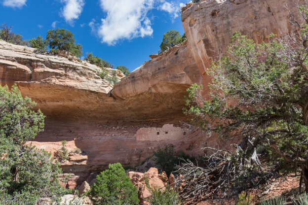
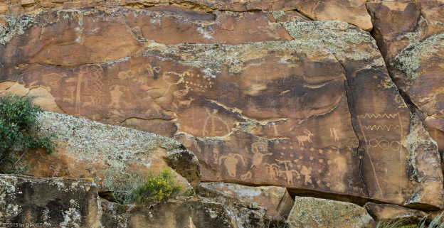
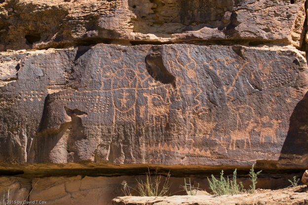
On Sunday I bicycled over to Clarkdale to see the Verde Valley Railroad depot, from where the summer tourist train departs for its day-trip up the Verde Valley. I then continued most of the way up to Jerome, the artsy ghost town on the side of the mountain overlooking the valley. I also found a site for early morning viewing of Tuzigoot, the ruins of the large 3-story, 120 room, Sinaguan Pueblo perched on a stone mound above the floodplain, which housed 100s of people from 1,000 to 1,400 AD.
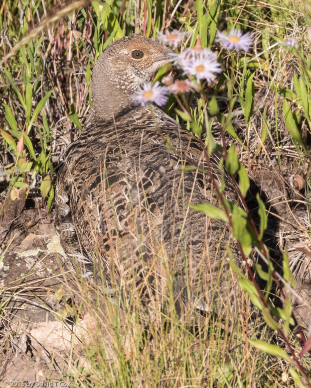
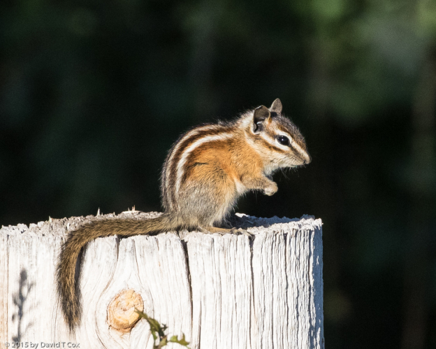
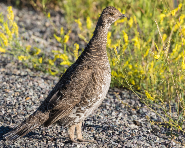
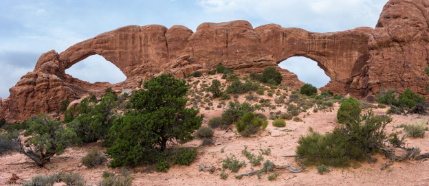
Monday I traveled on north passing through Flagstaff, up the western part of the Navajo Nation, across the Navajo Bridge over Marble Canyon at Lee’s Ferry (where all Grand Canyon river rafting trips start), past the Vermillion Cliffs (where the endangered California Condors are released) and finally up the Kaibab Plateau to just under 9,000 feet. There I camped under the pines for a few days at the Jacob Lake Campground, and tried to improve my photos of the elusive Kaibab Squirrel. It is a special subspecies of the tassel eared Abert’s Squrrel, and exists only on the Kaibab at the north rim of the Grand Canyon. The Kaibab Squirrel is the most exotic looking squirrel in North America, having a charcoal colored body with a bushy, all white tail – it has long pointed ears, which in the winter have tassels of hair which extend to double the length of the ears. Although not uncommon, it is difficult to get decent photos.
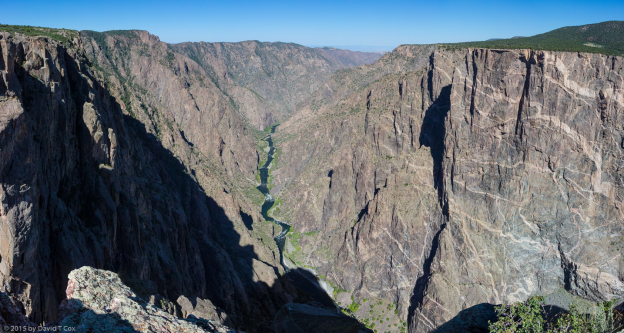
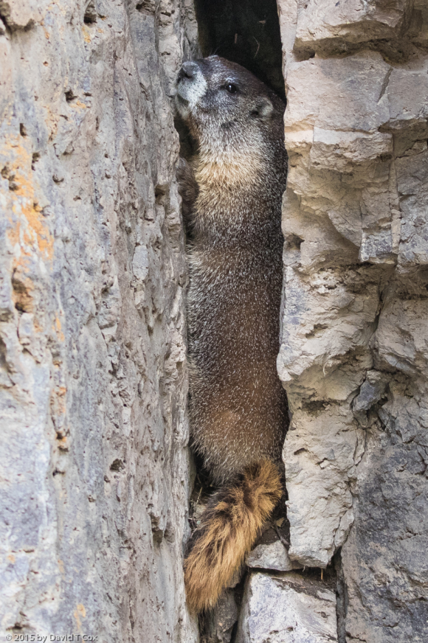
I spent two mornings driving the 44 miles across the plateau to the north rim, to get a few spectacular scenic overviews of the Canyon. Normally the very early drives produce a lot of wildlife sightings, but this time just a few mule deer and wild turkey made their appearance. I did have the breakfast buffet spread in the magnificent lodge dining room overlooking the canyon.
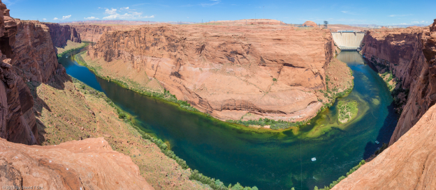
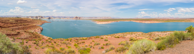
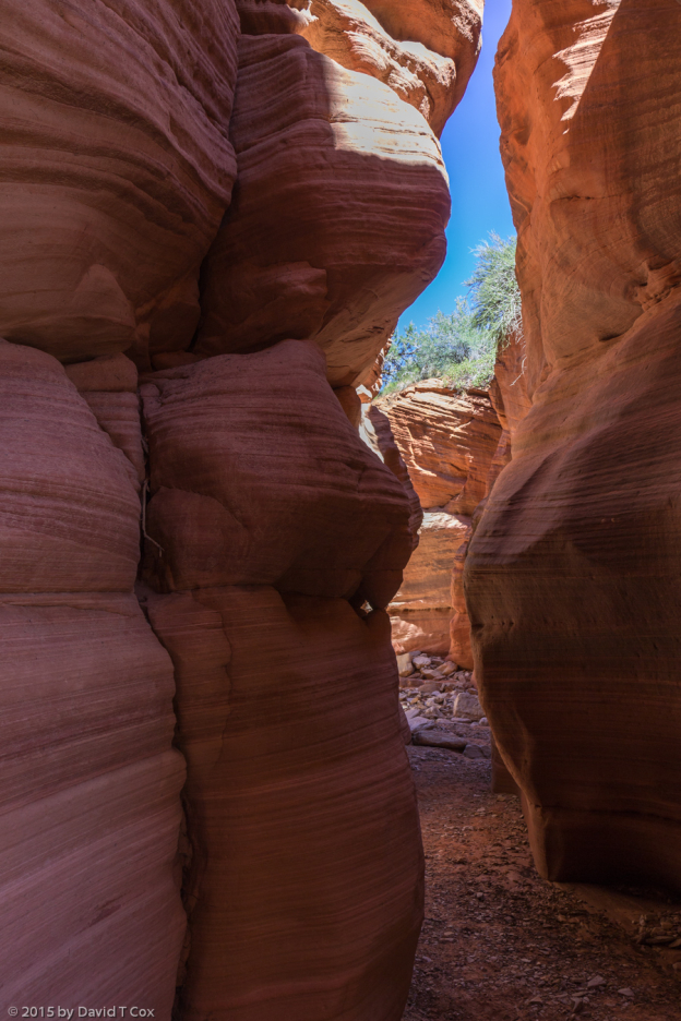
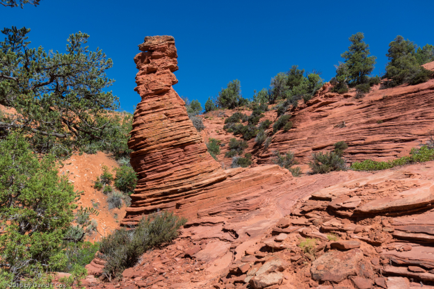
From Jacobs Lake I drove down off the Kaibab and crossed just into Utah to Kenab in red-rock country, a filming site for a number of mid-century western movies, including several by James Garner. I specifically wanted finally to visit some of the slot canyons in this part of the country, and the day before yesterday hired a small tour company to take me to the Peekaboo Slot Canyon. It required about 45 minutes of 4X4 drive time through deep sand and several stream wash-outs to reach the entrance. We had severe thunderstorms the afternoon before, and it turned out a small flash flood had just run through the Peekaboo slot – at several points the water had washed out the sandy bottom, and we found ourselves in waist-deep mucky water down to the bottom of the slot. These deep water pools already had frog spawn with small families of frogs trying to avoid our bodies in the narrows. I left all my gear except a single camera at the first water pool, but managed still to get a few decent photos in fairly good light. A second slot I was going to visit, the Wire Pass, apparently now has an 8-foot drop-in near the start, which is possible to descend but only passable to exit by those who like to rock climb. I do intend to visit another slot canyon or two on the Navajo Reservation near Page where I intend to go next.
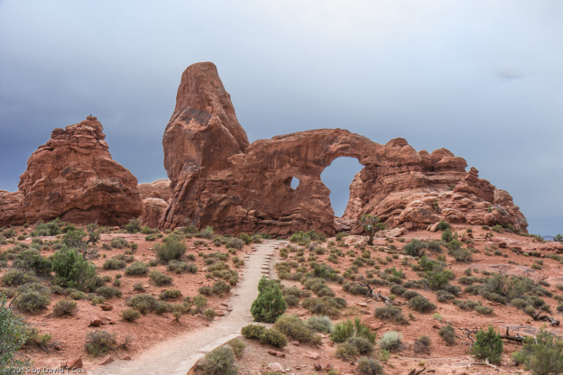
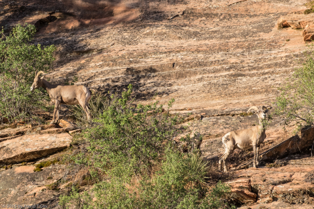
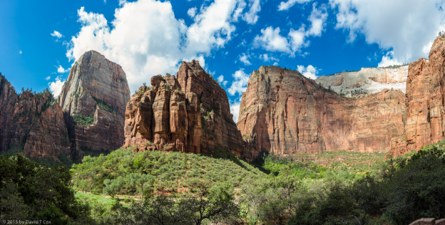
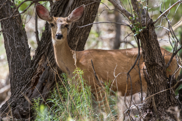
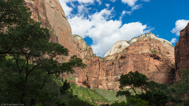
I spent much of yesterday instead re-visiting Zion National Park. I again saw bighorn sheep near the small tunnel where I have twice before photographed them. Zion Canyon always is stunning, but yesterday the crowds were almost unimmaginable – I got there for an early shuttle up to the end of the canyon, and then hiked out along the river, so only saw the crowds as I passed the trailheads, or as the “standing-room-only” shuttles passed by every 7 minutes on the road. Fairly heavy intermittant cloud cover lessoned the visual impact of the cliffs, at least for photography. I did see mule deer a number of times, several with fawns.
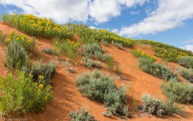
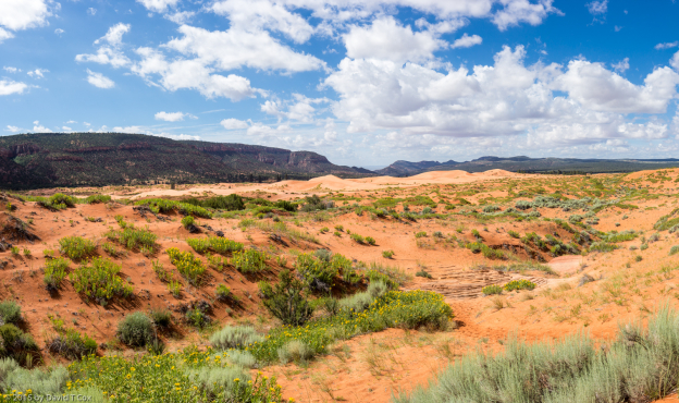
I probably will head out towards Page later this morning, but will decide after another cup of coffee, and perhaps a quick run out to see the Pink Coral Sand Dunes State Park very near by. Later. Dave
-
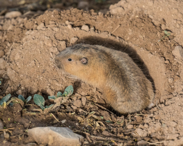
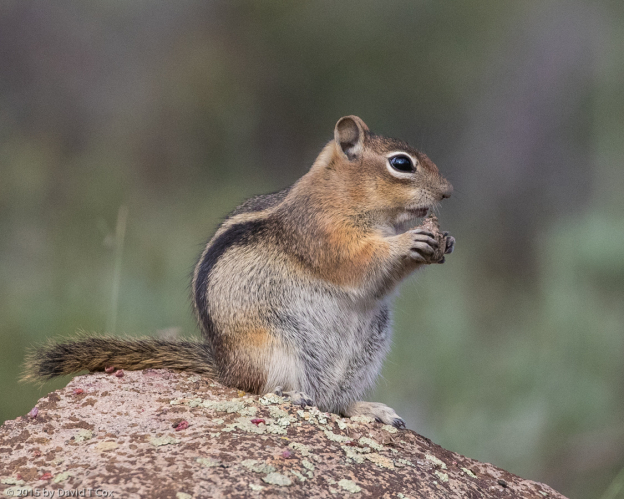
- Botta’s Pocket Gopher, Dead Horse Ranch SP, Arizona
-
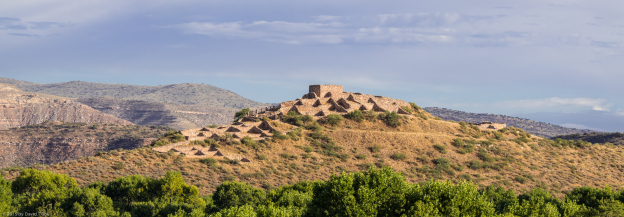
- Tuzigoot Pano, Sinaguan, 1000-1400, Az
-
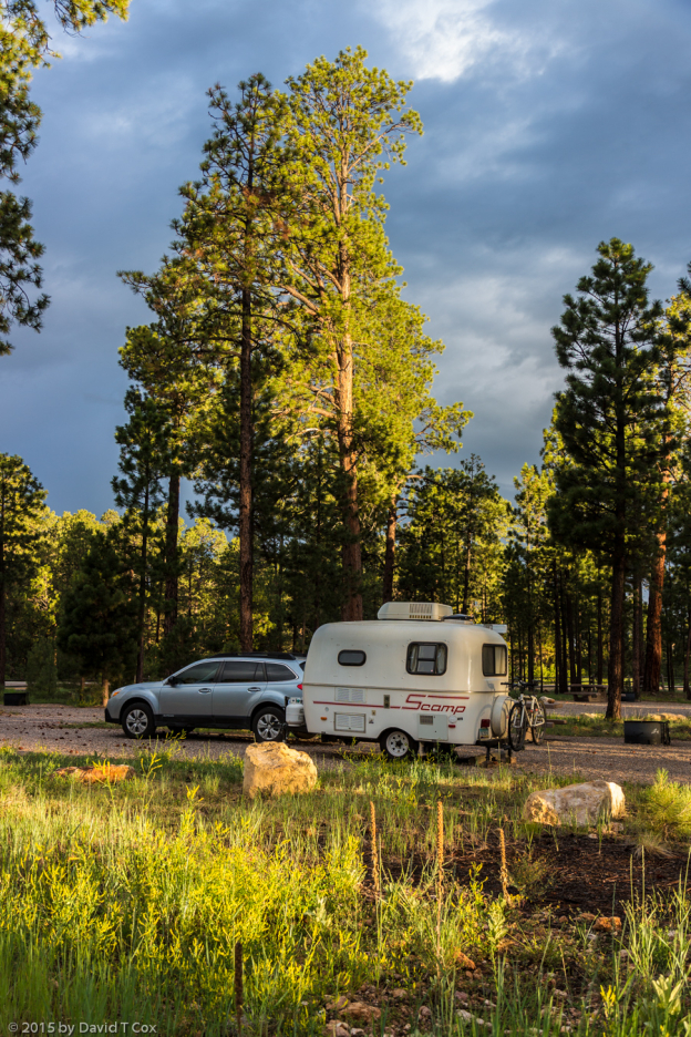
- Scamp at sunrise at Jacob Lake Campground, Az
-
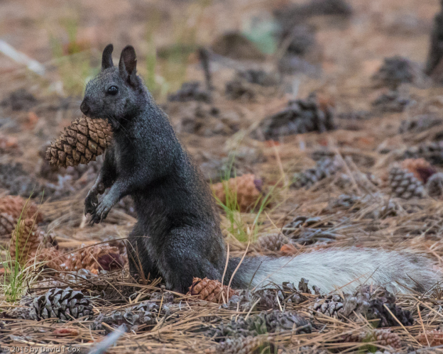
- Kaibab Squirrel, Jacob Lake Campground, AZ
-
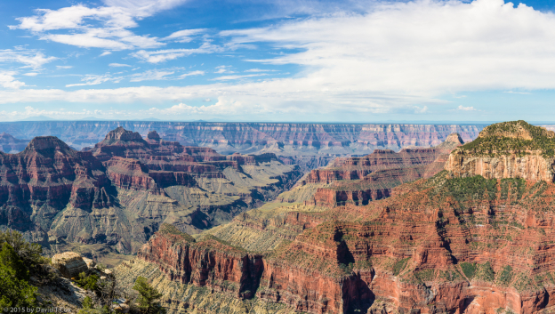
- Grand Canyon N. Rim pano 4, AZ
-
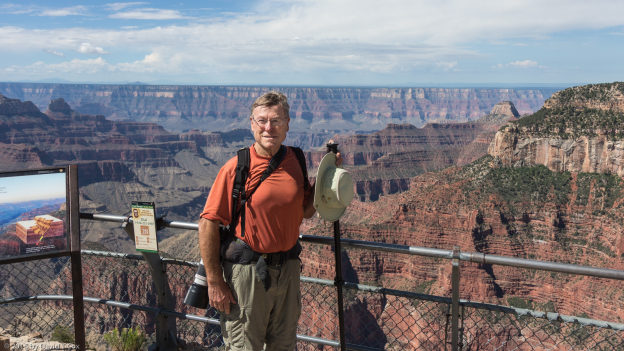
- Dave Cox at Grand Canyon N rim from Bright Angel Point, AZ
-

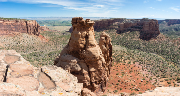
- Grand Canyon N rim from trail to Bright Angel Point, AZ
-
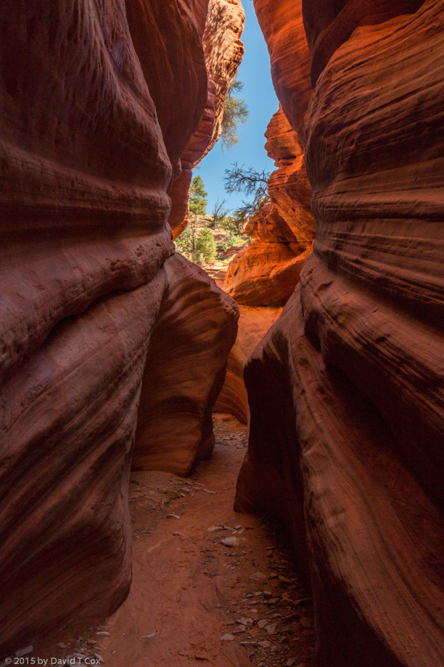
- Peekaboo Slot Canyon, near Kanab, UT
-
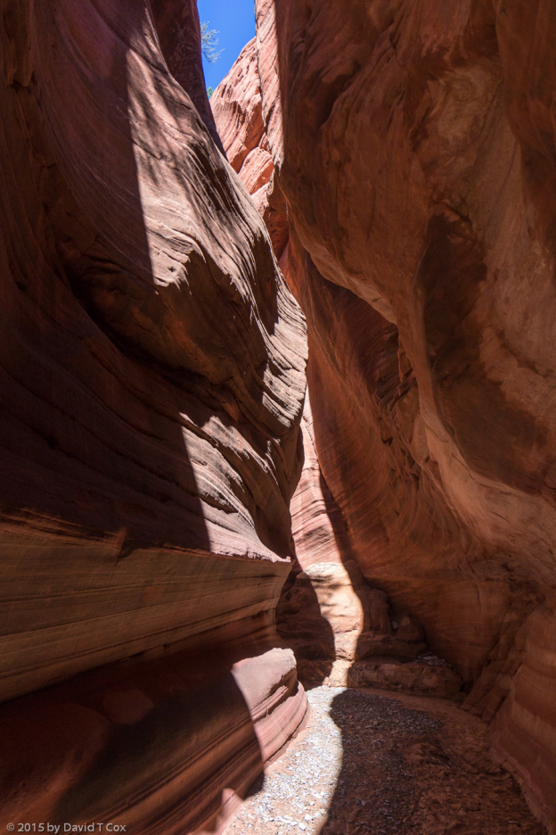
- Peekaboo Slot Canyon, near Kanab, UT
-
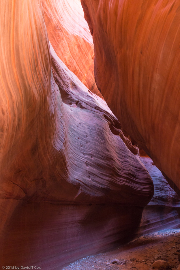
- Peekaboo Slot Canyon, near Kanab, UT
-
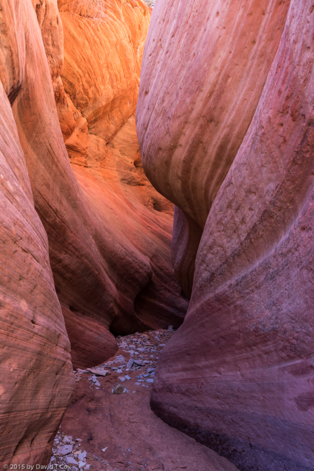
- Peekaboo Slot Canyon, near Kanab, UT
-
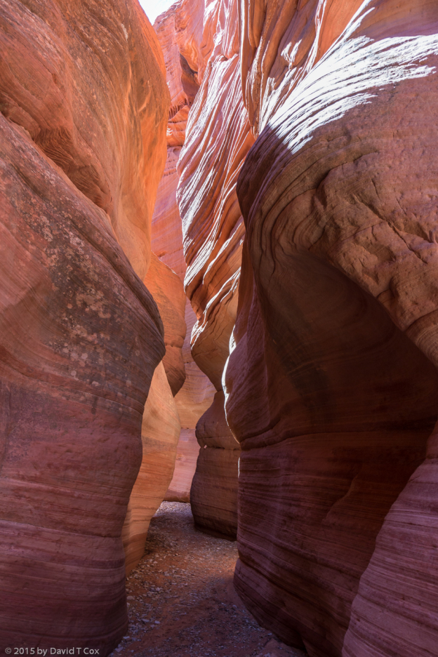
- Peekaboo Slot Canyon, near Kanab, UT
-
- Peekaboo Slot Canyon, near Kanab, UT
-
- at entrance to Peekaboo Slot Canyon, near Kanab, UT
-
- Bighorn Sheep, Zion NP, UT
-
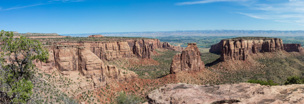
- Great White Throne, Organ & Angels Landing Pano 1, Zion NP, UT
-
- Mule Deer, Zion NP, UT
-
- Zion NP, UT