I departed Tucson on August 12. From locking my front door on Saturday afternoon to checking into my hotel in Darwin in the Northern Territory on Monday afternoon the journey consisted of a grueling 30 hours of travel, but included a day entirely skipped from crossing the international dateline. Each of the three flights was crammed full with nary an empty seat. A couple of drinks and food during the fairly long layover in the LA airport started my customization to Australian prices.
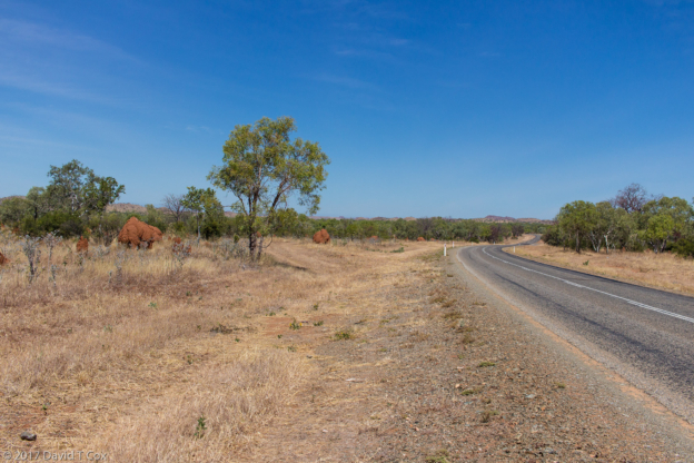
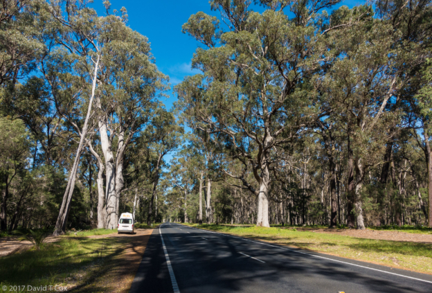
I stayed just one night in a small highway inn on the outer edge of Darwin, which was within walking distance of where I picked up my Britz campervan rental. The van is a short wheel-base hi-top Toyota with built-in fridge, stove, microwave, sink, cabinets and bed with housewares and linens included. This will be my transport and lodging for the remainder of this trip, which will see me start in Kakadu National Park in the far North of the Northern Territory, and then head West wrapping around all of Western Australia before traveling East through South Australia, Victoria and New South Wales to Sydney.
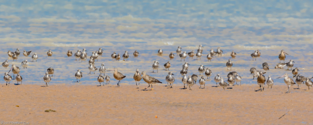
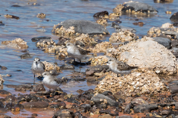
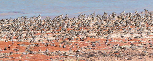
I stayed at a nice Campervan Park near Darwin for 2 additional days to stock up on supplies, including a large water jug, sim card for Australian smart phone service, and initial supplies of foods, snacks, wine and beer. I also did a little bird photography up north of Darwin at Lee’s Point and then south inside the Charles Darwin National Park. Both are great for nature viewing, but also contain numerous historic WWII installations, including machine gun bunkers and multiple underground depots for storage of all of the bombs utilized from the nearby airbase. Darwin was a major terminus for the Pacific battles, though only attacked by the Japanese by air once. Early on in the engagement Japan controlled all the Pacific Indonesian islands almost to the shores of Darwin.
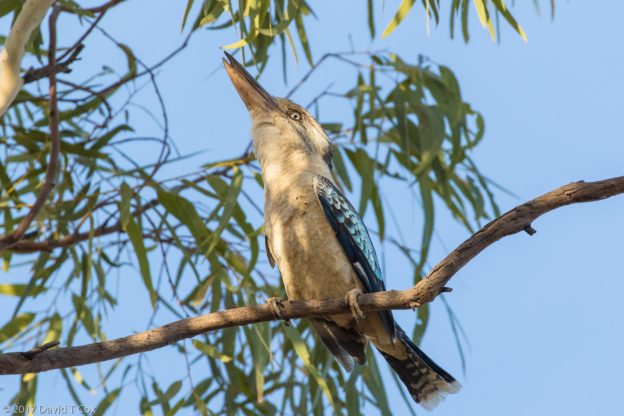
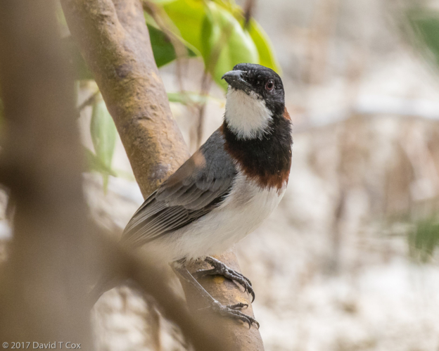
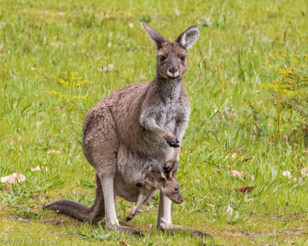
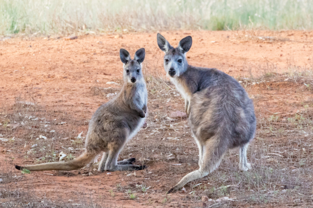
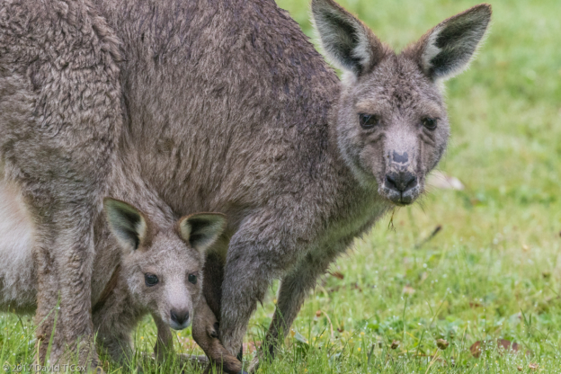
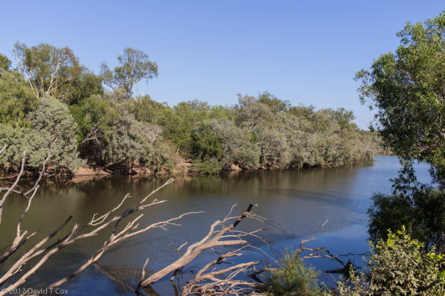
From Darwin I traveled southeast toward Kakadu and Arnhem Land, stopping first at Fogg Dam Conservation Area for some wetland hiking for water birds. There I photographed the Forest Kingfisher and the hundreds of Magpie Geese. Thursday night I stayed at the Mary River Wilderness Retreat at the edge of the National Park of the same name. I had many fond memories from 8 years earlier when I visited the same place – the owners were avid birders and ran a wonderful boat trip twice a day up the Mary River for viewing all manner of birdlife, as well as Estuarine and Fresh Water Crocodiles. Here I had photographed rare completely white morphs of a breeding pair of Grey Goshawks. I was hugely disappointed to find ownership had changed, and no one had heard of any boating up the Mary River. I did an early morning long walk along the river, encountering a hard-to photograph Golden-crowned Cisticola and some Crimson Finches, always inevitably hiding within thickets. Around the campsite were flocks of noisy Little Corellas, and in the evening dozens of Agile Wallabies came to feed on the watered grass. Enjoy the photo of the joey sticking his head into his mother’s pouch for a meal.
I drove onward on Friday to the Aurora Kakadu Lodge near the South Alligator River, just inside Kakadu National Park, again to find no boats plied the river except for fishing. Instead I spent almost 6 hours on and around the Mamukala Wetlands, where I found a number of interesting birds around the fringes, including the Horsfield’s Bronze-Cuckoo and the Cicadabird surrounded by gorgeous red tree blooms. I also encountered a wonderful lizard living in the water by running on the lily pads, half its body always submerged – I have been unable to find what it was.
Saturday I drove on to Jabiru, the small township at the heart of Kakadu, which exists to serve a nearby uranium mine. I stayed three days at the Kakadu Lodge (all these “lodges” have both small cabins and caravan camping sites, as well as facilities such as restaurant, pub and pool). Food at the bistros in these camps is generally quite good, though very expensive (plates running US $19-$30, with weak beers generally about $6). One evening I had local sausages over mashed potatoes and green beans; the sausages were huge – three of them – one of buffalo, one of crocodile and one of kagaroo.
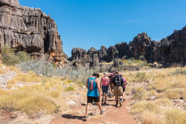
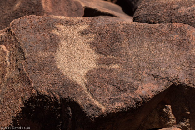
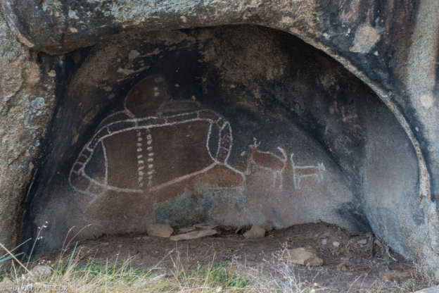
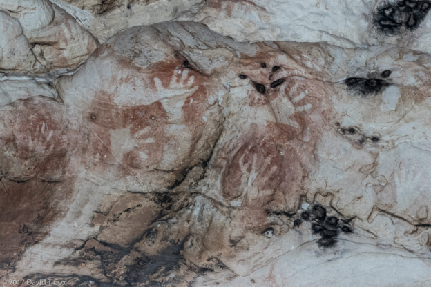
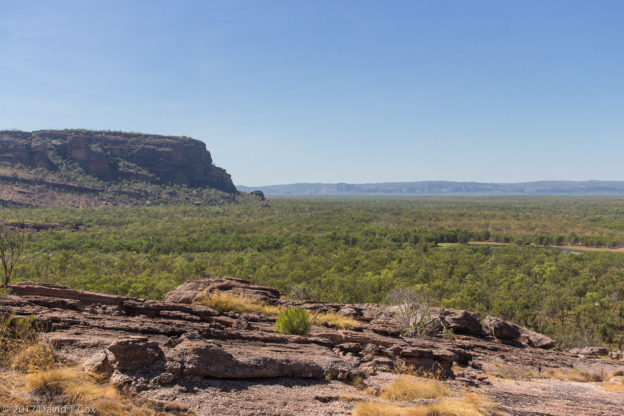
Sunday and Monday I visited the areas around two of the most famous aboriginal rock art sites in Australia. Arnhem Land, which includes Kakadu National Park to the West, covers well over half of the Darwin Peninsula – about 100,000 square kilometers – it is the largest and oldest aboriginal land in Australia. Other than the Park, it may only be visited by non-tribal members with special permits and accompanied by native guides. I traveled into Arnhem 8 years ago on a day-trip and photographed the great rock art on Injalak Hill. Kakadu National Park, to the west, also is owned by the aboriginals and leased to the Australia Government as the oldest and largest national park. Both areas have been occupied by aboriginals for over 40,000 years, and much great rock art exists. The two most famous sites are Ubirr, right on the border with Arnhem Land at the only road crossing, and Nourlangie Hill a little to the Southwest.
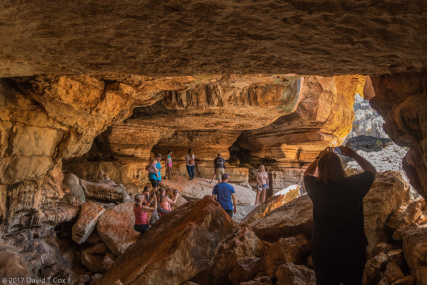
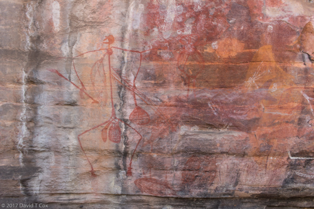
Ubirr probably is the best overall rock art site in the country (there are thousands of sites); Ubirr presents a number of panels, or galleries, with images painted mostly in shades of reds and yellows, with some blacks and whites. The largest panel contains dozens of large fish of different species, most painted “X-Ray” style, showing parts of the internal organs or bones. Along with the fish are images of several food animals, including long-necked turtles, goana (monitor lizard) and wallaby. The entire panel, some 35 feet long and about 3 feet high, seems to contain nothing but wild animal food sources. A nearby panel contains the Namarrgarn Sisters, two figures of spirit characters who permanently changed into the deadly Estuarine Crocodiles – the Sisters, painted in faded yellow, are overlaid on top of a running battle or hunting scene of running men with spear-throwers, painted in red. This Namarrgarn Sisters Panel is my favorite of all aboriginal rock art I have seen. I have created detailed panoramic stitched photos of the panels, copies of which are included below.
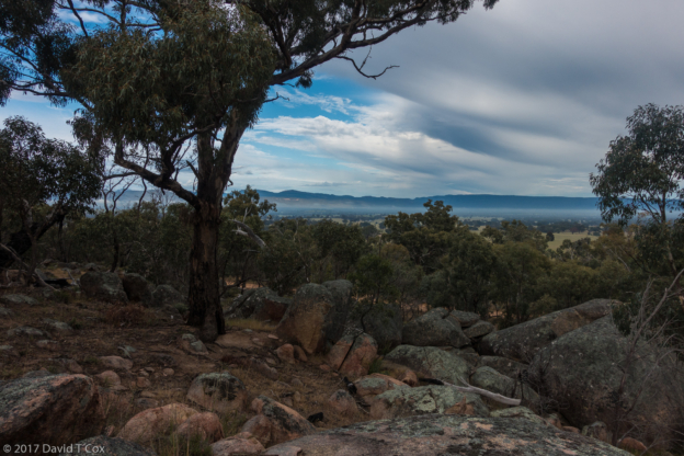
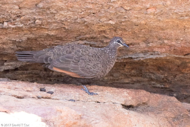
Nourlangie Rock art site, now called Anbangbang as originally named by the aboriginals, contains fewer panels than Ubirr but has one rather remarkable one of Lightning Man, wife and children. I did some hiking to an overlook with a terrific view of Nourlangie Rock in the morning sun, as well as visiting the nearby Anbangbang Billabong (don’t you love the names – a billabong is a year-round lake or pond which becomes connected to a river or floodplain during the wet season). I thrice climbed large rocky escarpments looking for the rather rare Black Wallaby and smaller Rock Wallabies, but had no luck, although I did find droppings. The small flies here in Kakadu, especially during the hottest part of the day, are dreadful. They are “sticky”, meaning they don’t frighten off easily with hand motions, and come right back to alight. Because they are “sticky,” however, they are much easier to smack than flies from elsewhere – it always gives me a bit of perverse pleasure to observe the dropping fly – dead, following the smack.
On Tuesday the 22nd I drove back westward on the southern Kakadu road to Cooinda, where I stayed 2 nights in the Lodge Park. As at Jabiru, the grounds are nice, including restaurant, bar and very large swimming pool with surprisingly cool water. I have used the pools 3 times and it certainly does help cool off after the 35 C degree days (95 F degrees).
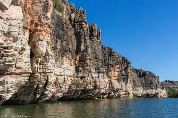
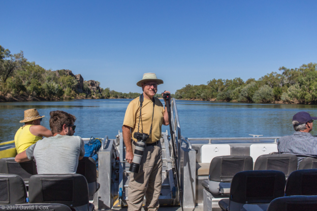
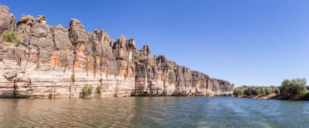
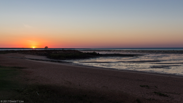
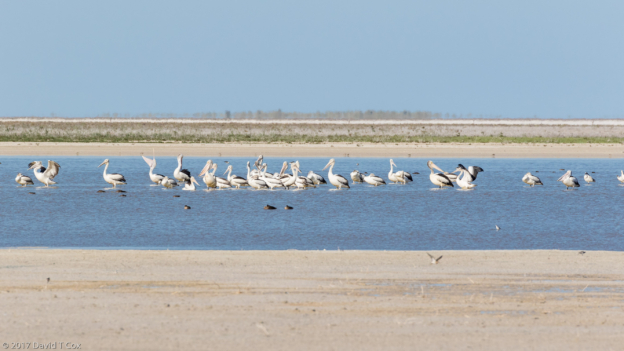
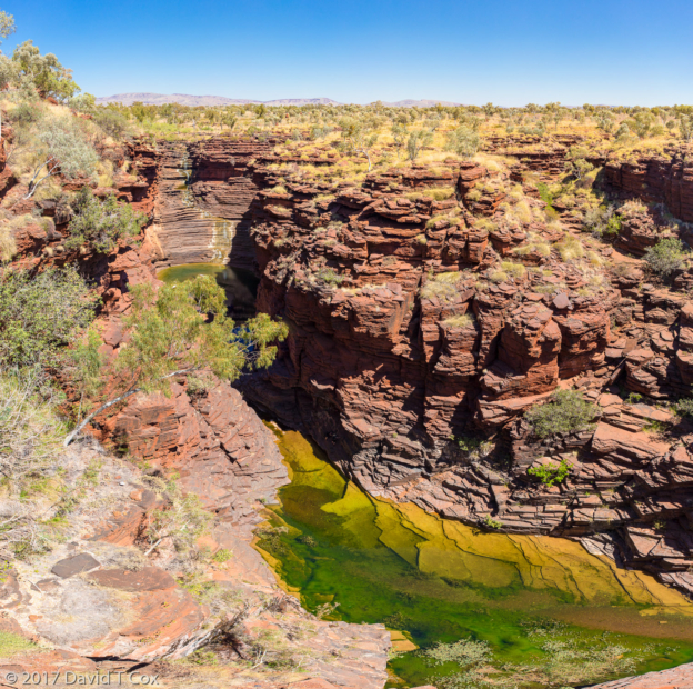
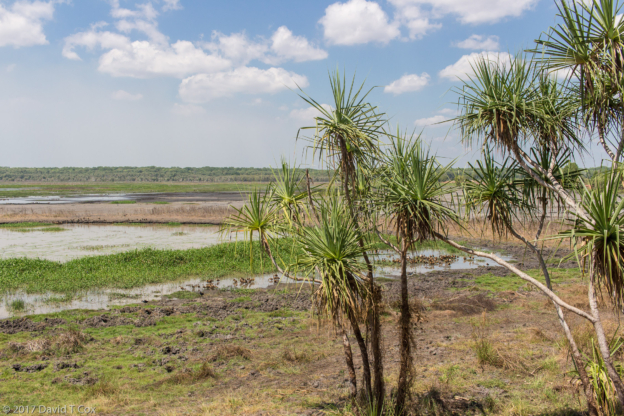
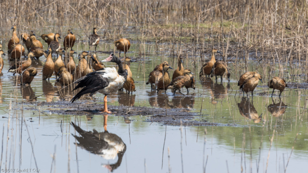
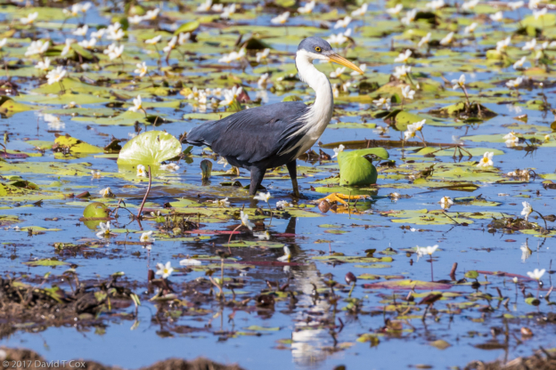
Cooinda is located at the edge of the Yellow Water Floodplain, into which flows the Jim Jim River and out of which flows the South Alligator River, which continues north 100 km to the sea. The Yellow Water Floodplain is a World Heritage Site, with several hundred species of birds, huge numbers of Estuarine Crocodiles, and many wild buffalo (originally imported from Indonesia, but now all feral and dangerous). Flat-boat cruises are available from the Lodge; these take one into the various floodplain channels and up the river for remarkable wildlife viewing. I did successfully get great photos (2nd time) of the very tiny Little Kingfisher, brilliant blue and white, and about the size of medium sized hummingbirds. They are very rare to see, my last one being on the Daintree River 8 years ago. Also I was able again to photograph the other magnificent small kingfisher, the Azure Kingfisher, with its pinkish-orange breast and brilliant azure back, also quite rare to see.
The waters seemed full of 6 inch, fat catfish – fortune was with me in permitting photos of the Australasian Darter (snakebird), Intermediate Egret and Nankeen Night-Heron, each catching and trying to eat one of these catfish, which were huge relative to the bird’s gullets. The catfish have long backward facing spines which the fish lock up until dead. The egrets and herons both strike downward into the water to grab fish in their long beaks, and then flip the fish so they can be swallowed whole, always head first. The darter, on the other hand, actually swims underwater to chase down fish, and rather than grabbing them, it spears the fish with the two forks of its beak, then must come above water to remove the speared fish, which then is maneuvered to be swallowed whole, head first.
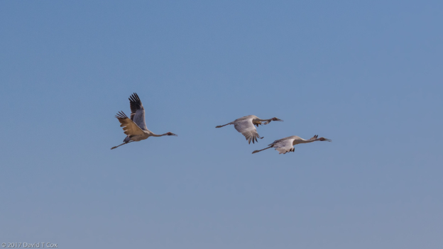
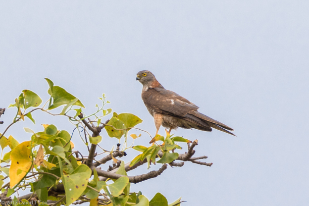
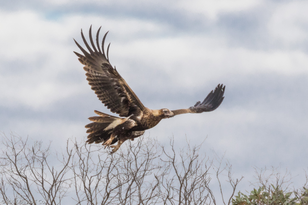
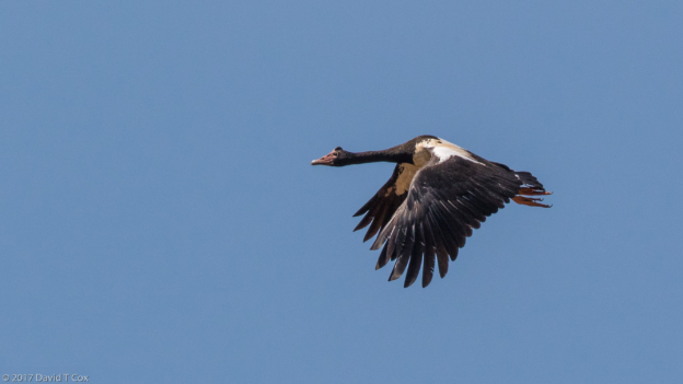
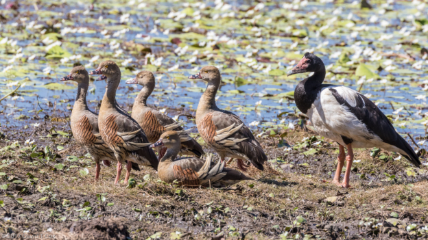
In the foggy early hours of one morning we had extreme luck in witnessing a mating display of two Brolga, very large red-headed cranes similar to Sarus Cranes. The cranes extend their great wings, and leap into the air in a form of dance for each other. Added to these views were encounters with the “grinning” toothy Estuarine Crocs, White-bellied Sea Eagles, protected Radjah Shelducks, a tiny 2-day old Crested Jacana with feet bigger than its body walking on a lily pad, and a couple of dozen other great encounters, all photographed and included below.
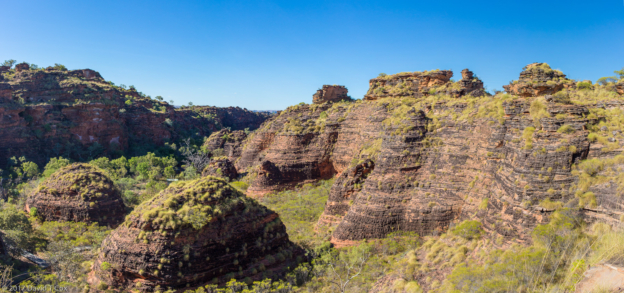
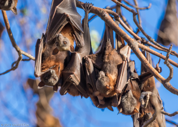
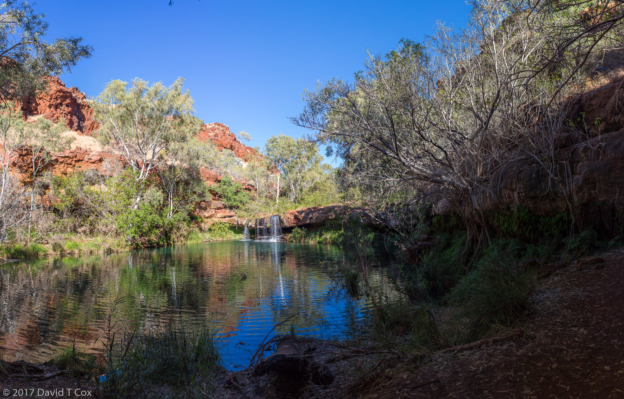
On Friday I drove out the south entrance of the Park, and turned back North toward Darwin to spend one day at the Litchfield National Park. There I found some wondrous termite mounds (among many in this part of Australia), which included the Magnetic Termite Mounds – the mounds appear as giant flat stelae, all perfectly aligned North to South for temperature control, with one part always toward the sun and the other side always shaded, and also the Cathedral Termite Mounds, which are simply monstrous castles, up to 25 feet high, with numerous turrets. Whereas most termites live in colonies underground, these Australian mound termites live in floodplains and so build their “underground” nests above ground level. I also visited the great plunge pool and double waterfall of Wangi Falls, home to fresh water crocs (all in hiding), Black Flying Foxes loudly filling the trees surrounding the pool, and feral pigs in the forest.
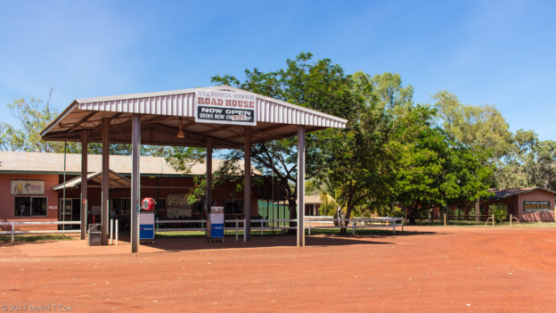
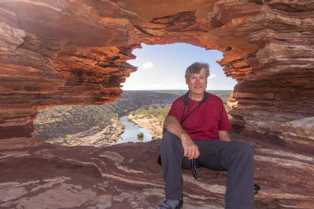
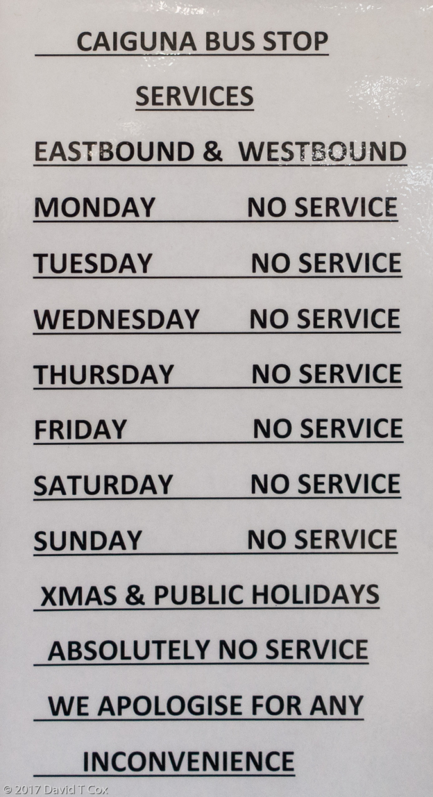
Saturday I headed south to Katherine where I now am staying for a few days. I have been without Wi-Fi for nine straight days, and so needed some time to get this travel report posted. Also, I now will start my travel west which will take me around Western and then Southern Australia over the next 10 weeks. While stocking up supplies a consistent issue here in the Northern Territory is a little annoying. Due to some drinking problems with the aboriginals (similar, I believe, to that with some Native Americans such as the Navajo, in which their livers genetically do not process alcohol as rapidly as other people), severe restrictions exist on some form of purchases. Arnhem Land is completely dry (except for the licensed lodge pubs). Darwin and Katherine have liquor stores, but operating hours are limited to 6 hours per day, and many wines, including the cask wines I buy for travel (no glass) are limited to one purchase per day – this is enforced by requiring one’s identification to be entered into a national database, which is accessed before each purchase, and will alert the store if a purchase already has been made that day. This restriction means a trip to the liquor store daily in order to stock up for the weeks in the outback.
As two weeks have passed, and a lot of photographic activity has occurred, quite a number of photos are included below, though these still only represent about 1 out of every 200 photos I have taken. More time may be needed to permit download of these even in the relatively smaller format of my travelogue. Also, as a reminder, these photos can be fully appreciated only on a high-resolution monitor (Smart phones just don’t do the photos justice, though they will reproduce low resolution full images).
That is it for now. Life continues to be good and being on the road again always is marvelous. Dave
-
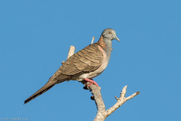
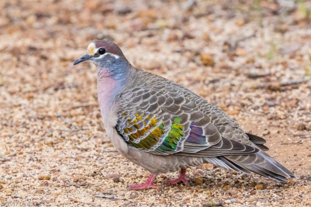
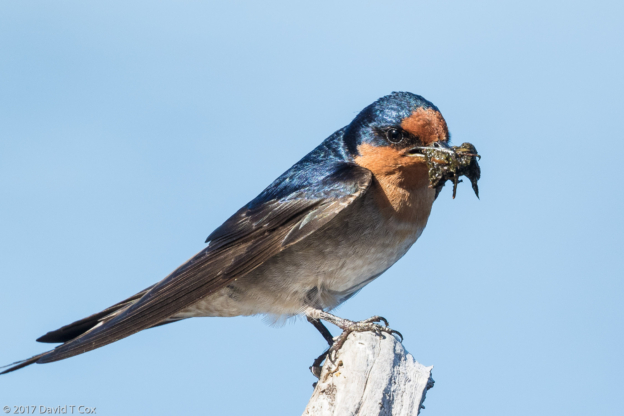
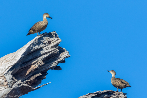
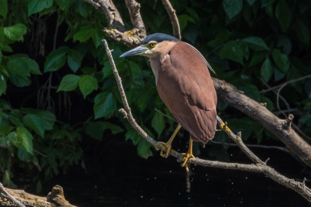
- Bar-shouldered Dove, Lee Point, Darwin, NT, Australia
-
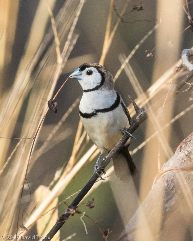
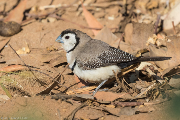
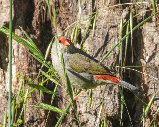
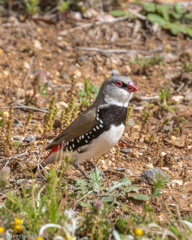
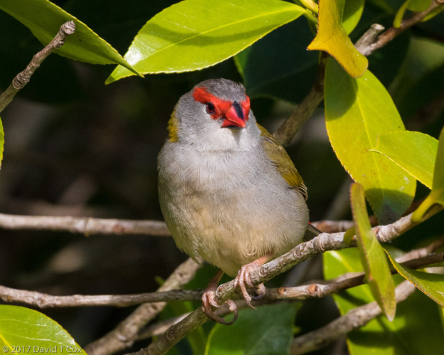
- Double-barred Finch, Lee Point, Darwin, NT, Australia
-
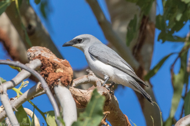
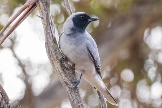
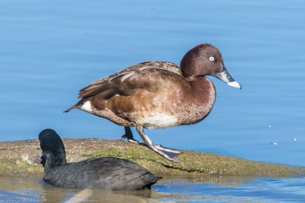
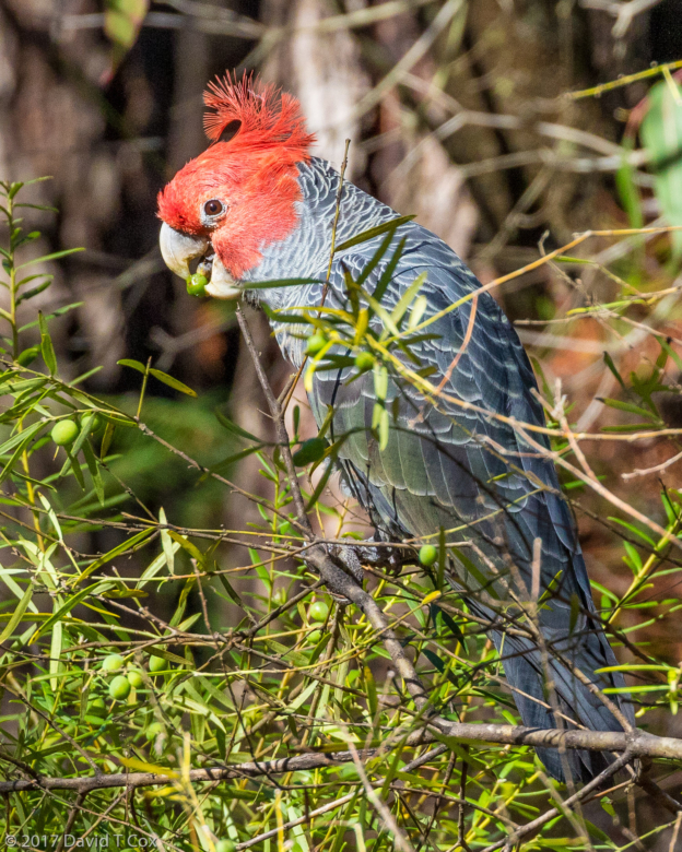
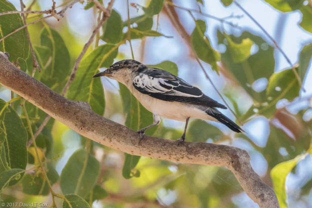
- White-bellied Cuckoo-Shrike, Lee Point, Darwin, NT, Australia
-
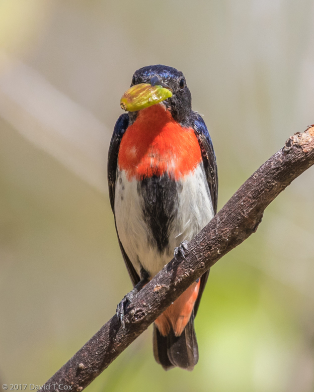
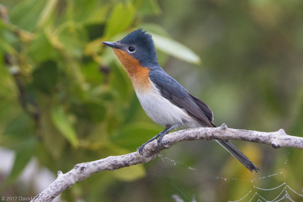
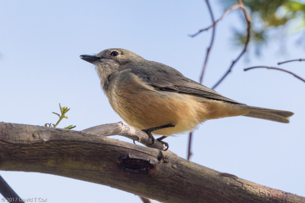
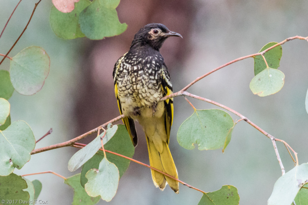
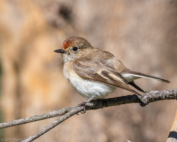
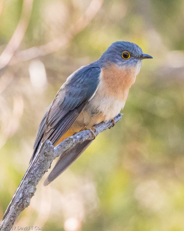
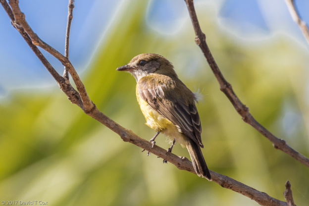
- Mistletoebird, Charles Darwin NP, NT, Australia
-
- Fogg Dam Conservation Area, NT, Australia
-
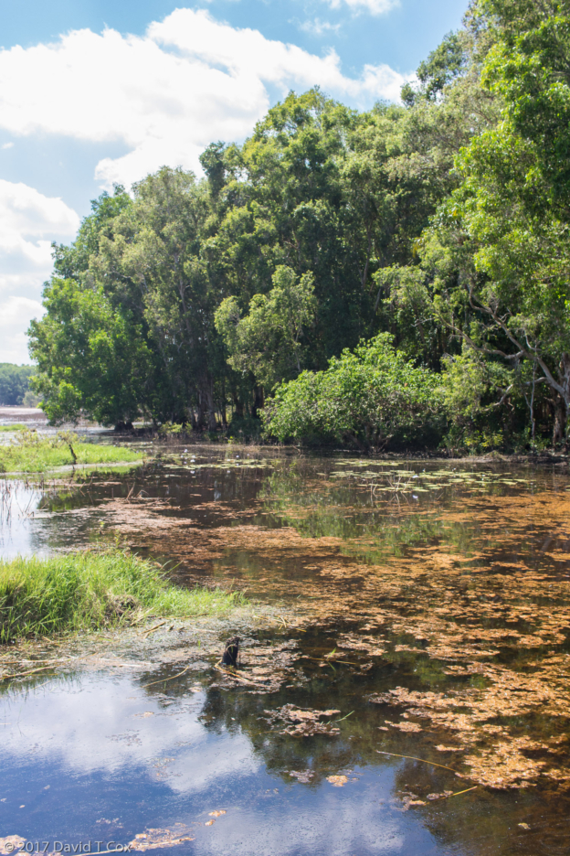
- Fogg Dam Conservation Area, NT, Australia
-
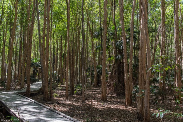
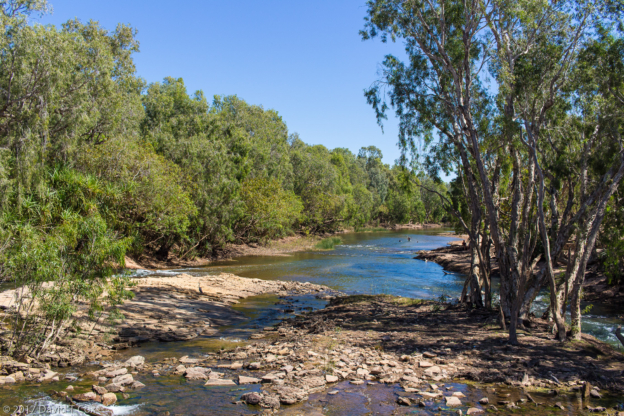
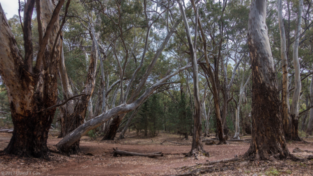
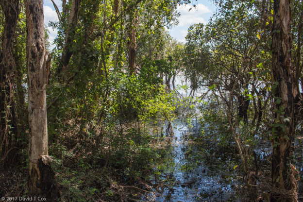
- Paperbark forest, Fogg Dam Conservation Area, NT, Australia
-
- Forest Kingfisher, Fogg Dam Conservation Area, NT, Australia
-
- magpie Goose, Fogg Dam Conservation Area, NT, Australia
-
- Fogg Dam Conservation Area, NT, Australia
-
- Wandering Whistling Duck and Magpie Goose, Fogg Dam Conservation Area, NT, Australia
-
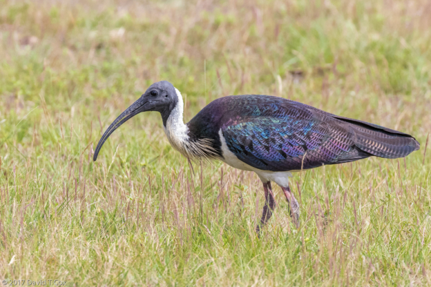
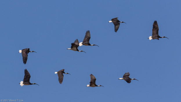
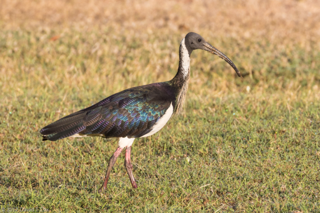
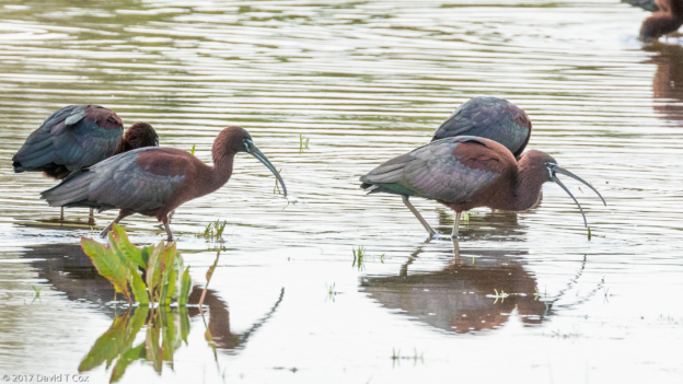
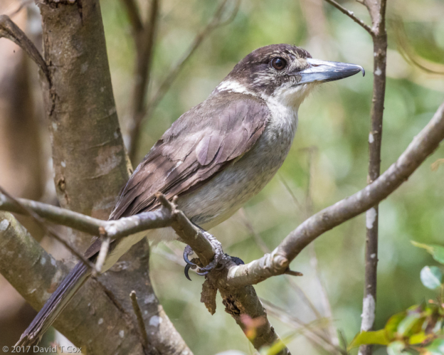
- Straw-necked Ibis, Mary River Wilderness Resort, NT, Australia
-
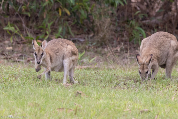
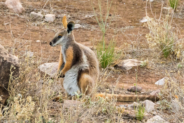
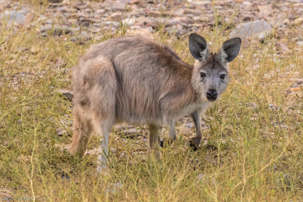
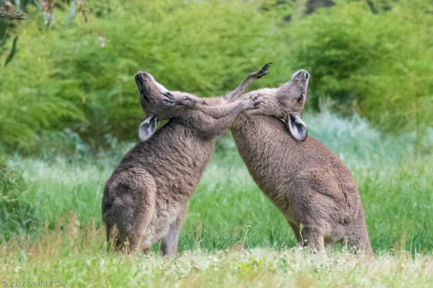
- Agile Wallaby, Mary River Wilderness Resort, NT, Australia
-
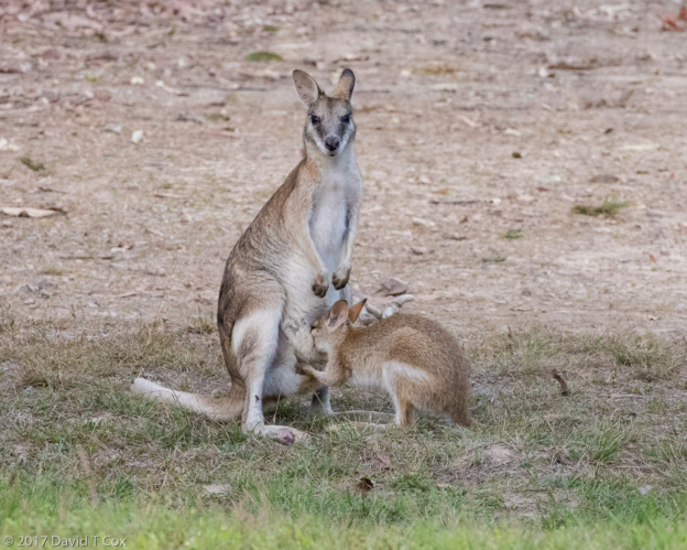
- Agile Wallaby and feeding Joey, Mary River Wilderness Resort, NT, Australia
-
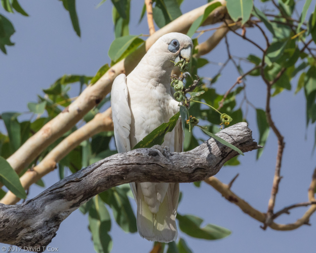
- Little Corella, feeding on Eucalyptus, Mary River Wilderness Resort, NT, Australia
-
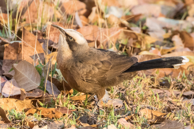
- Varied Triller, Mary River Wilderness Resort, NT, Australia
-
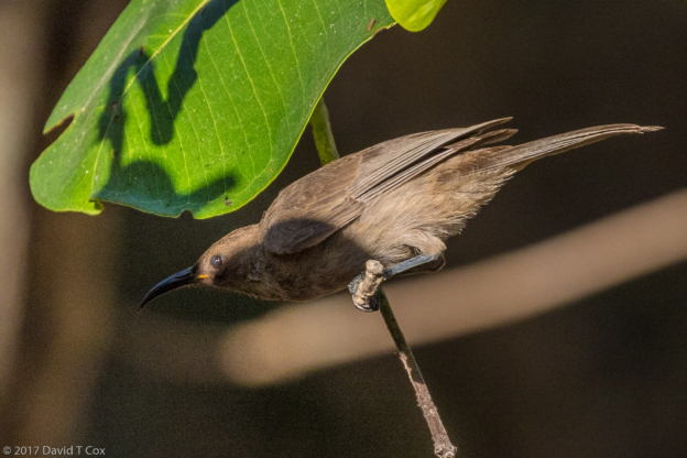
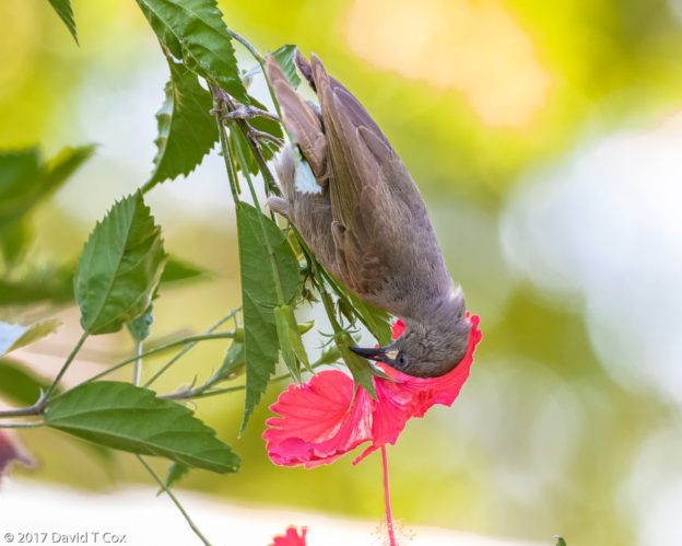
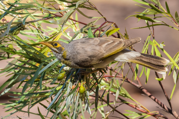
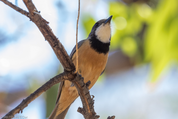
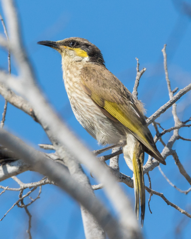
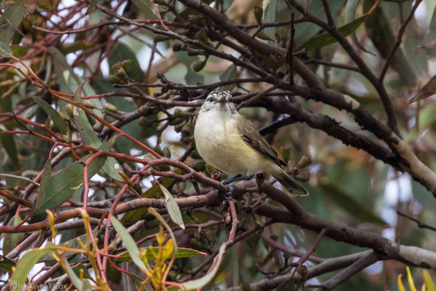
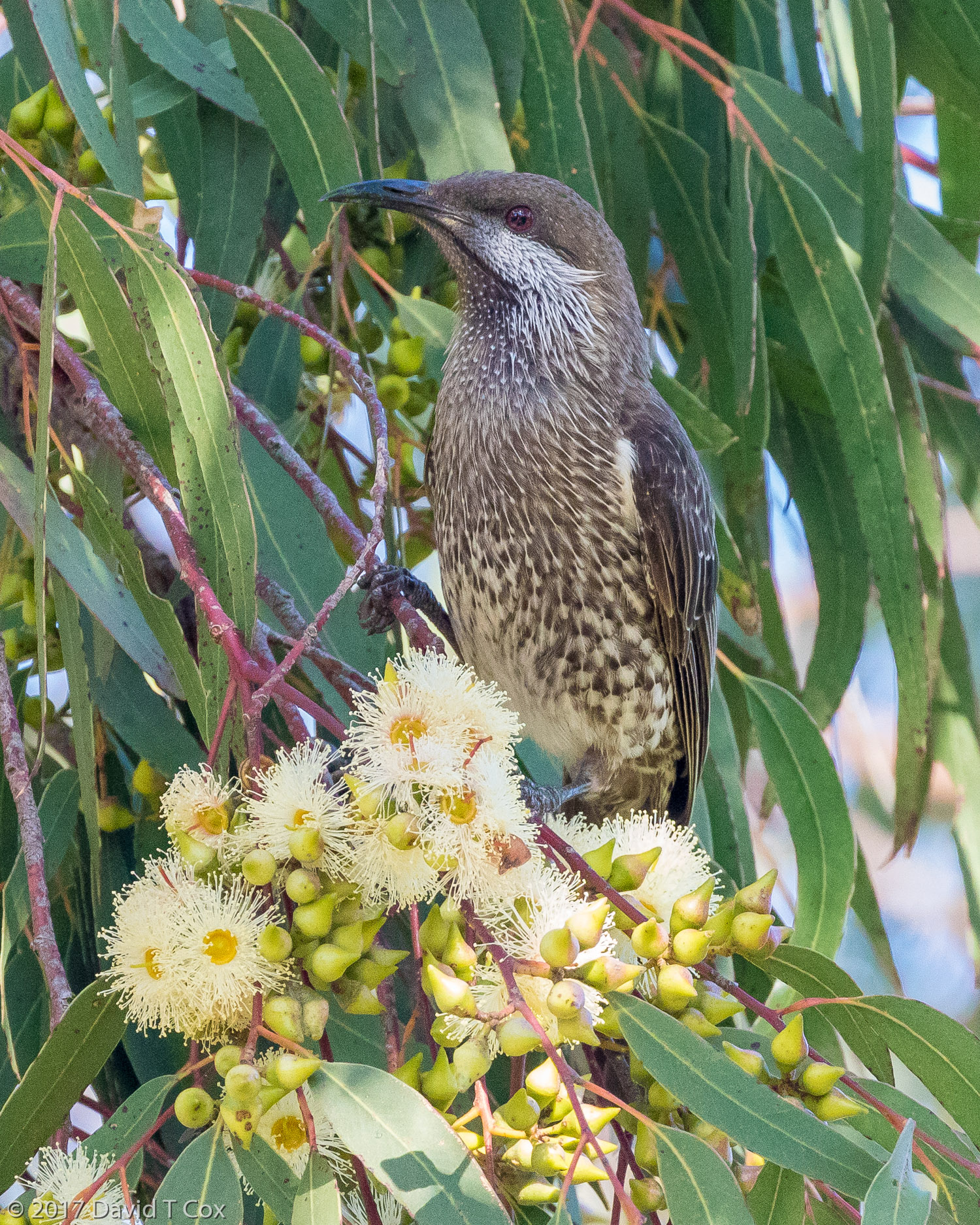
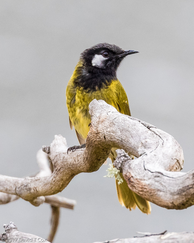
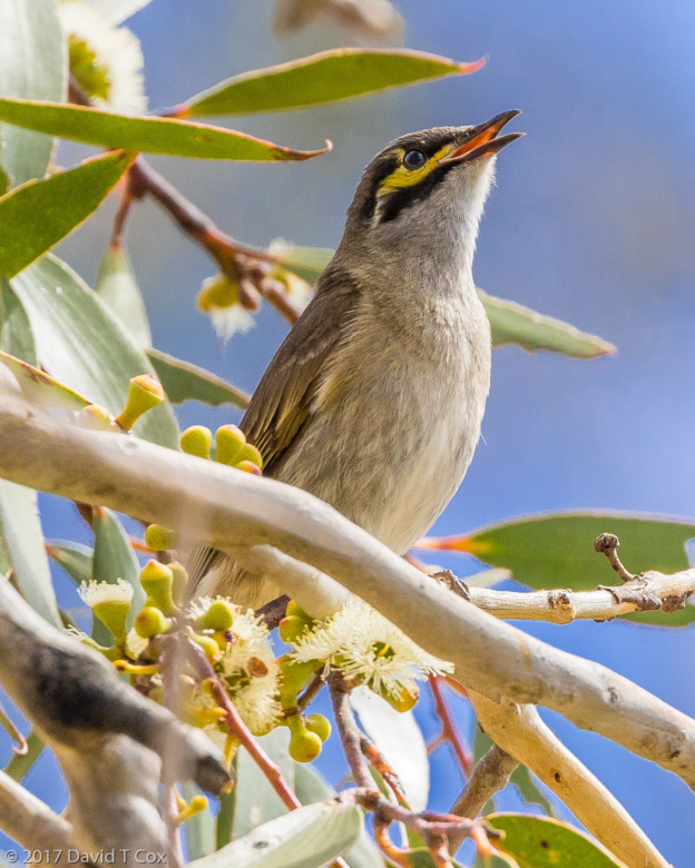
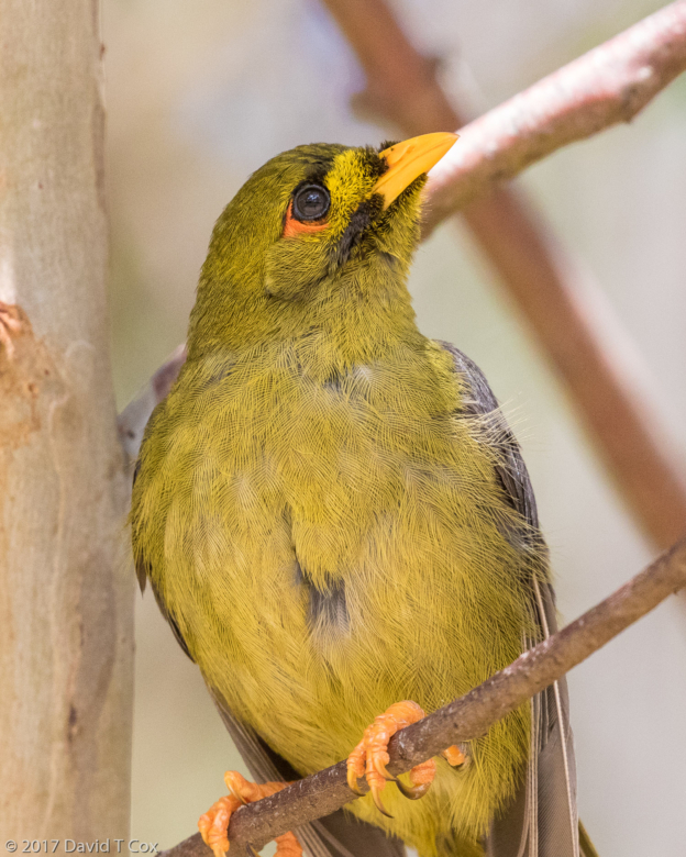
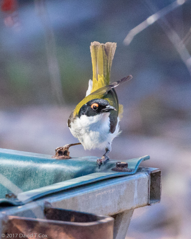
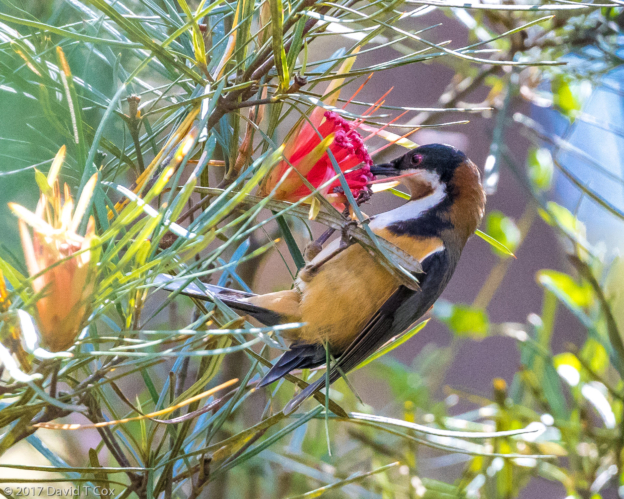
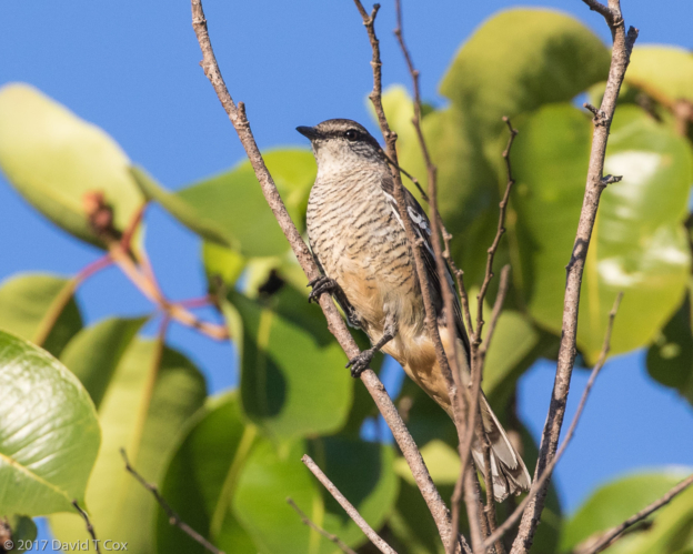
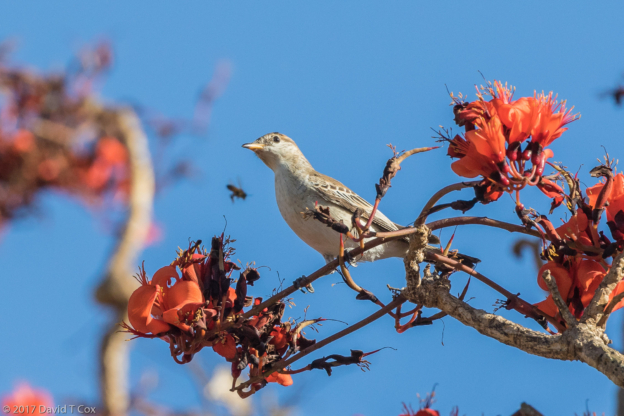
- Brown Honeyeater, Mary River Wilderness Resort, NT, Australia
-
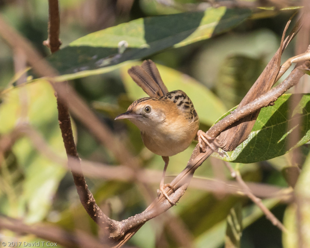
- Golden-headed Cisticola, Mary River Wilderness Resort, NT, Australia
-
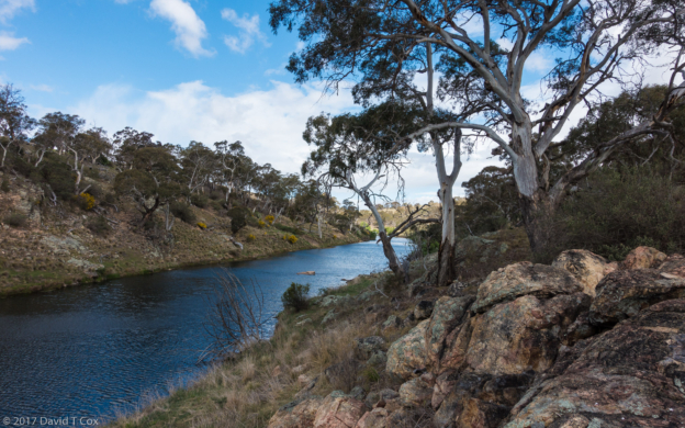
- Mary River Wilderness Retreat riverside trail, NT, Australia
-
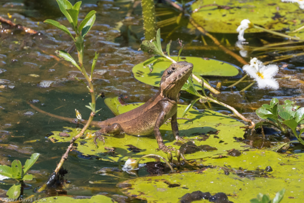
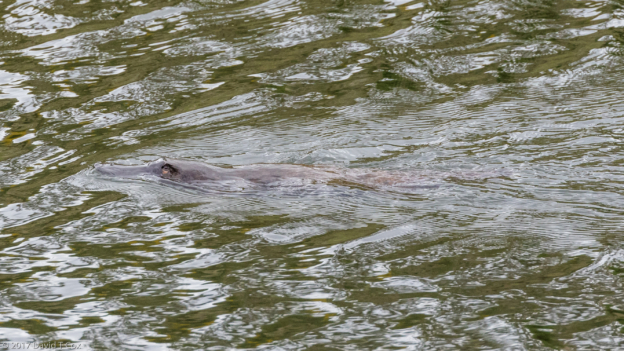
- water lizard, Mamukala Wetlands, Kakadu NP, NT, Australia
-
- White-winged Triller, Mamukala Wetlands, Kakadu NP, NT, Australia
-
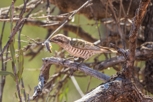
- Horsfield’s Bronze-Cuckoo, Mamukala Wetlands, Kakadu NP, NT, Australia
-
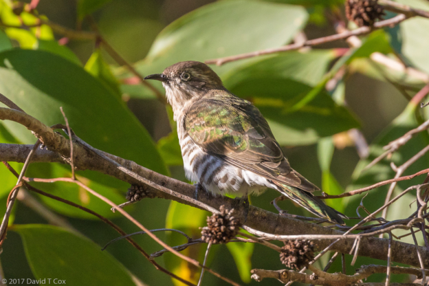
- Cicadabird, Mamukala Wetlands, Kakadu NP, NT, Australia
-
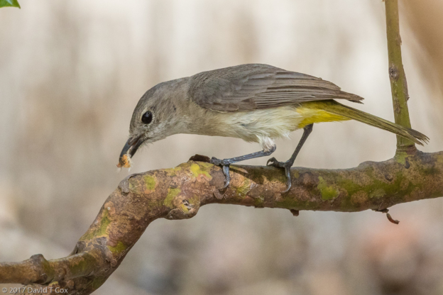
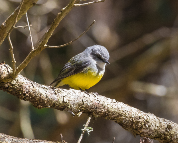
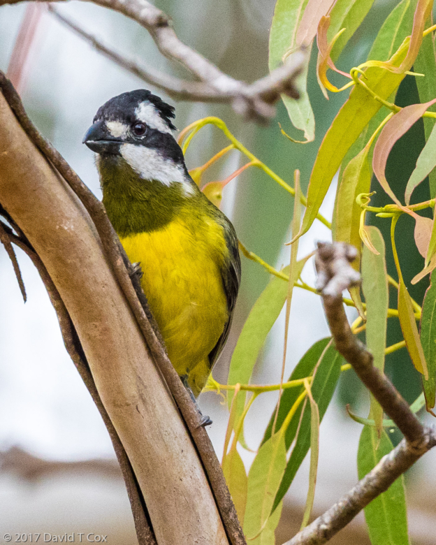
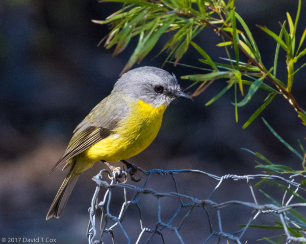
- Lemon-bellied Flycatcher, Mamukala Wetlands, Kakadu NP, NT, Australia
-
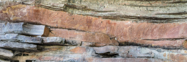
- Main Gallery Pano 3, Ubirr, Kakadu NP, NT, Australia
-
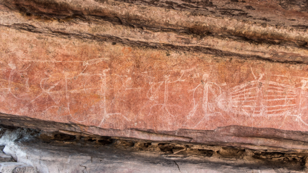
- Namarrgarn Sisters gallery, Ubirr, Kakadu NP, NT, Australia
-
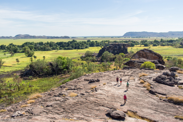
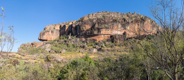
- Nadab Hill Lookout, Ubirr, Kakadu NP, NT, Australia
-
- image of Mabuyu, Ubirr, Kakadu NP, NT, Australia
-
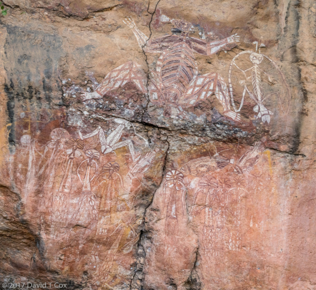
- Namarrgon – Lightning Man artwork, Pano, Anbangbang (Nourlangie), Kakadu NP, NT, Australia
-
- Namanjolg’s Feather, Pano 1, Bunwarrdehwarrde Lookout, Anbangbang (Nourlangie), Kakadu NP, NT, Australia
-
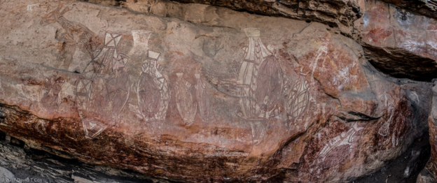
- Nanguluwur Rock Art Pano, Nourlangie Rock, Kakadu NP, NT, Australia
-
- Nawurlandja Lookout Hill, Anbangbang Billabong, Kakadu NP, NT, Australia
-
- Plumed Whistling Duck and Magpie Goose, Anbangbang Billabong, Kakadu NP, NT, Australia
-
- Chestnut-Quilled Rock-Pigeon, Nawurlandja Lookout Hill, Anbangbang Billabong, Kakadu NP, NT, Australia
-
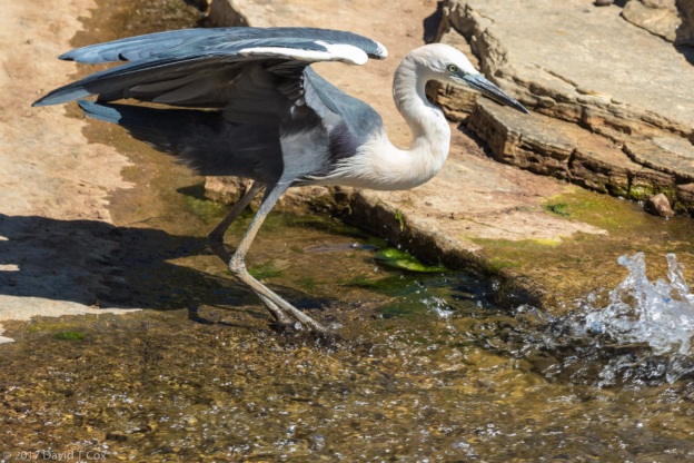
- Pied Heron, Anbangbang Billabong, Kakadu NP, NT, Australia
-
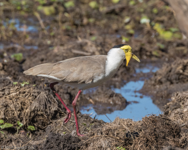
- Masked Lapwing ss miles, Anbangbang Billabong, Kakadu NP, NT, Australia
-
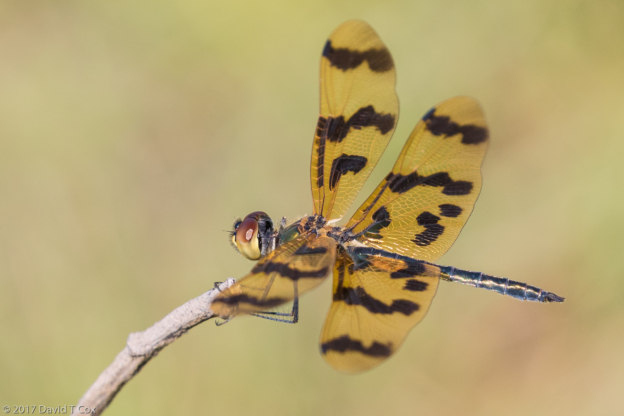
- small dragonfly, Anbangbang Billabong, Kakadu NP, NT, Australia
-
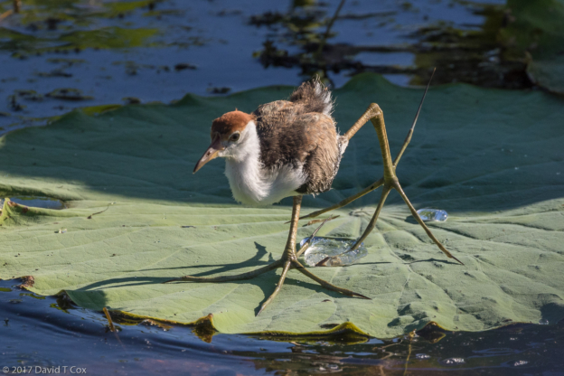
- Comb-crested Jacana infant, Yellow Water Wetlands, Kakadu NP, NT, Australia
-
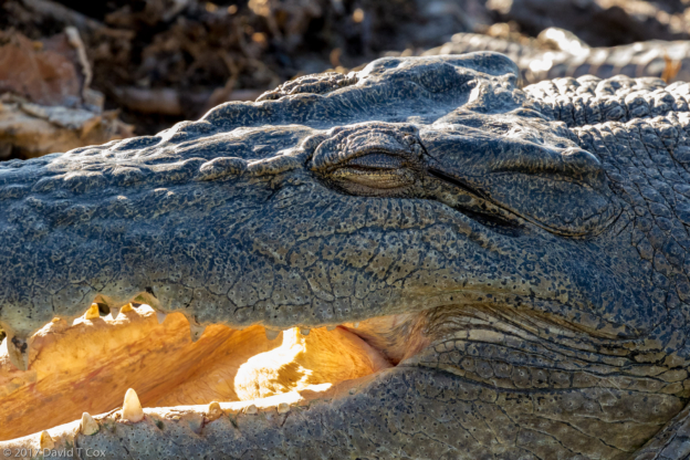
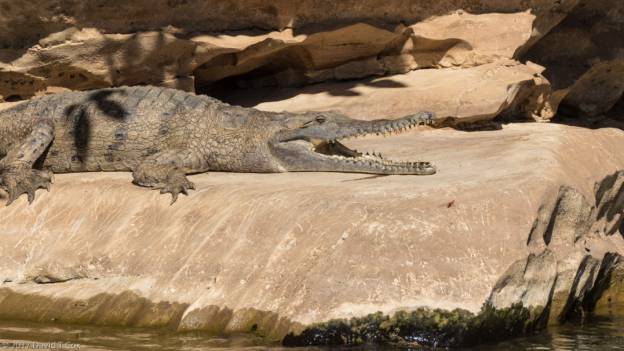
- Estuarine Crocodile, Yellow Water Wetlands, Kakadu NP, NT, Australia
-
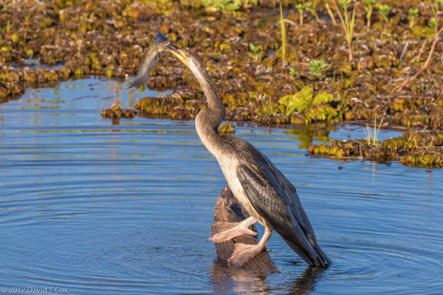
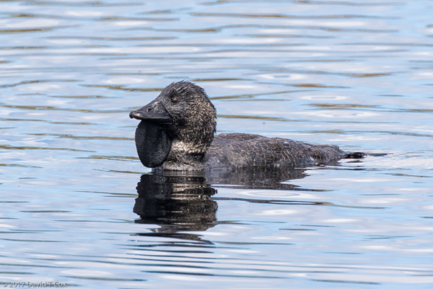
- Australasian Darter with catfish, Yellow Water Wetlands, Kakadu NP, NT, Australia
-
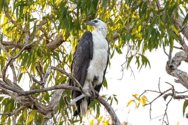
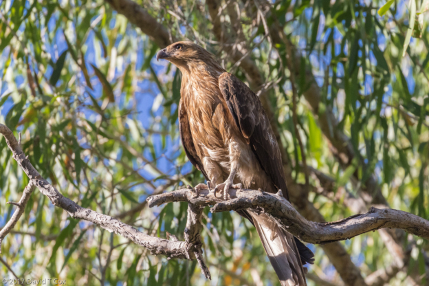
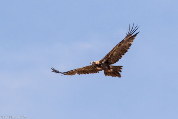
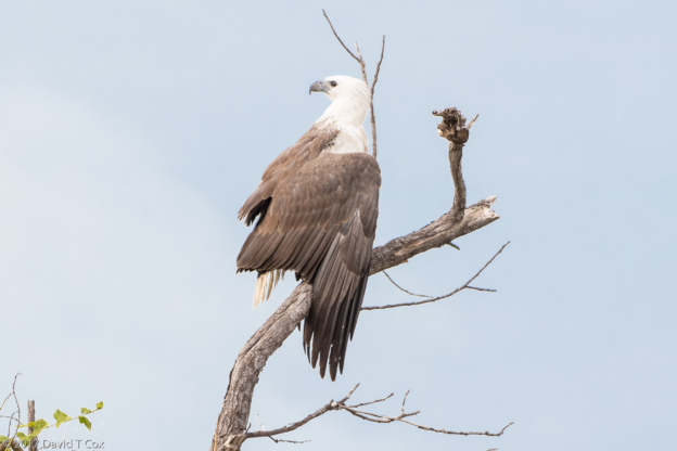
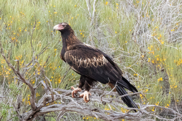
- White-bellied Sea-Eagle, Yellow Water Wetlands, Kakadu NP, NT, Australia
-
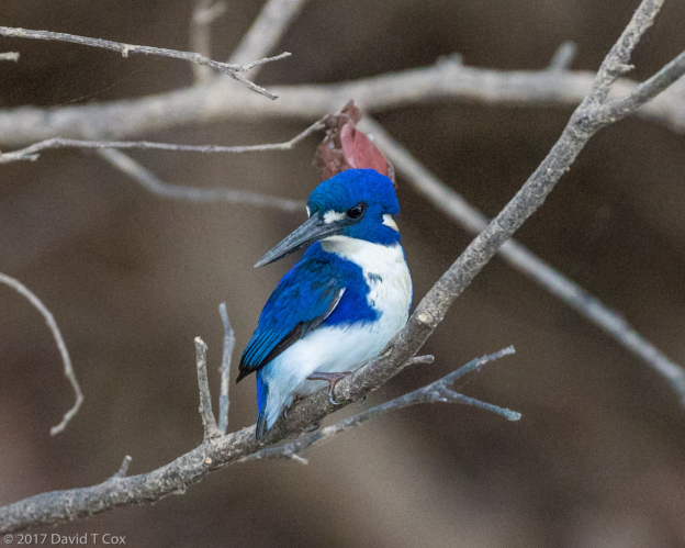
- Little Kingfisher, Yellow Water Wetlands, Kakadu NP, NT, Australia
-
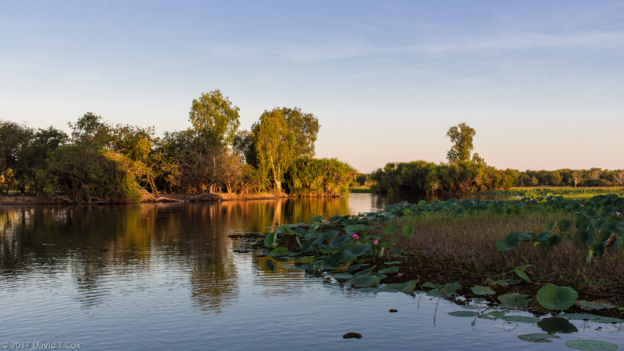
- close to sunset on Yellow Water Wetlands, Kakadu NP, NT, Australia
-
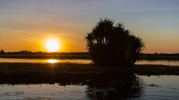
- sunset behind pandamus, Yellow Water Wetlands, Kakadu NP, NT, Australia
-
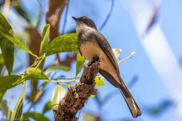
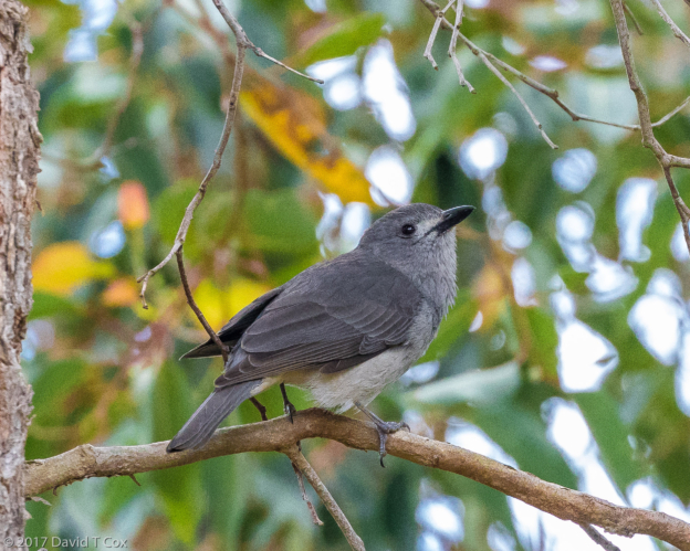
- Northern Fantail, Mardugal Billabong, Kakadu NP, NT, Australia
-
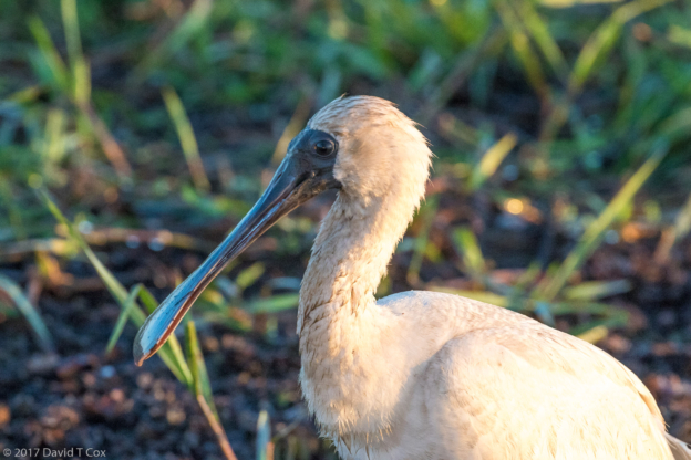
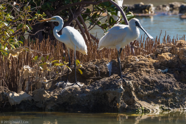
- Royal Spoonbill, Yellow Water Wetlands, Kakadu NP, NT, Australia
-
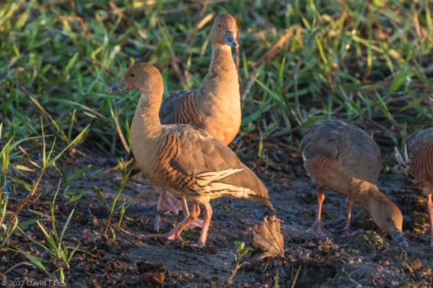
- Plumed Whistling Duck, Yellow Water Wetlands, Kakadu NP, NT, Australia
-
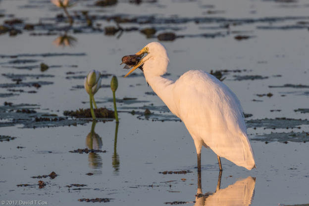
- Intermediate Egret with catfish, Yellow Water Wetlands, Kakadu NP, NT, Australia
-
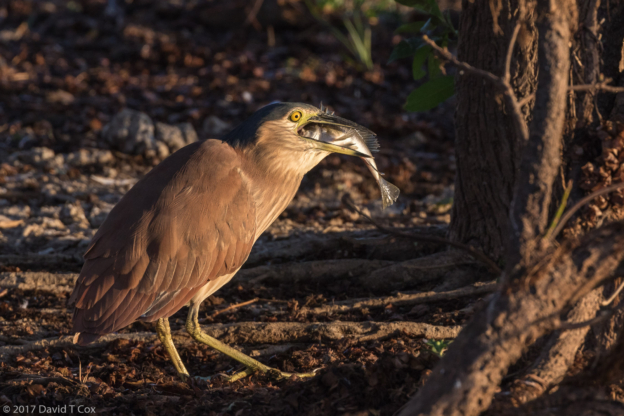
- Nankeen NIght-Heron w catfish, Yellow Water Wetlands, Kakadu NP, NT, Australia
-
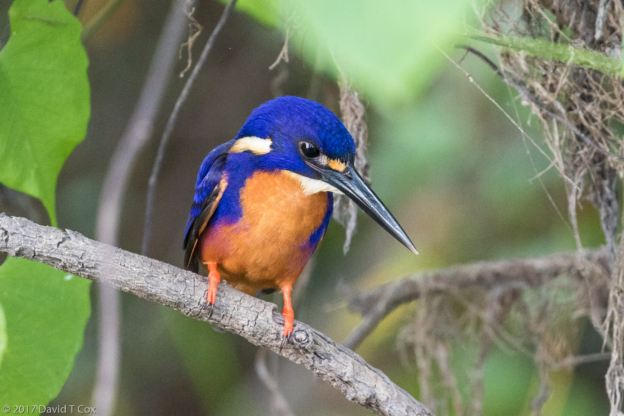
- Azure Kingfisher, Yellow Water Wetlands, Kakadu NP, NT, Australia
-
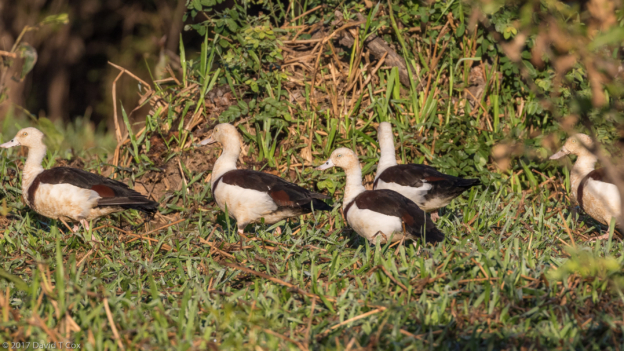
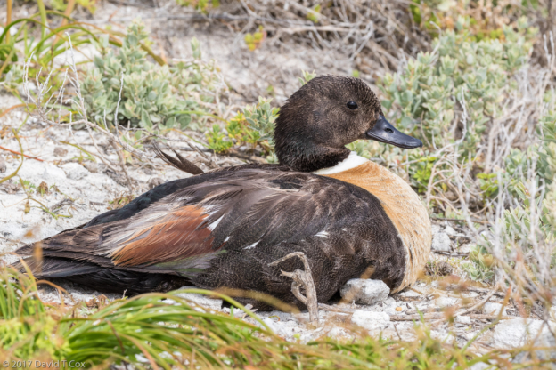
- Radjah Shelduck, Yellow Water Wetlands, Kakadu NP, NT, Australia
-
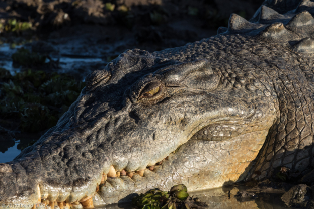
- Estuarine Crocodile, Yellow Water Wetlands, Kakadu NP, NT, Australia
-
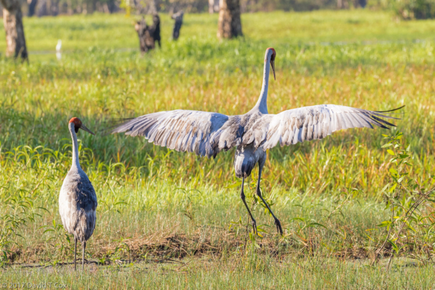
- Brolga dance display, Yellow Water Wetlands, Kakadu NP, NT, Australia
-
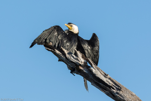
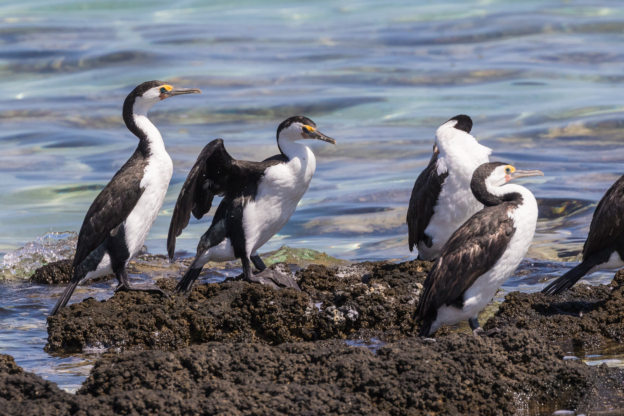
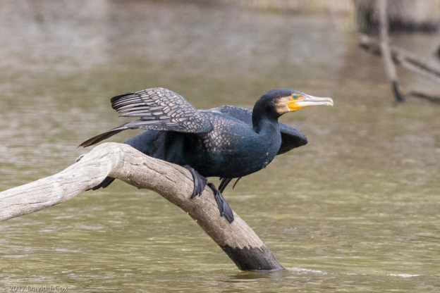
- Little Pied Cormorant, Yellow Water Wetlands, Kakadu NP, NT, Australia
-
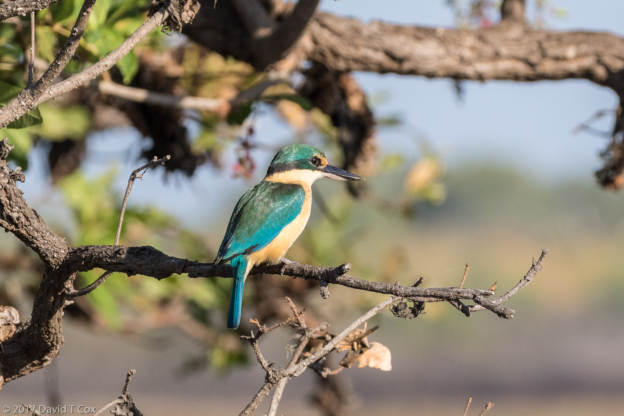
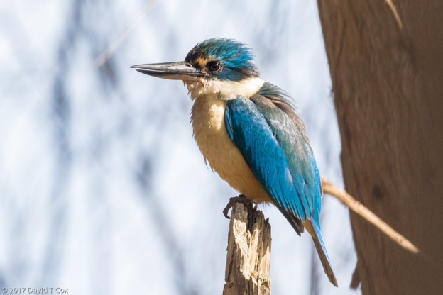
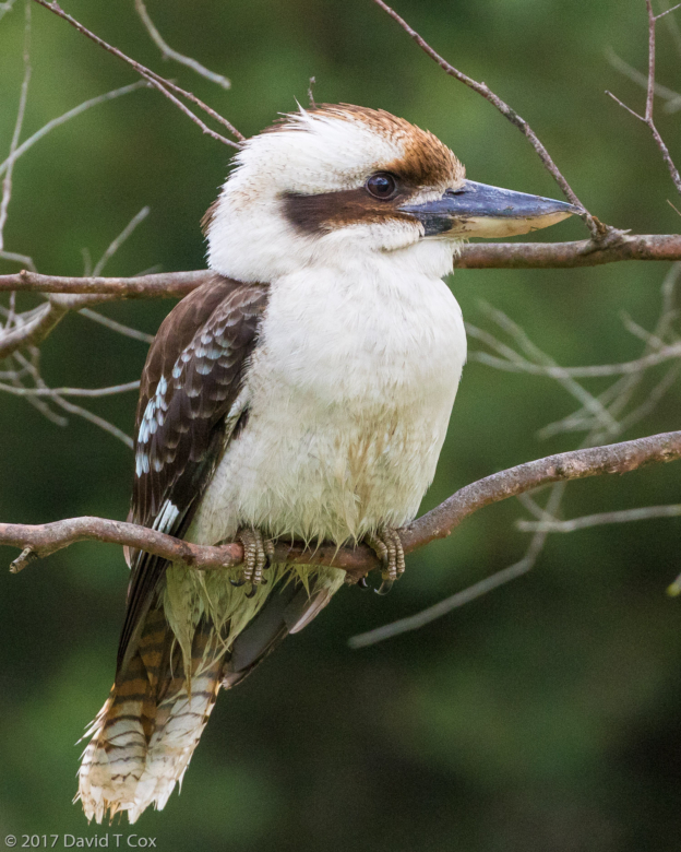
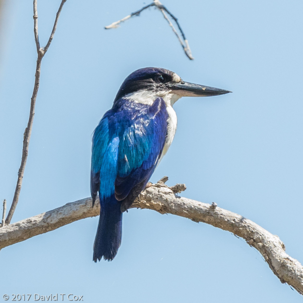
- Sacred Kingfisher, Yellow Water Wetlands, Kakadu NP, NT, Australia
-
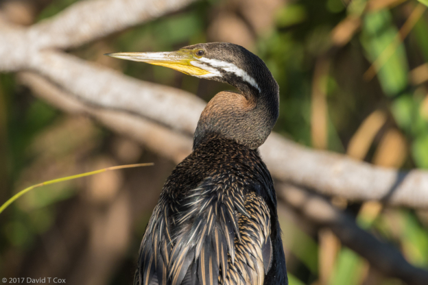
- Australasian Darter, Yellow Water Wetlands, Kakadu NP, NT, Australia
-
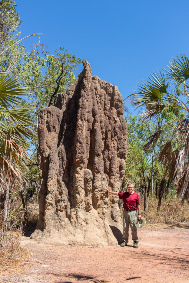
- Dave at a Cathedral Termite Mound, near Magnetic Termite Mounds site, Litchfield NP, NT, Australia
-
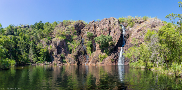
- Wangi Falls, panorama 1, Litchfield NP, NT, Australia