Category Archives: 2014 USA-4-Corners RV Trip

On the road in the Arizona 4-Corners Region, July 27, 2014

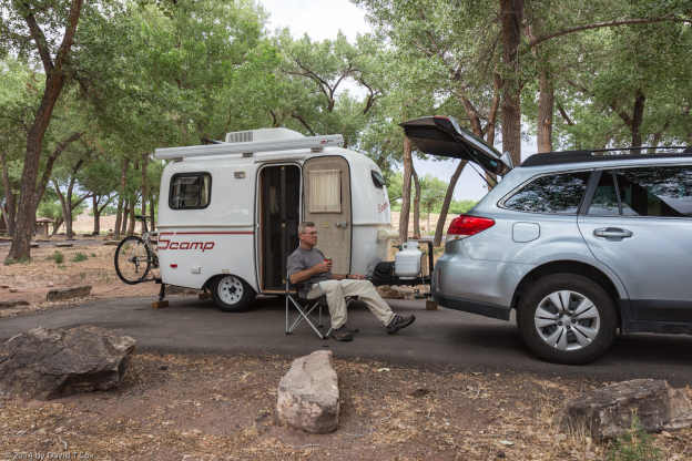
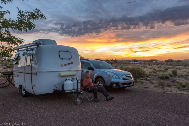
Hello all. I last posted a travelogue while traveling in Cambodia and Thailand last winter. I spent several months over Spring in Tucson taking care of house issues, and then exploring some medical issues. I became bored and decided to pack up the little Scamp RV and head north towards the 4-corners. I have been on the road almost 2 weeks and have traveled less than 200 miles, as the crow flies (but have put over a 1,000 miles on the odometer). With no very specific destinations in mind, and no time constraints whatsoever, I find more and more to do at each stop and so extend my stays day by day.
Two weeks ago I drove north to Cottonwood, AZ which sits on the pretty little Verde River – it is a very green valley belt running between high country with the mountains of Prescott to the south, and the Mogollon Rim to the north. I stayed for the second time in the attractive Arizona State Park called Dead Horse Ranch; back in the early 1900s the family that bought the land looked at a number of properties, and when they asked their kids which they liked best, they responded “the one with the dead horse”, and so the name stuck – indeed, the family required Arizona to keep the name as a condition to receipt of the gift of the property for a state park.
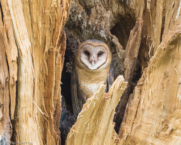
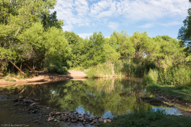
Every morning at sun-up I walked for several miles down along the river, a very small but permanent flow through a huge river channel from the occasional violent flooding. The channel is filled with dead logs and young cottonwood trees, and the much higher banks are lined with ancient cottonwoods. The first day I found a barn owl nest in a hole in a cottonwood; a number of mornings the young fledgling would come up and sit sleeping in the early morning on the edge of the nest hole. I only saw a parent once, very briefly. Further down river I found a Cooper’s hawk nest with 2 fledglings which were trying their wings every day, with short hopping flights from branch to branch of a dead tree next to the nest. My real goal was to find and photograph river otters, which the park rangers saw occasionally; I spotted their footprints twice but had no luck finding them. My lack of success spilled over into two pretty lame attempts at fishing for the reputed large mouth bass and catfish in the three lagoons in the park. The rangers assured me the lagoons were full of fish, because that is mostly where the illusive river otters came to feed. As usual, the only things grabbing my hooks were the weeds and sticks at the bottom of the lakes.
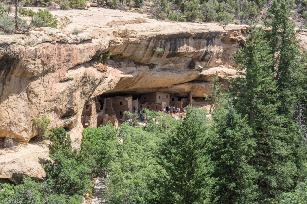
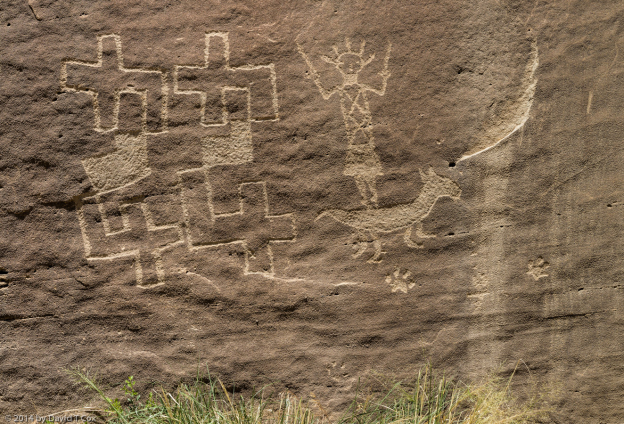
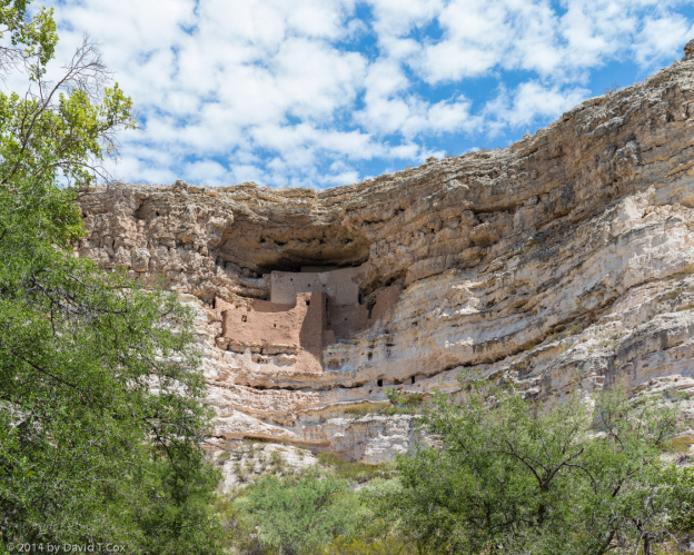
While in the Verde Valley I spent half a day re-visiting Montezuma’s Castle (a national Monument), one of the better preserved and most scenic of the smaller Puebloan cliff dwellings in the southwest. It was constructed by the Sinaguan peoples around the late 12th century. I also spent a day driving northwest of Sedona to two other Sinaguan Pueblos from the same period. Both are located at the base of red-rock cliffs at sites which used to have water seeps. Palatki, which is not open to “Pink Jeep” tours from Sedona, is the more interesting site with several alcoves of good rock art, including some archaic period geometric petroglyphs, many Sinaguan petroglyphs, some pictographs (one of which astonished me, as it appears almost certainly to be an archaic “Barrier Canyon style”, which I am not aware is supposed to be this far south), and more recent charcoal pictographs done by the Apaches and Yavapai which include people riding horses (horses were not seen here until just before 1800 when the Spanish made brief trips into the valley). A few miles away the ruins of Honanki, which not only permit “Pink Jeep” tours from Sedona, but are in part maintained by the Pink Jeep tours people, are slightly more dramatic, but include much less rock art. During the day the site sometimes seems overrun with tour groups, and the very rough dirt roads into the site are constantly under clouds of dust from the tourist laden pink jeeps.
The camp site next to mine at the Dead Horse St Pk had a pitched tent, but I never saw anyone at the site for 2 days. The third evening, a truck pulled up, and I met Rudy Soto, newly hired as a tribal policeman by the Yavapai-Apache Reservation, located just down the Verde Valley. Rudy is Apache, looks like George Clooney, has a child with his Finnish wife (currently in Finland), and has just moved up from Tucson, not yet deciding where to buy a house, and so camping out the first few weeks. We spent a couple of late afternoons chatting over beer. It was interesting talking to him about his work, as I was just half way through reading my second Tony Hillerman mystery novel about Navajo police work. Rudy intends on earning his detective badge, and eventually moving up to the 4-corners high country for work.
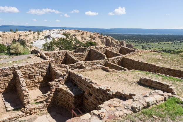
After 6 days in the Verde Valley I hauled my Scamp down the valley and up onto the Mogollon Rim to Winslow (which still has a city park with a statue honoring “Standin’ on a corner in Winslow Arizona”, the Eagle’s song); I stayed in another Arizona Park just outside of town called Homolovi, the site and name of a number of Puebloan Indian ruins of the Anasazi (Ancestral Puebloans) from about 800 to 1300. I had visited the ruins before, which are not particularly interesting from a tourist perspective, but a number of good rock art sites are in the area.
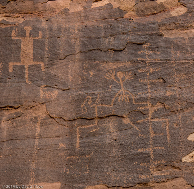
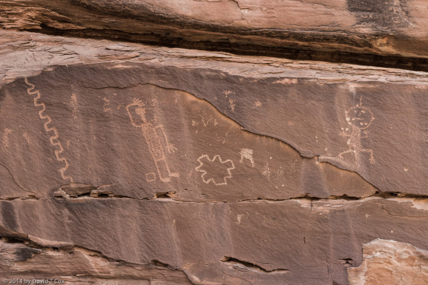
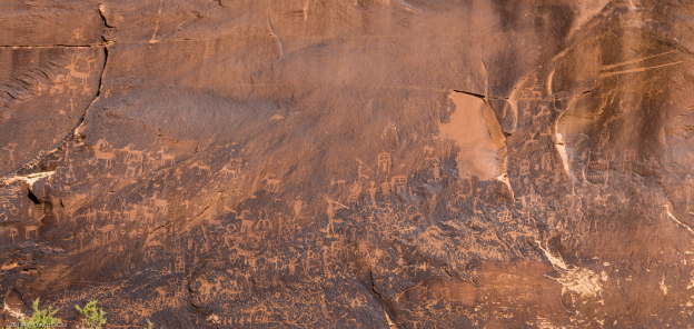
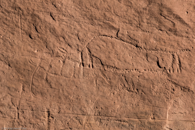
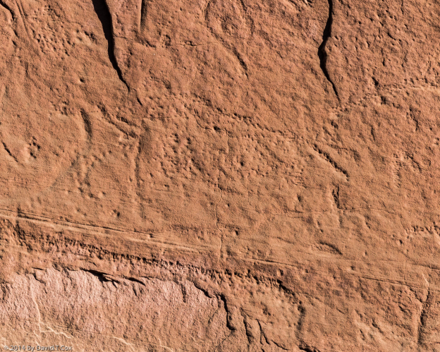
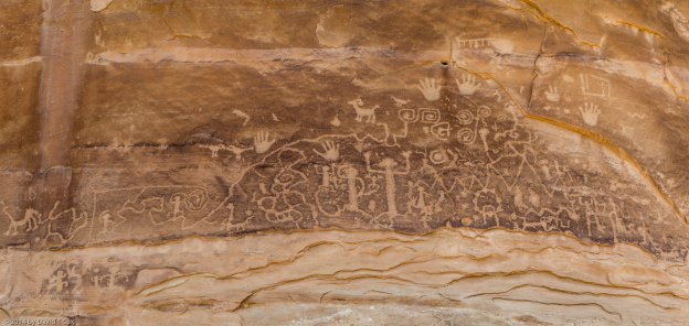
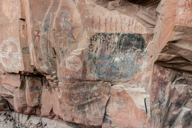
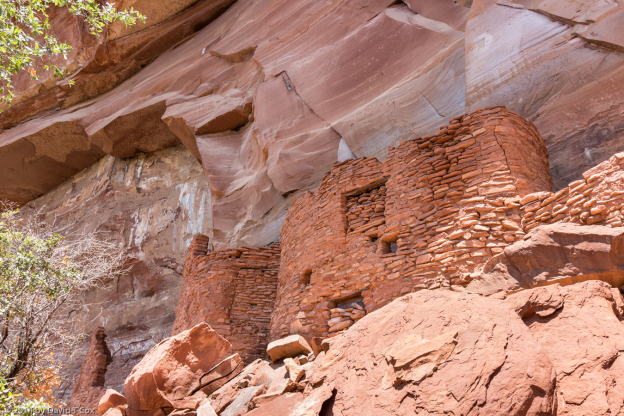
After perusing a masters thesis written by Sally Love in the 1980s, which studied the rock art of the area, I spent several days hiking and locating some of the better art. It was all Ancestral Puebloan art, and the ruins are mentioned prominently in the oral histories of 10 of the Hopi Indian clans as ancestral lands. Much of the rock art is thought to be iconographic representations of ancestral forms of the Hopi katsinas (aka kachinas, which are sort of supernatural spirits which guide aspects of life), and so is quite different from other Anasazi petroglyphs I have seen. Of particular interest to me was locating a related Puebloan site called the Cottonwood Creek Pueblo; it had been studied years earlier, but now is located on almost inaccessible land some miles east of the 4 Homolovi sites. With permission from one, I hiked across 2 rancher’s barren land along the route of old Hwy 66 out to the Cottonwood Creek, and beyond found the bluffs which held the ruins of the old pueblo on top. Below the ruins, along the top cliff edges of the bluff, are many large “panels” of smooth sandstone rock faces with dark patinas from aging; Upon many of these panels the ancients created their petroglyphs. It was a very tiring and hot day, but fascinating to locate many of the petroglyph panels which may not have been seen since the 1980s when Ms. Cole did her research.
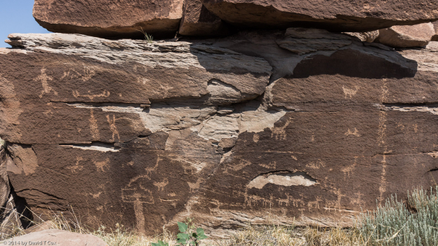
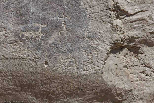
Last Wednesday I drove just 35 miles east to Holbrook, and am staying now in a small private RV camp on the north edge of town. I was able to meet Mike Odell, who has worked for the Holbrook City water and parks for many years, and helped get the town to purchase property to the north which includes a large Anasazi petroglyph field around high bluffs. Mike spent over 4 hours giving me a private tour of the site, locating many petroglyph panels I probably never could have found by myself; again a number of the panels had extraordinary figures. I gave Mike a complete set of the photos I took for possible future use as the town tries to develop the site for limited tourism (the town just received a $100,000 grant for such development – much of which will be used to fence and protect the site from ever increasing vandalism – a sad problem besetting any number of rock art sites as they become better known).
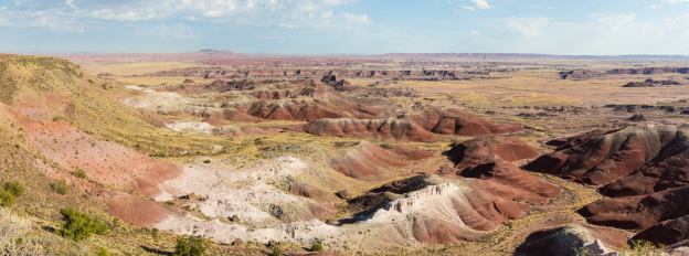
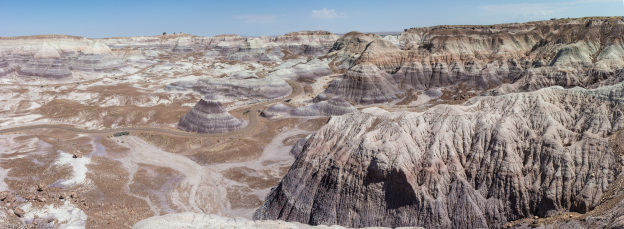
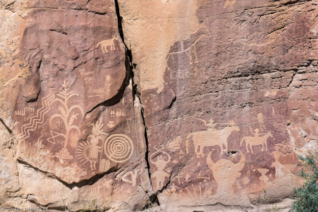
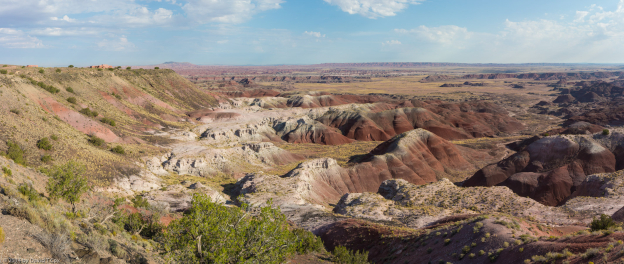
I have spent the last two days visiting the Petrified Forest (and Painted Desert) National Park; several days ago I called and spent some time on the telephone with Bill Reitze, the resident archaeologist for the Park, discussing the location of some wilderness rock art. The first day I hiked north of the south entrance to find a number of rather hard to get to petroglyph panels – the hike to the area was not difficult, but climbing the boulder fields up 50 degree soft pack sediment was not an easy task. Many of the best panels were hidden on the back sides of huge boulders near the top of the bluff face. Yesterday I drove the whole park, taking scenic panorama photos, and visited the two easy to get to petroglyph sites at Puerco Pueblo ruins, and Newspaper Rock.
Most of my dining this trip has been just evening meals (occasional breakfasts at Denny’s); I seldom eat during the day as I am often out in the middle of nowhere. Other than the usual fast-food joints, most sit-down restaurants in the three towns I have camped near serve mostly Tex-Mex food. I love Mexican food, but it gets a little old after several weeks. The majority of customers at the restaurants in Winslow and Holbrook have been Navajo and Hopi families who live just off the reservations.
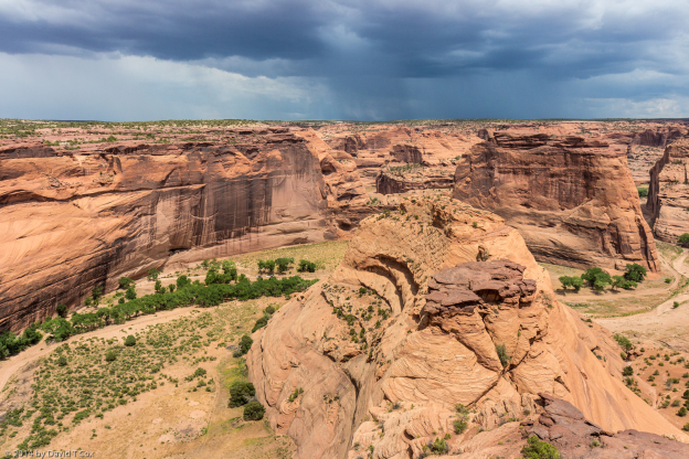
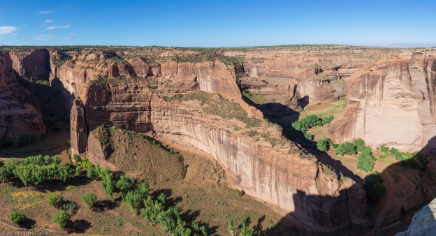
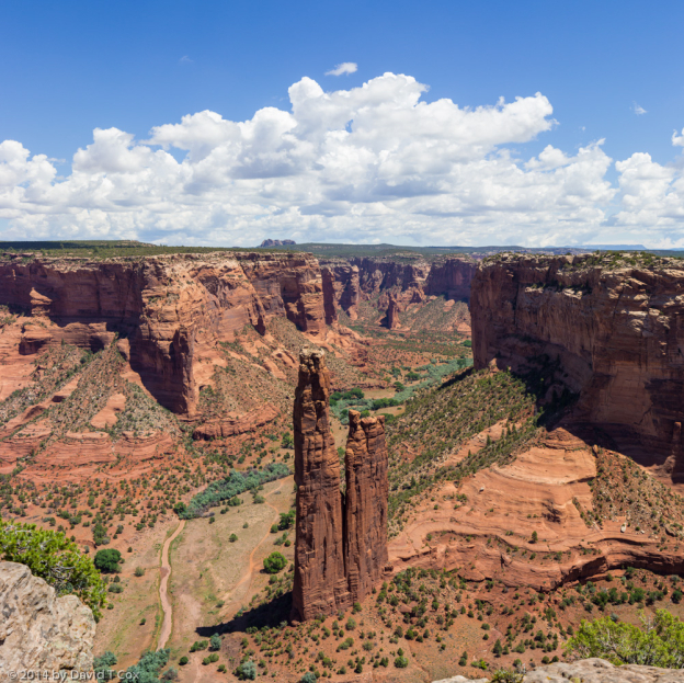
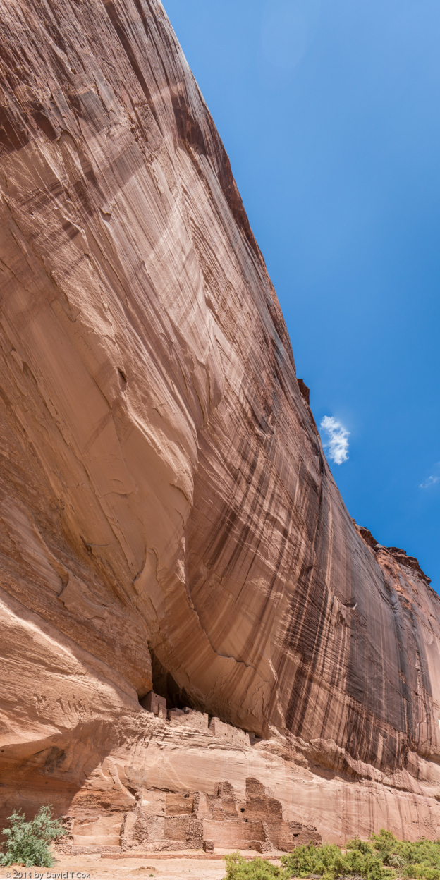
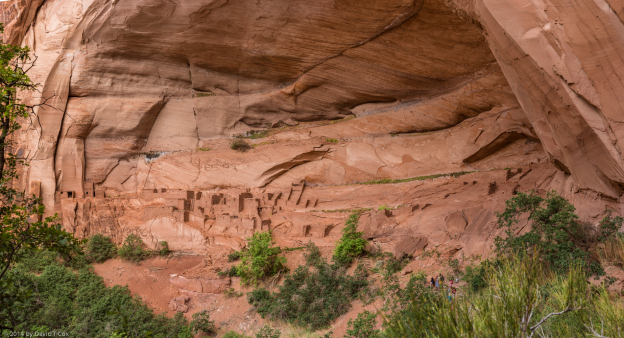
Tomorrow, the next day, or whenever I get around to it, I expect to haul myself on northeast to Chinle on the Navajo Reservation, where I want to spend some time revisiting Canyon de Chelly and Canyon del Muerto. Till later. Dave
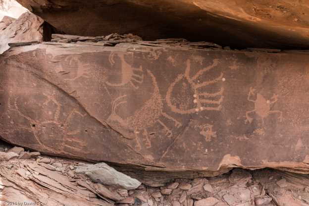
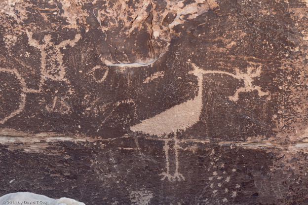
Canyon de Chelly, Monument Valley, Betatakin Cliff Dwelling & San Juan River Petroglyphs, Aug. 6, 2014

Hello everyone.   Since last I wrote from the Petrified Forest and Homolovi, I have re-visited 3 areas in northern Arizona and one in southern Utah,  all unified both by their stunning monumental bluffs and canyons and by their having served, around a millennia ago, as homelands to the Ancestral Puebloans (“Anasazi”).  All are within or bounded by the Navajo Reservation.

Canyon de Chelly (along with the adjoining Canyon del Muerto), a US National Monument, provides one of the most stunning visual treats in the US; the second largest canyon system in Arizona (after the Grand Canyon), the walls rise as sheer cliffs to increasing heights as one travels up from the mouths of the canyons, until reaching close to 1,000 feet above the canyon floors.   A small number of Navajo live in relative primitive conditions within the canyons, and the great cavities (“alcoves”) formed within the lower sandstone walls contain the ruins of many ancient Anasazi pueblos and cliff dwellings, most dating to the 10th to 13th centuries.  One can drive to various overlooks above the canyon walls, and one trail exists providing hiking access into the canyon at the White House Ruins.

In years past one could drive into the canyons with a suitable 4-wheel drive vehicle, and a Navajo guide authorized by both the US Park Service and the Navajo Nation; one also could join a tour from the historic Thunderbird Lodge, riding on rock-hard seats on top an open-air Korean War vintage weapon carrier with locked 6-wheel drive.  Both methods permitted exploring the canyon floors for many miles.  The Park Service has recently turned over most admission rights to the Navajo Nation, along with control of the campgrounds and lease of the historic Thunderbird Lodge facility (now renamed “Sacred Canyon Lodge”); the only deep access into the canyons is now by tour with 1 of 10 private Navajo individual businesses with tour jeeps.  No provision is made for solo travelers or small groups to join others, and no central booking is permitted.  One simply must make private arrangements with an operator, picked at random from a telephone listing.  The going price is $440 for a day tour.  Very unfortunate, in my view.  I wished to travel into the canyon for a couple of days to photograph rock art.  The price and randomness of calling an unseen operator deterred me.  Fortunately I have traveled into both canyons in the past.

I stayed for 2 nights in the Cottonwood Campground, and photographed extensively from the rim overlooks, as well as hiking down the White House Ruins trail.  It seems impossible to describe in any realistic sense the wonder of the views, so I will let the pictures included below serve – including the White House Ruins and the iconic Spider Rock formation.

From Canyon de Chelly I drove up to 4-corners and back around to Monument Valley, the famous movie location for a number of John Wayne (director John Ford) movies, among many others.  The area was “discovered” for Hollywood by the Gouldings, who built a trading post there, just on the Utah side, in the early 20th century.  I stayed for 3 days at the Gouldings RV park.  Of interest, it turned out to be the height of “foreign tourist” season – the RV park was always full by mid-day, and 90% of the RVs were the “rental van” type.  This contrasts to most touristed areas, where the majority of RVs are the large owner occupied types.  In the restaurants, here and later in Bluff, I was told almost all the August tourists in the southwest are French – July produces a more balanced flavor from all over Europe.  Interesting – I never knew that.  Either way, summer tourism in the southwest is international tourism.

From Gouldings I traveled into Monument Valley, as well as a couple of partial day trips south to the Navajo National Monument, the site of the best preserved cliff dwellings in the country, Keet Seel and Betatakin.  I previously have hiked the 17 mile trip to Keet Seel, walking through quicksand and climbing over 1,200 feet of elevation change, but my newly discovered start of hip osteoarthritis has probably ended such jaunts.  I did hike down a newly created 3 mile trail (600 foot drop, mostly down stairs, with the inevitable return trip), to the impressive Anasazi cliff dwelling of Betatakin, which housed around 120 people in the 13th century.  The cliff dwelling alcove is also visible from an overlook from the rim above.

To properly see the “monuments” of Monument Valley, one must drive around a 13 mile rutted single track dirt road which winds down and around the most impressive view points.  I have recently been emphasizing super-sized composite images in my photography (very briefly this involves first taking multiple moderate telephoto shots to provide full coverage of the same scenic area one would ordinarily wish to cover with a single wide angle lens shot – then using special software and proper technique to “stitch” together the multiple images into a single composite, often a very “wide angle” image.  These images can be printed to huge sizes containing more resolution than is visible to the naked eye without magnification).  I have taken dozens of such images at all my stops, but Monument Valley provided the perfect opportunity for many such shots.  I include copies of these in the pictures below, but of course, the full size and resolution cannot be seen as the “online” shots are of necessity very considerably downsized.

From Monument Valley 4 days ago I drove up to Bluff, Utah, which sits on the San Juan River.  In my prior visits here I have found this to be the center of some of the most spectacular and prolific ancient petroglyph panels anywhere.  I concentrated getting large panel photo shots on the amazing Sand Island Petroglyph panels.  One large panel always has intrigued me, and this time I was able to study it more extensively by getting a detailed composite photo of the entire panel, and then scrutinizing the photo.  I have included it below under the caption “Sheep Hunt Panel”.  It is easily observed, seen by thousands, but I have not found a write-up on this panel.  It appears to me to have had all the individual images created at the same time, and by the same or related artists, and very much seems to form a single very large active scene or mural.  If this is true, it is quite rare if not  unique.  The panel in the photo is probably about 12 feet high by 25 feet long.   On the left half a great herd of bighorn sheep flow away from the center; to the far left side a group of apparently jumping men with arms held wide seem to be startling the sheep to stop.   Four bow hunters populate the scene, one shown hitting a sheep with his arrow.  At the far top left a small group of sheep stand around a great antlered mule deer, and a single bow hunter.  Two sets of tracks follow the sheep path, one the cloven hooves of a sheep, the other apparently a person’s footprints.  On the right side, facing right, are no fewer than 6 Kokopeli images, standing among various other figures and sheep.  To their right, a small group of sheep cluster around what to me appears to be a “bighorn sheep Kokopeli”, a most unusual figure.  Among the Kokopeli are 4 or more “helmets”, possibly Katsina images.  Also present scattered throughout are bird images, and several of what I call “frog-men” images.  Between the flowing sheep and the Kokopelis stands a large oddly shaped humanoid with feathers on the head and hair coiled at the ears, holding perhaps a club.  All in all, a fascinating panel, and supremely so if, indeed, it is a single mural.

During my limited online research for information on the Sheep Hunt Panel, I stumbled across a very recent publication – 2011 – by a southern Arizona archaeologist and a northern Arizona language professor, “authenticating” 2 mammoth petroglyphs in the Upper Sand Island Petroglyph panels.  This is quite stunning to me.  I am not aware of any genuine zoomorphic or anthropomorphic petroglyphs of this antiquity in the Americas.  Mammoths would have been extinct from southern Utah by about 11,000 years ago (just about the time most archaeologists agree man first migrated to the continent).  American petroglyphs which are determined to be even 6,000 to 9,000 years old consist generally of just deep grooves, pits, and sometimes more complex lines.  Of course, the problem with all petroglyphs is they are very nearly impossible to date.  Perhaps some more complex shapes, including zoomorphs and anthropomorphs, really are 10,000 years old, but have been considered more recent.  The referenced petroglyphs are astonishing because, if indeed they display mammoths, the dating is secure (no other contacts with pachyderms until recent history, and these petroglyphs safely are determined not recent).  I spent a day looking for the site with no luck.  Asking around town, I got the area narrowed to a few hundred meters along the middle of the Upper Sand Island bluffs, but still no luck.  The published article credited a local Bluff artist with “discovery” of one of the petroglyphs which he then showed to one of the authors.  With the help of the owner of my RV Park I managed to locate this artist, Joe Pachak, and got a better account of the location and landmarks to look for.  Tuesday at dawn I again returned to the long bluff face along the river, and after half an hour, found the spot.  I have included a photo of both animals.  “Mammoth #1” (so numbered in the publication), shows the animal facing left, together with the superposition on its right haunch of what obviously is a bison.  The two animals together are about 3 feet long.  Although the bison appears to be the work of a different artist, and appears less weathered, if the first is indeed a mammoth, the bison probably would be the giant extinct species also of the late ice age.  Mammoth #2, which is just under 2 feet long, also is facing left.  Mr. Pachak showed me photos claiming to show more bison near the same panel, although I cannot yet make them out.  The two mammoth figures are about 8 feet apart on a panel in a line with some other indecipherable figures between.  The panel sits about 16 feet above a rock bench which itself is about 25 feet above the Sand Island floor.  The authors claim from a geologist report that the panel is located at what probably was the ground level during the last of the ice age.   I am  at just over 50% confidence level the two animals are mammoths, but the authors claim a much higher degree of confidence.  An extremely exciting rock art find.

Yesterday I drove the short distance over to Cortez in the southwest corner of Colorado.  For the first time in 3 ½  weeks the nights are cool – I left Tucson in part to escape some heat, but have been surprised at how warm the evenings have remained through all of north-eastern Arizona and into Utah.   I am taking a day or two of down time to catch up on some correspondence, including this post.  I then expect to visit the Crow Canyon Archaeological Center just outside of town which apparently did the rock art survey work on the Sand Island site discussed above.  I may find someone there to discuss with me the “Sheep Hunt Panel”.  Later.  Dave


Brief Report on Mesa Verde, Crow Canyon & El Morro Rock Art, Aug. 16, 2014

Hello all.  After a month on the road around 4-corners, I have returned home to a hot and stormy Tucson – on Thursday afternoon, in less than 30 minutes, we had a huge rainfall just over the few blocks around my house.  An official local rainfall meter just blocks away showed over 3/4 of an inch.  May not seem like much to some of you, but that is 10% of our annual rainfall, in half an hour.

Since my last posting I visited just 3 new sites of some interest, so have little to report and few pictures.  I have visited Mesa Verde National Park many times in the past, and it remains one of the most fascinating accessible areas for viewing Anasazi archaeological sites, including many remarkable late Puebloan III period cliff dwellings.  This trip I just made one quick pass to hike into the main petroglyph site in Mesa Verde.  Not much – just one single panel with a number of zoomorphic petroglyphs which modern Hopi elders (descendants of the Anasazi) claim to represent the various clan symbols of the people who  lived on Mesa Verde 8-14 centuries ago.

From Cortez I spent one long day driving down into north-central New Mexico, including some 50 miles round trip of washboard dirt roads, to the Crow Canyon, a side canyon to the Largo Wash.  The area currently is BLM land, and covered with operating oil and gas well pumps, but from 1600-1750 was part of Dinetah, the traditional home to the Navajo.  The canyon is known for perhaps the best existing Navajo rock art from the period of Navajo occupation.   Although “known” and discussed online, the actual visitors to the site are few; in the sign-in logs, I found no more than 5 visits per month registered within the recent past.  Some moderate hiking is required to get to the various panels.  The rock art all consists of petroglyphs, most on sandstone with a reddish patina, making for rather colorful figures.

My last full day, I stayed in Gallup, and visited the El Morro National Monument and the Zuni Reservation.  El Morro is a large sandstone bluff outcropping and mesa in north western New Mexico.  It is unusual in that at the base of one of the cliffs is a perennial spring which feeds a small pool  of water.  This of course has attracted travelers probably for millennia.  The mesa top has the ruins of two separate and very large pueblos of the Anasazi (in this case ancestors of the Zuni).  Atsinna Pueblo, the larger of the two, contained over 800 rooms around 1200.  Very little archaeological work has been done at the ruins.  Around the base of the bluffs, the lower cliff faces are covered with the “graffiti” of centuries.  Higher on the walls are petroglyphs of the Anasazi, but below them (reachable from todays ground level) are hundreds of inscriptions left by travelers and explorers, the earliest of which was left in 1605 by the first Spanish “governor,” Oñate,  who set up camp here in the late 1500s.  Hundreds of Spanish inscriptions follow for the next 200 years.  The first English inscription was left in 1849, and misspelled the word “inscription” by leaving out the “r”.  A much earlier and lengthy Spanish inscription originally described the subject as a “Christian gentleman”, but subsequently had the word “gentleman” (caballero in Spanish) scratched out – no telling why, but a copy of the inscription made in 1849 showed the “correction” already made.  Interesting, and tough to make changes when authoring in sandstone.  Later. Dave