All Photos Are Below the Travelogue Text
Click on Any Photo To Open Slide Show
To print the travelogue, right click anywhere on the page. Choose "Print" from your browser dialog box. You can choose Save to PDF in the browser print window.
Share your thoughts.
Email Dave - coxdavid55@hotmail.com
Hello all. I last wrote from Dolores, CO, not knowing where I would head next. Well, I haven’t gone far. I drove northeast over the Goatshead Pass through the mountains by Telluride, and down into the Uncompahgre Valley to the town of Montrose, CO. – and here I am 8 days later. The town itself is spread out along US Highways 50 and 550, and is what one expects of a 130 year old western town. It is crowded as the annual Rodeo and County Fair have been ongoing. It does have 2 brewpubs, the presence of which always assist in my decision as to whether to remain someplace awhile. Upon arriving I discovered three nearby attractions of which I previously had been unaware (the 3 listed in the travelogue title).
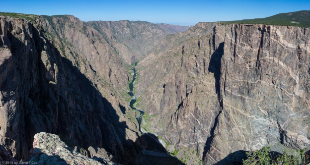
I thought I had at least heard the names of all of the National Parks – but I never had heard of the Black Canyon of the Gunnison. It is just 15 miles northeast of Montrose, requiring a very steep drive from under 6,000 to close to 8,000 feet. A large uplift of a small landmass, starting about 2 million years ago, across the path of the Gunnison River created the geologic wonder. The river has cut an almost half mile deep gorge through very hard, almost black, metamorphic rock (the oldest type of rock on earth), striped with light colored ancient lava flows forced into cracks, leaving incredibly dark, lined, steep cliffs comprising the gorge. It is so steep in most places that it is only possible to just see bits of the river at the bottom from a few vantage points. The passage through the canyon is considered basically impenetrable to man, although some have braved it, and some have not made it. It is a small park, but quite a marvel and jewel.
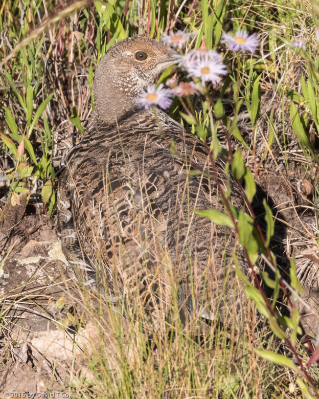
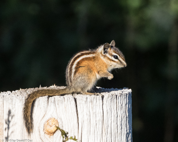
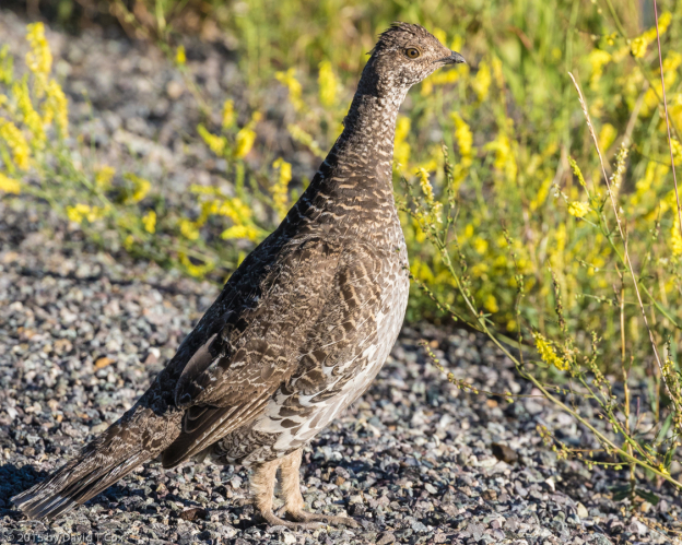
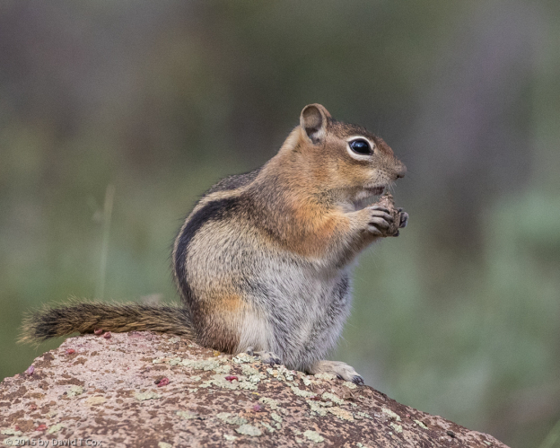
I spent three long mornings exploring the south rim of the Canyon, with its numerous overlooks (most requiring short hikes out from the rim road). The entire rim top is beautiful Juniper Pinyon Forest, full of Mule Deer, and incredible numbers of Golden-mantled Ground Squirrels and the very tiny Least Chipmunks which run with their tails held vertically. Along the rim I got to see (and report) the bear that has been ravaging several trailers and camps in the Park’s campground (saw him up on a hill above the campground – he was headed down into the camp at mid-day, which I reported to the authorities). I also lucked into my first viewing of several families of Dusky Grouse, a very large (chicken size) bird formerly known as the Blue Grouse, as well as my first Mountain Cottontails (rabbits similar to Desert Cottontails, but with shorter ears).
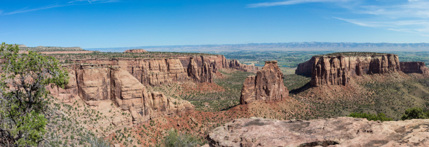
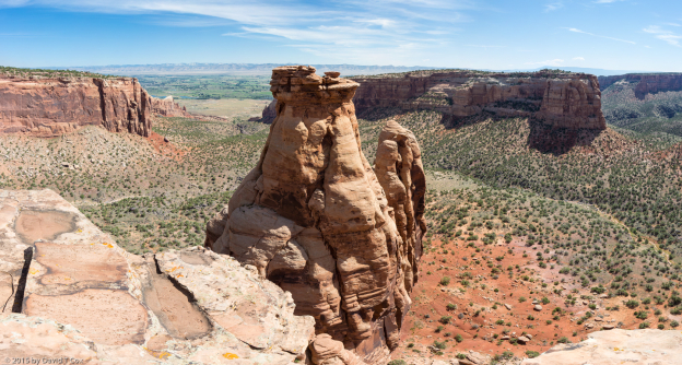
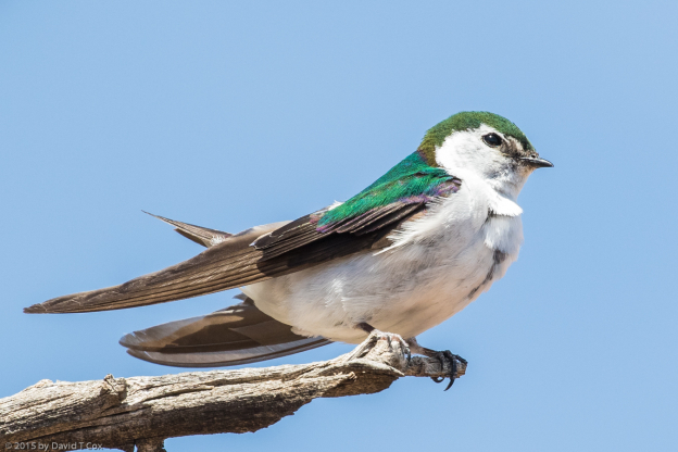
I spent another full day driving up through Grand Junction and out just west to the Colorado National Monument, of which I also was ignorant. It is a small set of red sandstone canyons cut through a mesa, which can be best viewed from the rim drive. Although magnificent, it really is no more impressive, and sometimes less so, than any number of canyon systems in the northern 2/3 of Arizona and much of southern Utah (and so, a little surprising it acquired national monument status). Still, some of the vistas comprised terrific panoramic scenes, designed seemingly purposefully for large multi-shot photo montages (the first three scenic photos attached each are created from up to 40 individual photos, although the reduced size uploaded to the website does not permit appreciation of the inherent resolution). I also enjoyed the many Violet-green Swallows and White-throated Swifts swooping through the canyons; one swallow sat on a dead branch over a precipice allowing me to sneak within meters to photograph it from behind a Pinyon Pine tree.
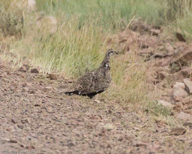
While discussing the Dusky Grouse with Park Service rangers at the Black Canyon, I inquired about the Gunnison Sage Grouse – this is a very rare grouse (maybe 5,000 living), which exists in just two tiny geographic pockets of high sage-grass mesas. It is listed under the Endangered Species Act. I was referred 3 times to different offices, and never got any concrete info on where the birds might be seen, other than references to the general vicinity of the Curecanti National Recreation Area (this consists of the area around Blue Mesa Lake along the Gunnison River just upstream from the Black Canyon Park). Online research disclosed that the rangers only publicly disclose one single spot where the general pubic may see the grouse during their breeding performances (not this time of year) – this lack of assistance designed apparently to protect the birds from too many birders.
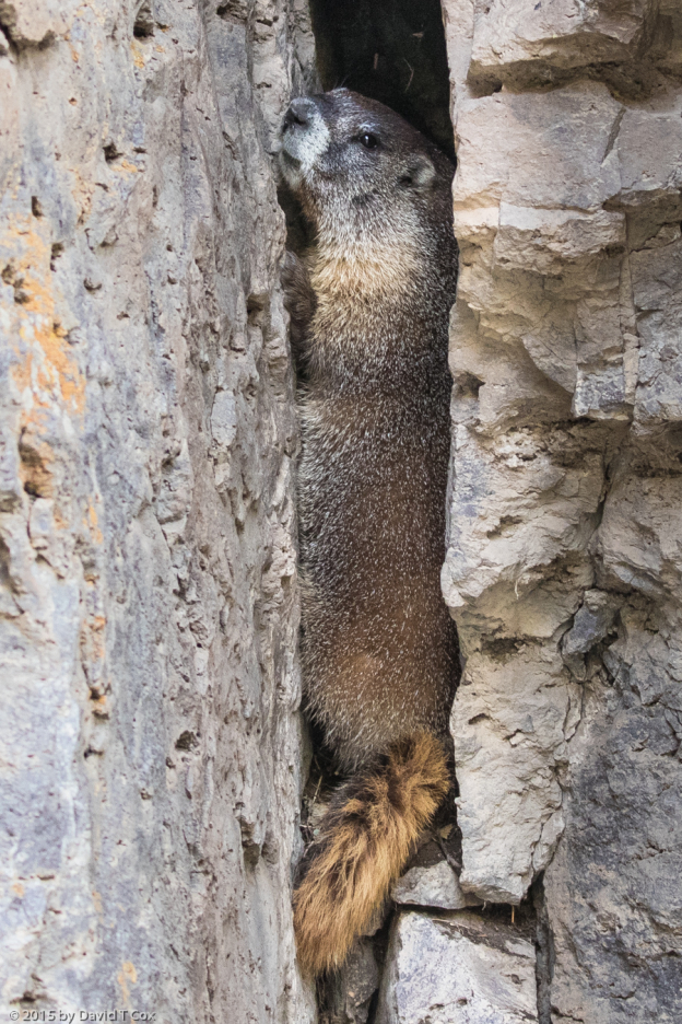
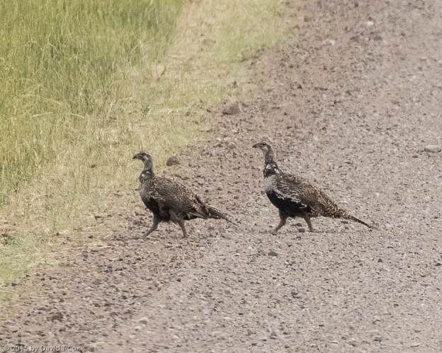
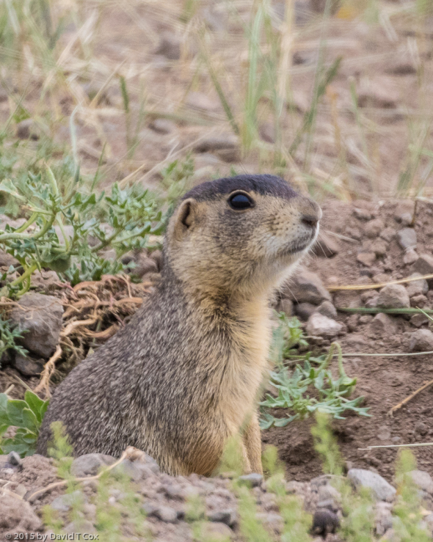
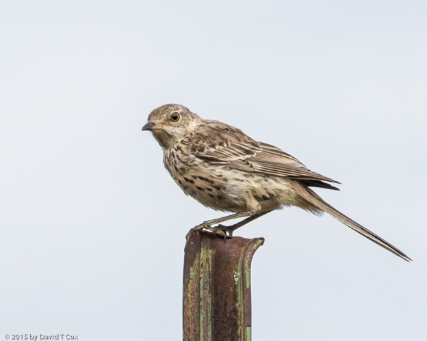
Two days ago I drove over to the Curecanti area and took a dirt county road south up onto a large mesa; traversing this mesa top I enjoyed mule deer and a cheeky Yellow-bellied Marmot, which ran up into a vertical crevice and, while I photographed him, held there as if I could not see him. At the south end of the mesa I drove over and up onto a neighboring mesa for another dirt county road headed back north. Here I had luck, spotting my first 4 Gunnison Sage Grouse as they flushed and flew directly away from me. No chance for photos, but the high mesa top, covered with thick sage brush and high grasses, with periodic water holes, appeared ideal habitat. I returned the day before yesterday and spent the early morning hours along an 8 mile stretch of the mesa top and was rewarded with sightings of 13 more Gunnison Sage Grouse in 4 different groups. I got some photos of the grouse crossing the road; as soon as they enter the sage they become invisible, even when you know exactly where to look (I have included a couple of not-so-great photos only because the birds are rare). On the same mesa top I photographed my first Sage Thrasher, my first White-tailed Prairie Dog, and was surprised to see a Pronghorn. All in all a successful hunt day.
Today I intend to drive to Green River, Utah, sitting close to some of the world’s greatest rock art sites. I still am entirely uncertain what I will do after that. Every time I pull out the map, I find vague reasons for not continuing north. I think this is a sign I should return soon toward Tucson and start working on an international trip. I have been living in the little RV for exactly one month now. Later. Dave
- Black Canyon of the Gunnison NP, Dragon Point, Pano 1, CO
- Colorado Nat Mon, Grand View, Pano 1, CO
- Colorado Nat. Mon., Otto’s Trail Pano 1, CO
- Violet-green Swallow, Fruita Canyon overlook, Colorado Nat Mon, CO
- Dusky Grouse (fka Blue Grouse), Black Canyon of the Gunnison, E Portal Rd at top, CO
- Least Chipmunk, Black Canyon of the Gunnison NP, CO
- Dusky Grouse (fka Blue Grouse), Black Canyon of the Gunnison, E Portal Rd at top, CO
- Yellow-bellied Marmot, Blue Mesa, S of Curecanti NRA, CO
- Golden-mantled Ground Squirrel, S of Curecanti NRA, CO
- Gunnison Sage Grouse, S. of Curecanti Nat Rec Area, CO
- Gunnison Sage Grouse, S. of Curecanti Nat Rec Area, CO
- White-tailed Prairie Dog, S. of Curecanti Nat Rec Area, CO
- Sage Thrasher, S. of Curecanti Nat Rec Area, CO
To print the travelogue, right click anywhere on the page. Choose "Print" from your browser dialog box. You can choose Save to PDF in the browser print window.
Share your thoughts.
Email Dave - coxdavid55@hotmail.com
