All Photos Are Below the Travelogue Text
Click on Any Photo To Open Slide Show
To print the travelogue, right click anywhere on the page. Choose "Print" from your browser dialog box. You can choose Save to PDF in the browser print window.
Share your thoughts.
Email Dave - coxdavid55@hotmail.com
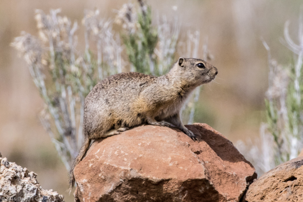
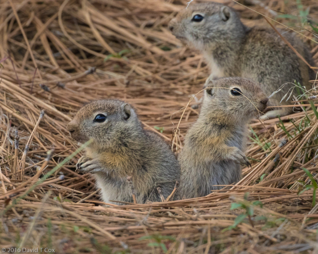
Hello all. I last wrote from Lassen Volcanic Nat. Park. Starting at Lassen in north-central California, the Cascade Range is a string of volcanoes running north through central Oregon and Washington (and on through Canada and into Alaska, though with different names). From Lassen I drove the short distance to Lava Beds Nat. Monument, where I camped for 4 days. I had no nearby restaurants either at Lassen or Lava Beds, and survived off of sandwiches and salads stockpiled from a Walmart in Redding the week before – great meals neither to anticipate nor in which to indulge. The couple who owned the RV park, Eagle’s Nest, in Tionesta, was delightful, making up for any “out-in-the-boonies” issues. Their property, along with most of the Monument, was filled with the little Belding’s Ground Squirrels, which dug their holes everywhere. Cute babies (see photo)!
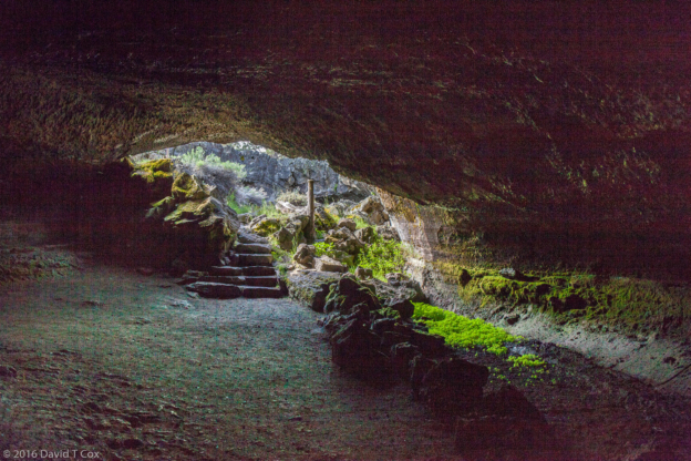
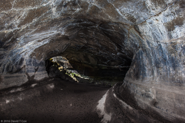
Lava Beds, well off any beaten track, has few visitors – but is marvelous. The Park Service claims over 700 lava tube caves, of which about 18 have been improved to the extent of having ladders or stairs permitting entrance and exit into the different levels. Some of the caves approach a mile in extent. Many are wet, with bacterial or fungal mats lining the walls and ceilings, and amazing colors when lit with a light source. Exploration requires obtaining a permit after certification that one is free of fungal spores from caves elsewhere within or out of the country for the “white-nose” fungus which infects bat populations. The accessible caves are shown on park maps, and rated 1, 2 or 3 for difficulty; rating 1 signifies little stooping and no crawling, and relatively smooth walking surfaces – rating 2 signifies the need to at times climb over rocks, and some stooping (duck walking) through areas with less than 4 foot ceilings – rating 3 signifies the need for helmets, gloves and knee pads to traverse crawl spaces sometimes less than 1 foot high, and tunnel complexes within which someone could get lost. I avoided “3s”, but visited 7 different 1 and 2 rated caves. Two tube-caves dropped down through 3 different superimposed lava tube levels, to sufficient depth underground that they had permanent ice floors. Others opened into larger chambers ½ mile downtube where the ceilings were covered with a hydrophobic bacterial mat which formed microscopic water beads on the outside of the mats which reflected all light as brilliant gold veins. All required good light sources; the Park Service recommended 3 lights per person and not traveling alone. I, of course, travel alone, but always carried 4 quality LED light sources (the idea of being half a mile underground, with no idea of direction, in an earthquake prone area, in total blackness, with no light source spooks me just a little).
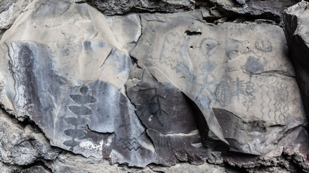
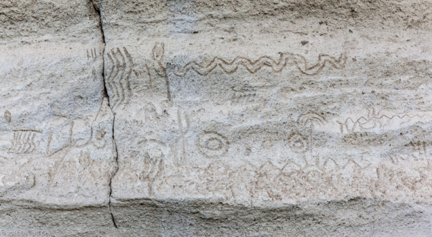
Ancestors of the Modoc Indians lived in the area for many thousands of years, and a number of sites are rich in rock art, mostly petroglyphs, but with two small lava tube cave entrances displaying pictographs. Petroglyph Point is a very long sandstone shelf along the base of a mountain which, until a hundred years ago, was an island in a much larger version of what today is Tule Lake National Wildlife Sanctuary. In the early 20th century the federal government drained much of the lake creating thousands of acres of new fertile farmland, still farmed today. What remains of the lake, with man-made channels, connects with vast marsh lands and seasonally flooded areas which run north and west, connecting with the Upper and Lower Klamath National Wildlife Refuges, which extend into Oregon almost all the way to Crater Lake National Park. The petroglyphs must number in the thousands, depending on what one counts as a single item. Large areas of the shelf have been degraded by century old and modern graffiti. The petroglyphs mostly are geometric designs, including many “saw tooth” lines, dot formations, and some anthropomorphic figures. As their original creation occurred on the rock face where it rose vertically out of the water of the lake, the petroglyphs are said all to have been made from canoes. Considering the quality (low) and scrawling nature of most of the “art”, I almost can picture groups of happy native American kids swimming in the warm shallow summer lake waters, along the islands shore around to the cliffs, where they scribbled whatever “art” they chose onto the soft walls. Who knows?
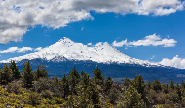
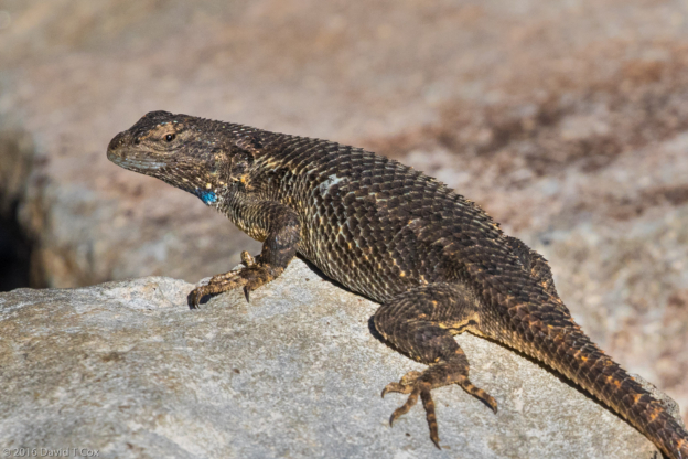
From Lava Beds I drove the short distance north, west and south again to go around Mt Shasta to Weed California (when clear and covered with snow, at over 14,000 ft. Mt Shasta presents one of the most stunning volcano appearances in the world). The town’s name “Weed” has been somewhat controversial in recent years as many businesses have used it to create tourist paraphernalia such as “I ‘heart’ Weed”. The local brewery, Mt Shasta Brewery, even got into a legal tiff with the California legislature a couple of decades back by using the web address and selling beer known as Weed Ale (the brewery won the legal battle). In fact, the town is named for its founder, a lumberman by the name of Abner Weed, founded back around 1900. Mt Shasta Brewery (still WeedAle online) is a rather strange pub. A huge sheet metal building with 30 foot ceilings, located on College Street in the middle of a small residential neighborhood, it produces and sells the normal micro-brewery assortment of beers. I have visited it twice, and continue to find the brews mediocre at best, but an interesting visit none-the-less. I stayed in the Trailer Lane RV Park out of town, between the highway and the railroad tracks: needed white noise at night to sleep. I did get to see there my first Granite Spiny Lizard, pretty with its blue throat, but never saw the black bear that had torn the trash cans apart the day I arrived.
I remained in Weed for 4 days, working out my travel course for the next 6 weeks, as I had given little thought to what to do after visiting the California parks. Deciding I had several weeks before revisiting Yellowstone, I decided to spend some days further visiting the Lower Klamath National Wildlife Refuge for its abundant birdlife. I first moved to tiny Dorris, on the California Oregon border, but as the only RV Park, owned by a lovely but very elderly couple, had no Wi-Fi, locked bathrooms with showers advertised as hot on Tuesdays and Saturday and sited between the railroad and highway, I moved on to Klamath Falls, Oregon the next day. Klamath Falls is a lovely old lumber town, sitting on the Lower Klamath Lake and River, and sporting dozens of interesting restaurants and brew pubs.
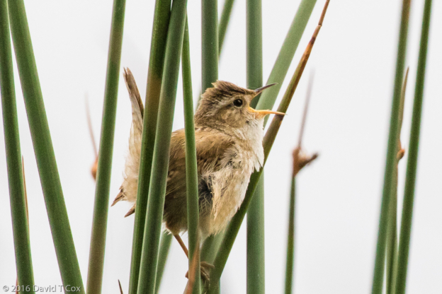
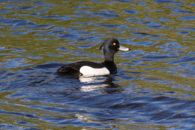
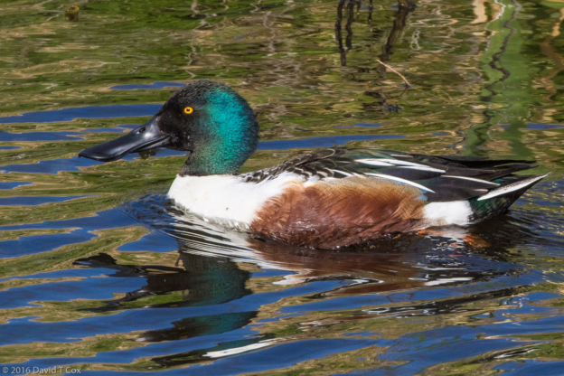
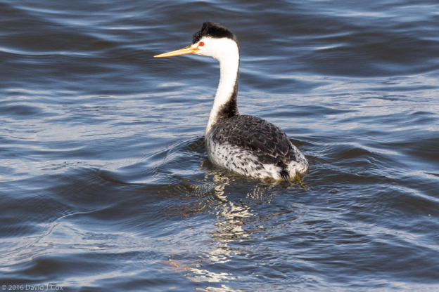
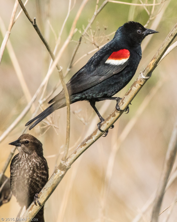
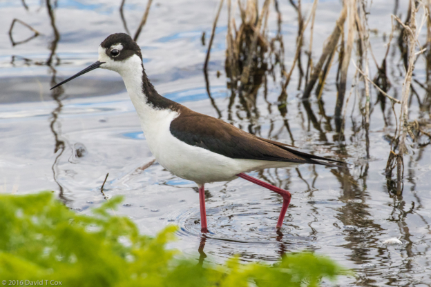
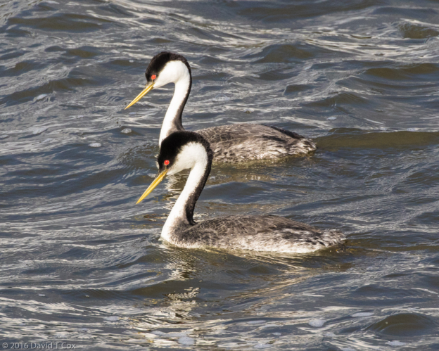
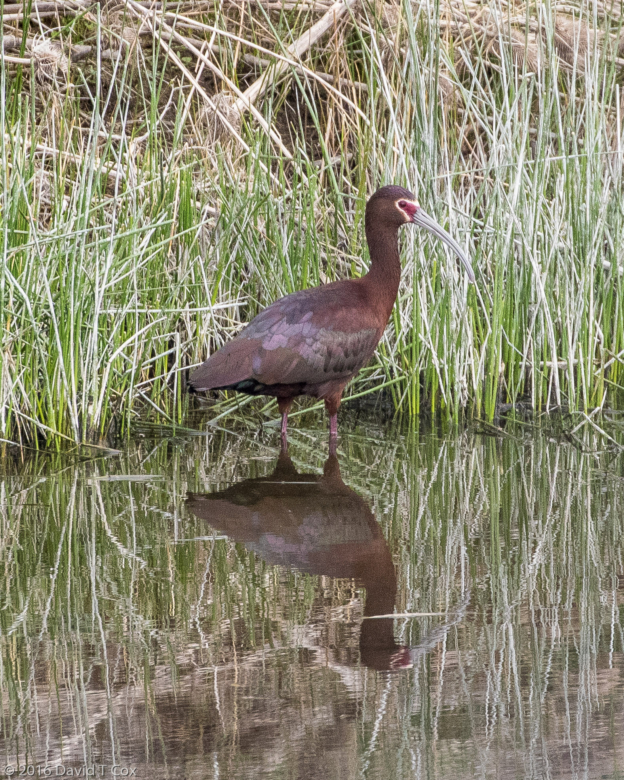
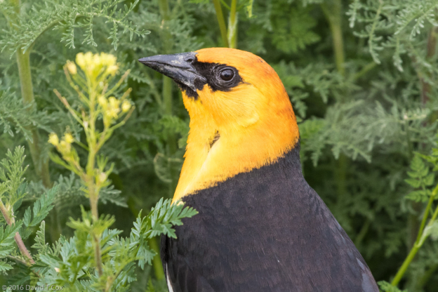
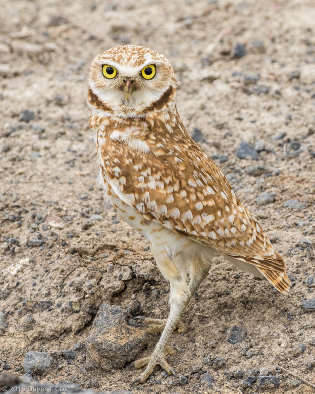
The two Klamath National Wildlife Refuges, the Lower spanning the California-Oregon border, and the Upper between Klamath Falls and Fort Klamath to the north, are among the premier waterfowl refuges in the country. The wetlands, marshes, river, and lakes lie in one of the major flyways for migrating waterfowl, and host a huge number of permanent species, including birds of prey, which nest here. I have spent two days driving the dirt roads around various marshes, lakes and canals, and have seen an astounding variety of birds, including a number of new ones for me, some quite rare, or difficult to view, such as the Tufted Duck, Tricolored Blackbird, Marsh Wren, Burrowing Owl and White-fronted Goose. I had great luck in locating the nesting burrow of a Burrowing Owl with the help of a local photographer, and so obtained good close-ups of the owl. Other birders told me where to go to find the lone Tufted Duck, a rare if not unique sighting in Oregon. I regularly see over 12 species of ducks and geese, 3 of grebes and over 12 of shore birds, along with numerous birds of prey and songbirds. Putnam Point, just outside Klamath Falls, is reputed to be the best spot in the country for viewing the mating dances of both the Western and Clark’s Grebes. I have photographed both species there, but have yet to witness the dance.
I will spend a couple more days in Klamath Falls, hoping for a chance to observe the grebes dancing, then move on to Bend, OR, and from there east to the Snake River Birds of Prey National Wildlife Refuge in Idaho, another premier birding sanctuary, but for nesting eagles, hawks, falcons and owls rather than waterfowl. Later Dave
- Beldings Ground Squirrel, Eagles Nest RV Park, Lava Beds Nat. Mon., CA
- Belding’s Ground Squirrel babies at entrance to nest, Eagle’s Nest RV, Tionesta, CA
- Valentine Cave, Lava Beds Nat. Mon., CA
- Valentine Cave, Lava Beds Nat. Mon., CA
- Symbol Bridge pictograph cave, Lava Beds Nat. Mon., CA
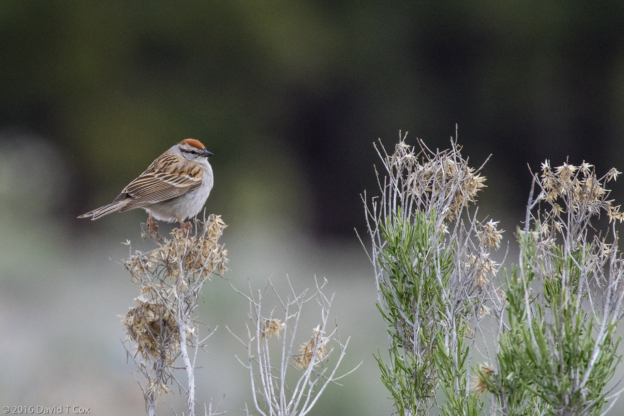
- Chipping Sparrow, Tule Lake National Wildlife Refuge, CA
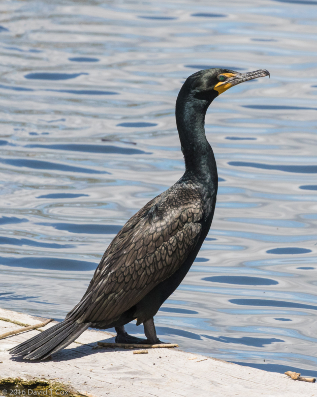
- Double-crested Cormorant, Tule Lake National Wildlife Refuge, CA
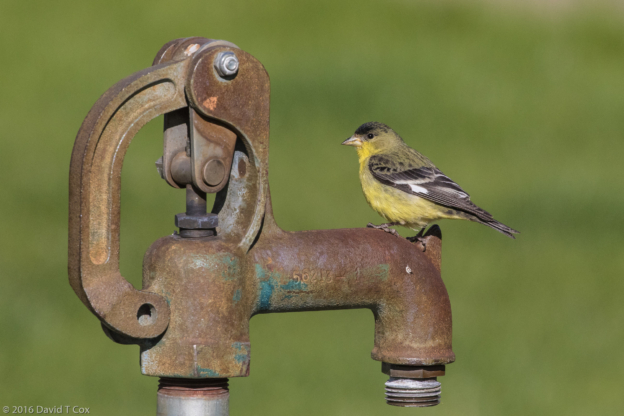
- Lesser Goldfinch, Eagle Nest RV Park, Lava Beds Nat. Mon., CA
- Mt Shasta, from N of Weed, CA
- Granite Spiny Lizard, Trailer Lane RV, Weed, CA
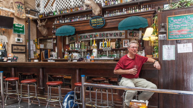
- Dave in Mt Shasta Brewery, enjoying a porter, Weed, CA
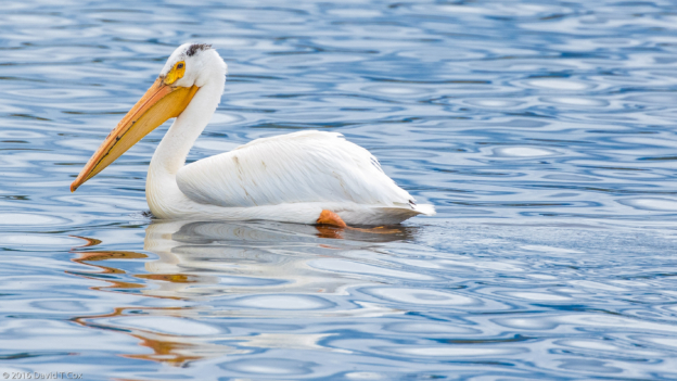
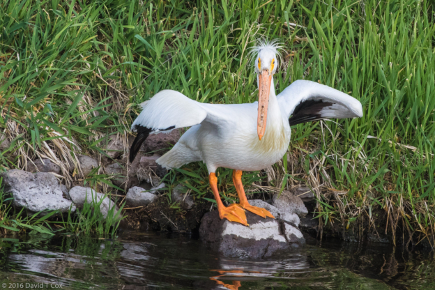
- American White Pelican, Lower Klamath National Wildlife Refuge, CA
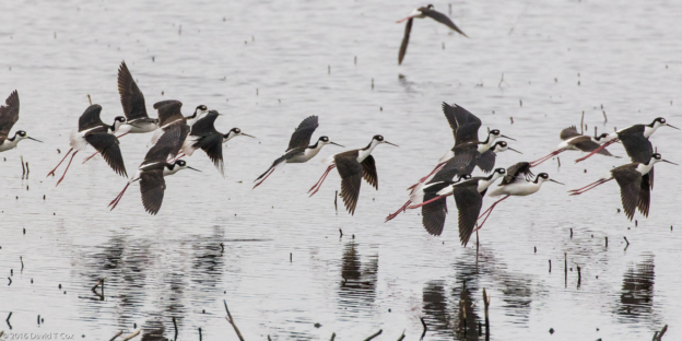
- Black-necked Stilt, Lower Klamath National Wildlife Refuge, CA
- Marsh Wren, Lower Klamath National Wildlife Refuge, CA
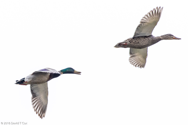
- Mallards in flight, Lower Klamath National Wildlife Refuge, CA
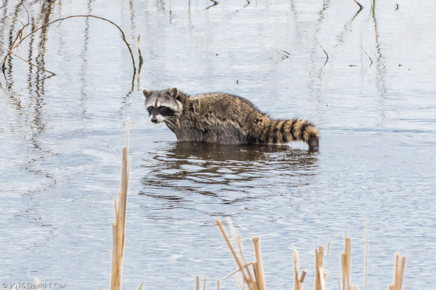
- North American Raccoon, Lower Klamath National Wildlife Refuge, CA
- American White Pelican, Lower Klamath National Wildlife Refuge, CA
- Tufted Duck, Lower Klamath National Wildlife Refuge, CA
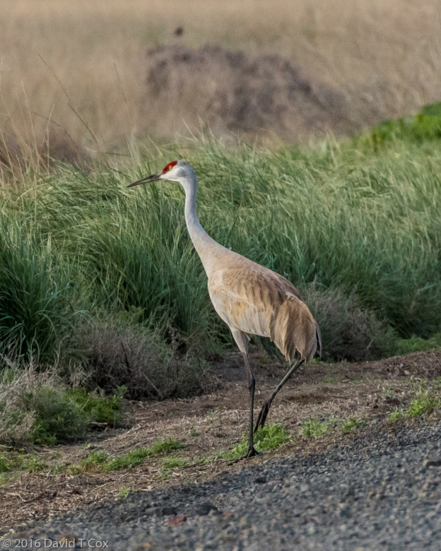
- Sandhill Crane, Lower Klamath National Wildlife Refuge, CA
- Northern Shoveler, Lower Klamath National Wildlife Refuge, CA
- Clark’s Grebe, Putnam’s Point, Klamath Falls, OR
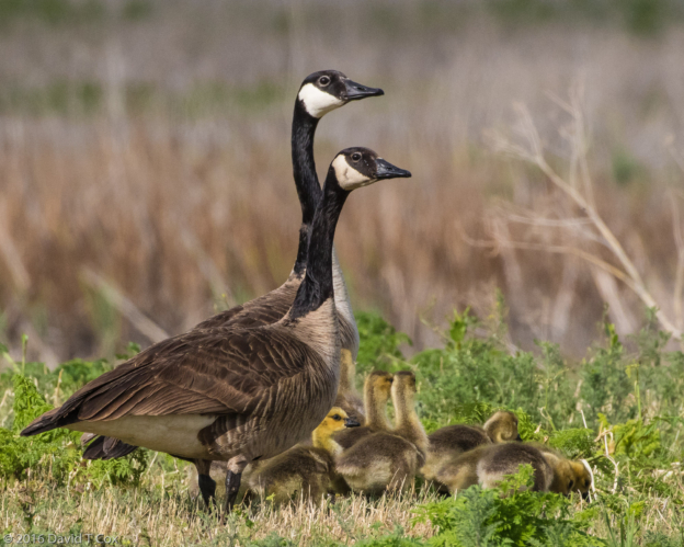
- Canada Goose w young, Lower Klamath National Wildlife Refuge, CA
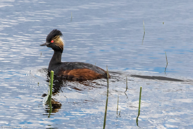
- Eared Grebe, Lower Klamath National Wildlife Refuge, CA
- Tricolored Blackbird, Lower Klamath National Wildlife Refuge, CA
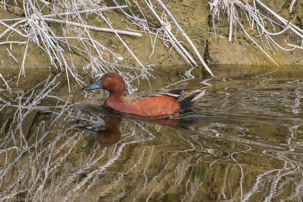
- Cinnamon Teal, Lower Klamath National Wildlife Refuge, CA
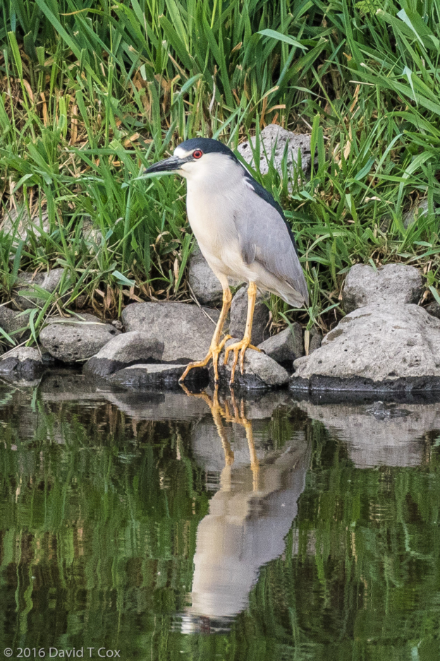
- Black-crowned NIght Heron, Lower Klamath National Wildlife Refuge, CA
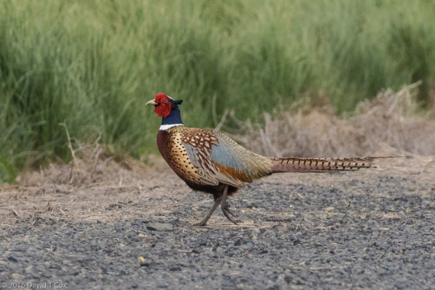
- Ring-necked Pheasant, Lower Klamath National Wildlife Refuge, CA
- Black-necked Stilt, Lower Klamath National Wildlife Refuge, CA
- Western Grebe, Putnam’s Point, Klamath Falls, OR
- White-faced Ibis, Lower Klamath National Wildlife Refuge, CA
- Yellow-headed Blackbird, Lower Klamath National Wildlife Refuge, CA
- Burrowing Owl, Lower Klamath National Wildlife Refuge, CA
To print the travelogue, right click anywhere on the page. Choose "Print" from your browser dialog box. You can choose Save to PDF in the browser print window.
Share your thoughts.
Email Dave - coxdavid55@hotmail.com
