All Photos Are Below the Travelogue Text
Click on Any Photo To Open Slide Show
To print the travelogue, right click anywhere on the page. Choose "Print" from your browser dialog box. You can choose Save to PDF in the browser print window.
Share your thoughts.
Email Dave - coxdavid55@hotmail.com
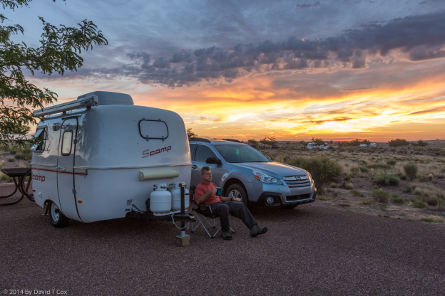
Hello all. I last posted a travelogue while traveling in Cambodia and Thailand last winter. I spent several months over Spring in Tucson taking care of house issues, and then exploring some medical issues. I became bored and decided to pack up the little Scamp RV and head north towards the 4-corners. I have been on the road almost 2 weeks and have traveled less than 200 miles, as the crow flies (but have put over a 1,000 miles on the odometer). With no very specific destinations in mind, and no time constraints whatsoever, I find more and more to do at each stop and so extend my stays day by day.
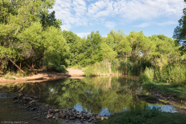
Two weeks ago I drove north to Cottonwood, AZ which sits on the pretty little Verde River – it is a very green valley belt running between high country with the mountains of Prescott to the south, and the Mogollon Rim to the north. I stayed for the second time in the attractive Arizona State Park called Dead Horse Ranch; back in the early 1900s the family that bought the land looked at a number of properties, and when they asked their kids which they liked best, they responded “the one with the dead horse”, and so the name stuck – indeed, the family required Arizona to keep the name as a condition to receipt of the gift of the property for a state park.
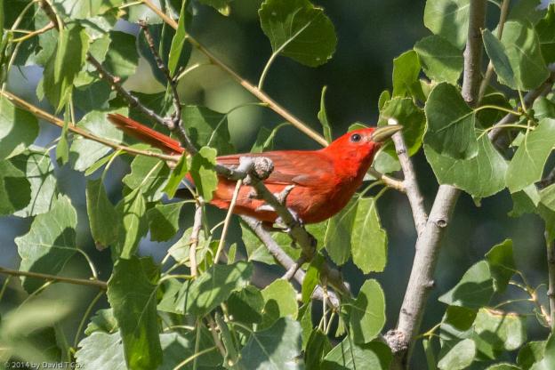
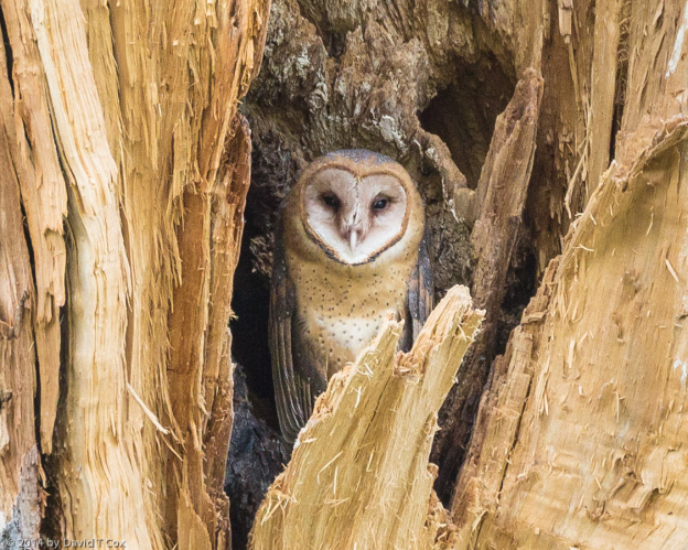
Every morning at sun-up I walked for several miles down along the river, a very small but permanent flow through a huge river channel from the occasional violent flooding. The channel is filled with dead logs and young cottonwood trees, and the much higher banks are lined with ancient cottonwoods. The first day I found a barn owl nest in a hole in a cottonwood; a number of mornings the young fledgling would come up and sit sleeping in the early morning on the edge of the nest hole. I only saw a parent once, very briefly. Further down river I found a Cooper’s hawk nest with 2 fledglings which were trying their wings every day, with short hopping flights from branch to branch of a dead tree next to the nest. My real goal was to find and photograph river otters, which the park rangers saw occasionally; I spotted their footprints twice but had no luck finding them. My lack of success spilled over into two pretty lame attempts at fishing for the reputed large mouth bass and catfish in the three lagoons in the park. The rangers assured me the lagoons were full of fish, because that is mostly where the illusive river otters came to feed. As usual, the only things grabbing my hooks were the weeds and sticks at the bottom of the lakes.
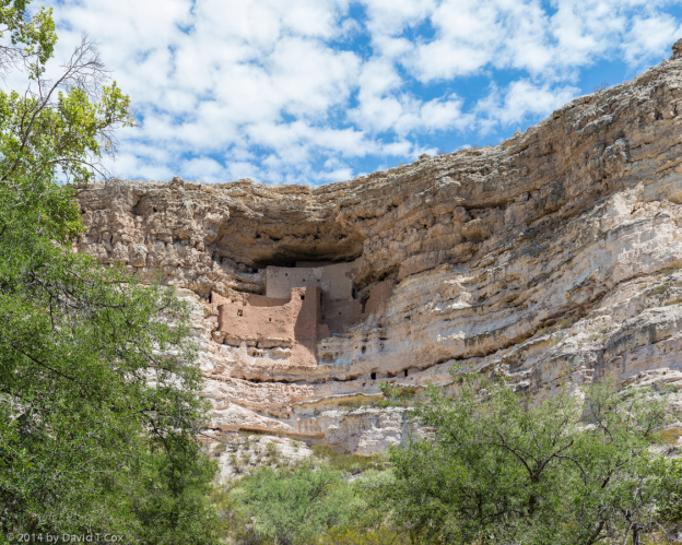
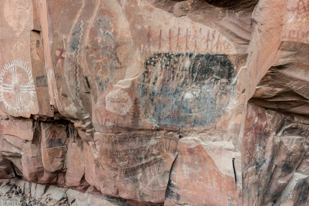
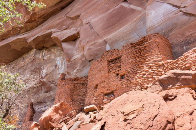
While in the Verde Valley I spent half a day re-visiting Montezuma’s Castle (a national Monument), one of the better preserved and most scenic of the smaller Puebloan cliff dwellings in the southwest. It was constructed by the Sinaguan peoples around the late 12th century. I also spent a day driving northwest of Sedona to two other Sinaguan Pueblos from the same period. Both are located at the base of red-rock cliffs at sites which used to have water seeps. Palatki, which is not open to “Pink Jeep” tours from Sedona, is the more interesting site with several alcoves of good rock art, including some archaic period geometric petroglyphs, many Sinaguan petroglyphs, some pictographs (one of which astonished me, as it appears almost certainly to be an archaic “Barrier Canyon style”, which I am not aware is supposed to be this far south), and more recent charcoal pictographs done by the Apaches and Yavapai which include people riding horses (horses were not seen here until just before 1800 when the Spanish made brief trips into the valley). A few miles away the ruins of Honanki, which not only permit “Pink Jeep” tours from Sedona, but are in part maintained by the Pink Jeep tours people, are slightly more dramatic, but include much less rock art. During the day the site sometimes seems overrun with tour groups, and the very rough dirt roads into the site are constantly under clouds of dust from the tourist laden pink jeeps.
The camp site next to mine at the Dead Horse St Pk had a pitched tent, but I never saw anyone at the site for 2 days. The third evening, a truck pulled up, and I met Rudy Soto, newly hired as a tribal policeman by the Yavapai-Apache Reservation, located just down the Verde Valley. Rudy is Apache, looks like George Clooney, has a child with his Finnish wife (currently in Finland), and has just moved up from Tucson, not yet deciding where to buy a house, and so camping out the first few weeks. We spent a couple of late afternoons chatting over beer. It was interesting talking to him about his work, as I was just half way through reading my second Tony Hillerman mystery novel about Navajo police work. Rudy intends on earning his detective badge, and eventually moving up to the 4-corners high country for work.
After 6 days in the Verde Valley I hauled my Scamp down the valley and up onto the Mogollon Rim to Winslow (which still has a city park with a statue honoring “Standin’ on a corner in Winslow Arizona”, the Eagle’s song); I stayed in another Arizona Park just outside of town called Homolovi, the site and name of a number of Puebloan Indian ruins of the Anasazi (Ancestral Puebloans) from about 800 to 1300. I had visited the ruins before, which are not particularly interesting from a tourist perspective, but a number of good rock art sites are in the area.
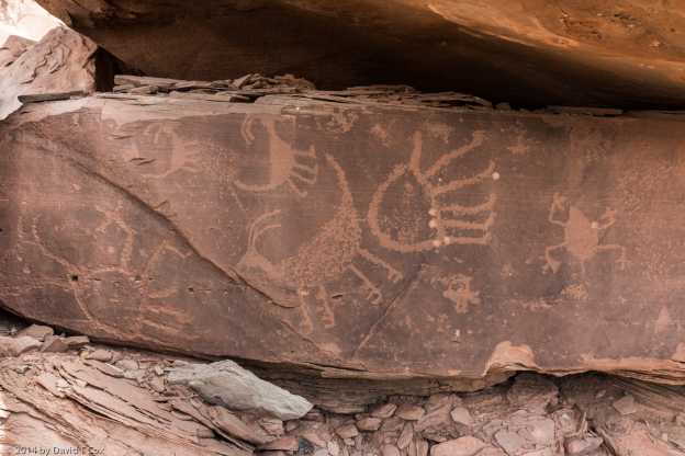
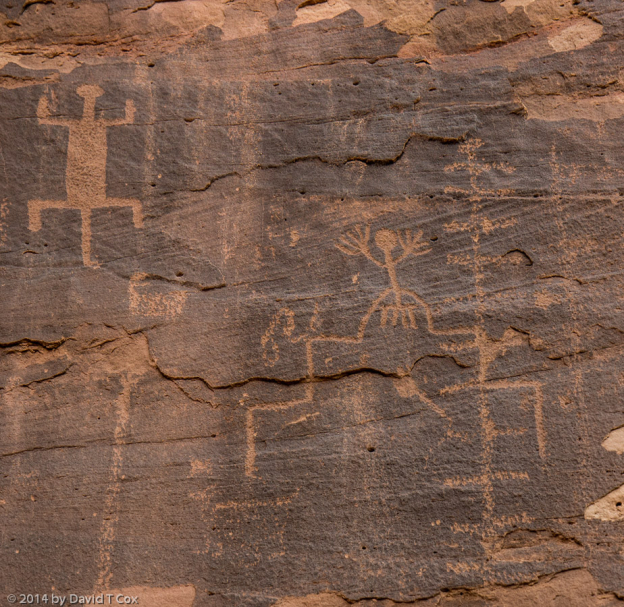
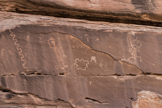
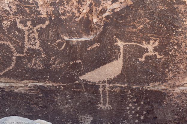
After perusing a masters thesis written by Sally Love in the 1980s, which studied the rock art of the area, I spent several days hiking and locating some of the better art. It was all Ancestral Puebloan art, and the ruins are mentioned prominently in the oral histories of 10 of the Hopi Indian clans as ancestral lands. Much of the rock art is thought to be iconographic representations of ancestral forms of the Hopi katsinas (aka kachinas, which are sort of supernatural spirits which guide aspects of life), and so is quite different from other Anasazi petroglyphs I have seen. Of particular interest to me was locating a related Puebloan site called the Cottonwood Creek Pueblo; it had been studied years earlier, but now is located on almost inaccessible land some miles east of the 4 Homolovi sites. With permission from one, I hiked across 2 rancher’s barren land along the route of old Hwy 66 out to the Cottonwood Creek, and beyond found the bluffs which held the ruins of the old pueblo on top. Below the ruins, along the top cliff edges of the bluff, are many large “panels” of smooth sandstone rock faces with dark patinas from aging; Upon many of these panels the ancients created their petroglyphs. It was a very tiring and hot day, but fascinating to locate many of the petroglyph panels which may not have been seen since the 1980s when Ms. Cole did her research.
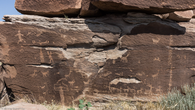
Last Wednesday I drove just 35 miles east to Holbrook, and am staying now in a small private RV camp on the north edge of town. I was able to meet Mike Odell, who has worked for the Holbrook City water and parks for many years, and helped get the town to purchase property to the north which includes a large Anasazi petroglyph field around high bluffs. Mike spent over 4 hours giving me a private tour of the site, locating many petroglyph panels I probably never could have found by myself; again a number of the panels had extraordinary figures. I gave Mike a complete set of the photos I took for possible future use as the town tries to develop the site for limited tourism (the town just received a $100,000 grant for such development – much of which will be used to fence and protect the site from ever increasing vandalism – a sad problem besetting any number of rock art sites as they become better known).
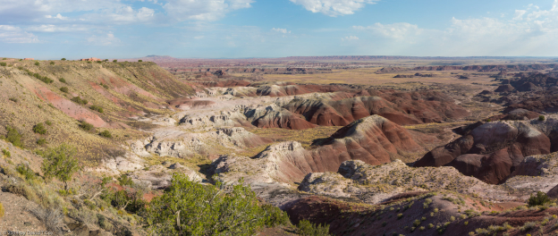
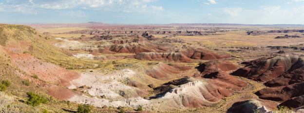
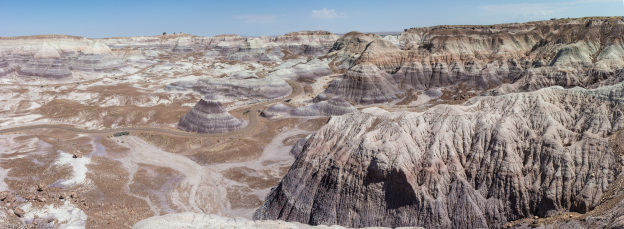
I have spent the last two days visiting the Petrified Forest (and Painted Desert) National Park; several days ago I called and spent some time on the telephone with Bill Reitze, the resident archaeologist for the Park, discussing the location of some wilderness rock art. The first day I hiked north of the south entrance to find a number of rather hard to get to petroglyph panels – the hike to the area was not difficult, but climbing the boulder fields up 50 degree soft pack sediment was not an easy task. Many of the best panels were hidden on the back sides of huge boulders near the top of the bluff face. Yesterday I drove the whole park, taking scenic panorama photos, and visited the two easy to get to petroglyph sites at Puerco Pueblo ruins, and Newspaper Rock.
Most of my dining this trip has been just evening meals (occasional breakfasts at Denny’s); I seldom eat during the day as I am often out in the middle of nowhere. Other than the usual fast-food joints, most sit-down restaurants in the three towns I have camped near serve mostly Tex-Mex food. I love Mexican food, but it gets a little old after several weeks. The majority of customers at the restaurants in Winslow and Holbrook have been Navajo and Hopi families who live just off the reservations.
Tomorrow, the next day, or whenever I get around to it, I expect to haul myself on northeast to Chinle on the Navajo Reservation, where I want to spend some time revisiting Canyon de Chelly and Canyon del Muerto. Till later. Dave
- Cottonwood Wash Pueblo petroglyphs, near Homolovi, Ancestral Puebloan, 800-1400 AD, AZ
To print the travelogue, right click anywhere on the page. Choose "Print" from your browser dialog box. You can choose Save to PDF in the browser print window.
Share your thoughts.
Email Dave - coxdavid55@hotmail.com
