Italy, during two time periods lasting a couple of centuries each, originated much of what we consider Western Civilization; the first was the height of the Roman Empire (roughly 0 to 200 AD), borrowing heavily on the preceding Greek and Macedonian traditions, and the second was the emergence of the Italian Renaissance (roughly 1350 to 1550). For an intoxicating immersion in the output of these time periods, one definitely must spend lots of time in, and attention to, two geographic areas; the coastal area lining the Bay of Naples (Napoli) within the morning shadow of Mount Vesuvius, and the great city on the banks of the Arno River, Florence (Firenze). Pompeii and Herculaneum, buried by Vesuvius’ eruption in 79AD, best preserved great living cities at Rome’s height, along with much of its best art in the form of frescos, mosaics and statuary. For the output of Renaissance masters, Florence was ground zero producing the earliest, and subsequently also some of the greatest, artwork in paintings and sculpture; these masters included Donatello, Botticelli, da Vinci, Michelangelo, Raphael, Titian and Caravaggio.
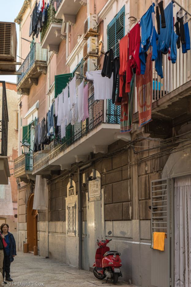
I arrived in Naples on the West coast of Italy on Mar. 30, after a short bus haul from Bari on the Adriatic Sea. Napoli, as it is known in Italy, reputedly has the best pizza on earth, though I cannot discern much difference from the pizza in Rome, Bari or Lecce – all are very thin crust in the middle, where, fresh from the wood ovens, the centers can be almost soupy with melted cheese and olive oil. All are delicious as long as devoured before getting cold. My apartment was located with over a dozen pizzerias nearby, as well as numerous coffee shops and pastry stores selling sinful dark chocolate stuffed in every type of pastry imaginable.
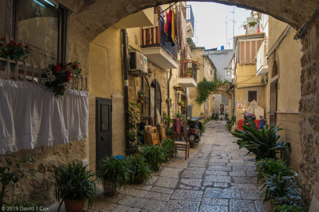
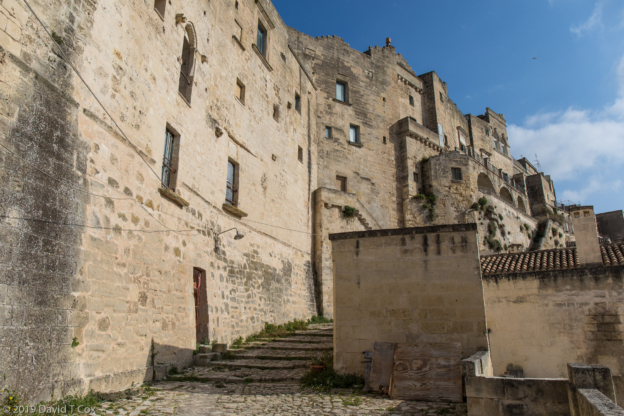
My apartment, on the 5th floor of a very old building, was huge and bright, modern, two levels, and had 3 sets of 12 foot double wooden doors which each opened onto balconies. The two eastern balconies looked north and south on Via Duomo, the main street in the Old City which runs by the cathedral; to the south the Bay of Napoli could be seen. The north facing balcony opened directly on the Duomo square and main entrance to the 13th century cathedral, an amazing sight which fully caught the afternoon sun.
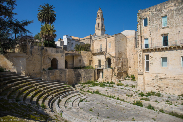
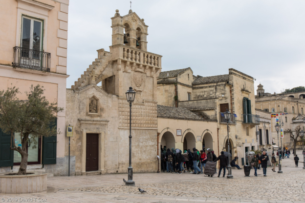
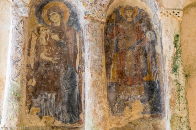
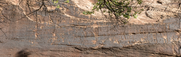
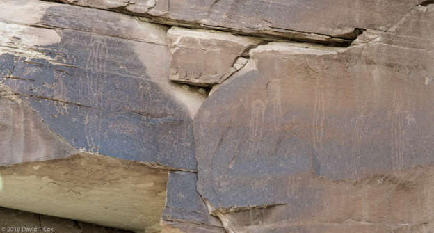
My first day I visited the gothic Church of San Lorenzo Maggiore, with a number of huge rooms around its cloister, each with colorful wall designs, used during the 15th and 16th centuries for various political purposes. More interesting was what lay under the church; excavations allow one now to descend many meters under this part of the city to walk the complete original stone roadways, lined with shops and bakery stores, and other merchants, of the original Greek and Roman settlements. I also visited the small church called the Pia Monte della Misericordia Museum to view the famous Caravaggio painting called “Obras de Misericordia.”
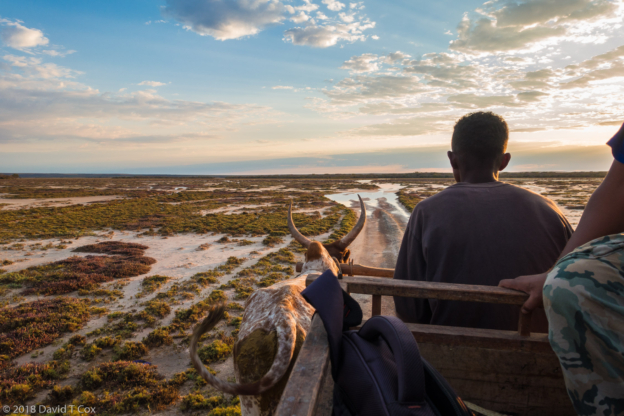
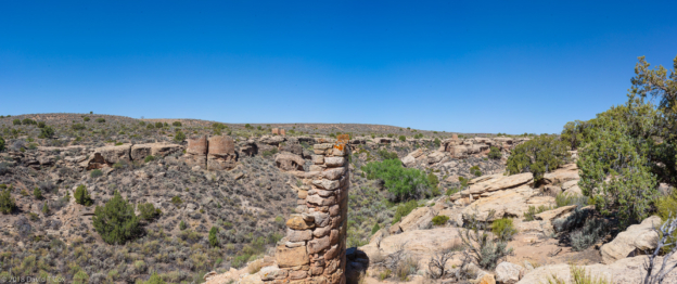
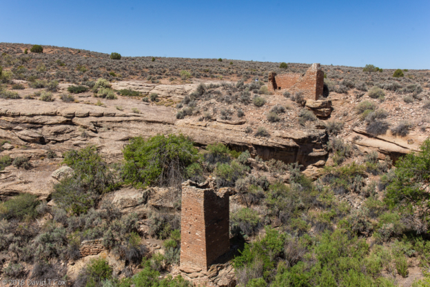
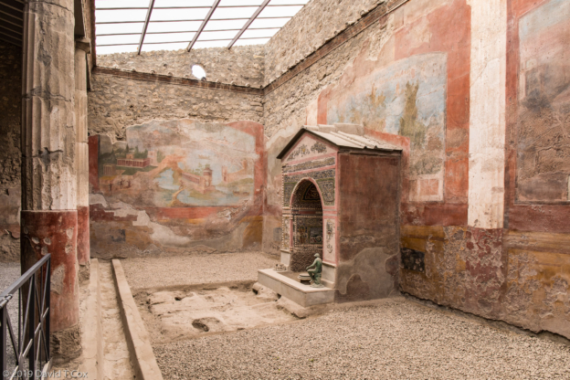
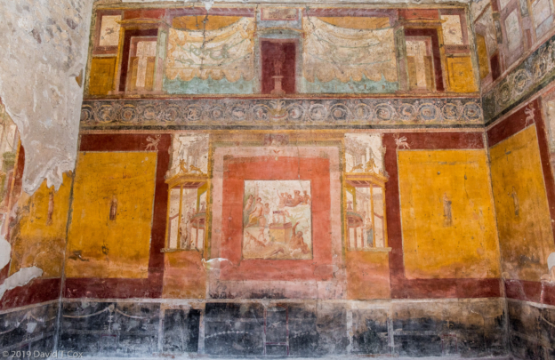
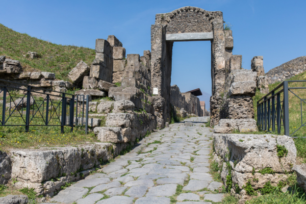
On Monday I took a local train (see photo of colorful graffiti covered train below) south around the bay to the west side of Mt. Vesuvius where sits the ancient city of Pompeii. I had little idea how vast an area now has been uncovered – the entire wealthy and main commercial part of the city all are preserved, and one walks along the original stone paved streets of the city just as they existed up until the fateful day of Vesuvius eruption in 79AD. The building roofs mostly were destroyed, but the walls, gardens, taverns, shops etc. all remain. The boulder paved streets show the deep ruts cut over the centuries from the wheeled carts and wagons which plied the ancient thruways. I spent five hours walking most of the main routes through the excavated parts of the city, visiting dozens of wealthy houses, a few maintaining still some fine wall frescos and floor mosaics.
At the main crossroads of Pompeii lies the huge Forum, full of columns, with the adjoining granary, now housing hundreds of amphorae and other items. The southeast side of the city held the side by side Teatro Piccolo, or Odeon, and the large Teatro. Further east lay the huge Amphiteatro where the gladiators fought. After the hours of wandering I truly was tired at the end.
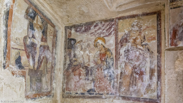
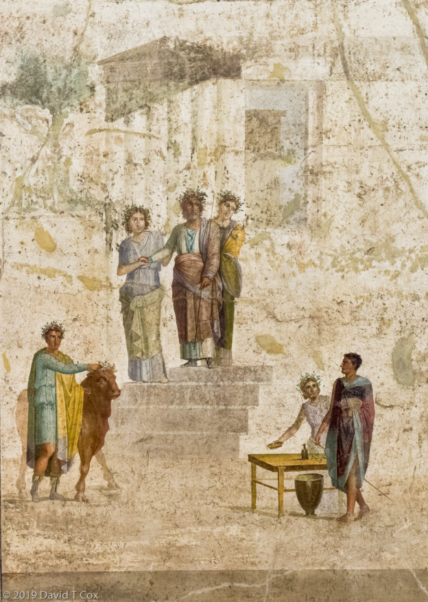
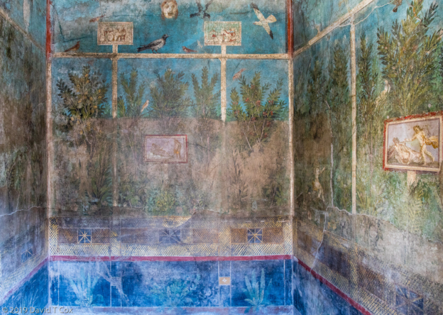
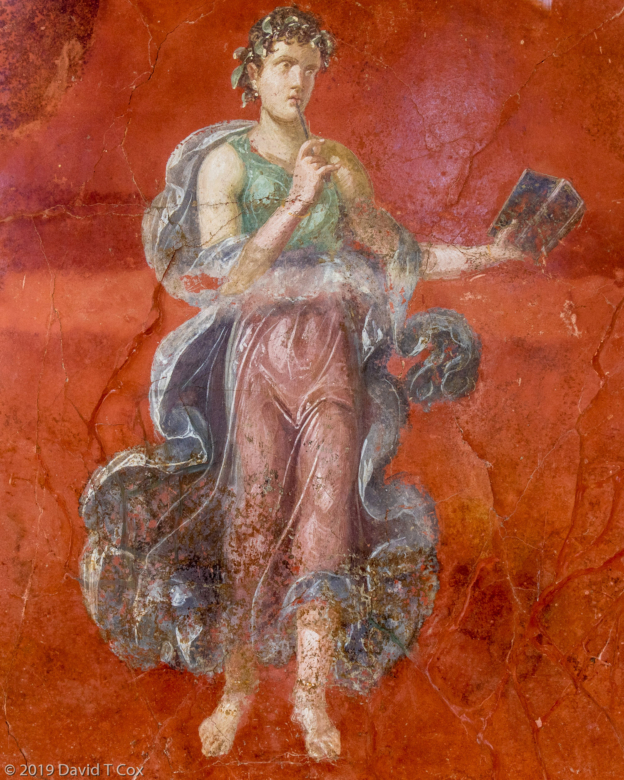
A few of the villas have in situ original mosaics and wall frescos. Among my favorites, photo included below, note the vicious black dog mosaic which covered the floor at the entrance to a huge villa – the dog is chained, but the message is as clear today as any posted sign stating “BEWARE OF DOG” – and the 2,000 year old posting is far more beautiful and impressive. The partial Alexander Mosaic is a stunning work of tiny mosaic stones depicting horses in battle with an amazing 3D depth and lifelike moving quality; the photo I have included is of the original which now resides in the Museum discussed below. Among the in situ frescos, I particularly enjoyed the small room walls with complex garden scenes. Finally, individual personages in frescos were on display from the nearby ruins of Moregine, which seemed to depict gauze and loose clothing as well as some renaissance masters.
The following day I wanted to visit Herculaneum, the sister city to Pompeii, somewhat smaller and less crowded with tourists; unfortunately I arrived at the railroad station to find the regional train serving the Bay area shut down – a result of a workers’ 1 day strike. I decided then to visit the museums I had scheduled for the following day, only to find they all were closed on Tuesdays. Because of my scheduling then I never made it to Herculaneum.
I later visited the Naples’ highlight, the National Archaeological Museum of Naples, where the best frescos, mosaics and statuary of Pompeii and Herculaneum have been preserved, along with objects from the temples and many implements of daily life. At the museum one discovers why Pompeii, which seems so perfectly complete and undisturbed, has so few interior spaces still decorated with the famous wall paintings and floor coverings – all have been removed over the past 150 years. Many were stolen or taken out of the country. In most cases, just portions of the plaster or mosaic highlights were cut out and retained to be presented elsewhere in frames. Thus the entire wall or floor coverings were removed from their original location just to preserve pieces. Some of the signage in the Museum admits that even much of the more recent archaeological work thus destroyed the in situ beauty of what was so perfectly preserved in Pompeii. Nevertheless, on two floors of the huge museum, room after room is full of small and large fragments of the painted wall frescos and vast and intricate floor mosaics. I have included a large number of photos below, together with photos of the current villas and casas in Pompeii; mentally one must attempt to put the decorations back together with the architecture.
On Wednesday I visited the Cappella Sansevero at opening to avoid the worst crowds. It contains one of the world’s great marble sculptures – “The Veiled Christ” by Sanmartino. Indeed I found it a masterpiece, depicting the dead body of Christ, after crucifixion, covered completely by a veil. “Astounding” is the correct word describing the appearance of the veil, folds and all, which looks utterly transparent over the body and face of Christ, yet all sculpted from the single block of marble.
On Thursday I took the super-high-speed train, the Frescciarossa, from Naples to Florence – the train travels at 300 KPH, or about 185mph. It is sufficiently smooth and quiet that, but for the scenery rushing by at incredible speed, one has little idea how fast it is going (bragging rights for these high-speed trains means they put monitors in the passenger compartments which show a speedometer).
My apartment in Florence was the largest I have so far had, 990 sqft; a large living room with two windows over the street, and a huge dining and kitchen area and neighboring bedroom, both with ancient high wooden double doors opening onto an outside terrace. These large apartments are often in better locations than any hotels (all of my lodging so far has been absolutely central with superb locations – I have only used one hotel). In bridge season like now, I get them at great prices, generally cheaper than most mid-range hotel rooms which are tiny by comparison. The restaurant next door is Tuscan classic, extremely busy, but wonderful food.
The Florence art scene must be the envy of the world – here there was far too much to digest in a few days. The crown jewel was the Uffizi Gallery with its massive collection of Italian Renaissance paintings; most were commissioned or acquired in Florence by the Medici family or other nobility during the Renaissance, and most were acquired by or gifted to the Uffizi centuries ago. Three of the only 15 da Vinci paintings in existence reside here, jostling for space with Michelangelo, Raphael, Botticelli, Caravaggio and Titian works, all of which fill rooms. Four hours and my feet wouldn’t allow more time.
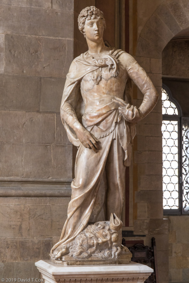
The next morning was reserved for the Bargello Museum, filled with its statuary including several pieces by Michelangelo and Donatello’s two different David’s, one in marble, the other bronze. Sansovino’s Bacchus in marble was made to compete with Michelangelo’s earlier one, and later joined by Giambologna’s bronze, all three of which are found in the same room. Finally I visited the Gallery Accademia with its masterpiece, Michelangelo’s huge marble of David. The Accademia held a number of other Michelangelo marbles, and a huge collection of Byzantine-Gothic-very-early Renaissance painted panels.
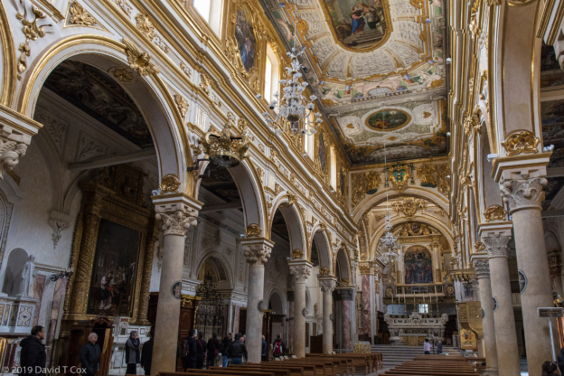
My final full day I visited the Basilica Santa Maria Novella, with its huge Romanesque exterior and gothic cloisters and austere interior. The Gothic marble facade is a delight for the eyes. Inside were more riches, from Gothic to early Renaissance frescos and wood panels painted by Masaccio, Botticelli, Uccello and Giotto, all very early artists.
Bottom line, Florence simply contains way too much to try to take in on one visit. On Tuesday I head to a small town, Lucca, in western Tuscany, where the medieval city walls still are in place. Smaller towns permit a much less frenetic pace in trying to soak up the history.
Later. Dave
-
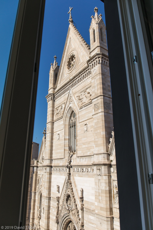
- view from my Appartamento Cattedrale, Naples, Italy
-
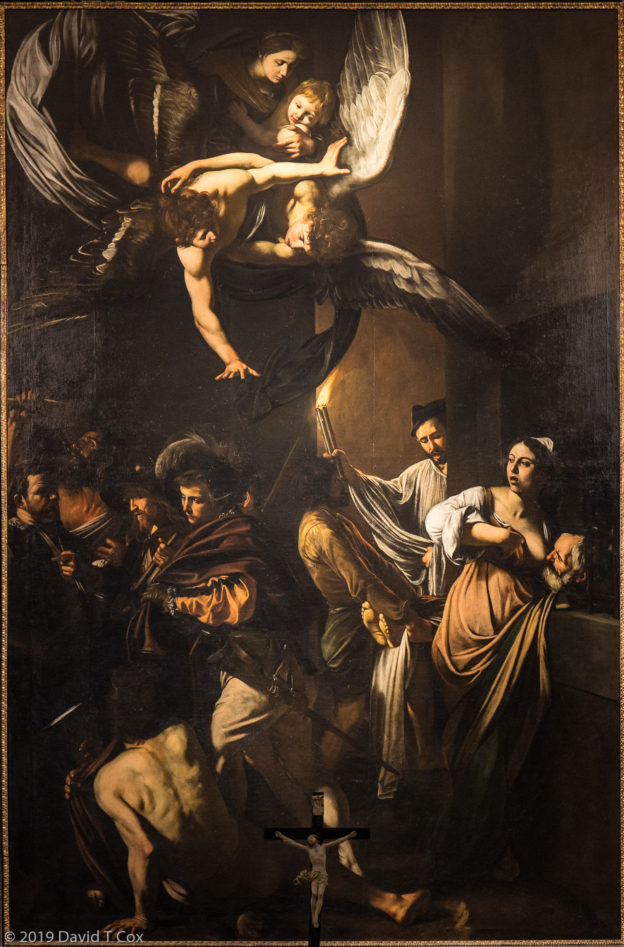
- Caravaggio’s “Obras de Misericordia”, Pia Monte della Misericordia Museum, Naples, Italy
-
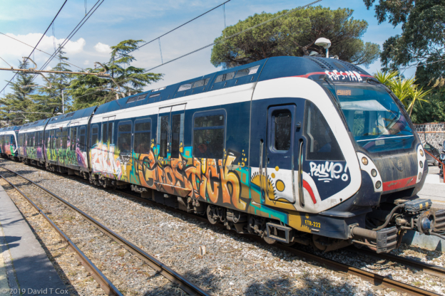
- Circumvesuviano Train to Pompeii, note covering of colorful graffiti, Italy
-
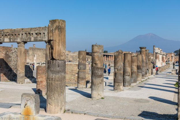
- Forum w Mt. Vesuvius in background, Pompeii, Italy
-
- Casa della Fontana Piccola, Pompeii, Italy
-
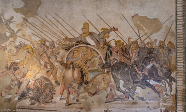
- Alexander and Darius Battle Mosaic, ca 125 BC, from House of Faun at Pompeii, Naples National Museum of Archaeology, Naples, Italy
-
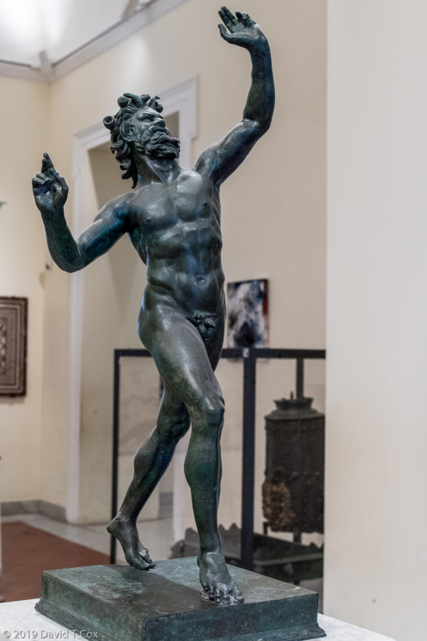
- Dancing Faun, House of Fawn, Pompeii, Naples National Archaeology Museum, Naples, Italy
-
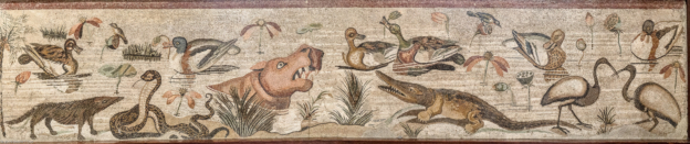
- Nile Wildlife Scene Mosaic with reflections in water of ducks and shadows below snake and croc, and note mongoose intense interest in snake, pano, from House of Faun at Pompeii, Naples National Museum of Archaeology, Naples, Italy
-
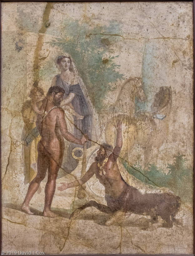
- Fresco Hercules and Nessus, from House of the Centaur, Pompeii, Naples National Museum of Archaeology, Naples, Italy
-
- frescos, domus of Publius Vedius Siricus, Pompeii, Italy
-
- fresco Jason and Pelias, House of Giasone, Pompeii, Naples National Museum of Archaeology, Naples, Italy
-
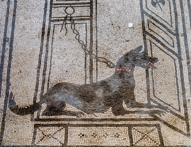
- Dog Mosaic at floor of entrance door, Casa di Paquius Proculus, Pompeii, Italy
-
- frescos, Casa del Frutteto, Pompeii, Italy
-
- frescos from “triclinia” in villa in Moregine, on display in Palestra Grande, Pompeii, Italy
-
- Porta Nocera, Pompeii, Italy
-
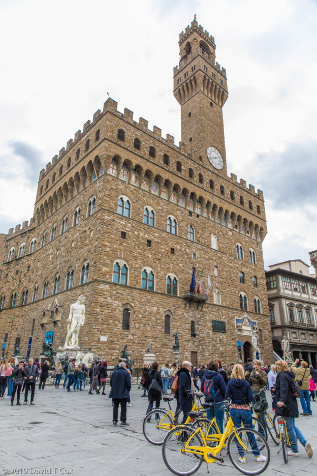
- Palazzio Vecchio on Piazza Signoria, Florence, Italy
-
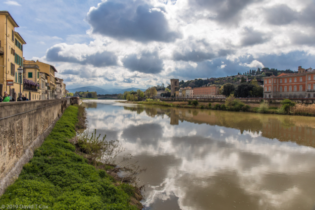
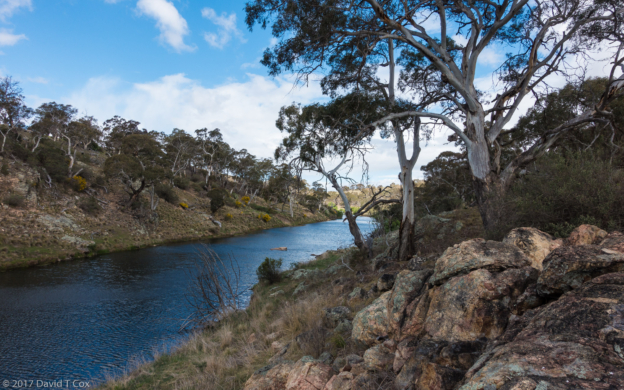
- along Arno River, Florence, Italy
-
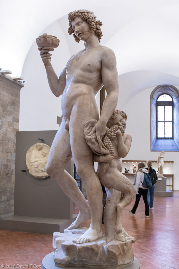
- Bacchus, marble, 1496-97, Michelangelo Buonarroti, Bargello Museum, Florence, Italy
-
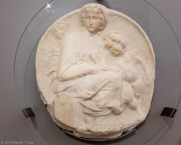
- Madonna w Child, marble, Michelangelo, ca 1505, Bargello Museum, Florence, Italy
-
- David, marble, 1408, by Donatello, Bargello Museum, Florence, Italy
-
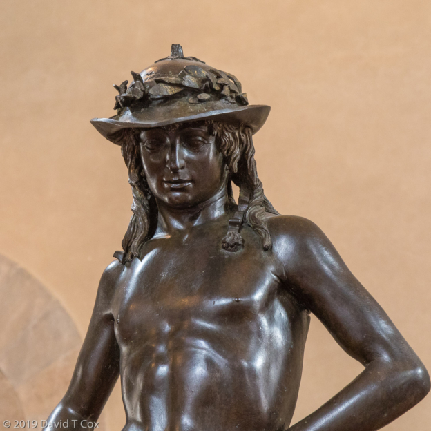
- David, bronze, ca 1440, by Donatello, Bargello Museum, Florence, Italy
-
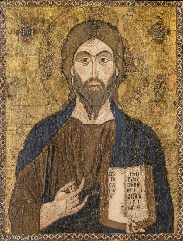
- Byzantine micro mosaic, the Pancreater, mid 12th C, Bargello Museum, Florence, Italy
-
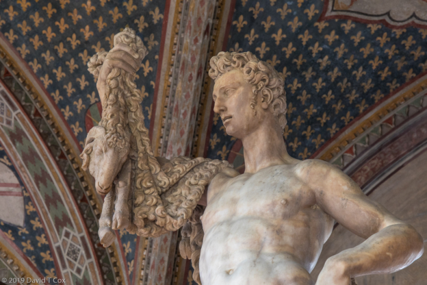
- Jason, marble by Pietro Francavilla 1589, Bargello Museum, Florence, Italy
-
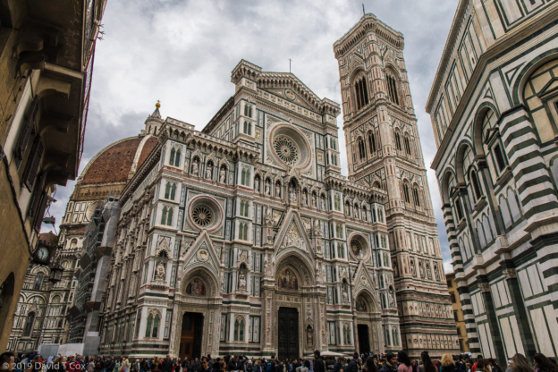
- Cattedrale w Brunelleschi’s dome, Florence, Italy
-
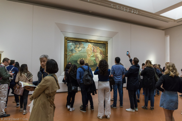
- Botticelli, Birth of Venus, ca1485, Uffizi Museum, Florence, Italy
-
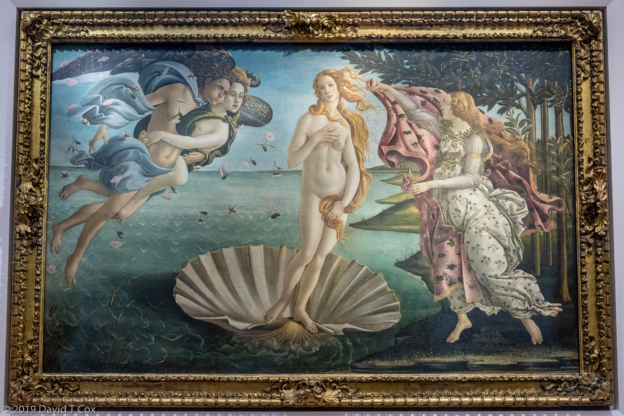
- Botticelli, Birth of Venus, ca1485, Uffizi Museum, Florence, Italy
-
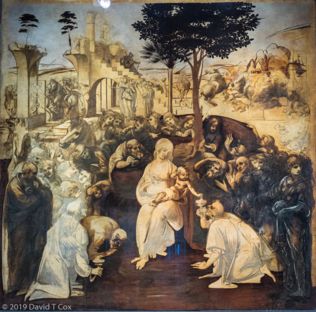
- Da Vinci, Adoration of Magi, ca 1481-82, Uffizi Museum, Florence, Italy
-
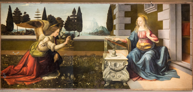
- Da Vinci, Annunciation, ca 1472-75, Uffizi Museum, Florence, Italy
-
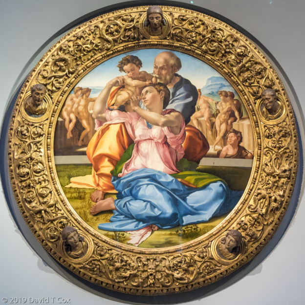
- Michelangelo, Holy Family “Doni Tondo”, ca 1505-07, Uffizi Museum, Florence, Italy
-
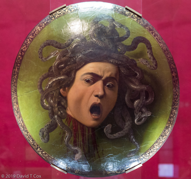
- Caravaggio, Medusa, ca 1595-98, Uffizi Museum, Florence, Italy
-
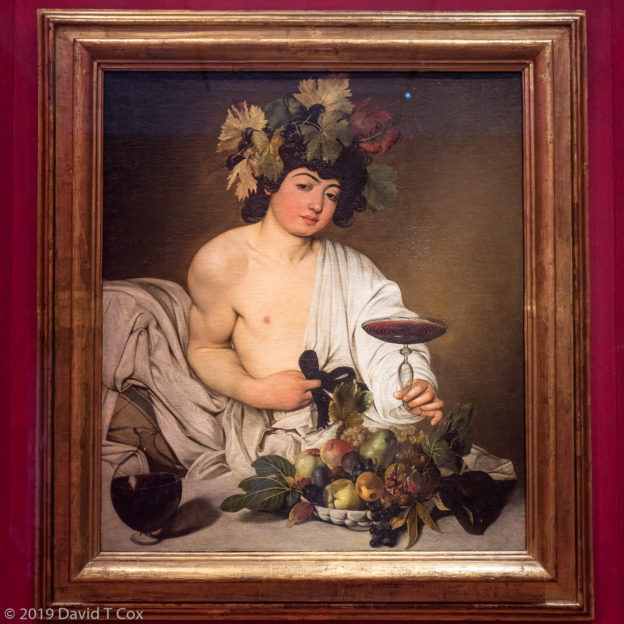
- Caravaggio, Baccus, ca 1597-98, Uffizi Museum, Florence, Italy
-
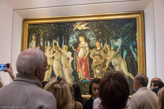
- Botticelli, Spring, 1480, Uffizi Museum, Florence, Italy
-
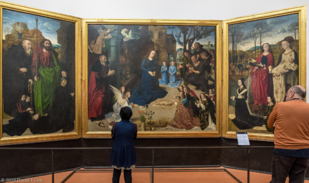
- Hugo Van Der Goes, Adoration of Shepherds, ca 1476-78, Uffizi Museum, Florence, Italy
-
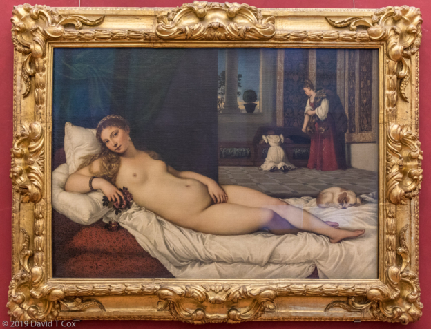
- Tiziano, Venus of Urbino, 1538, Uffizi Museum, Florence, Italy
-
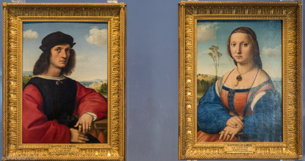
- Raphael, Portraits of Agnolo Doni and Maddalena Strozzi, ca1504-06, Uffizi Gallery, Florence, Italy
-
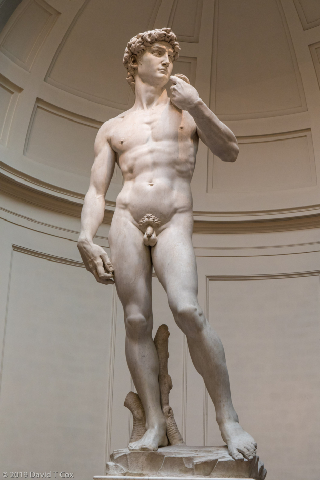
- Michelangelo, David, in marble 1502-04, Galleria Accademia, Florence, Italy
-
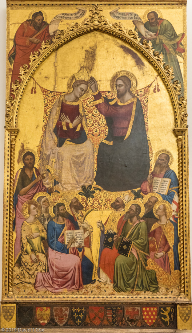
- Jacopo di Cione, Coronation of Virgin, 1372-73, Galleria Accademia, Florence, Italy
-
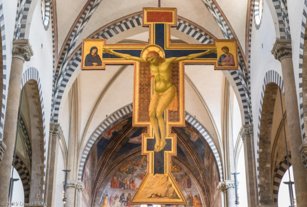
- Giotto, Crucifix, 1288-89, Basilica Santa Maria Novella, Florence, Italy
-
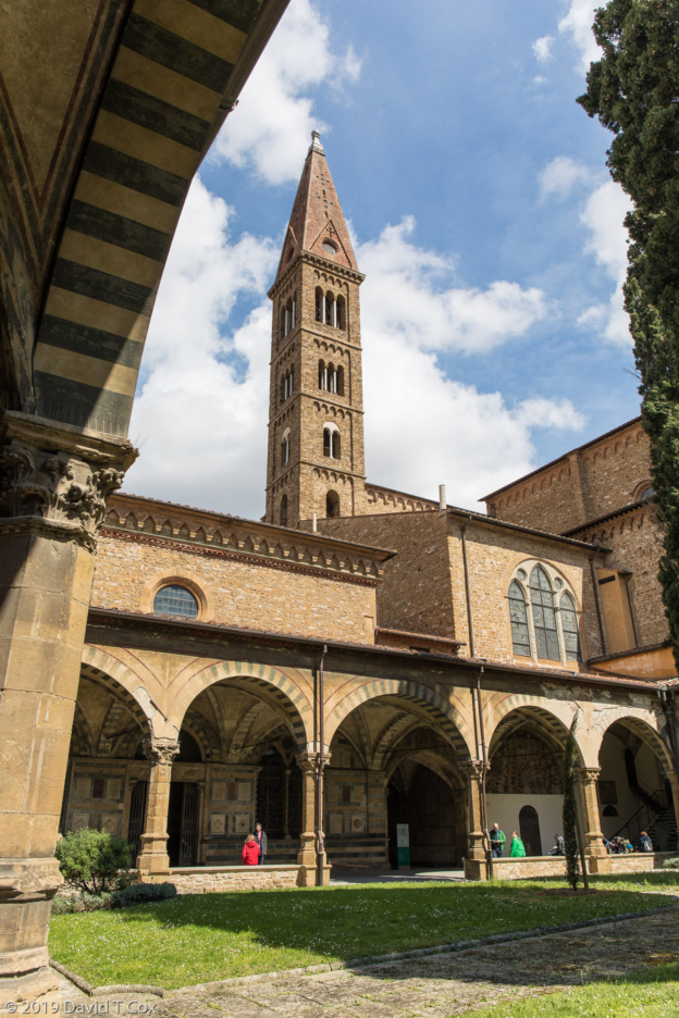
- Green Cloister w Paolo Uccello frescos from Old Testament, early 15th C, Basilica Santa Maria Novella, Florence, Italy
-
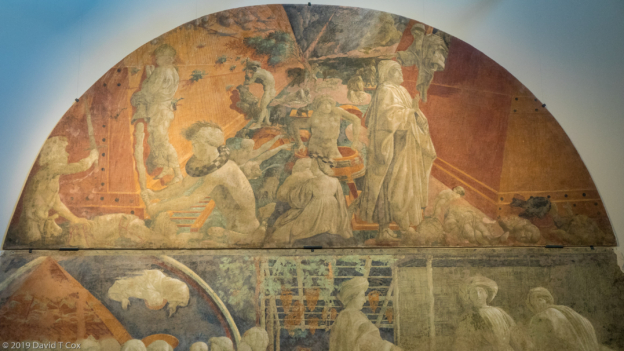
- Paolo Uccello, restored Green Cloister fresco “Flood”, Basilica Santa Maria Novella, Florence, Italy