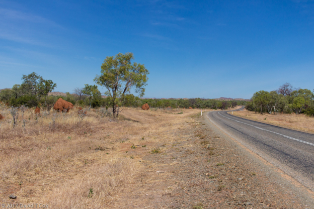
On Saturday, Oct. 14, I departed Esperance to drive north and then east across the great and daunting Nullarbor Plain to enter South Australia. The first day I drove the section of road called the longest straight highway in the country – probably the world; for 147kms (92 miles) the two lane Eyre Highway runs absolutely straight with nary a turn of even 1 degree. For two hours you never worry about whether a curve will creep up on you. This is the middle section of the Nullarbor Links Golf Course, created about 14 years ago, the longest golf course in the world at over 1,000 kms. The holes are located at each of the various outback ranches or roadhouses along the way, and are named rather than numbered, so the course can be played in either direction. The 18 holes are a par 70, but the average distance between greens and the next hole is over 50 kms. Apparently one can rent irons at each hole for about $5 – a good idea as much of the course is rocks and dirt. See photo below of one of the promotional posters for the course.
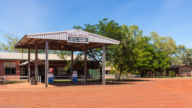
I stayed at the Caiguni Roadhouse the first night. Below, among the photos, you will find the posted bus schedule for this roadstop in the middle of nowhere – quite funny – Aussie humor. Another 550 kms the next day and I stayed at the Nullarbor Roadhouse in South Australia, more great signs – see photo of entrance to Pub tavern. It is difficult to get your head around the time zones in the central part of the continent – West Australia is on western time and Sydney on Eastern, two hours apart, but South Australia is 1 ½ hours ahead of West Australia, and goes on Daylight Savings which West does not, so the change at the border is 2 ½ hours (there actually is a small area of southeastern West Australia which switches by 45 minutes, but as you pass right through it without stopping you don’t notice).
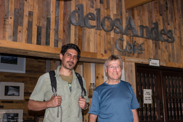
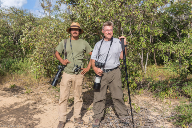
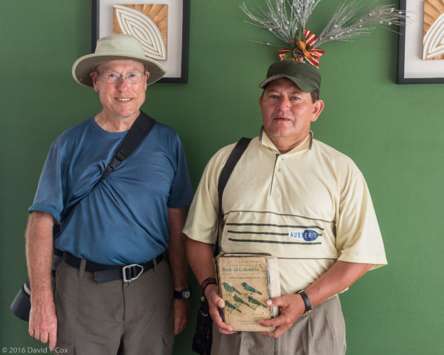
From Nullarbor I drove on to Ceduna, the first actual town since Norseman 1,200 kms ago, and from there on to Port Augusta, the crossroads of Australia. All highways, except the Great Northern, from Western Australia join into one southern highway which passes through Port Augusta. All highways from Eastern Australia do the same. And the lone northern highways which meet at Katherine join just one north-south highway, the Sturt, which runs through Alice Springs and, yes, meets the southern highways at Port Augusta. Geographically this is where the ocean spears well up into the central desert of the central south of the country. It is home to the Arid Lands Botanical Gardens which are a refuge for many birds, and where 8 years ago I encountered Peter Langdon, a volunteer and serious bird expert, who spent parts of two days showing me a number of birds in the region. Peter still was there and I spent a little time with him – he recently published a guide book on the birds of the Arid Lands Gardens.
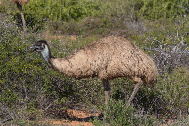
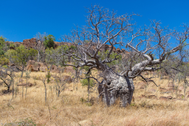
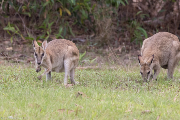
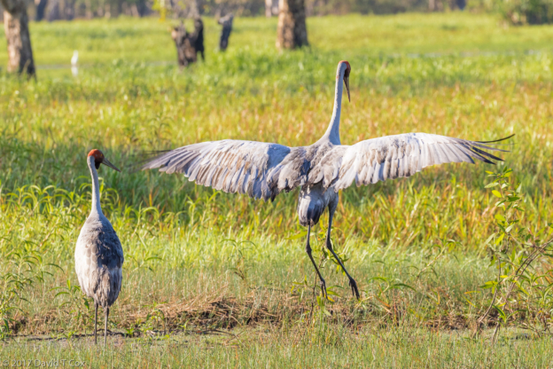
From Port Augusta I traveled up into the Flinders Range National Park and Wilpena Pound, a beautiful area of magnificent River Red Gum trees and pines, and home to more kangaroos, wallaroos, wallabies and emus than anywhere else I have been in the country. Driving early mornings or before sunset requires slow speeds and constant diligence as the animals burst out of anywhere crossing the small roads. This is the one place I have found, twice now, emu fathers followed by their dark and white striped chicks (as I wrote 8 years ago, the emu and cassowary females are n’er-do-well harlots, who lay their eggs then promptly abandon them forever, leaving the nesting and year-long raising of the young, to the males. I suppose some will find cross-species karma evident in this fact. I spent one long afternoon driving up to the Brachina Gorge where there are families of the endangered Yellow-footed Rock Wallabies. After spending well over an hour at the remote rocky site I was rewarded near sunset with one lone photogenic rock wallaby venturing out of the rocks into the small valley to feed.
From the Flinders I headed south and east into Victoria, first passing a pleasant day in Burra on the eastern border of South Australia; Burra is a heritage town, having been built by a copper mining company a hundred years ago. The copper mine was the largest for 50 years in Australia, and mined some of the purest ore in the world. The old buildings, hotel and churches in town are real jewels of outback architecture.
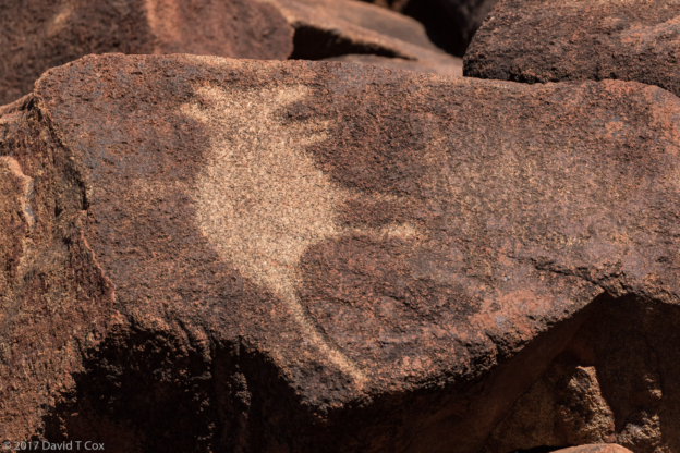
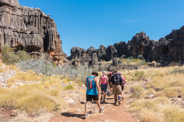
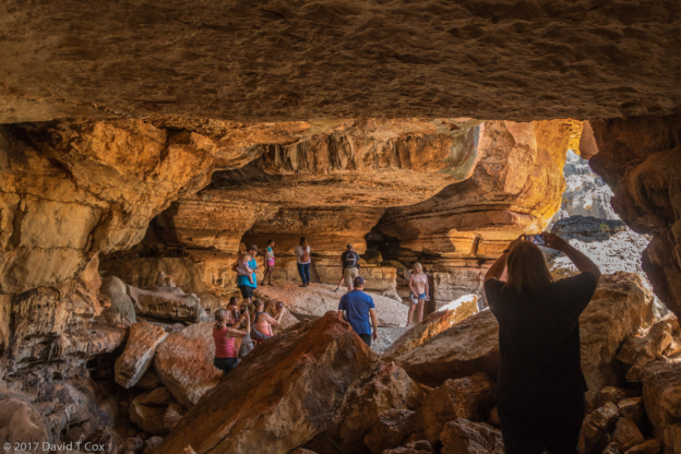
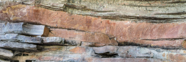
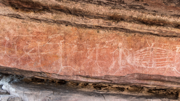
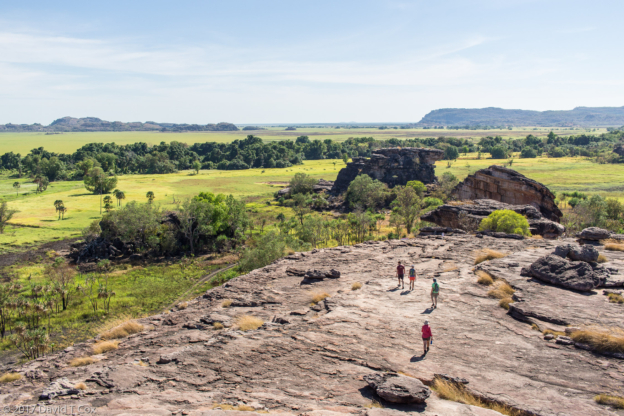
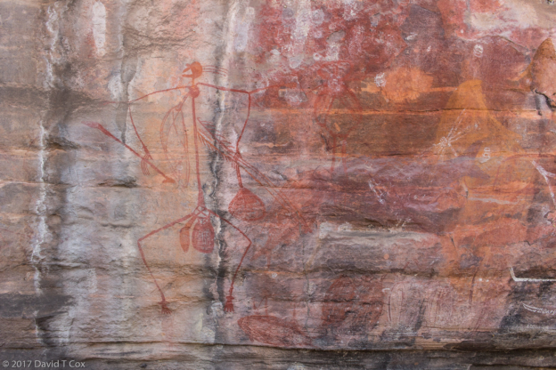
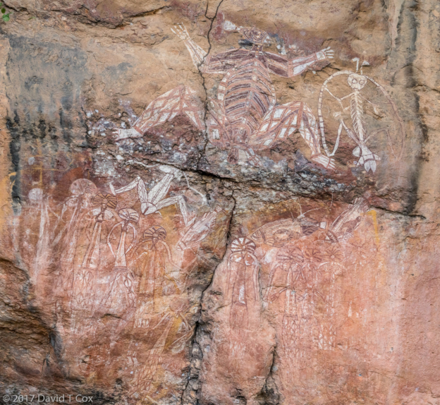
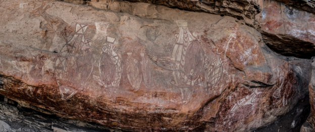
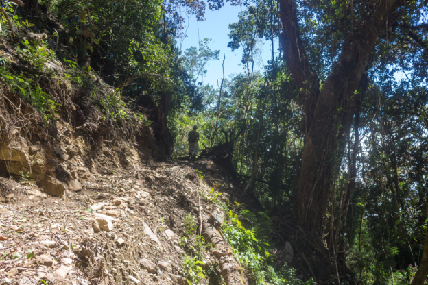
From Burra I drove to Mildura on the border of New South Wales and Victoria, the state line of which is the Murray River which runs well over 1,500kms. Expecting lots of birds around this river plain, as I had found 8 years ago along the Darling River, a tributary, I was disappointed. Rather than spending two days, I drove on to the Grampians National Park the next day where I was not disappointed. The Grampians are the highest mountains in Victoria, and contain the best Aboriginal rock art in the south. They also are full of neat birds. The days were rather overcast and rainy, but I made the most of them. After some research and help from the local tourist center, I encountered bird guide Neil Macumber. I spent over 6 hours with him, discovering a number of new birds. The next day I spent close to 8 hours driving to the three corners of the tiangular Grampian Park system to visit 4 rock shelters with the best rock art. This involved not just lots of beautiful driving through the mountains, but about 8 kilometers of hiking trails, most on steep climbs, to reach the various far-flung shelters. The rock art all was pictographs (paintings), and many appeared quite old, although as usual, dating doesn’t exist. I was impressed with two shelters containing both red hand stencils and red hand prints. These are common rock art subjects on three (and perhaps more) continents, which has lead me to much internal speculation about the age of this symbolism with blood colored pigments (Cueva de Monte Castillo in the north of Spain has red hand stencils dated to 22,000 years ago).
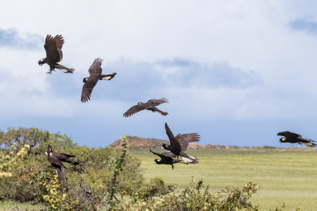
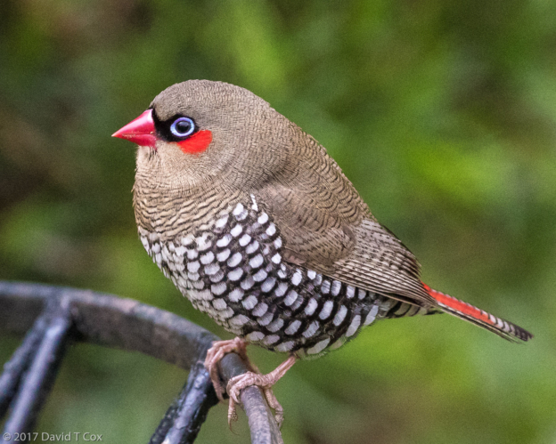
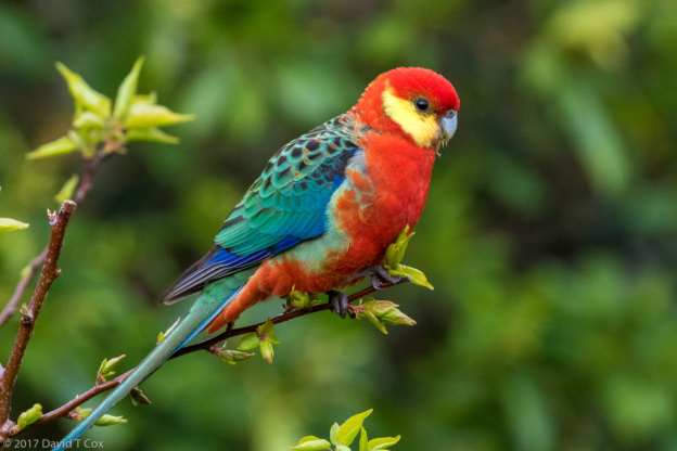
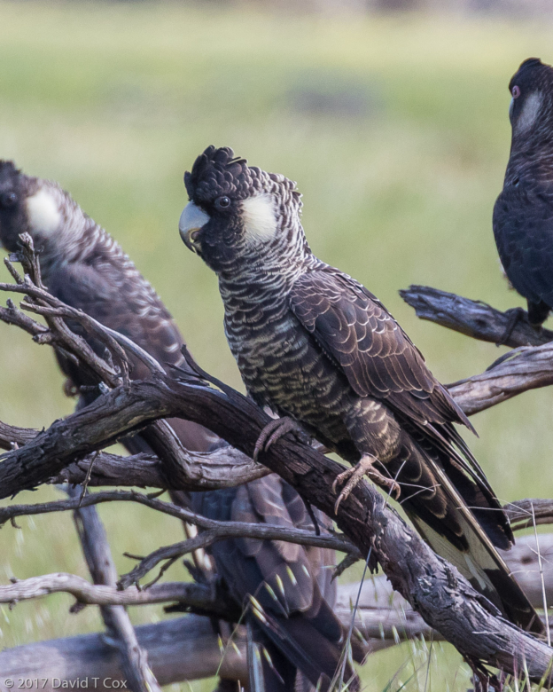
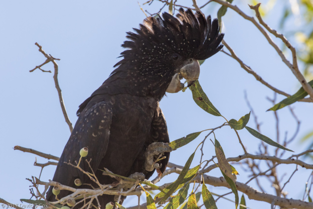
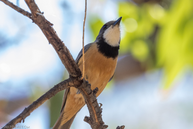
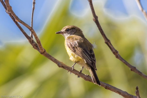
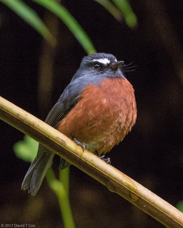
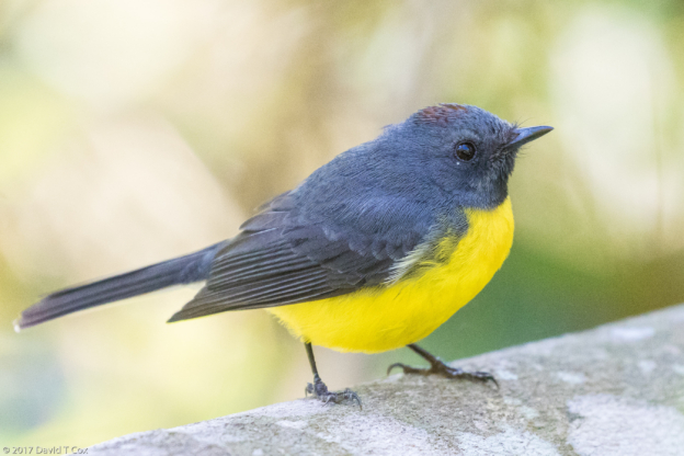
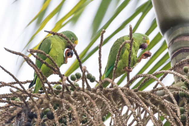
Birds encountered included the Red-browed Finch (a member of the Firetails), the GangGang Cockatoo, the Yellow-tailed Cockatoo (finally photographed, after searching 8 years), the Yellow Rosella (subspecies of Crimson Rosella), and the Great-crested and Hoary Grebes.
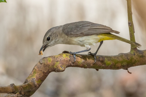
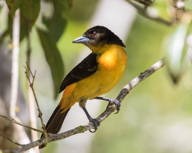
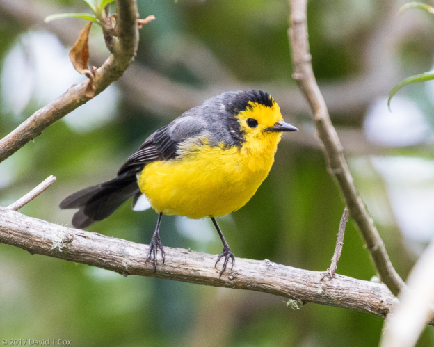
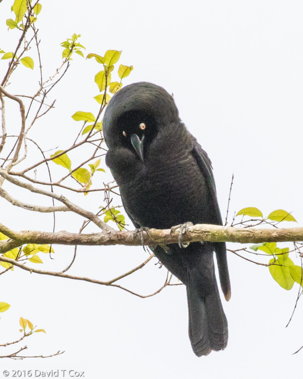
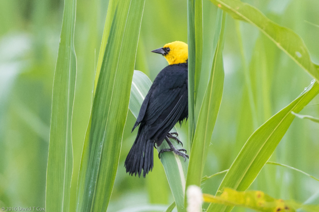
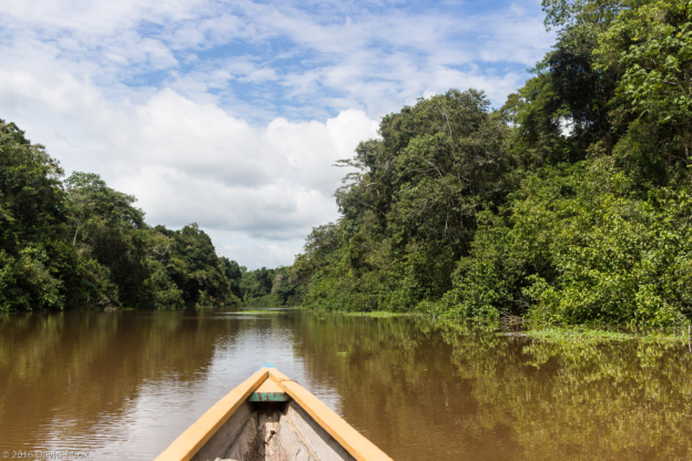
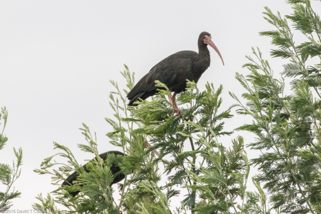
From the Grampians I returned north to the Murray River at Echuca, where I spent a full day in the Barmah National Park, including a few hours on a cruise along the Murray River. I again was disappointed at the dearth of birds, although I got some nice shots of the Brown Treecreeper and the White-winged Chough (pronounced chuff). From Echuca I traveled further up the Murray River to Chiltern, a tiny old gold mining town famed for its mid-19th century buildings and for its rare birds. Here, after some inquiry, I met Neville Bartlette, a local bird photographer who helped me find a number of wonderful birding spots. The best known bird among birders here is the very rare and endangered Regent Honeyeater, which now has been captive bred for some years as its reintroduction is engineered into its only native range. It is believed that fewer than 1,000 exist. They are a beautiful black and yellow bird, and I encountered 3 pairs with nests over a two day period – lovely, though one does need to overlook the multiple leg bands attached to most nesting birds as they are continuously studied.
From here I will continue roughly east-south-east to pass through the southern Great Dividing Range (“Snowy Mountains”) to finally meet the eastern coast down at the New South Wales – Victoria border, from where I will end the drive by heading gradually north into Sydney. Later. Dave
-
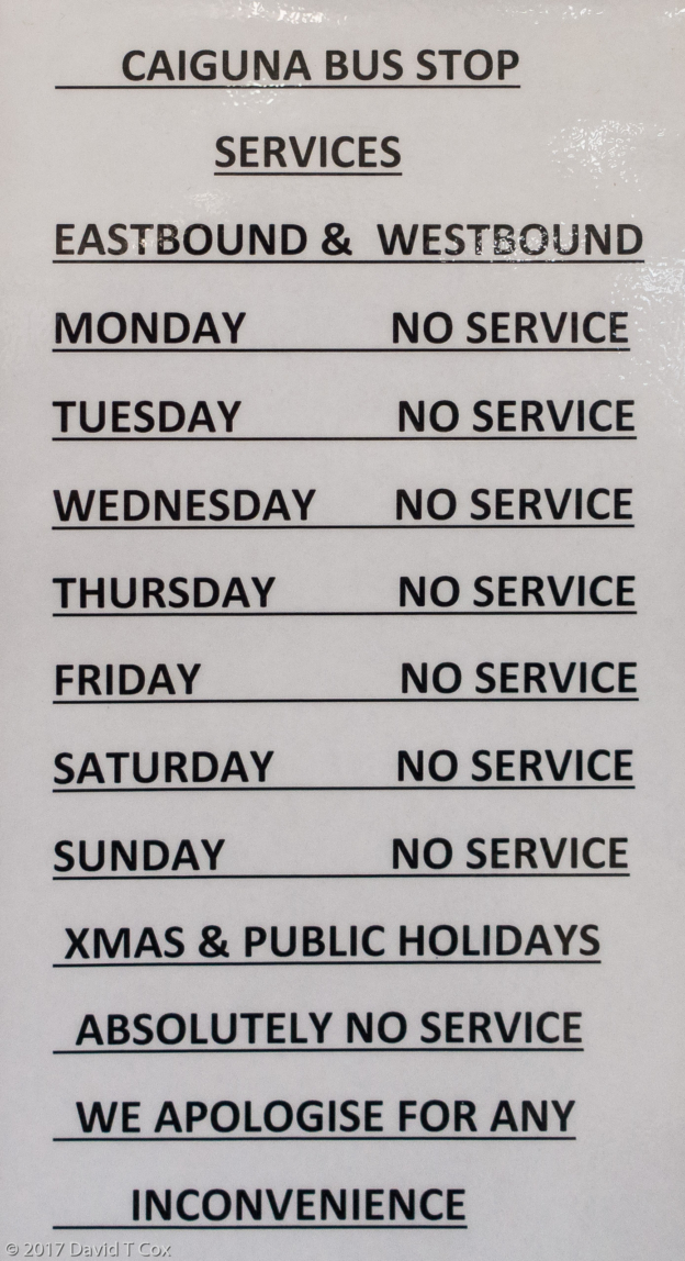
- bus schedulle posted at Caiguna Roadhouse, Nullabor Plain, WA, Australia
-
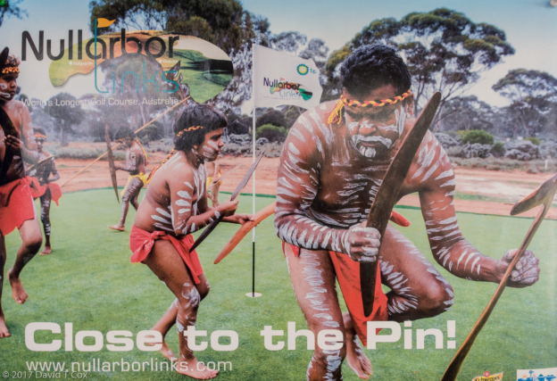
- Nullabor Golf Course poster. Caiguna Roadhouse, Nullabor Plain, WA, Australia
-
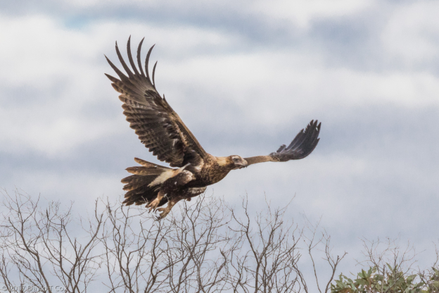
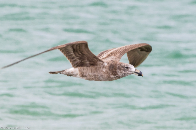
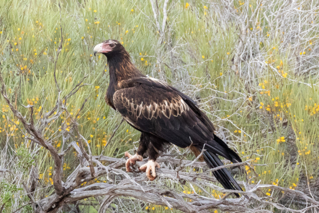
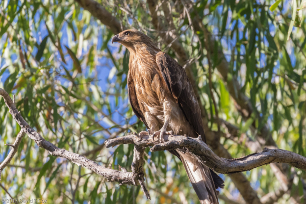
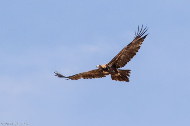
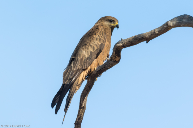
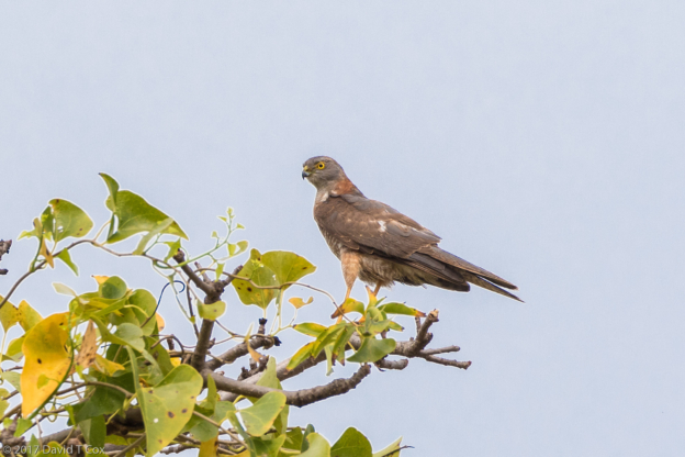
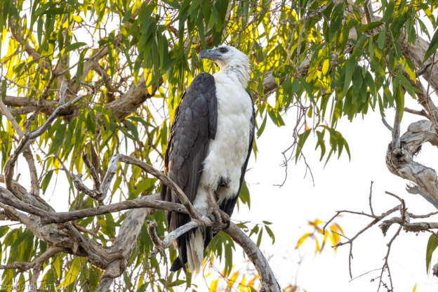
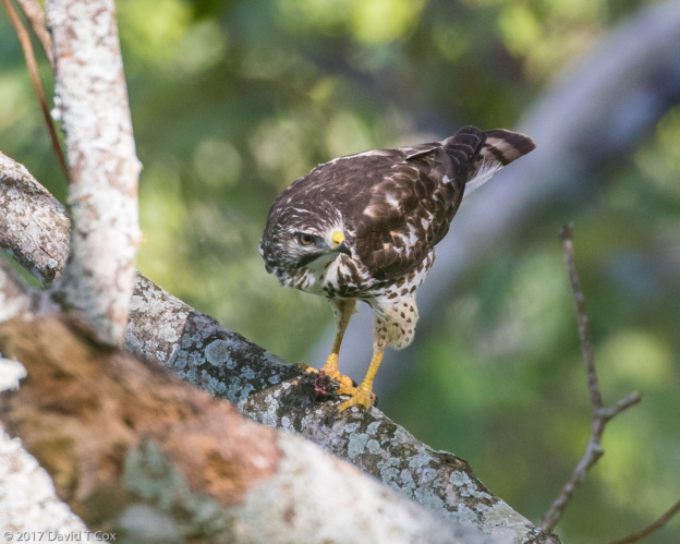
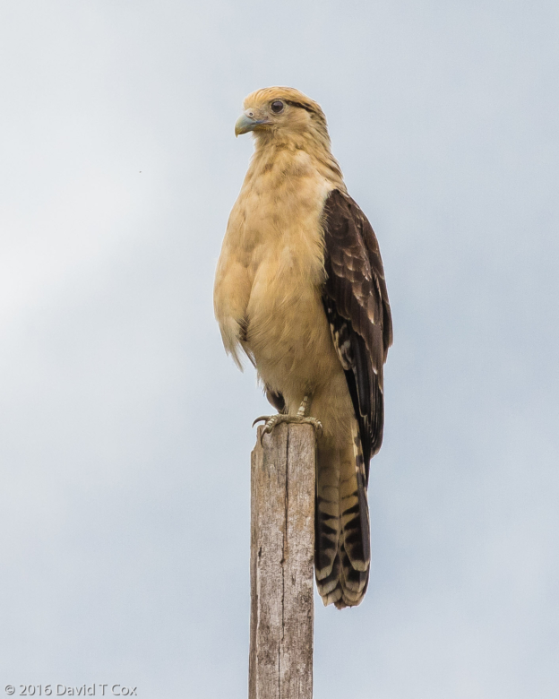
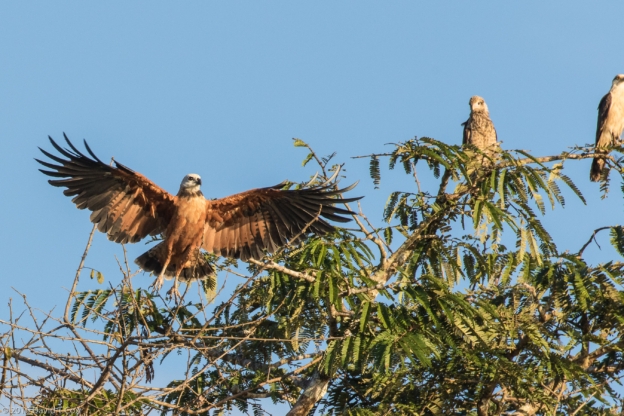
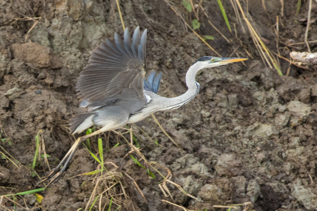
- Wedge-tailed Eagle, Hwy West of Nullarbor Roadhouse, SA, Australia
-
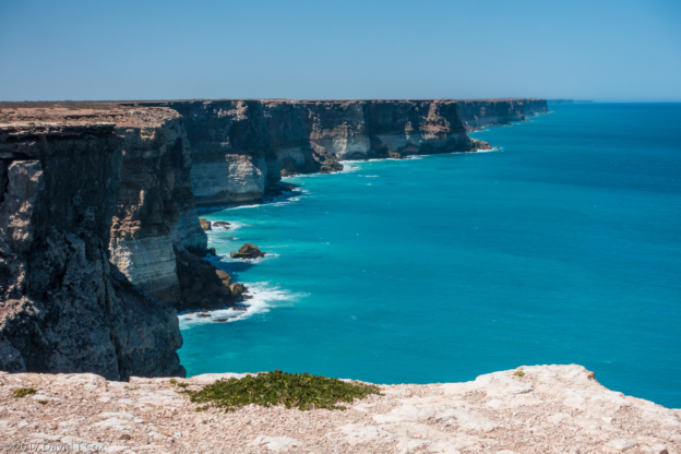
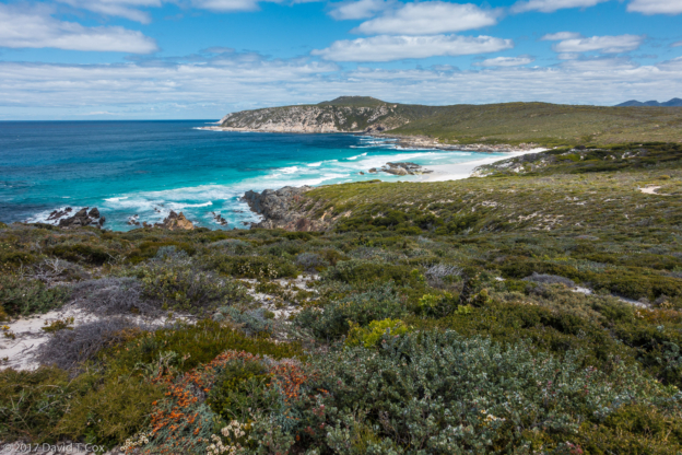
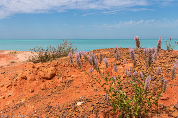
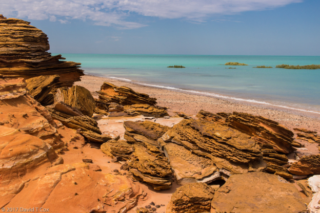
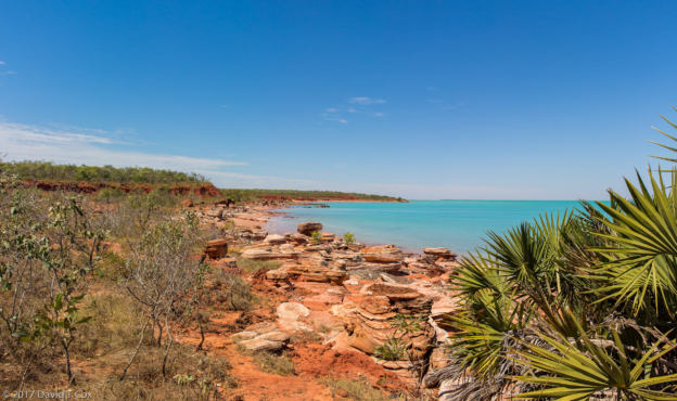
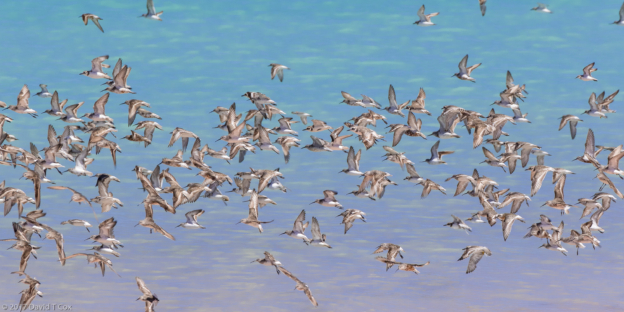
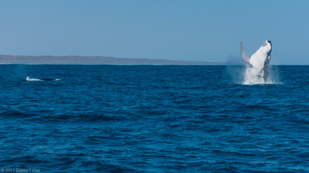
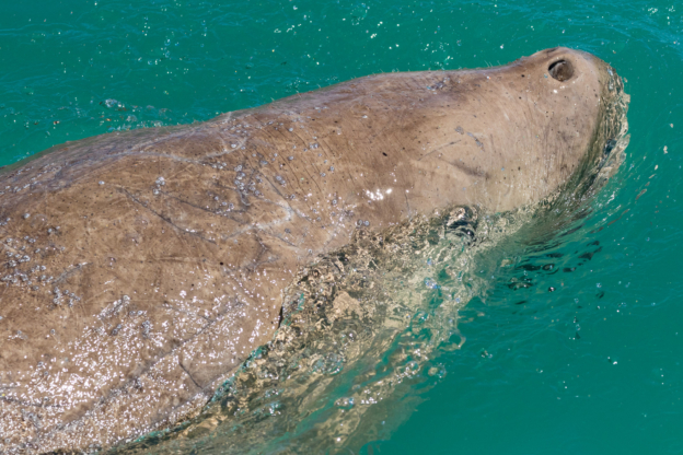
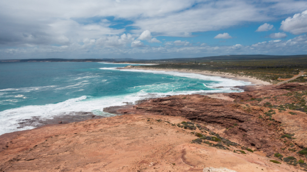
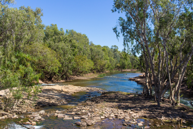
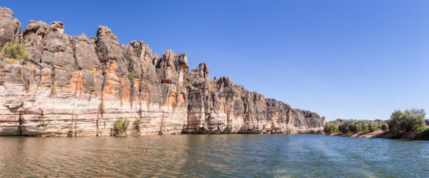
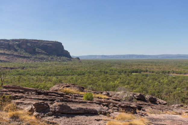
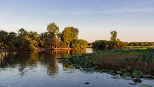
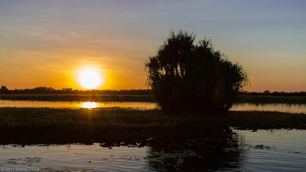
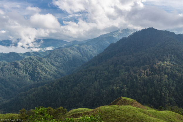
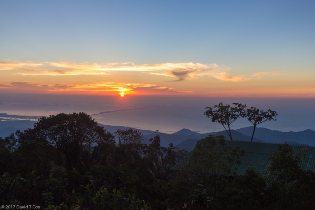
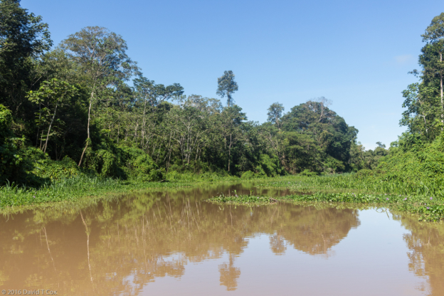
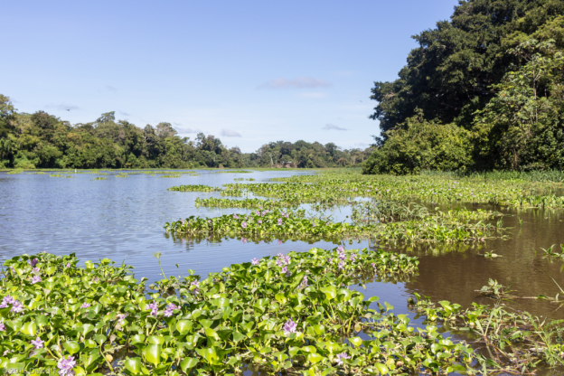
- Great Australian Bight, WA, Australia
-

- Pub door sign at Nullarbor Roadhouse, SA, Australia
-
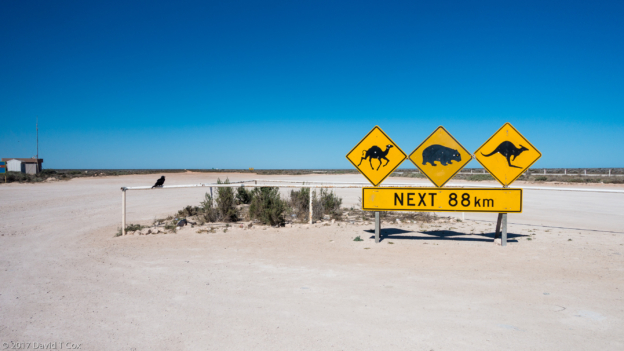
- road sign at Nullarbor Roadhouse, SA, Australia
-
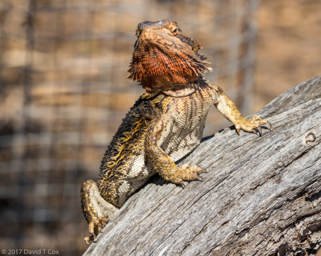
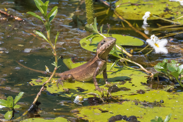
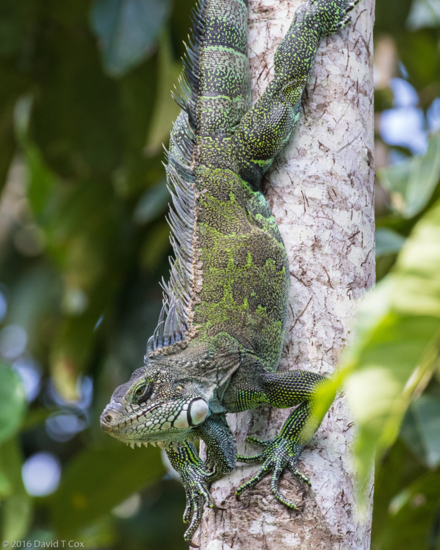
- Eastern Bearded Dragon, Arid Lands Botanical Gardens, Pt. Augusta, SA, Australia
-
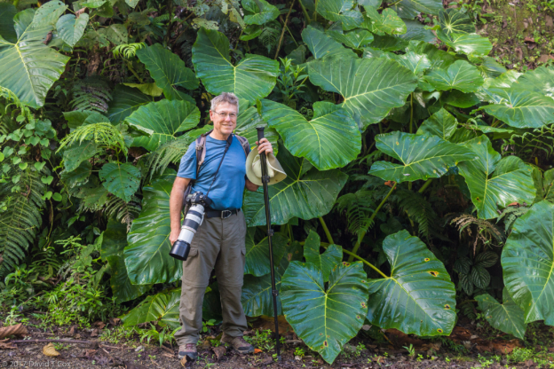
- Peter Langdon (bird guide 8 yrs ago) and Dave at Arid Lands Botanical Garden, Pt. Augusta, SA, Australia
-
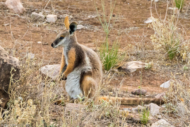
- Yellow-footed Rock Wallaby, Brachina Gorge, Flinders Range NP, SA, Australia
-
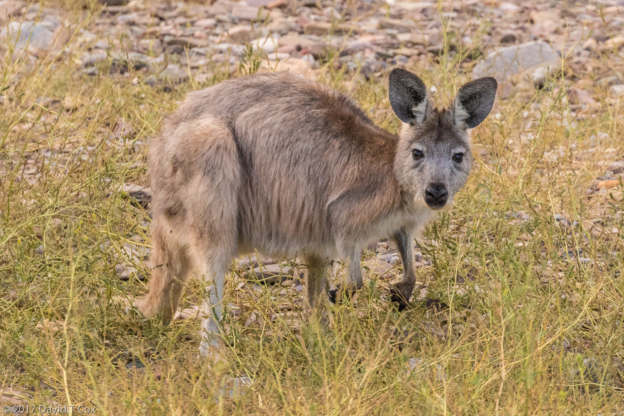
- Euro, Brachina Gorge, Flinders Range NP, SA, Australia
-
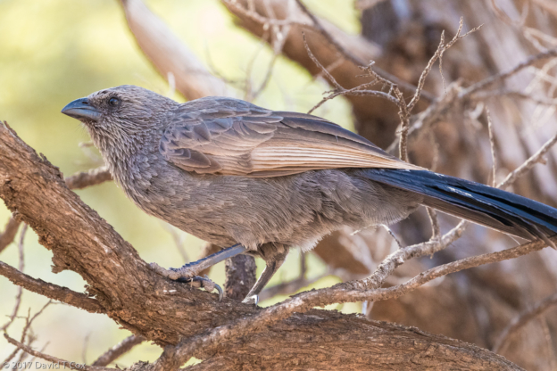
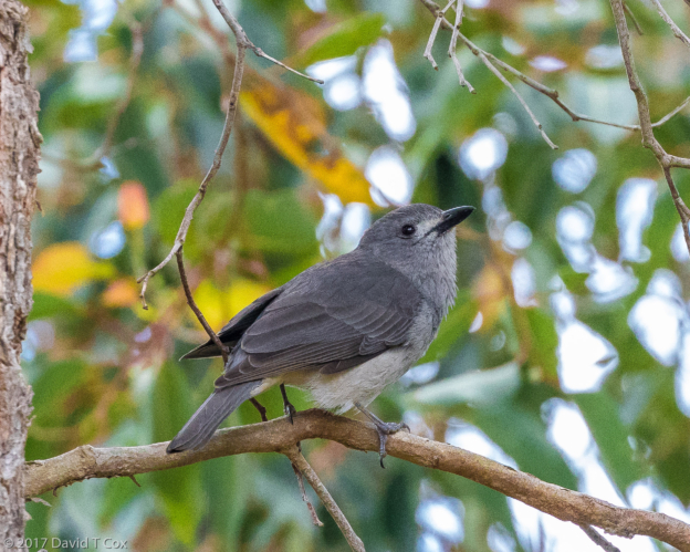
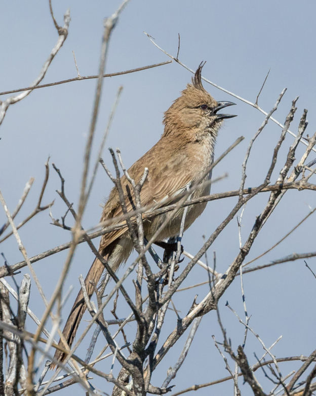
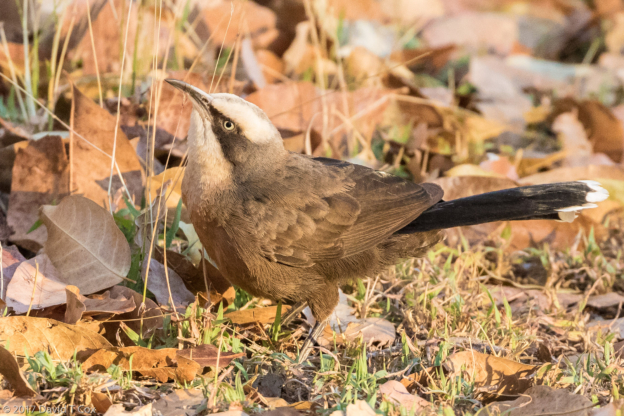
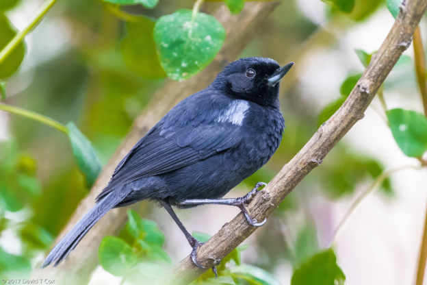
- Apostlebird, Wilpena, Flinders Range NP, SA, Australia
-
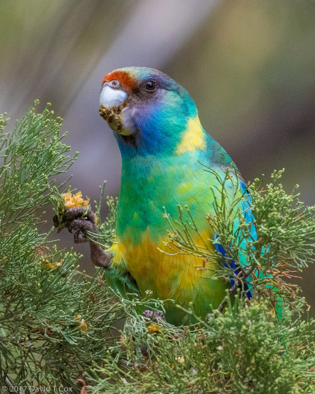
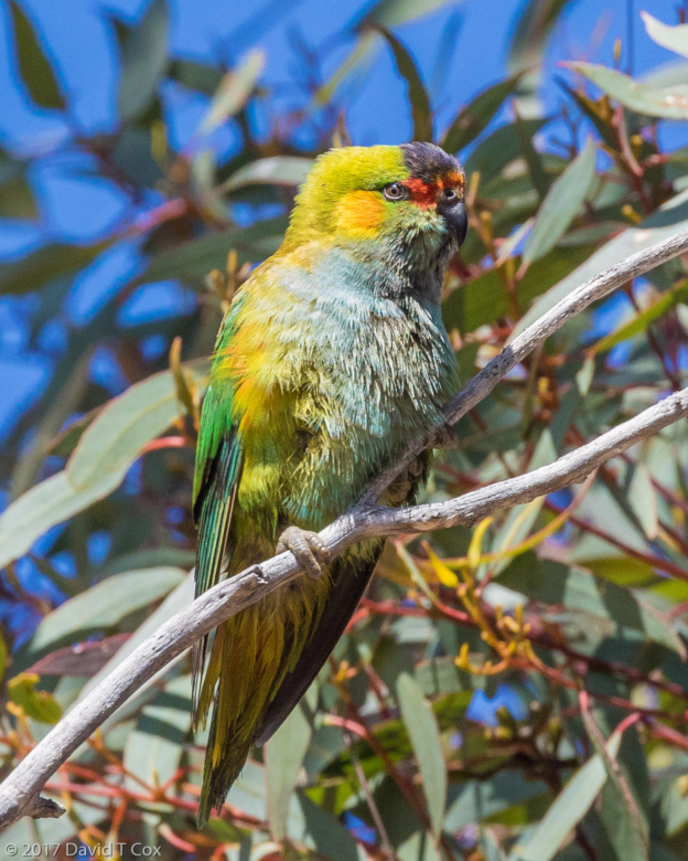
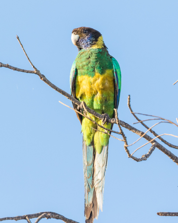
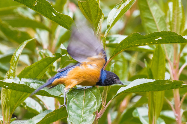
- Australian Ringneck ss barnardi (aka Mallee Ringneck), Wilpena, Flinders Range NP, SA, Australia
-
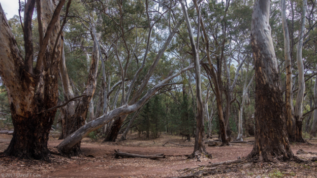
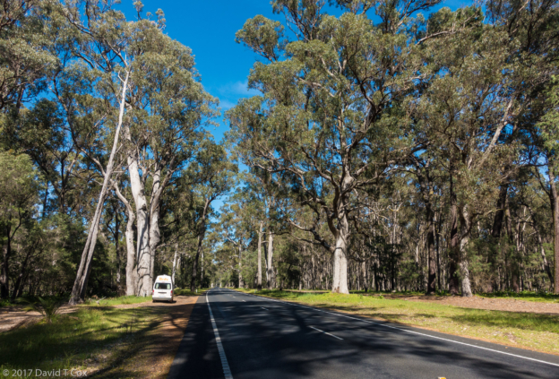
- River Red Gum, Wilpena, Flinders Range NP, SA, Australia
-
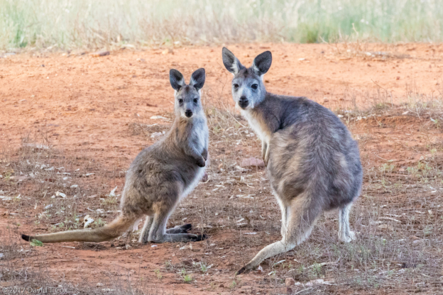
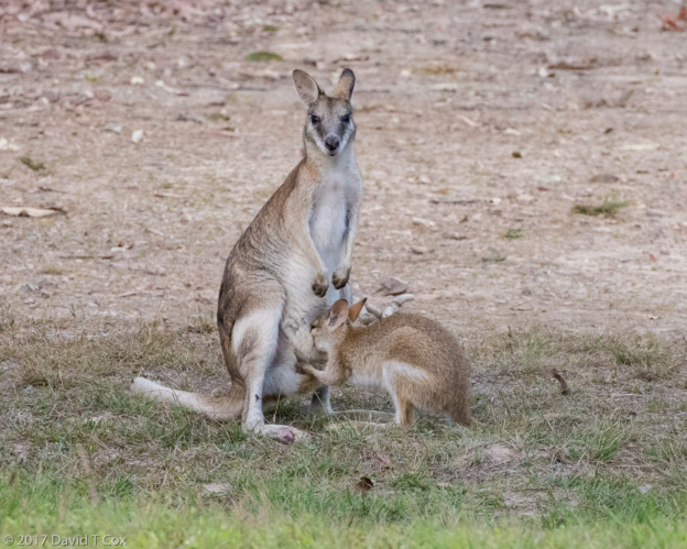
- Euro and Joey, Wilpena, Flinders Range NP, SA, Australia
-
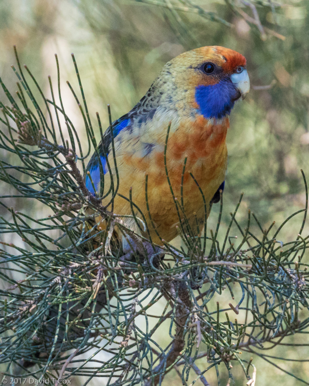
- Crimson Rosella ss flaveolus interbreed, Burra, WA, Australia
-
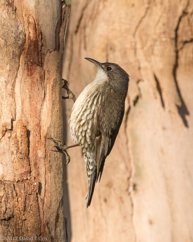
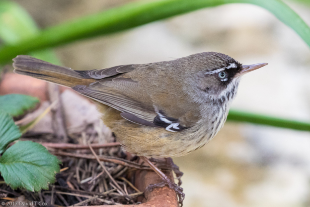
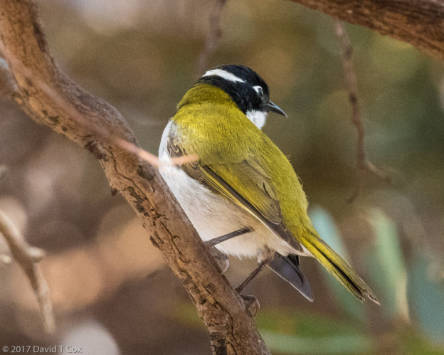
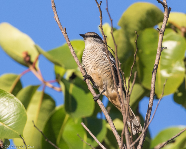
- White-throated Treecreeper, guide Neil Macumber, Grampians NP, Victoria, Australia
-
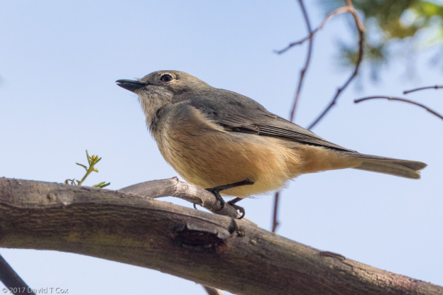
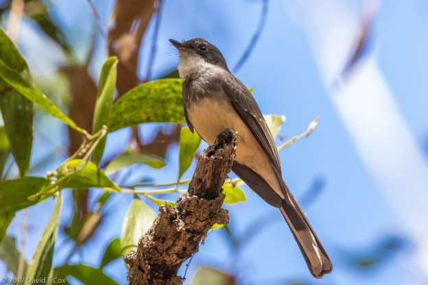
- Rufous Whistler, guide Neil Macumber, Grampians NP, Victoria, Australia
-
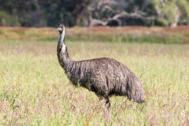
- Emu, guide Neil Macumber, Grampians NP, Victoria, Australia
-
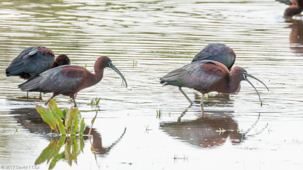
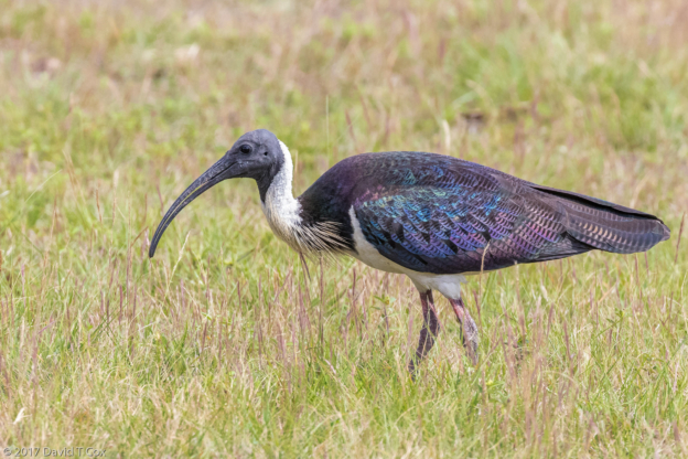
- Glossy Ibis, guide Neil Macumber, Grampians NP, Victoria, Australia
-
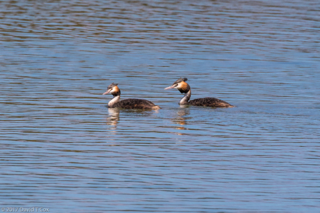
- Great-crested Grebe, guide Neil Macumber, Grampians NP, Victoria, Australia
-
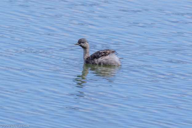
- Hoary-headed Grebe, guide Neil Macumber, Grampians NP, Victoria, Australia
-
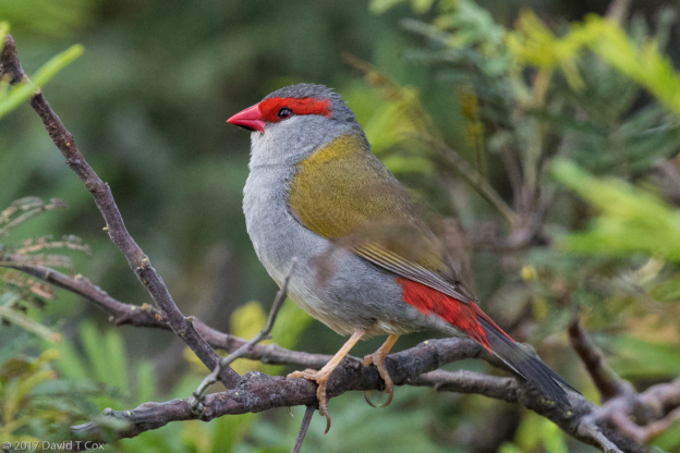
- Red-browed Firetail, guide Neil Macumber, Grampians NP, Victoria, Australia
-
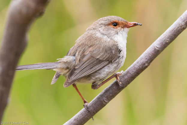
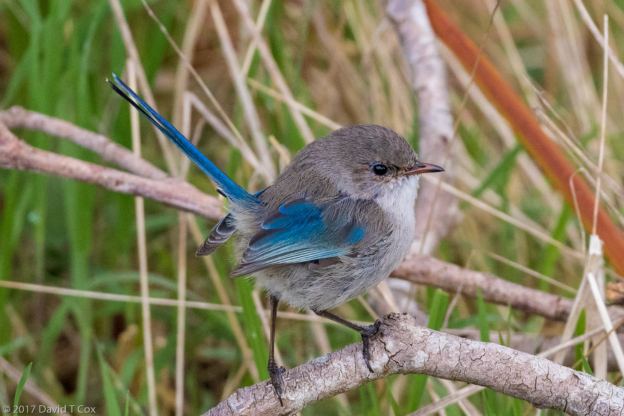
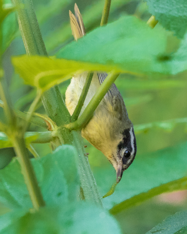
- Superb Fairy-Wren female, guide Neil Macumber, Grampians NP, Victoria, Australia
-
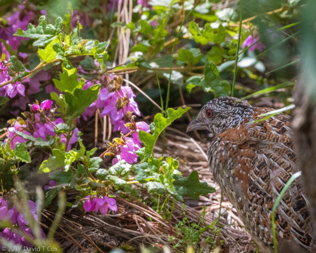
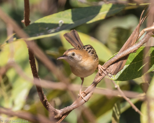
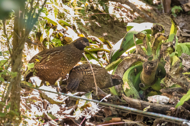
- Painted Button-Quail, guide Neil Macumber, Grampians NP, Victoria, Australia
-
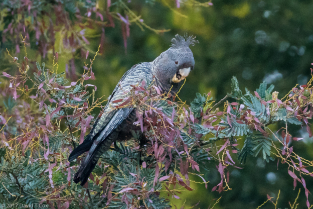
- GangGang Cockatoo, Halls Gap, Grampians NP, Victoria, Australia
-
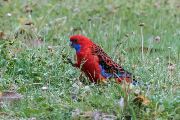
- Crimson Rosella, Halls Gap, Grampians NP, Victoria, Australia
-
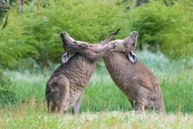
- Eastern Grey Kangaroos “boxing”, Halls Gap, Grampians NP, Victoria, Australia
-
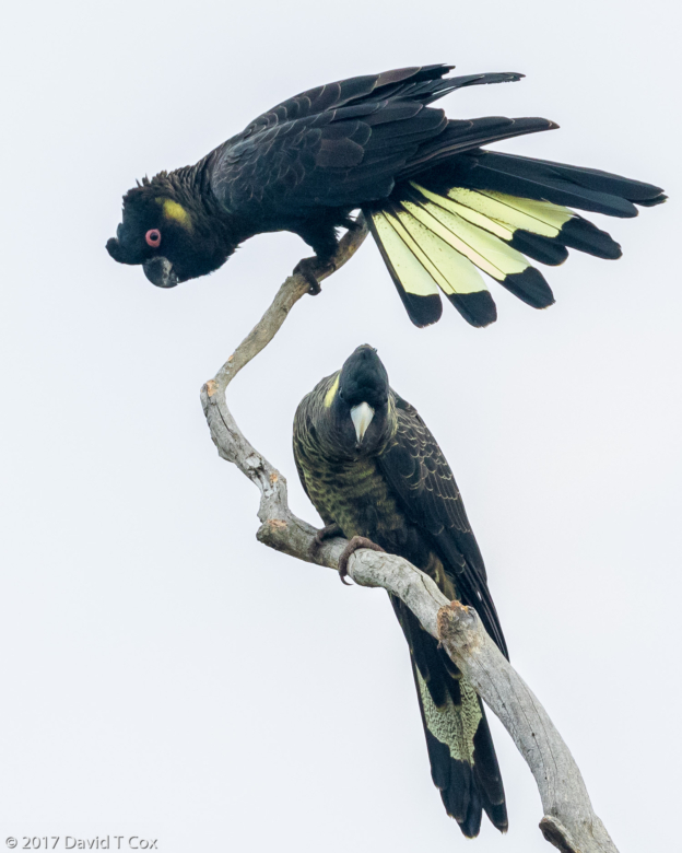
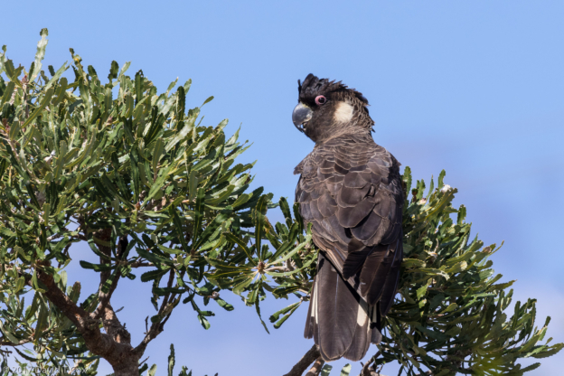
- Yellow-tailed Black Cockatoo, Grampians NP, Victoria, Australia
-
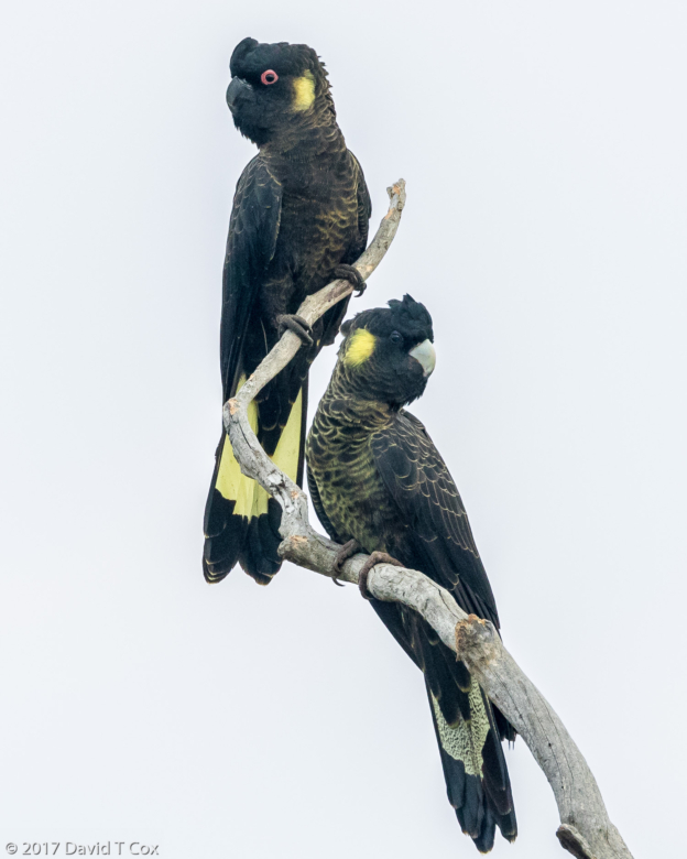
- Yellow-tailed Black Cockatoo, Grampians NP, Victoria, Australia
-
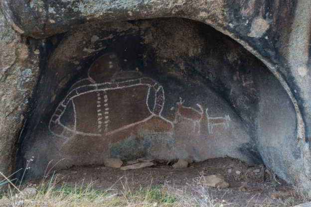
- Bunjil Shelter Rock Art, creator and his dingos, Grampians NP, Victoria, Australia
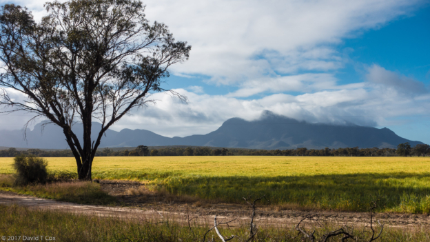
-
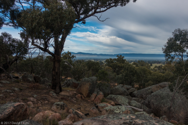
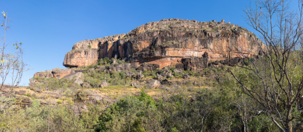
- Grampian Mtns from Bunjil Shelter Rock Art, Grampians NP, Victoria, Australia
-
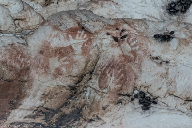
- Manja Shelter Rock Art, hand print stensils, Grampians NP, Victoria, Australia
-
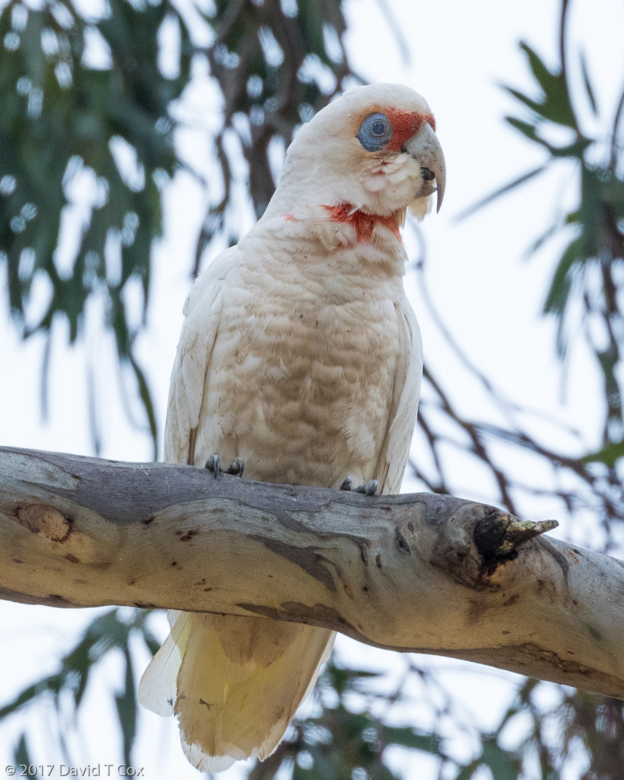
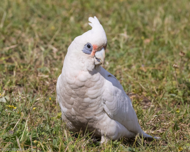
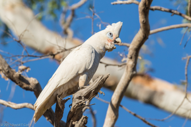
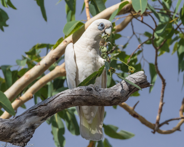
- Long-billed Corella,, Grampians NP, Victoria, Australia
-
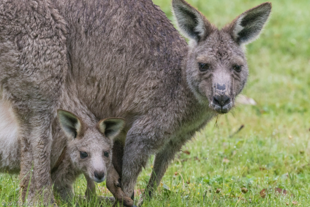
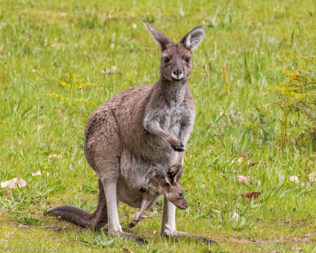
- Eastern Grey Kangaroo w Joey in pouch, Halls Gap, Grampian NP, Victoria, Australia
-
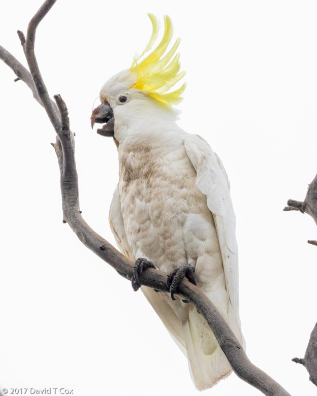
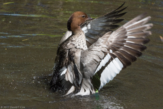
- Sulfur-crested Cockatoo, Hwy Halls Gap to Echuca, Victoria, Australia
-
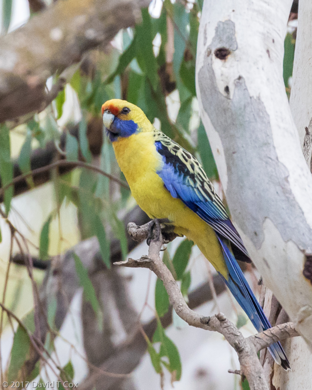
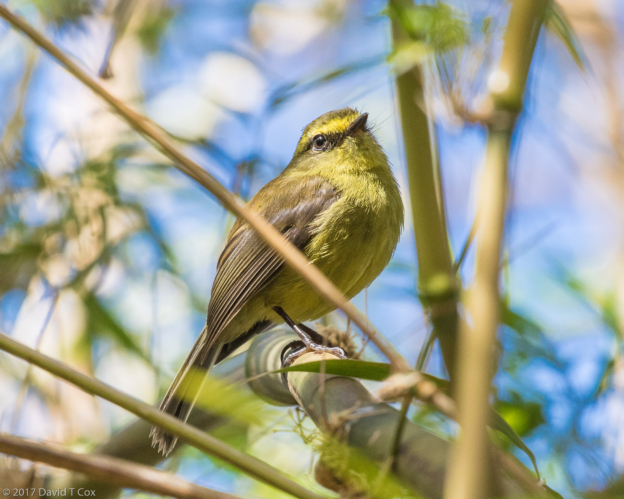
- Crimson Rosella ss flaveolis aka Yellow Rosella, Barmah NP, N of Echuca, Australia
-
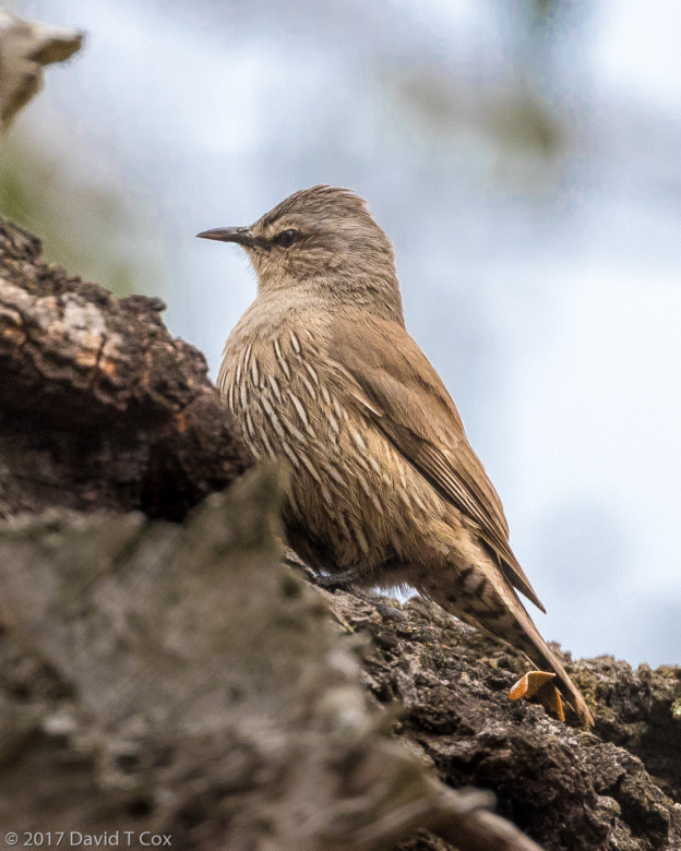
- Brown Treecreeper, Barmah NP, N of Echuca, Australia
-
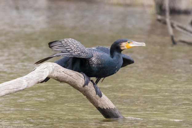
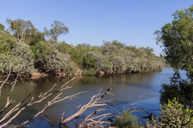
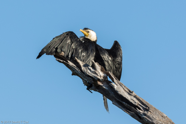
- Great Cormorant, Murray River cruise, Barmah NP, N of Echuca, Australia
-
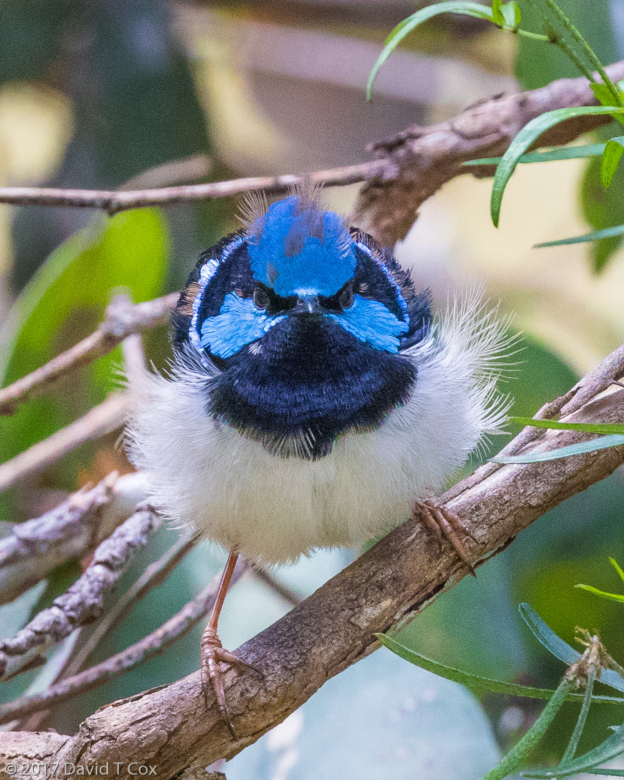
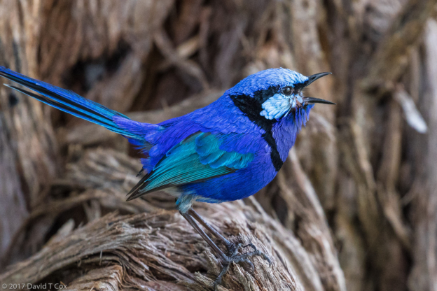
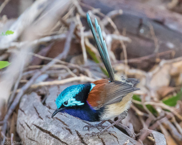
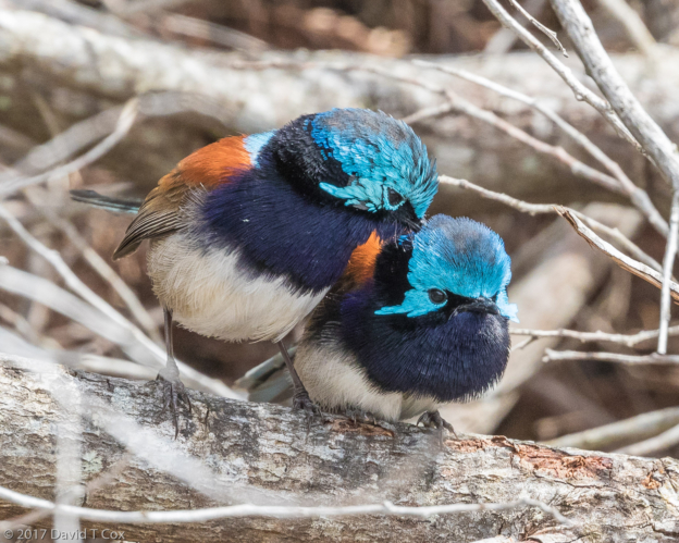
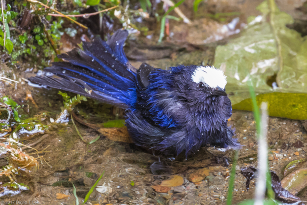
- Superb Fairy-Wren breeding plumage male display, Chiltern NP, Victoria, Australia
-
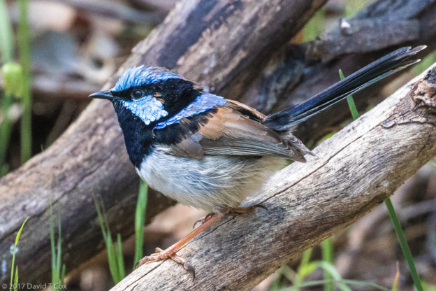
- Superb Fairy-Wren, Chiltern NP, Victoria, Australia
-
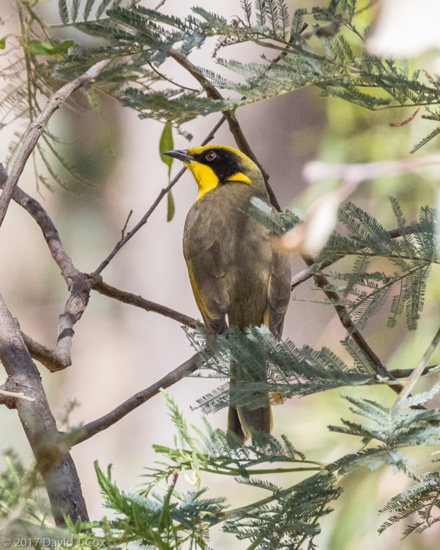
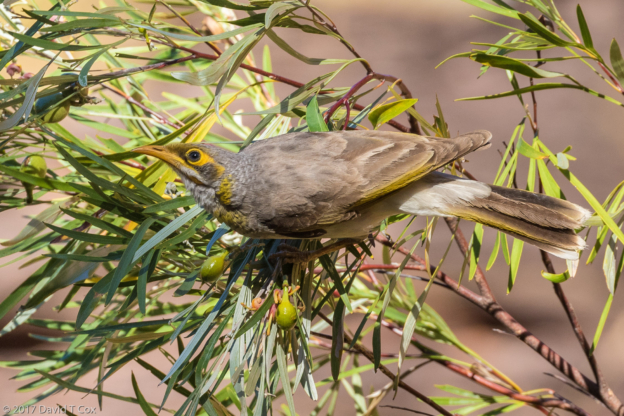
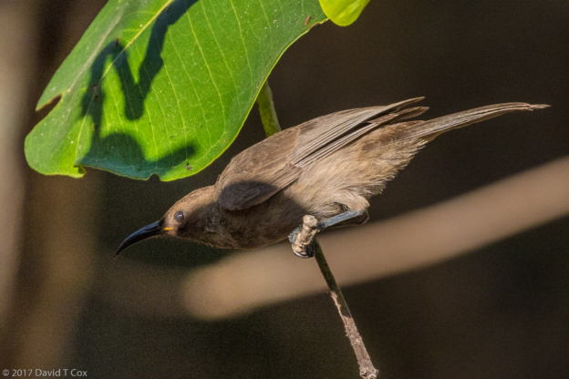
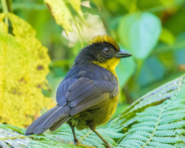
- Yellow-tufted Honeyeater, Chiltern NP, Victoria, Australia
-
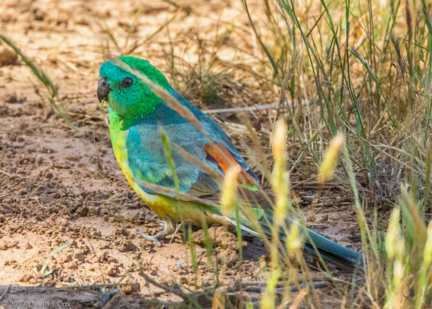
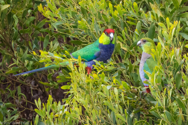
- Red-rumped Parrot, near Chiltern NP, Victoria, Australia
-
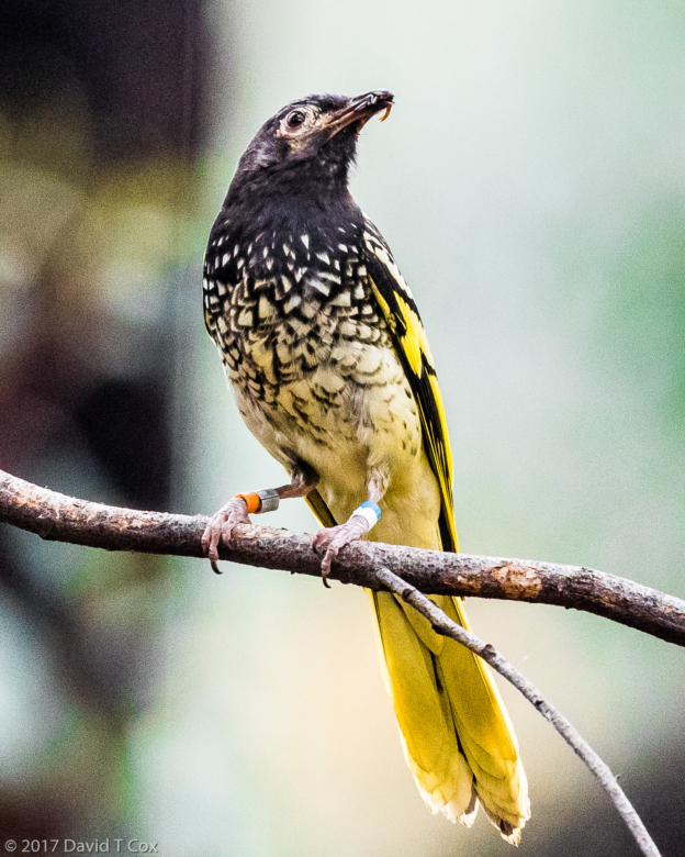
- Regent Honeyeater (with its jewelry), near Chiltern NP, Victoria, Australia
-
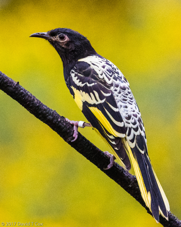
- Regent Honeyeater, near Chiltern NP, Victoria, Australia