Author Archives: coxdavid55

Report on Kathmandu, Pokhara & Chitwan Nat. Park, Nepal, Feb. 16, 2015

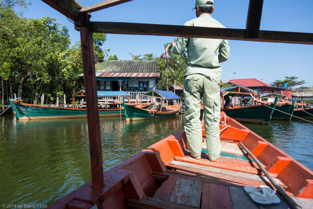
From Delhi I flew to Kathmandu 9 days ago;  I again had a little trouble clearing security – my daypack is filled with camera and hiking items, most of which have metal.  The Indian security, much tighter than in the USA, requires every item with any metal to be removed and put in separate containers for inspection – a very time consuming process for me (I do not trust most of these items to my checked luggage).

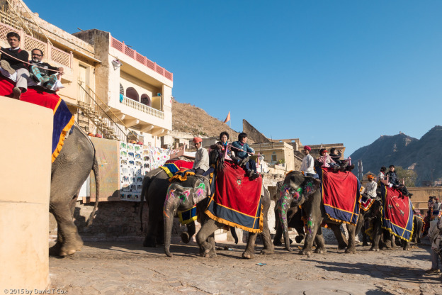
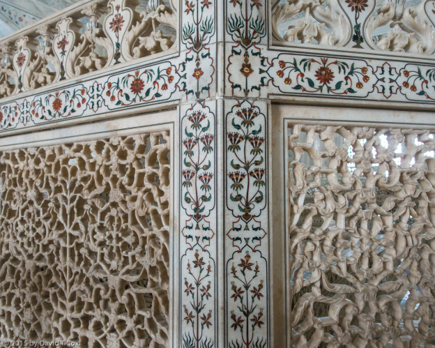
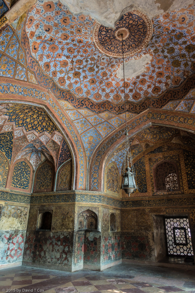
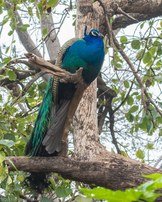
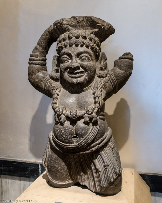
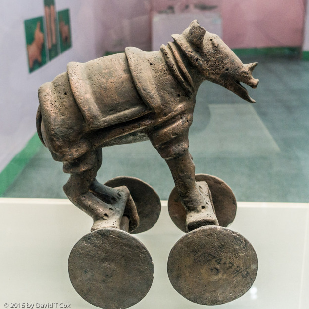
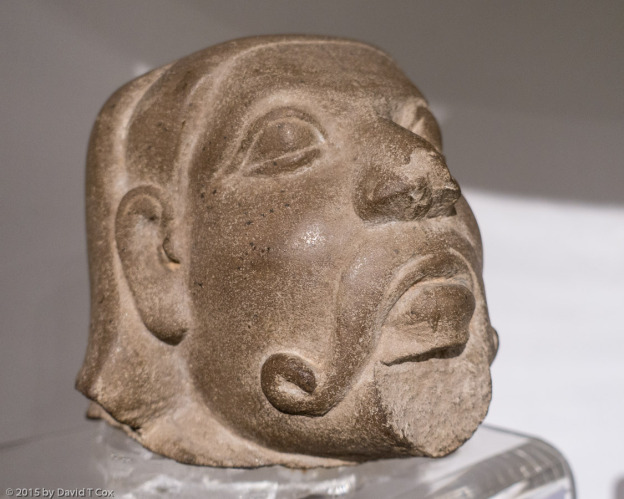
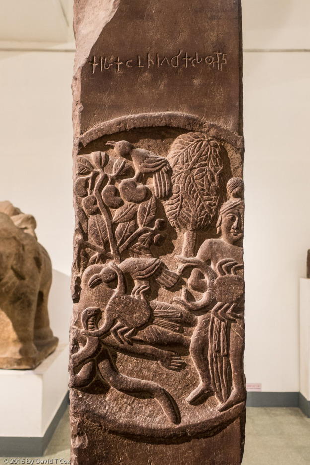
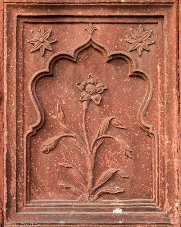
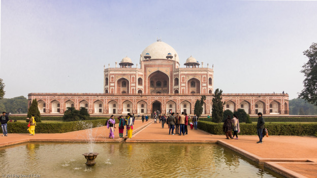
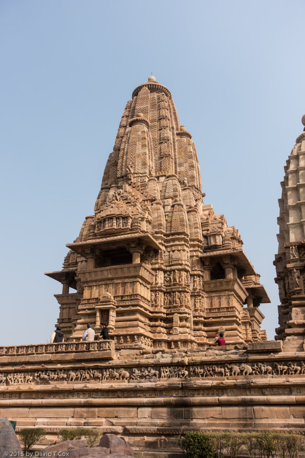
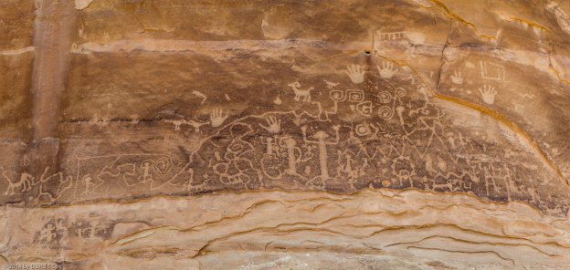
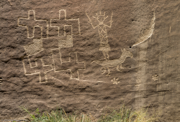
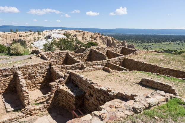
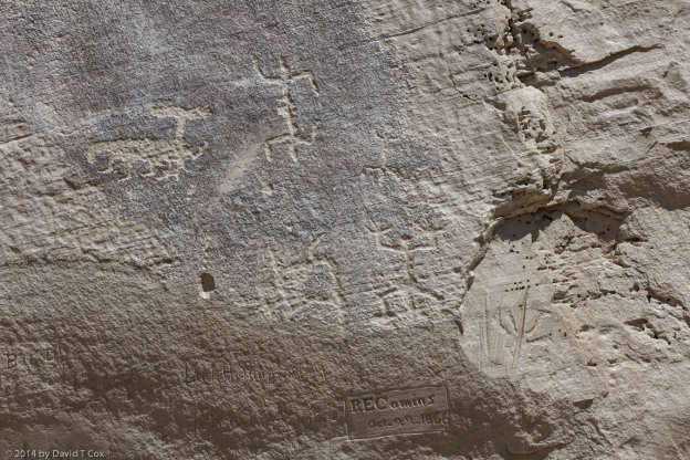
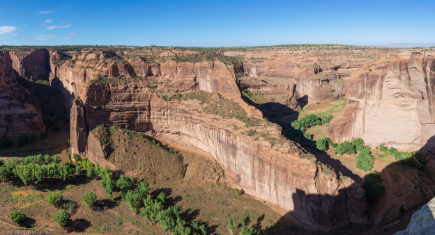
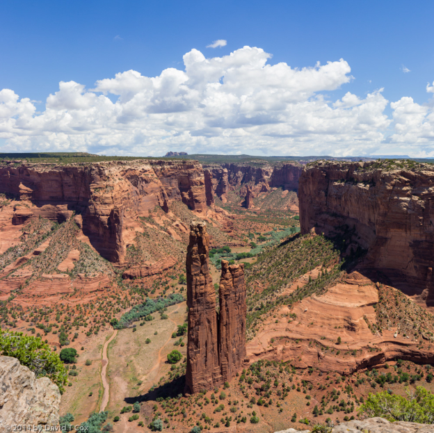
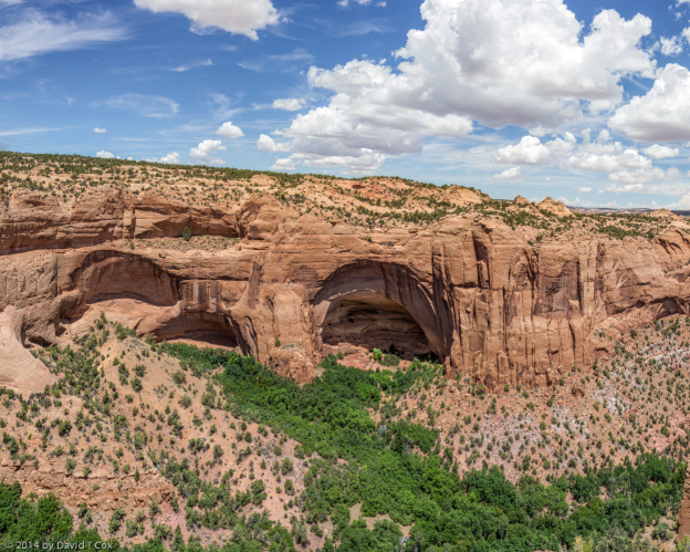
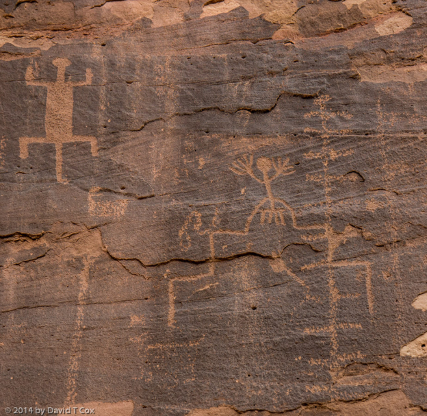
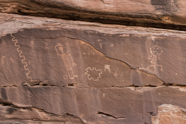
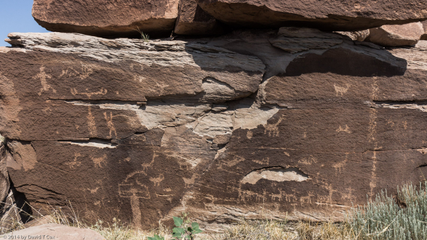
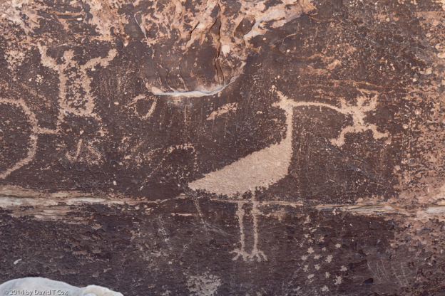
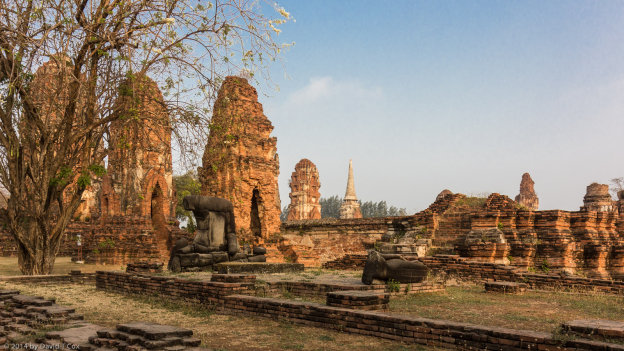
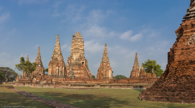
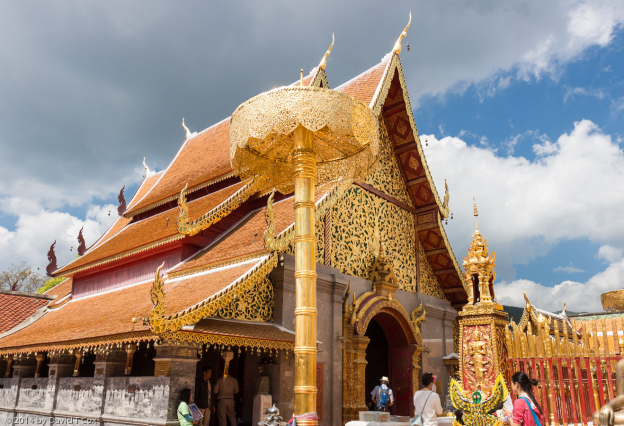
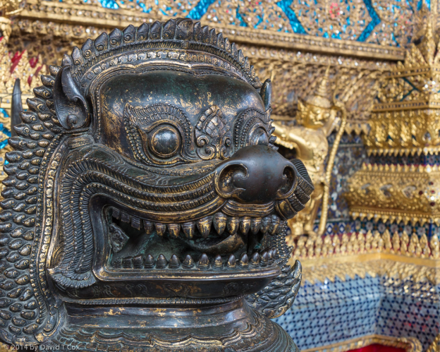
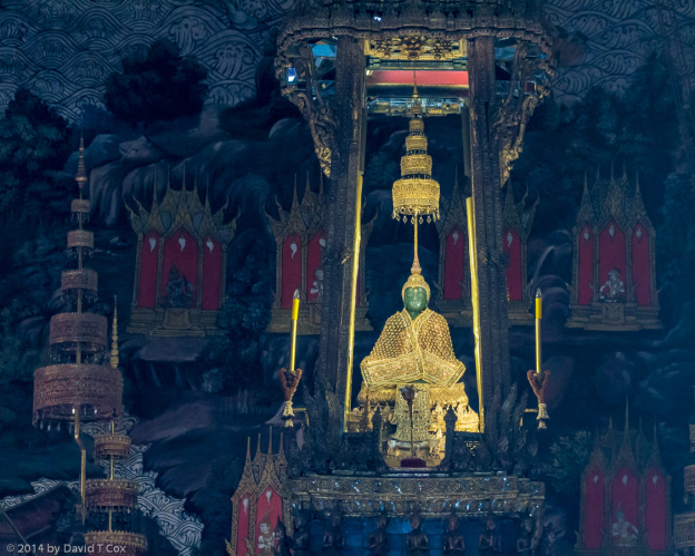
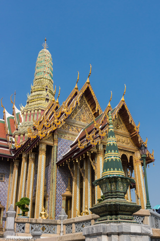
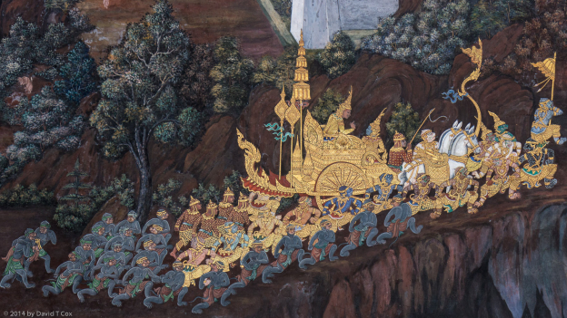
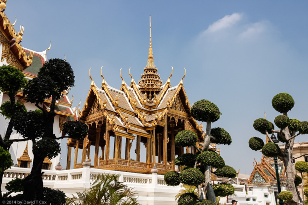
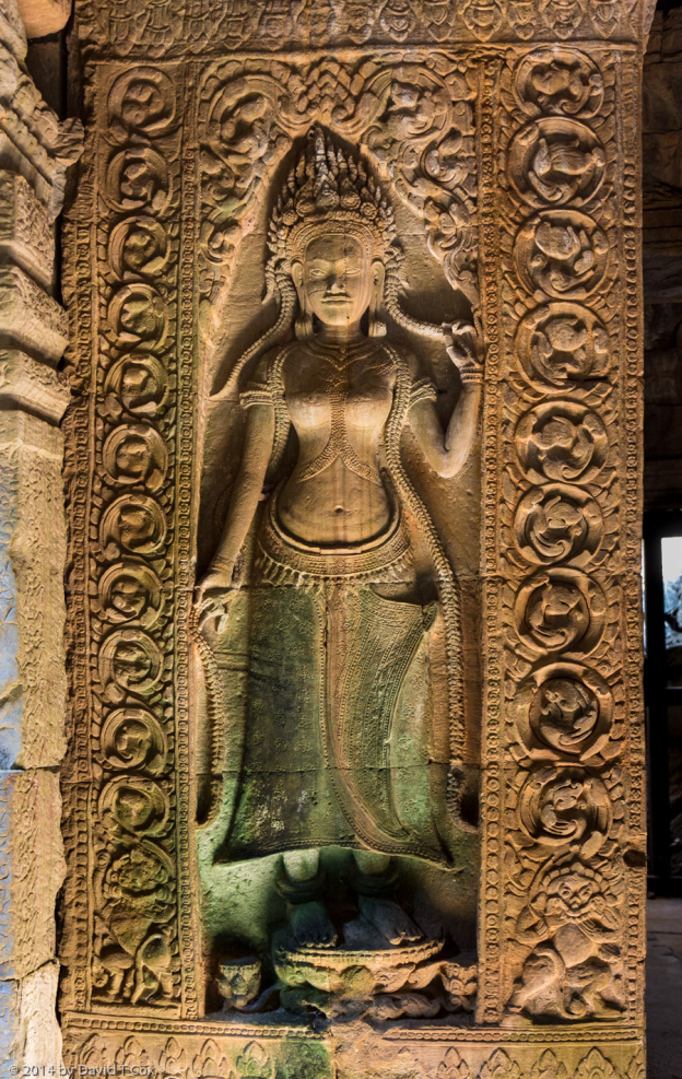
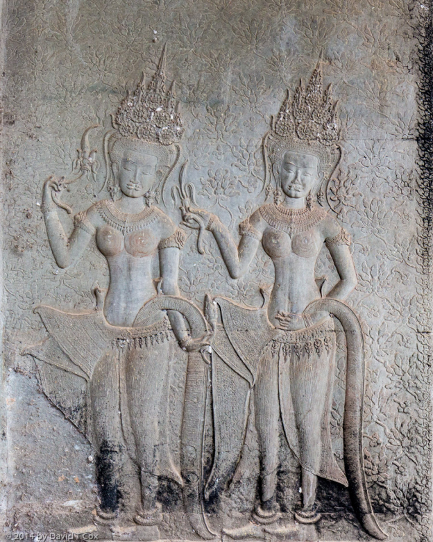
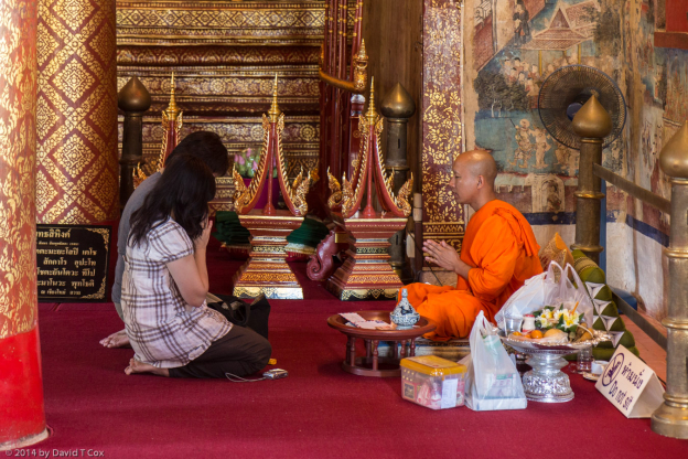
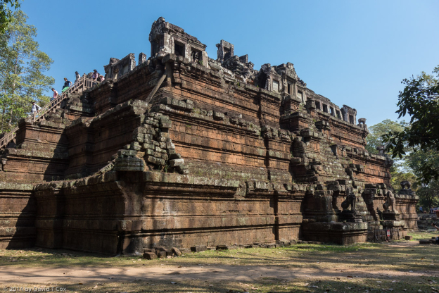
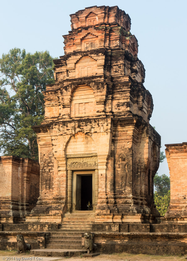
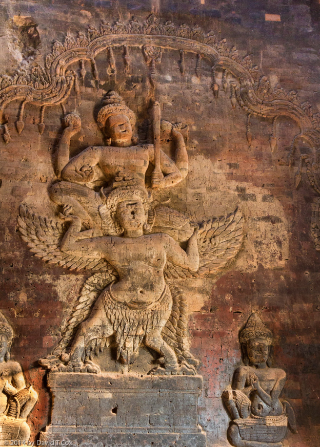
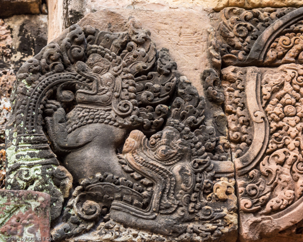
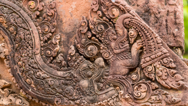
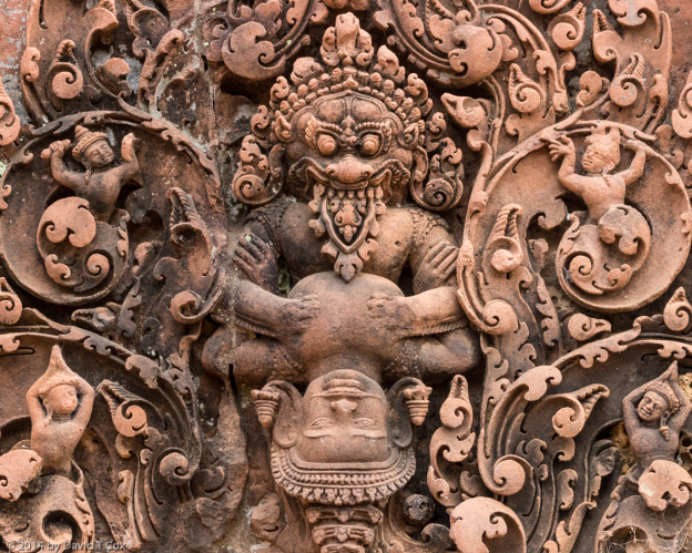
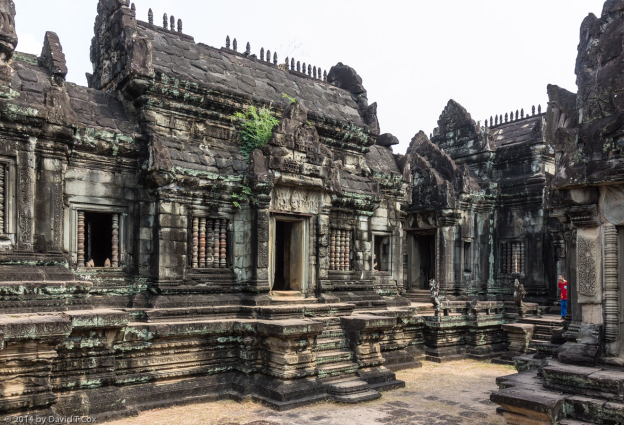
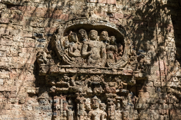
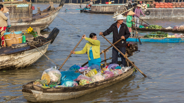
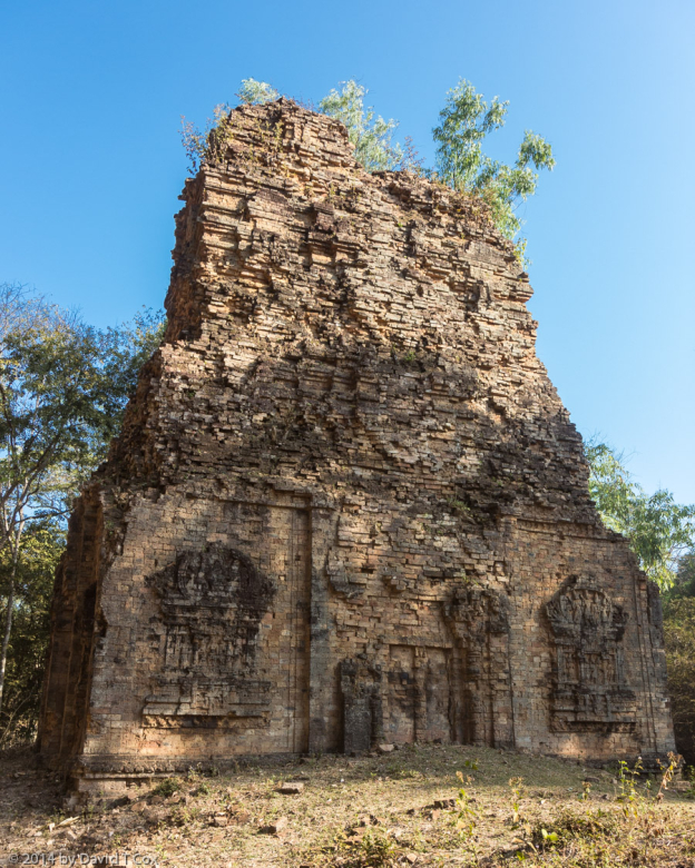
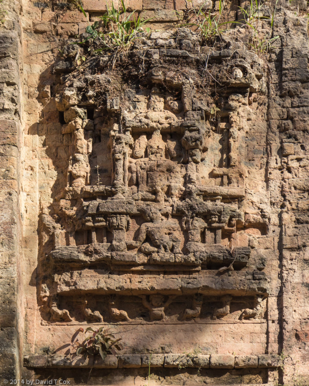
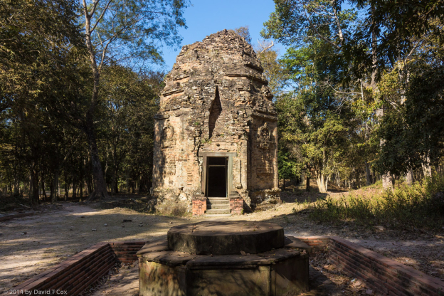
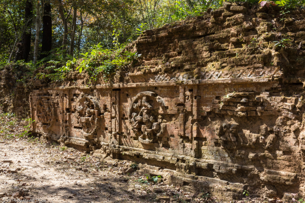
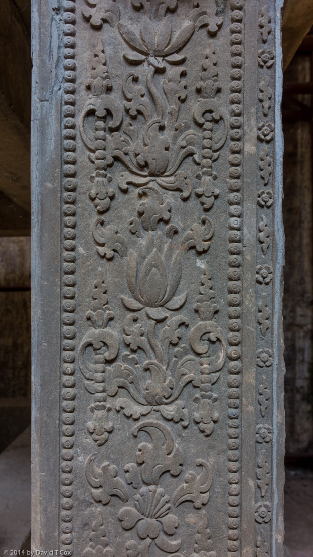
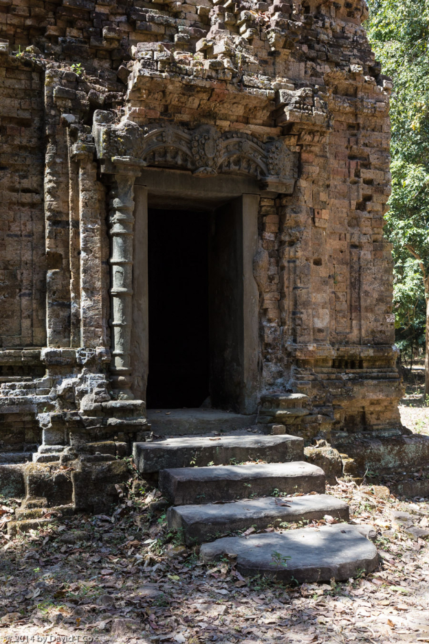
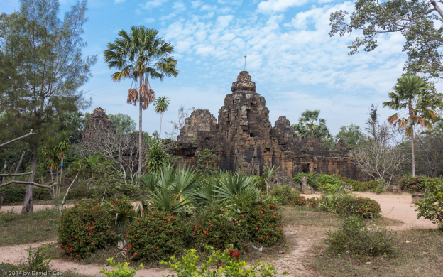
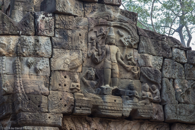
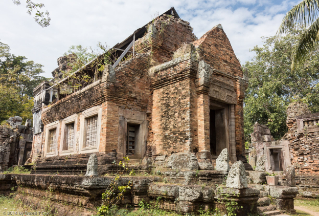
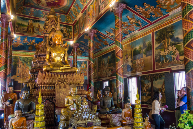
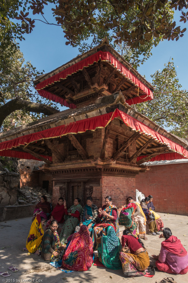
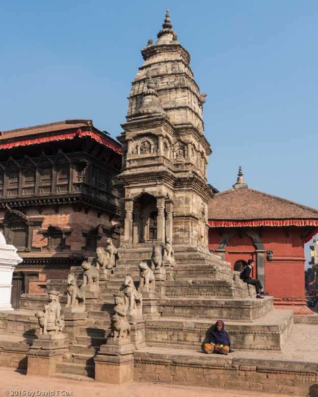
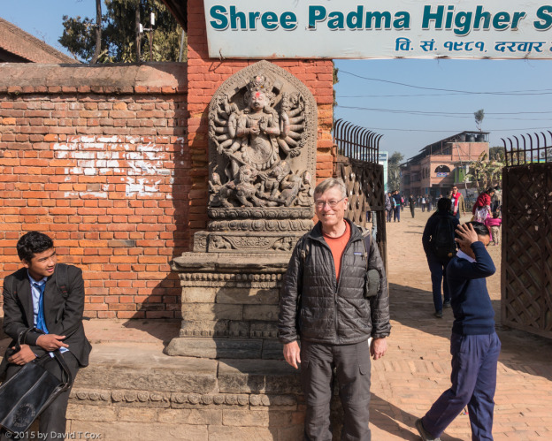
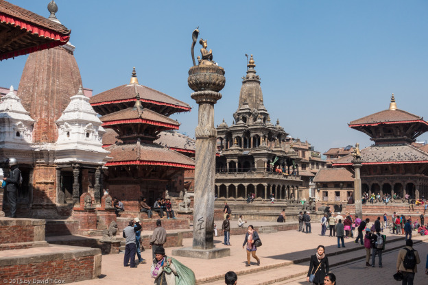
Kathmandu has certainly changed since my last visit in 1982.  It has gone from a hill town, with many old wooden structures and population of 350,000 to a vast continuous concrete jungle, with terrible air and water pollution, choked streets and arteries and a population of over 3 million.  Getting to see the sites was a real chore.  Still – the entire valley is named a World Heritage Site for 7 remarkable  core areas – I visited 6 of these.  The capitals of three Kingdoms which ruled the Valley from the 12th through the early 18th centuries, Kathmandu, Bhaktapur and Patan, each has an ancient center called Durbar Square.  Here one finds the old palaces and temple pagodas, mostly constructed of brick and wood from the 15th through the early 18th centuries, with intricate carvings in the wood.  Pillars and stone gods abound.

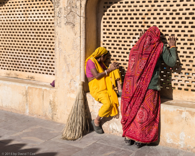
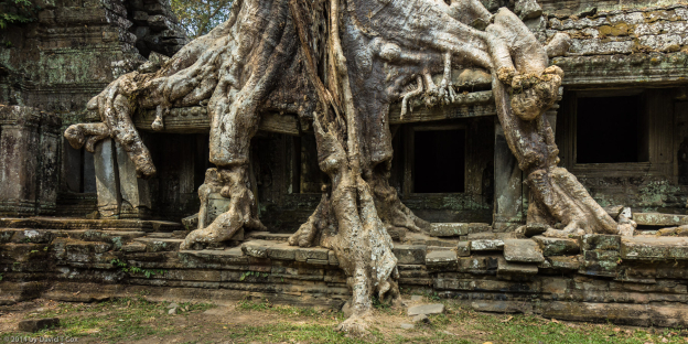
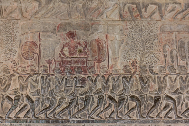
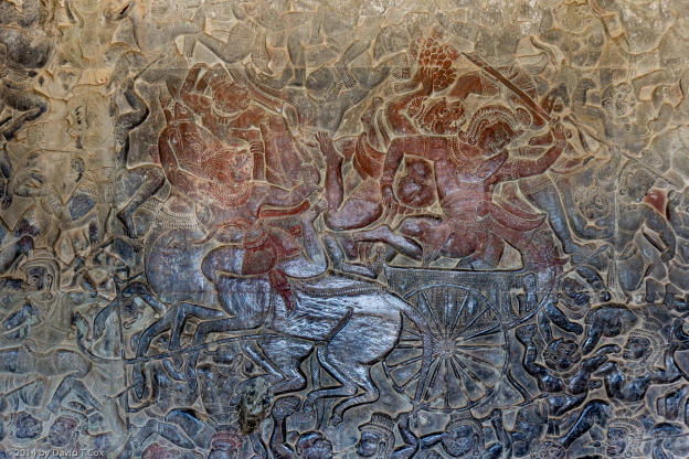
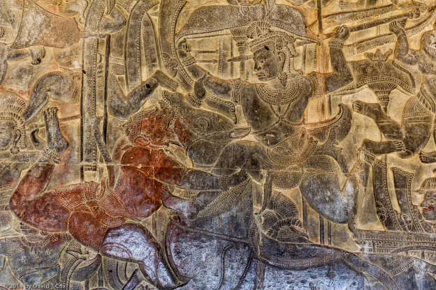
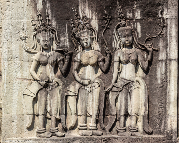
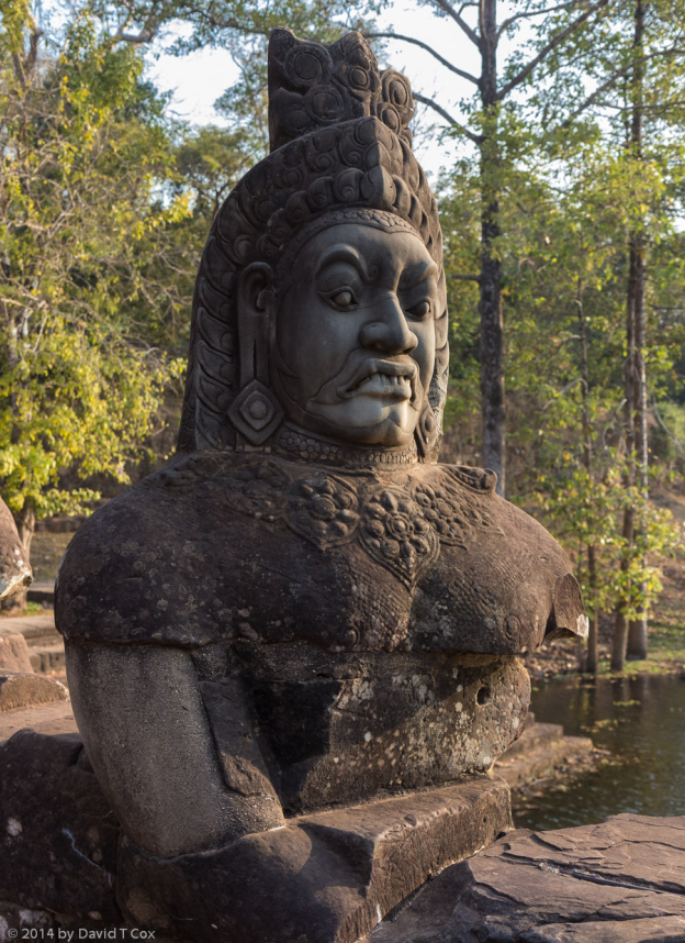
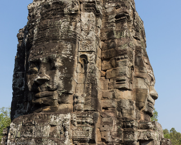
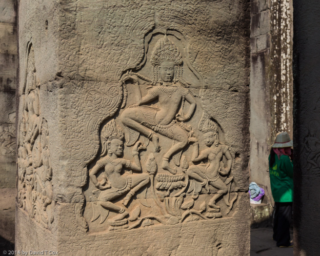
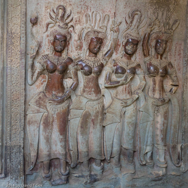
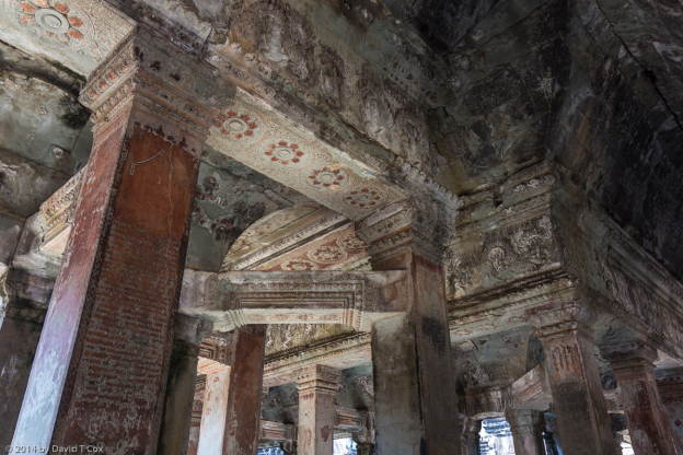
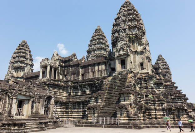
The monuments are a photographer’s dream – which creates a photographer’s problem, identical to one I encountered in the Cambodian Angkor Watt temples.  Roughly 90% of the tourists here are from mainland China, coming by the thousands in large tour groups.  Numbers of young women come with friend, husband or contract photographers, I don’t know which, and perch themselves as “models” before and upon the temples, statues, windows or any spots providing photogenic opportunities.  They dress in spectacular colors, favoring local indigenous clothing, with gaudy jewelry, and the males with the cameras start shooting.  I have not figured out whether this is just a form of self-absorption or whether these are women trying to create portfolios for entering careers as models.  Whatever, it is a bit of a nuisance for those of us interested in the Heritage site monuments themselves.  The structures should remain unadorned by dressed up wannabee models, sitting glamorously, even sulkily, but, always, sitting to block the windows, doorways, ledges, stairs or wherever.  This certainly is a form of monument pollution – it should be forbidden.  They strike poses, gazing through sunglassed eyes off in the distance, one arm languorously extended with a hand resting on an elephant’s or god’s head.  These photo “shoots” can extend through dozens of poses.

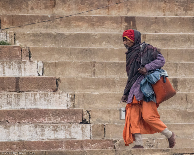
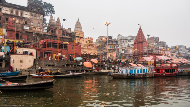
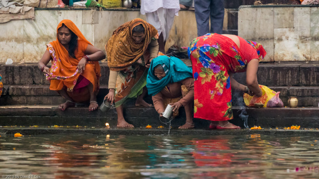
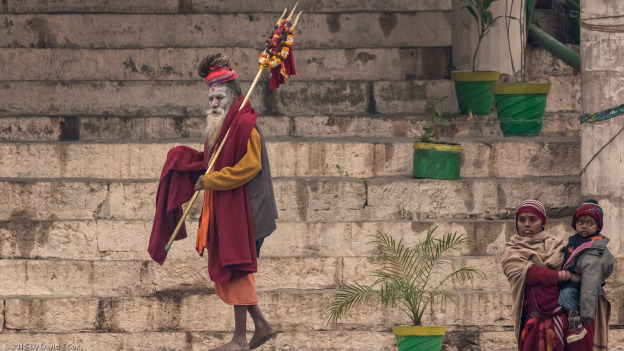
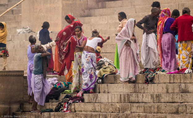
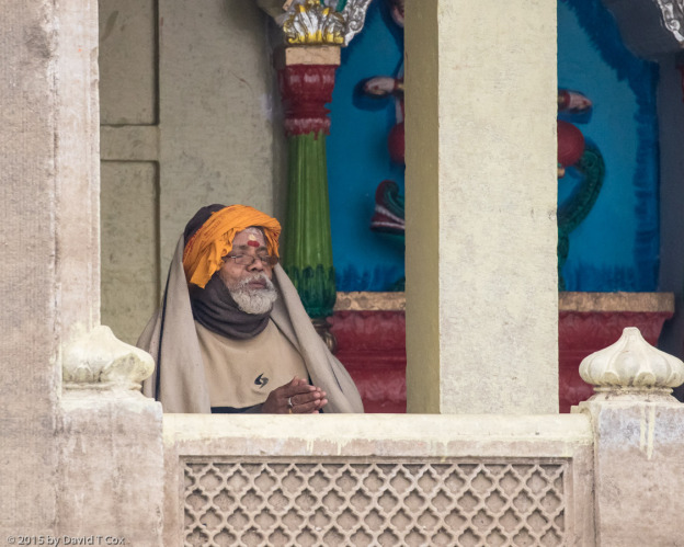
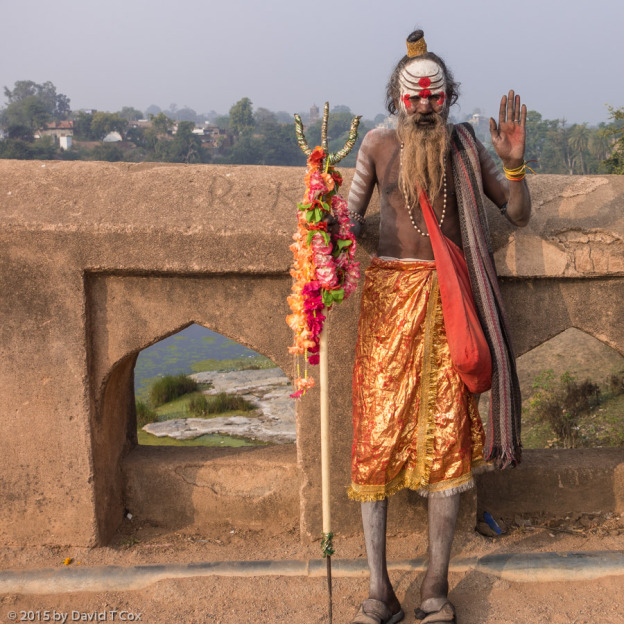
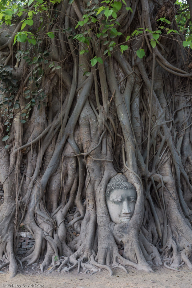
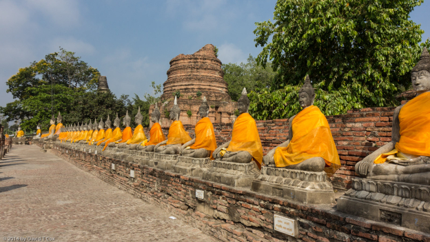
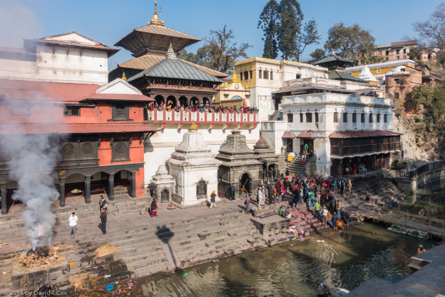
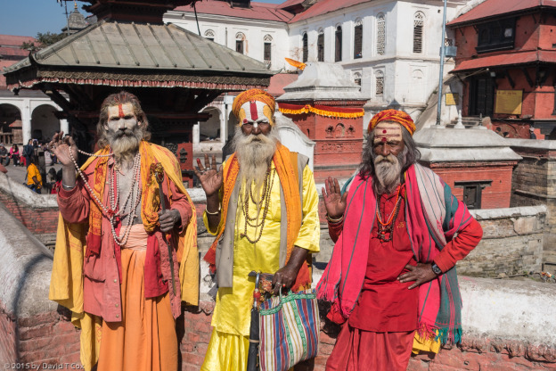
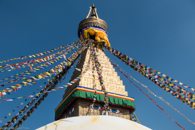
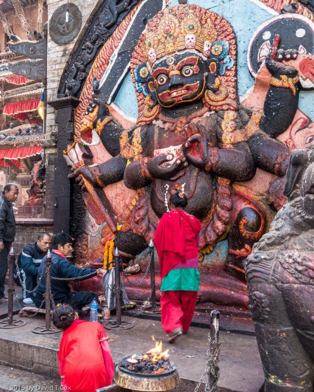
The other Heritage sites in the Kathmandu Valley include two spectacular Buddhist Stupas, the Boudhanath and the Swayumbhunath, both dating from the 5th century.  Finally, the Pashupatinath Hindu Temple is the holiest in Nepal and famous throughout SE Asia, and its site on a small river rivals the Varanasi Ghats for funerals.  No one knows when the temple first was constructed – the earliest historic reference to reparations are from the 12th century – but it all is very old.  I watched one entire cremation ceremony, moved by one wailing woman, presumably the wife of the deceased.  The Temple monuments cover over half a square kilometer, and everywhere are both Brahmins bestowing blessings on visitors, and large numbers of Sadhus (holy, usually ascetic, men), many covered in ash, all with long hair and beards, and most wearing blazing colors.  Decades ago one could ask and usually receive permission to take photos of a Sadhu, usually then giving a small baksheesh (gift).  Today they band together and actively market their availability for photo opportunities for cash payment.  I wonder how this commercial activity has affected their “holiness”.

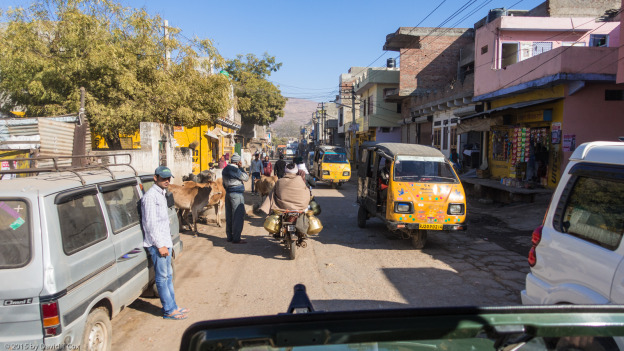
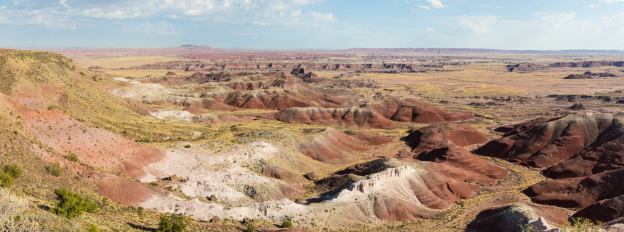
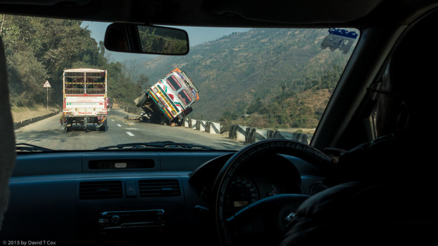
From Kathmandu I drove to Pokhara, in a different Himalayan foothills valley.  The road to Pokhara, the only “major” highway through central Nepal, is a death-trap.  I have traveled the world and seen some dangerous mountain roads, but this was the worst I recall.  Drivers of the huge trucks speed downhill, and many crazies attempt to pass on curves.  We were involved in a dozen very near misses, and along the 200 km route I counted the results of 7 accidents, two clearly fatal.  I advise anyone traveling this route to consider using the small prop aircraft that fly to Pokhara.

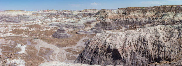
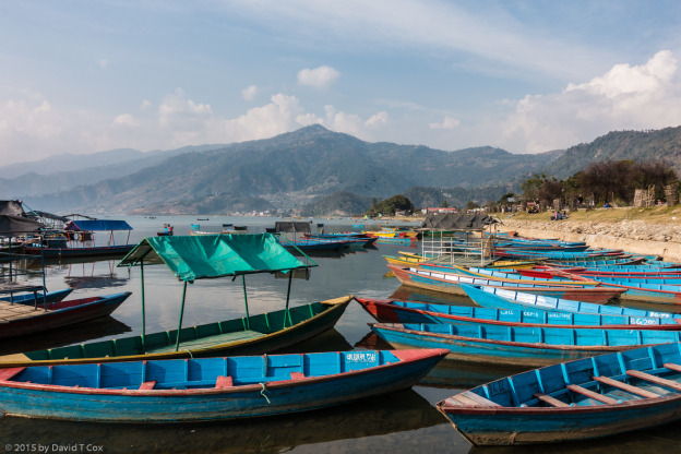
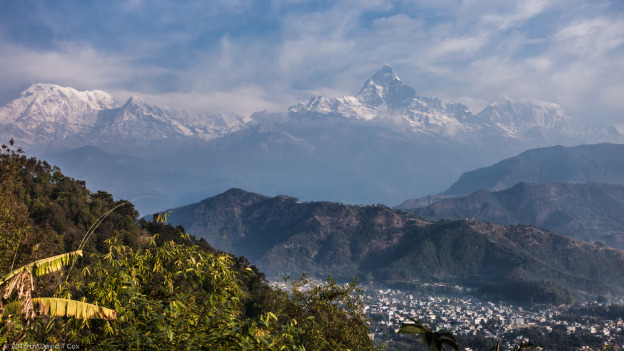
Pokhara itself sits in a valley with the highest rainfall in Nepal, close to the Annapurna  Range of the Himalaya.  From Pokhara, and particularly from the tops of some of the low mountains around it, one has a view of 3 of the highest peaks in the world, all over 26,000 feet.  A major factor in mountains’ impressiveness is, of course, scale – the gain in elevation over one’s view point, and distance to the mountains.  The Rocky Mountains from Denver, though with several 14,000 ft. peaks, tower only about 9,000 feet above Denver.  Even the great Andes Peaks, which climb to over 20,000 ft., must usually be viewed from elevations of close to 8,000 feet, giving a differential of about 12,000 ft.  But the Himalayas, with many peaks over 26,000 ft. can be viewed from many vantage points at under 5,000 feet, giving them over a 20,000 foot differential.  This creates an “awesomeness” no other mountain range in the world achieves.

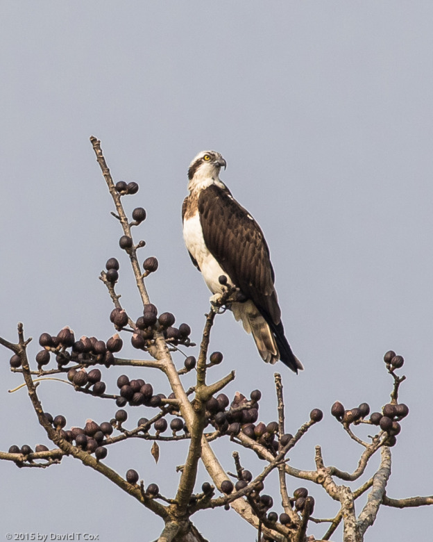
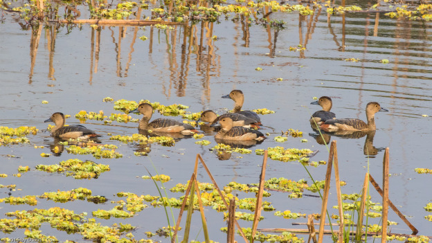
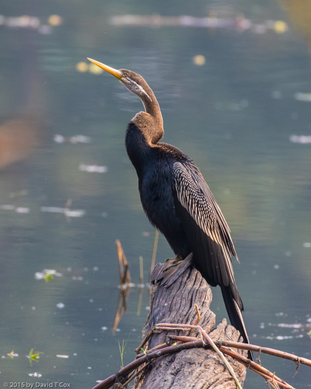
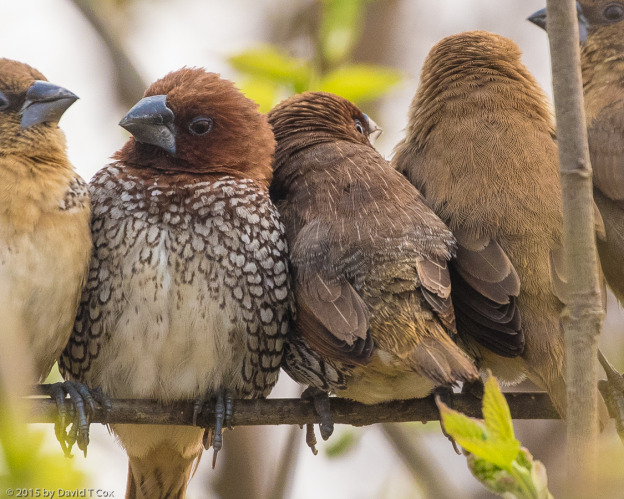
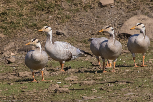
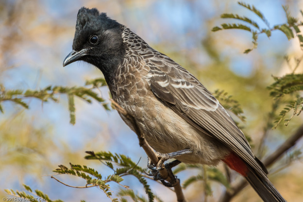
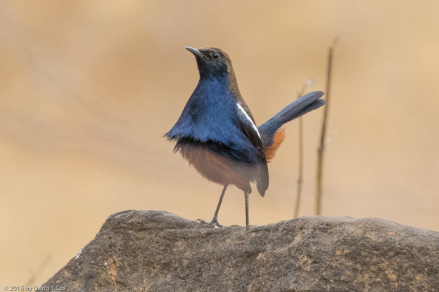
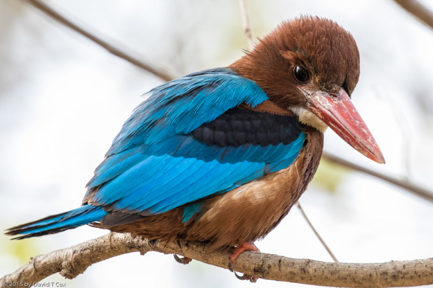
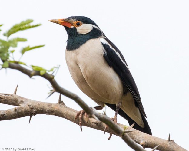
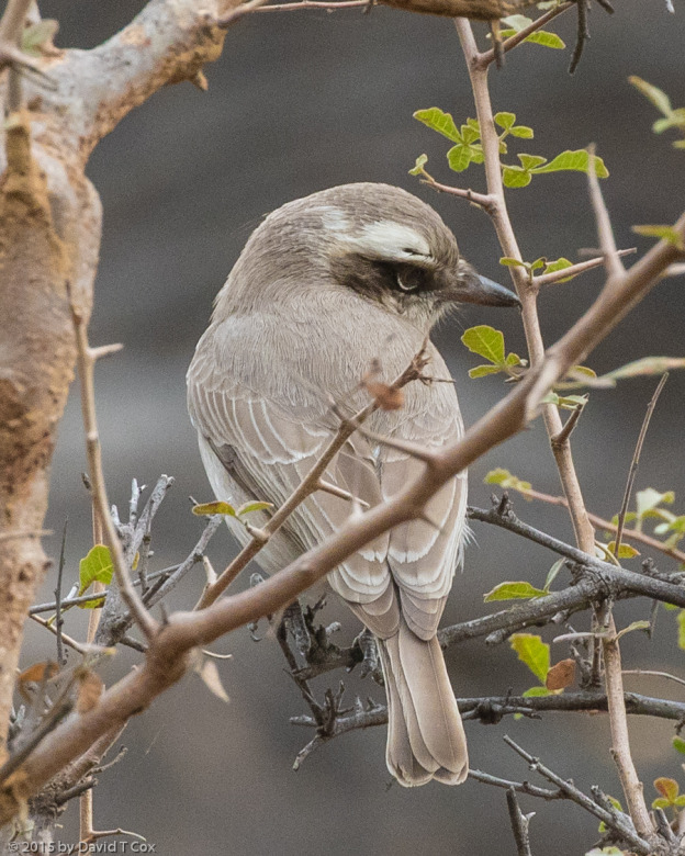
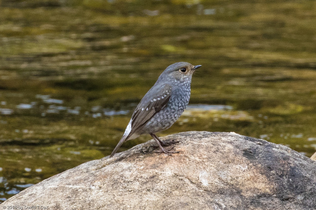
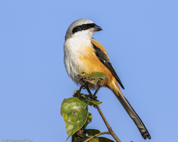
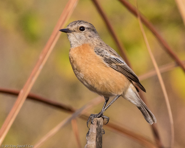
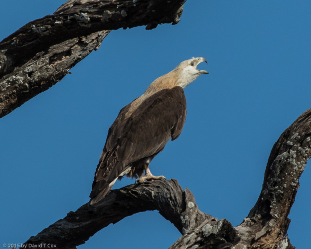
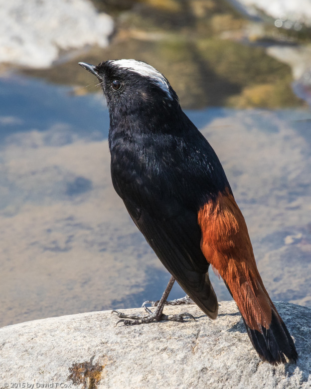
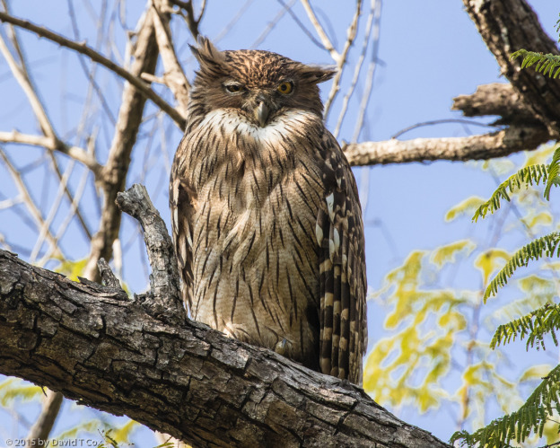
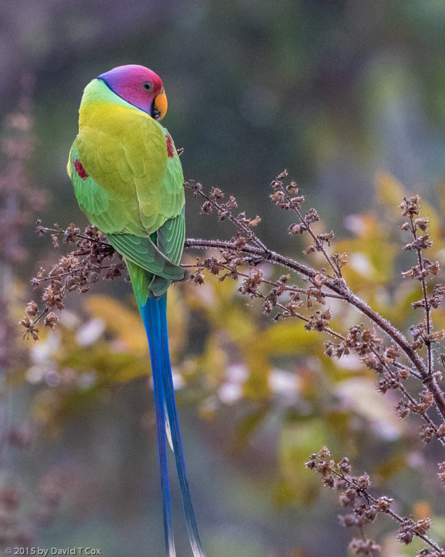
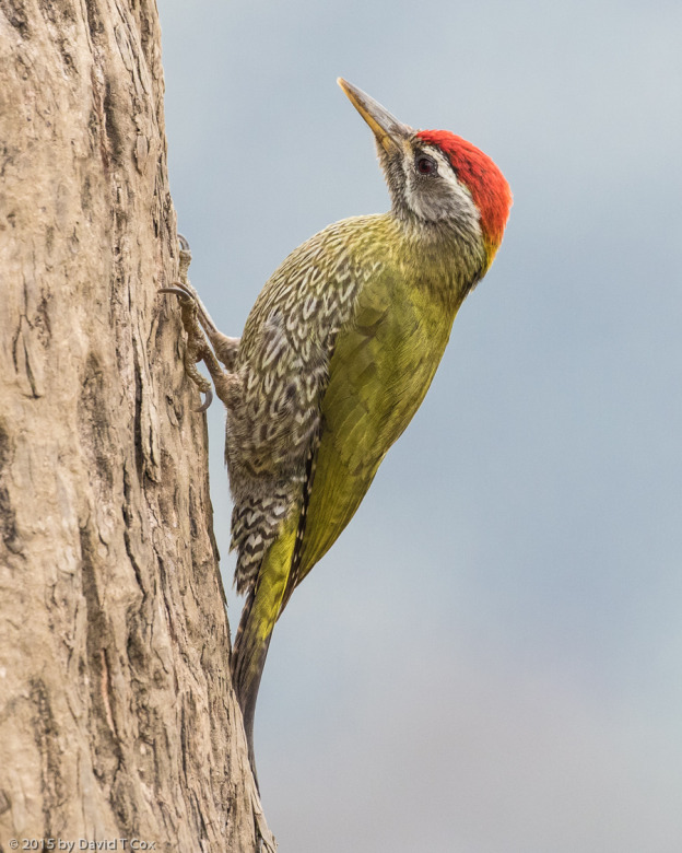
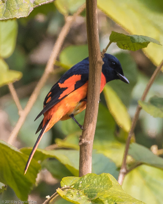
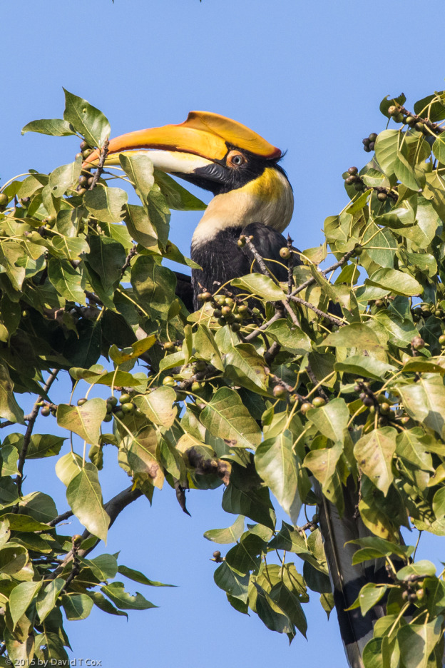
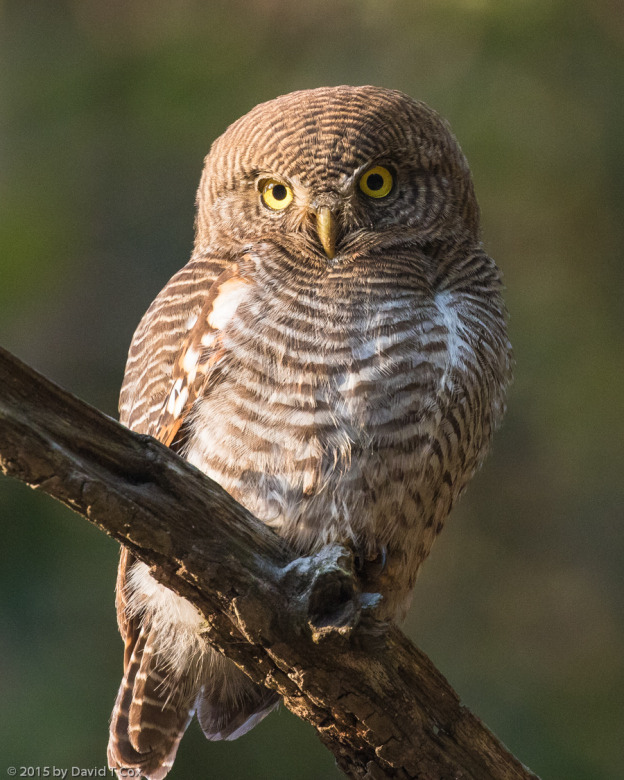
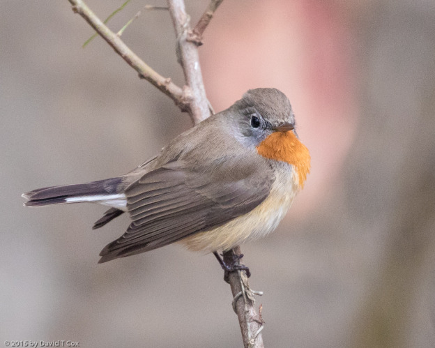
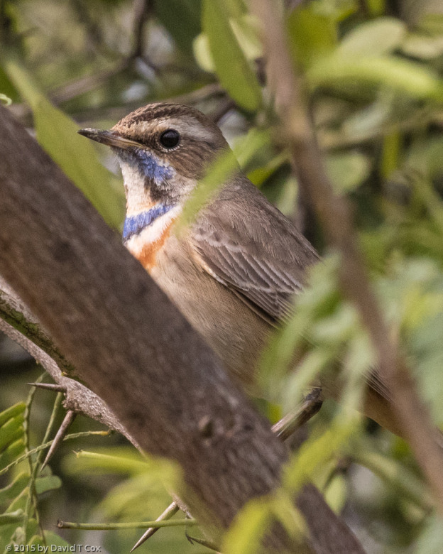
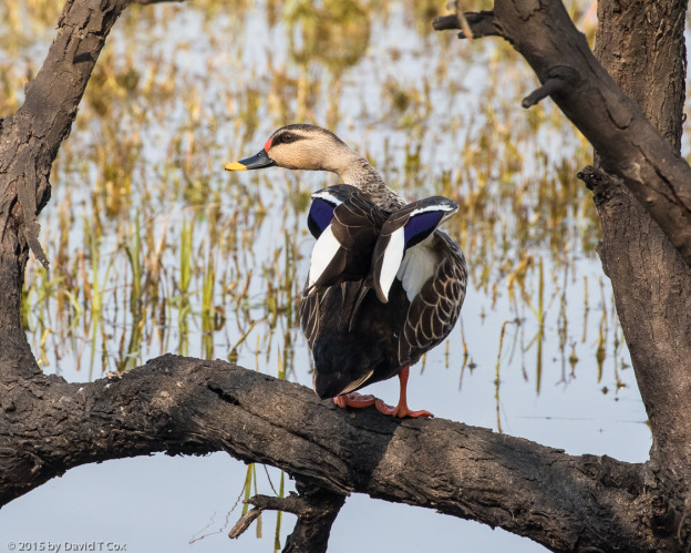
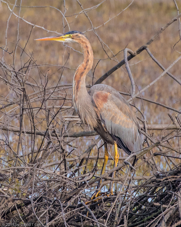
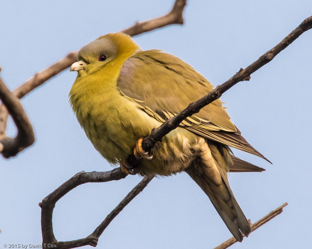
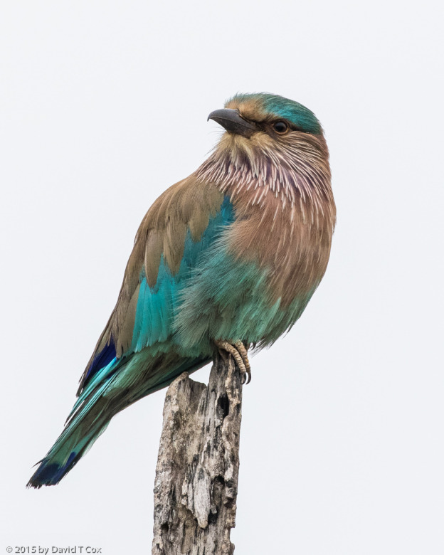
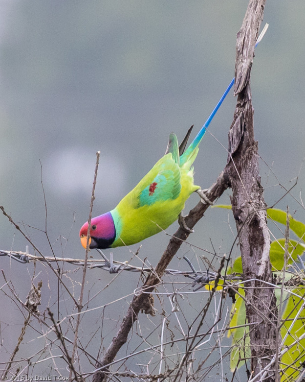
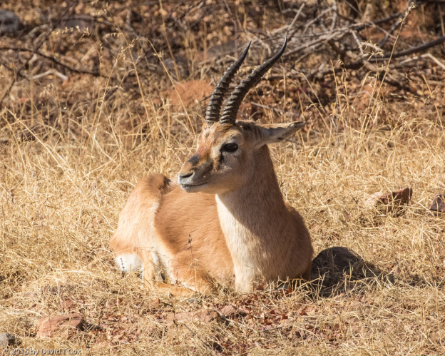
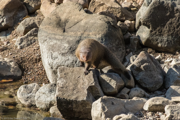
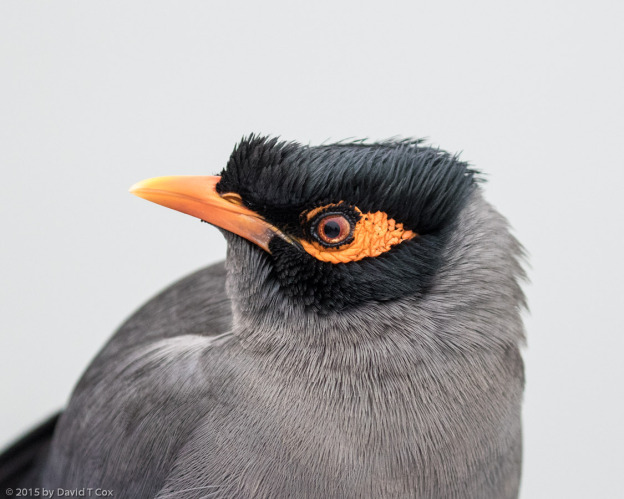
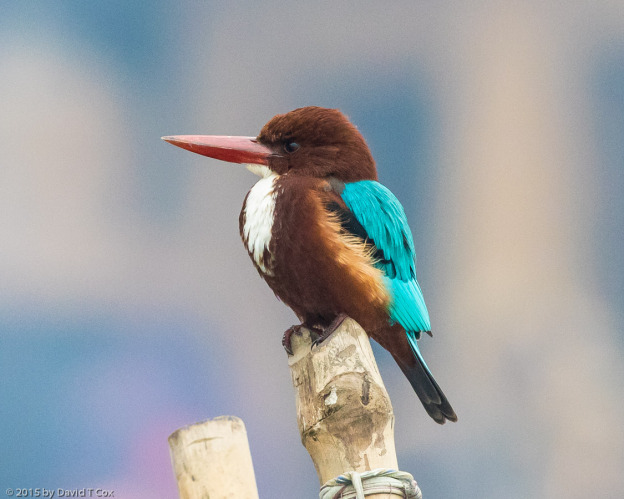
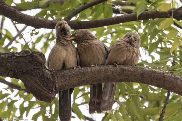
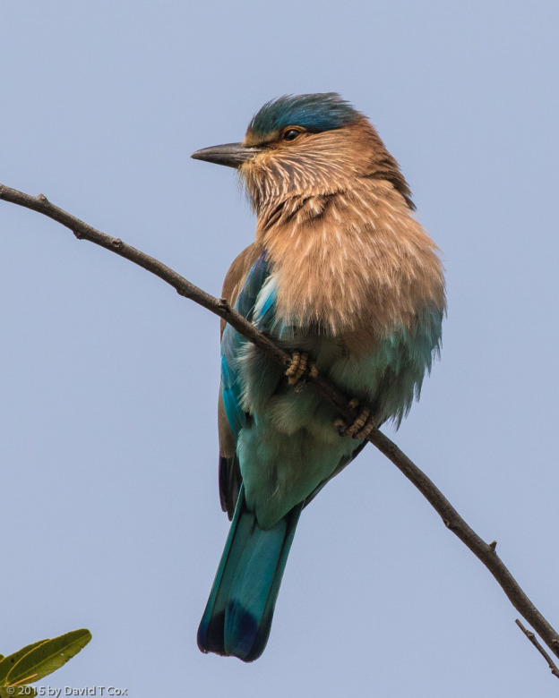
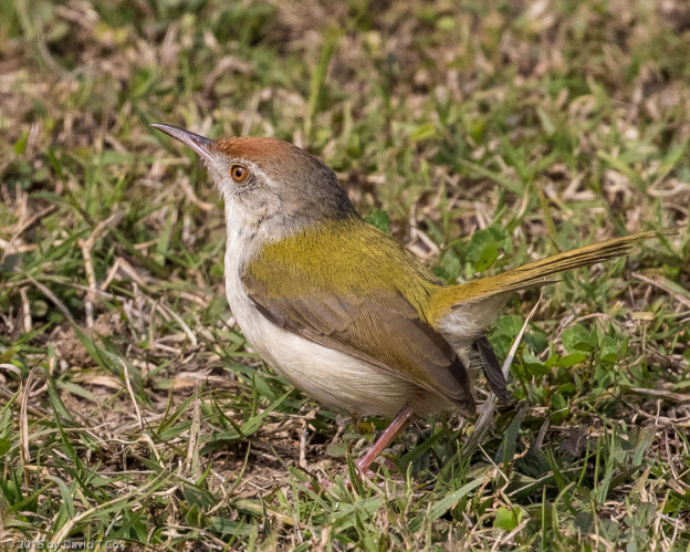
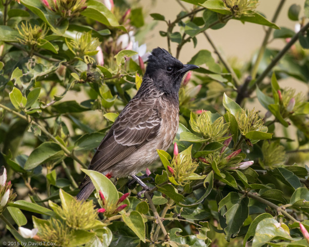
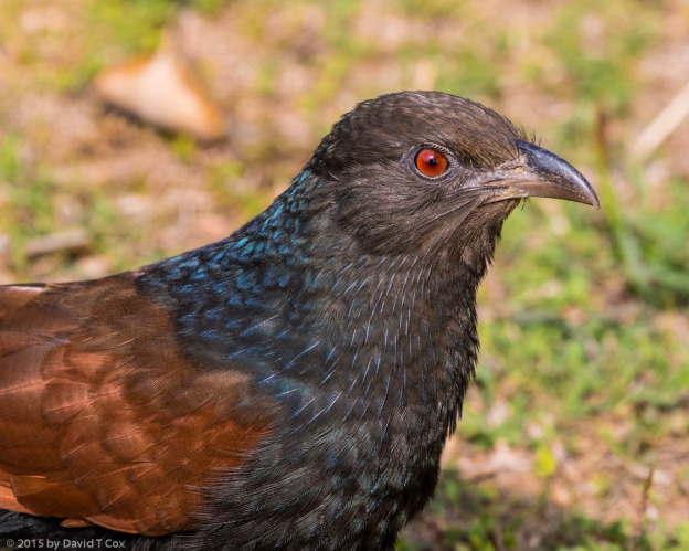
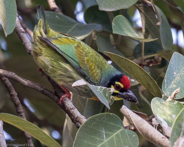
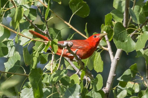
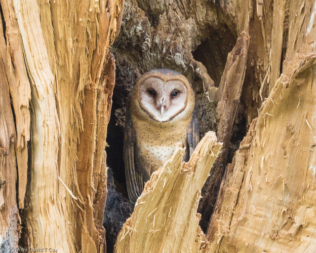
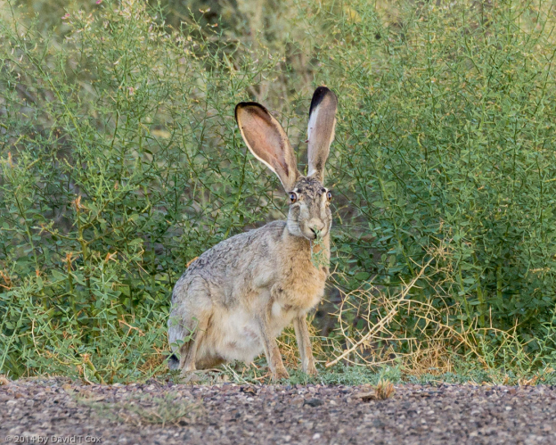
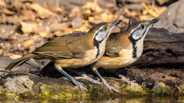
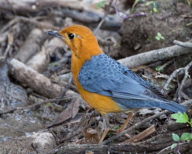
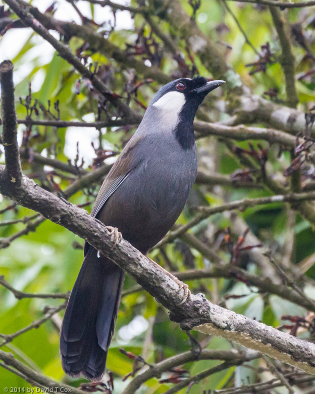
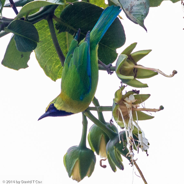
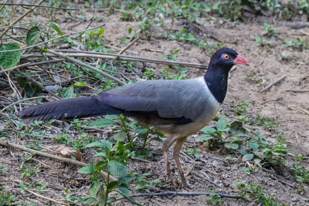
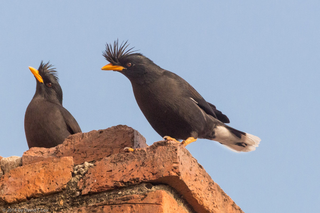
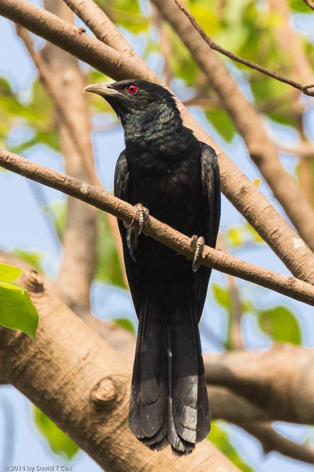
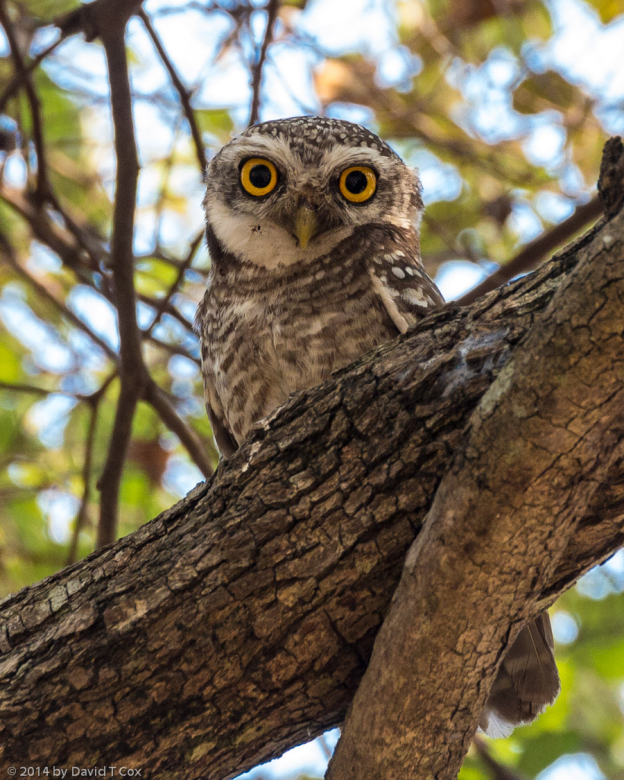
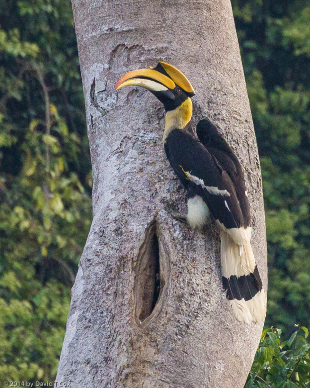
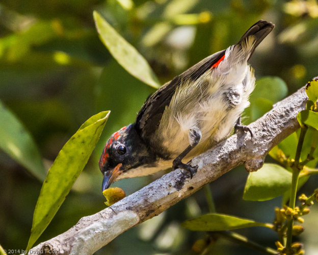
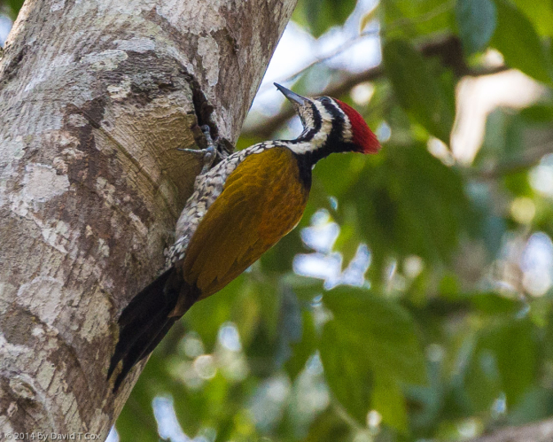
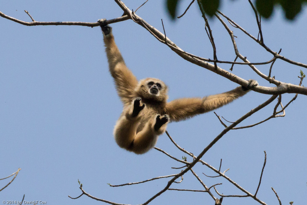
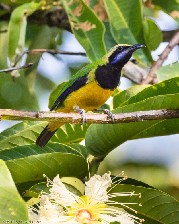
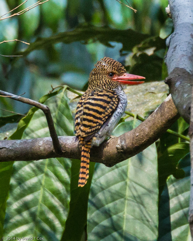
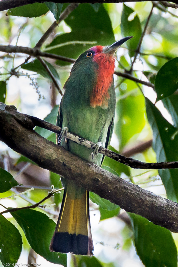
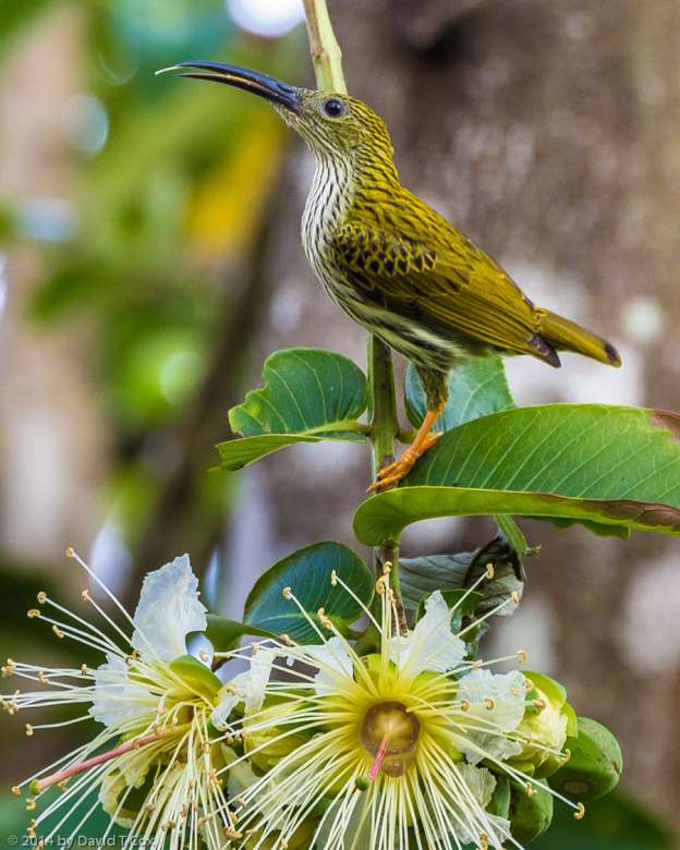
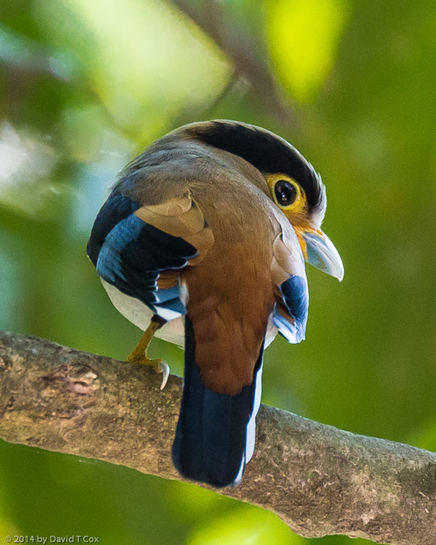
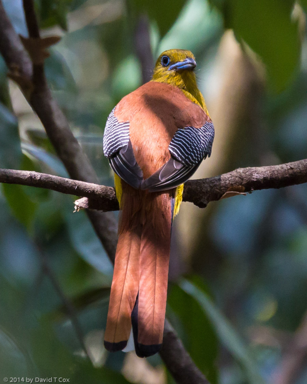
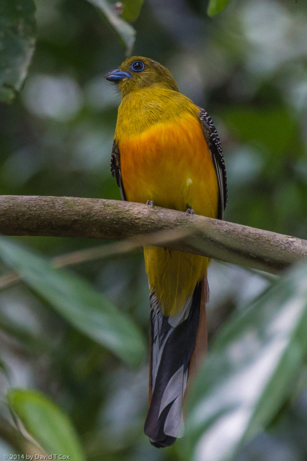
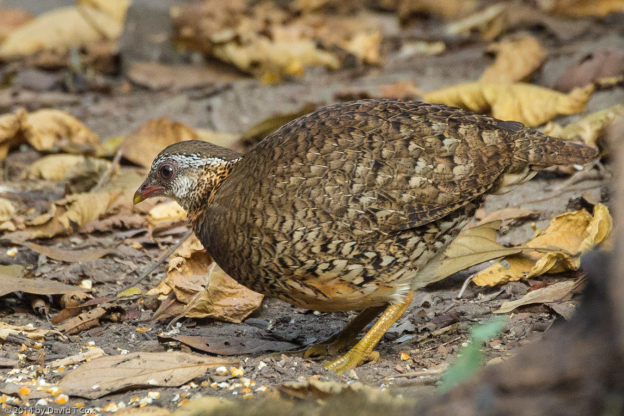
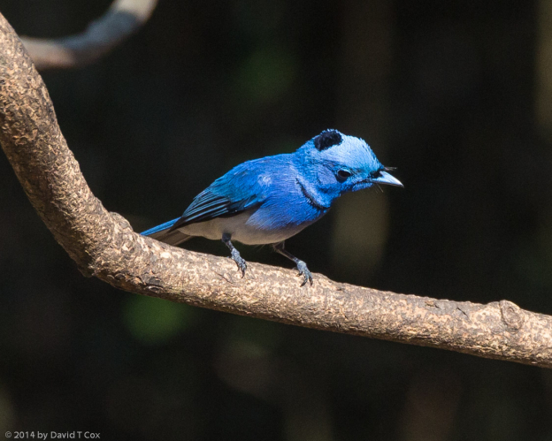
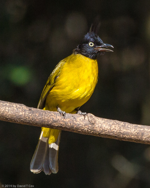
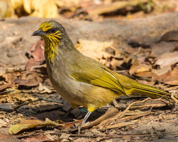
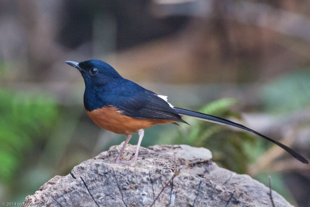
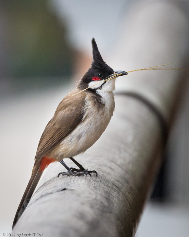
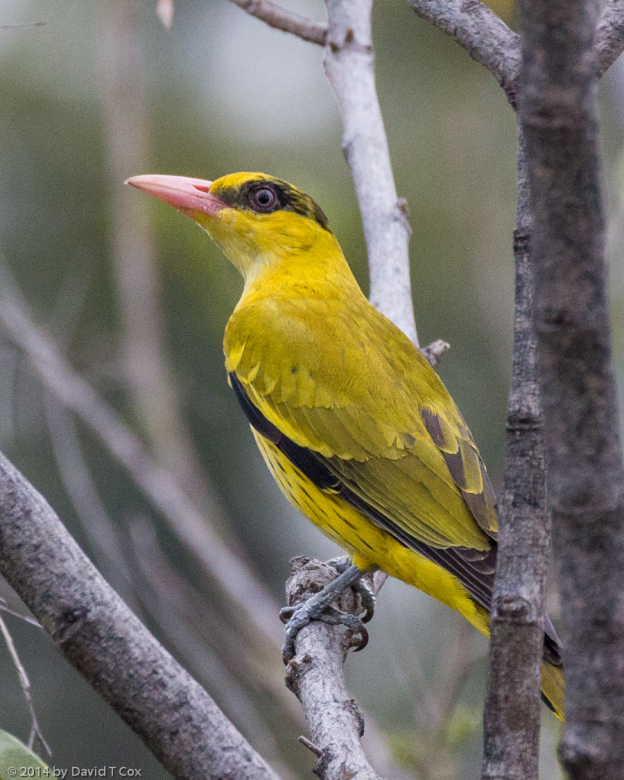
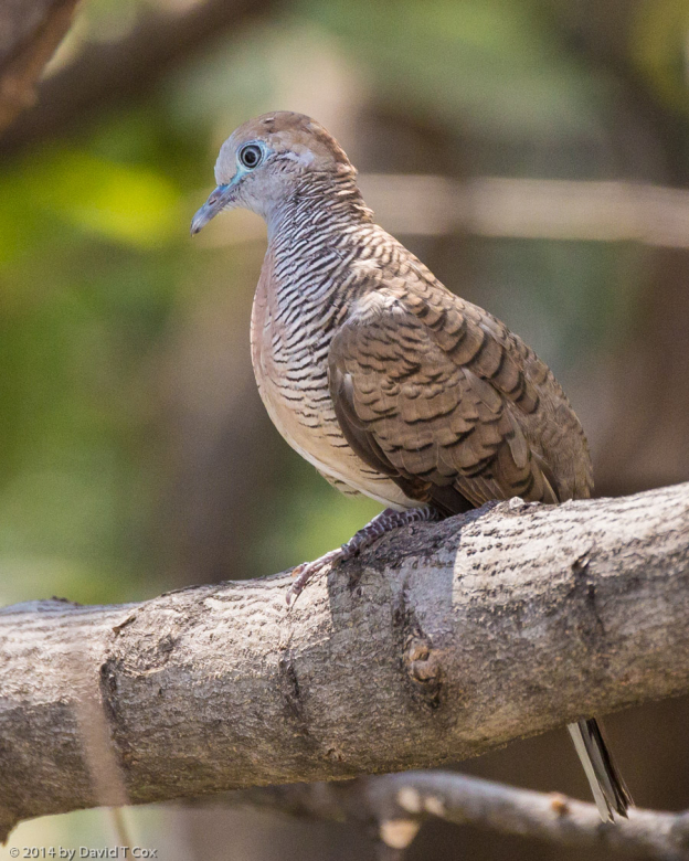
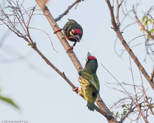
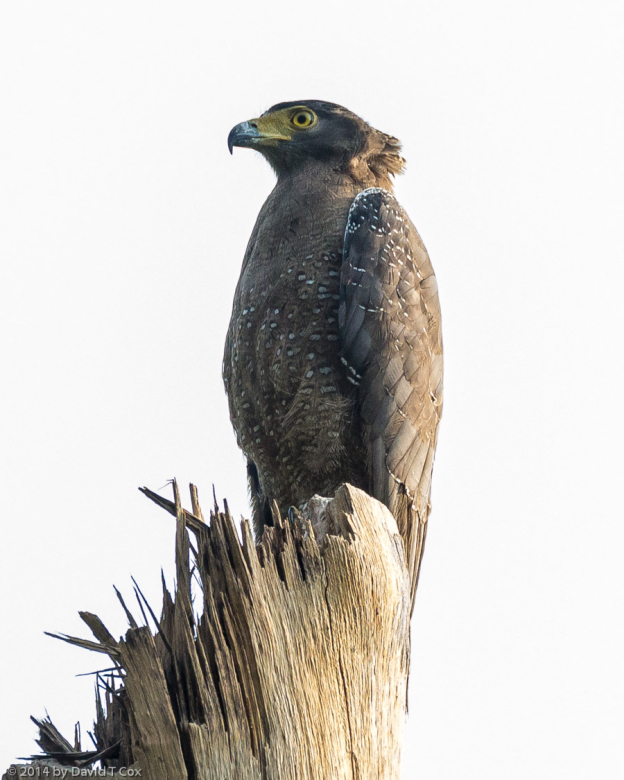
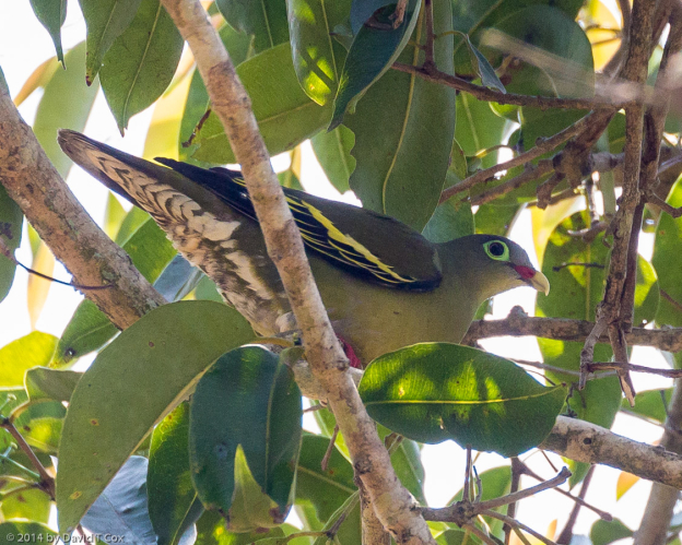
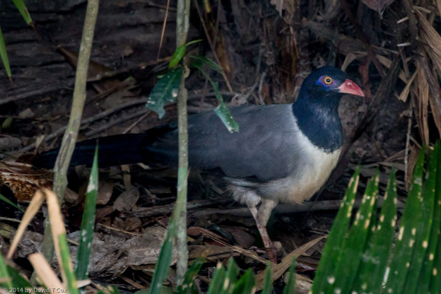
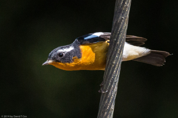
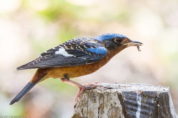
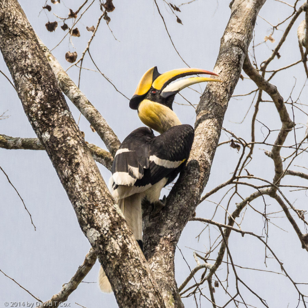
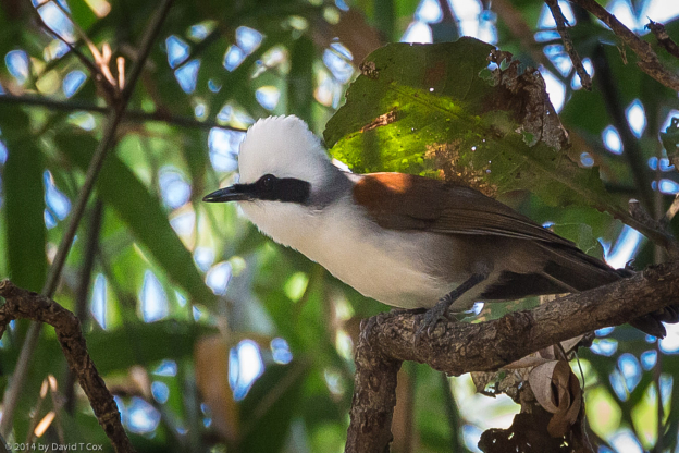
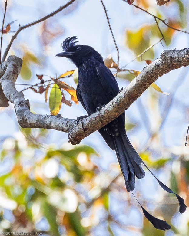
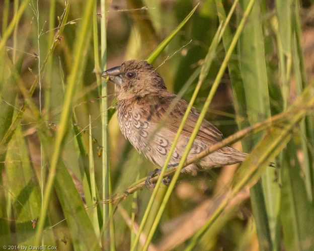
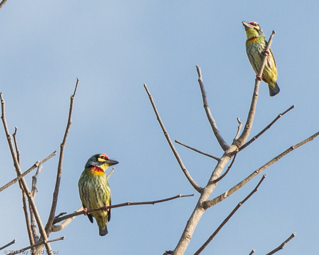
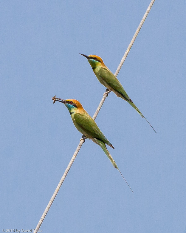
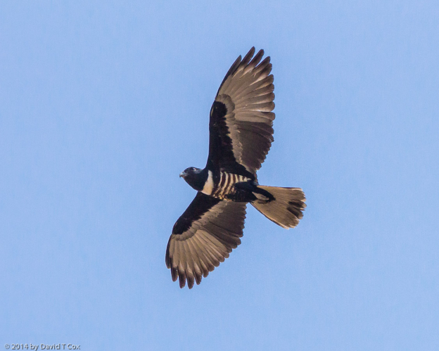
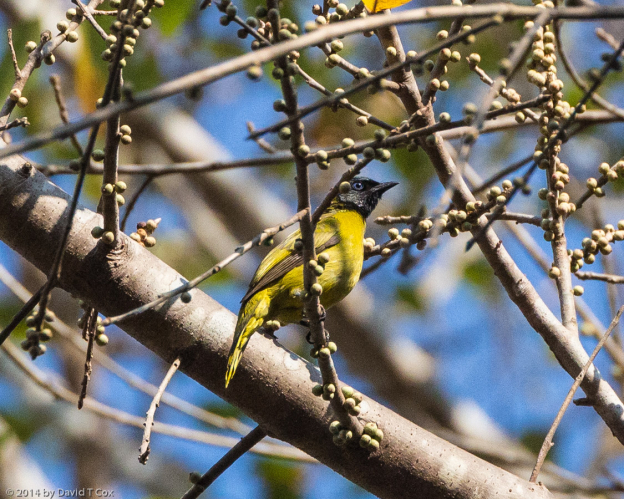
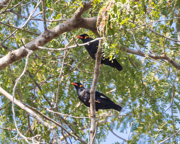
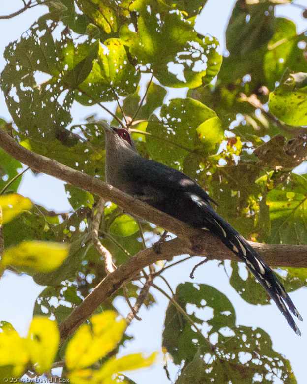
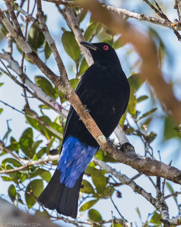
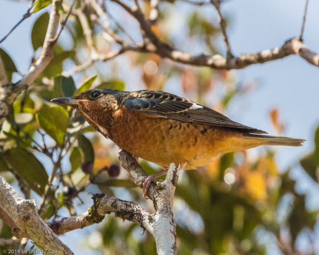
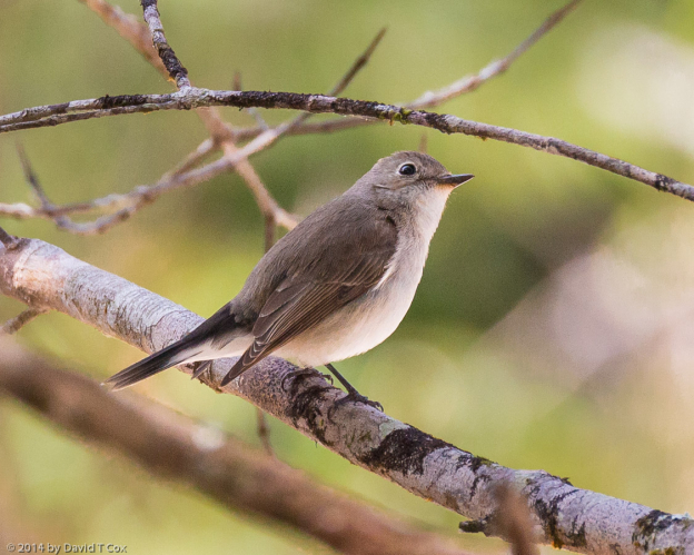
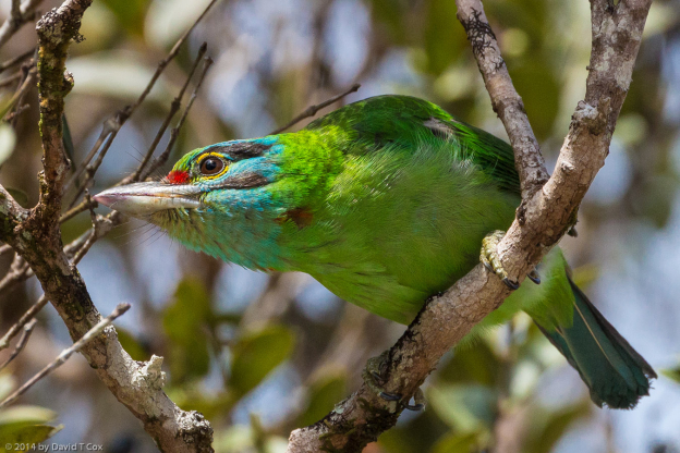
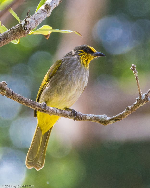
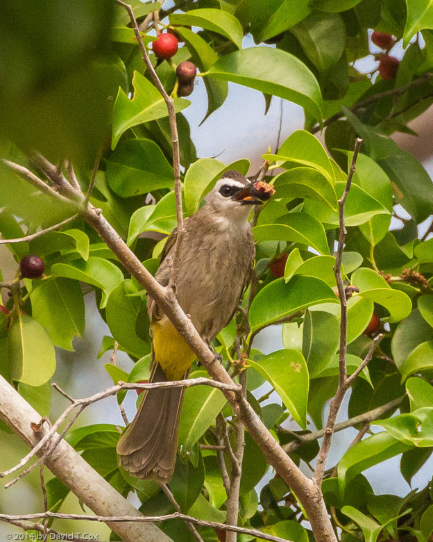
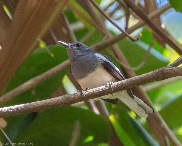
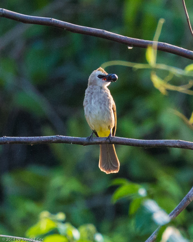
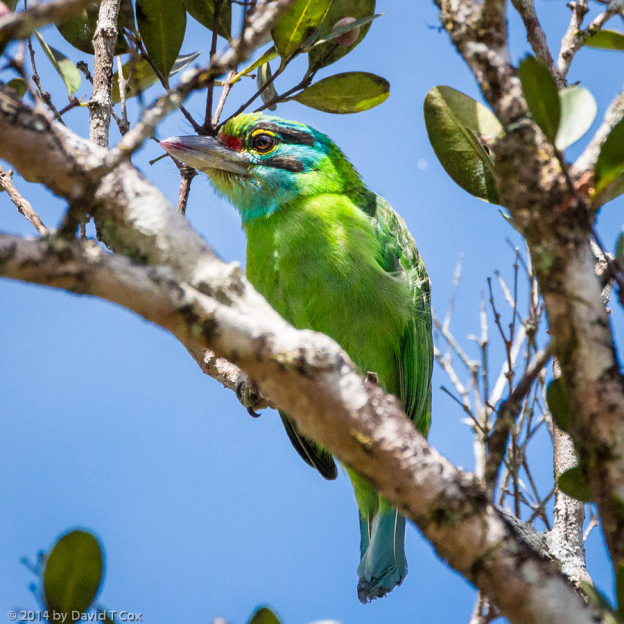
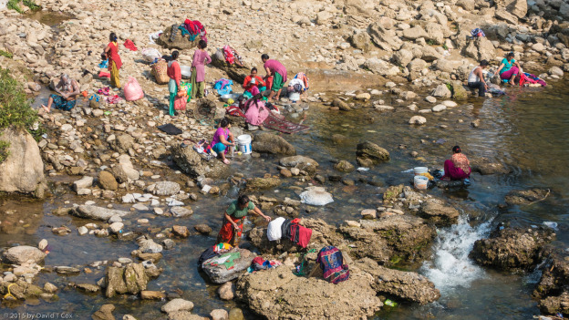
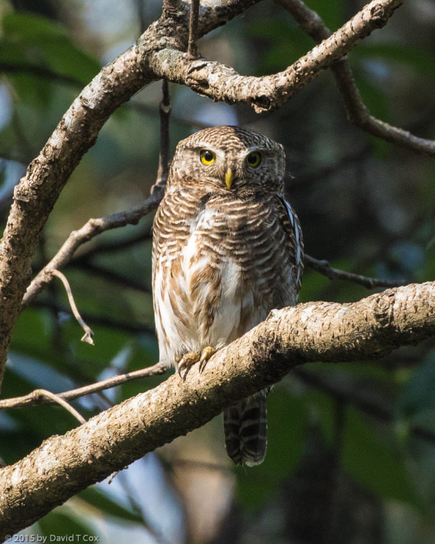
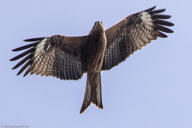
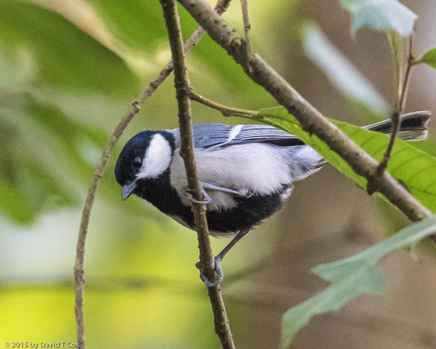
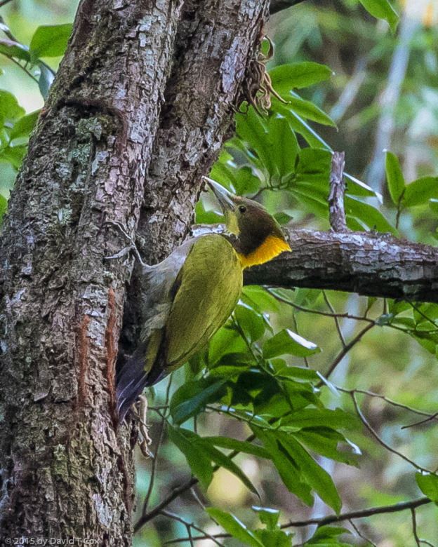
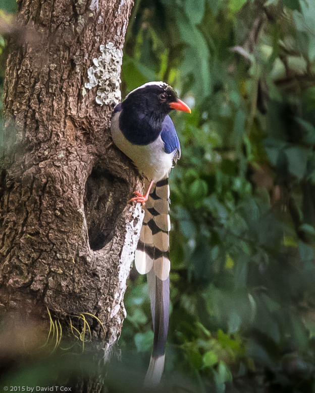
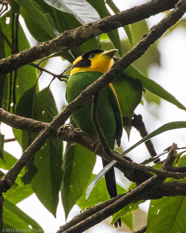
Pokhara sits on the north shore of a dammed lake, on the south side of which is the Raniban Forest.  I hired a local guide to lead me on a hike though the forest – twice we had to climb about 200 meters up 60 degree slopes to gain passage around the lake, often climbing on knees to keep from careening back down the mountain side.  I did get to see 8 new and glorious species of spectacular forest birds, including the Greater Yellownape, Long-tailed Broadbill, Asian Barred Owlet and Maroon Oriole; got a few pictures, but the distance, intervening growth, and under-foliage darkness made any great photography practically impossible (my apologies in advance for including a few less than stellar bird photos, but those included were some of my favorite birds).

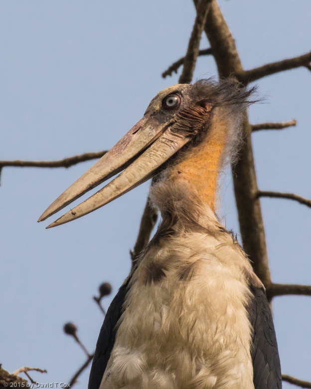
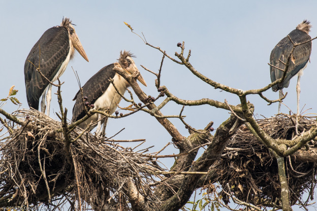
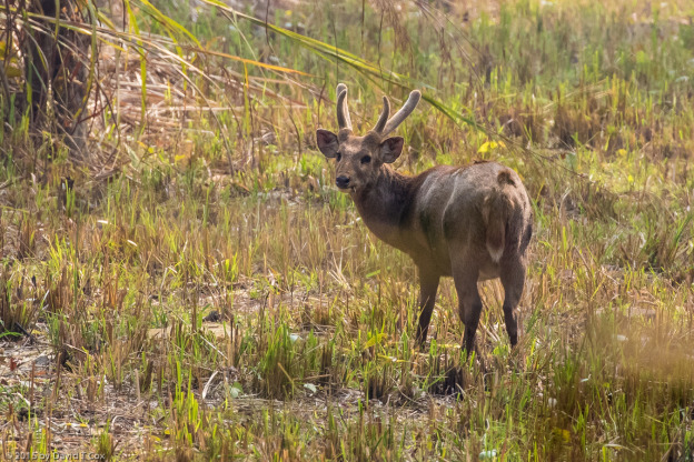
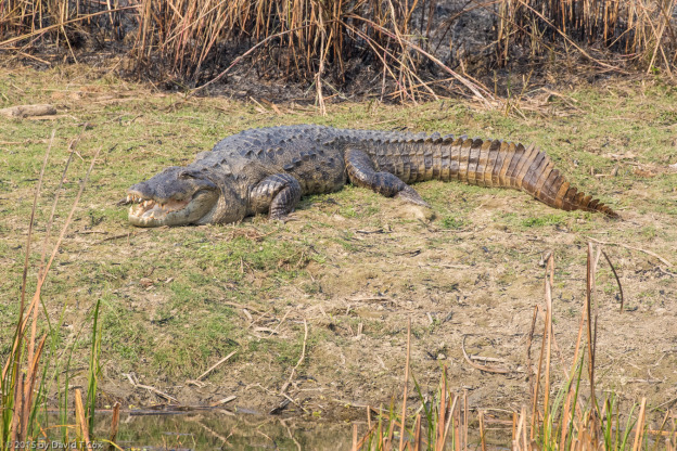
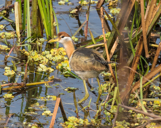
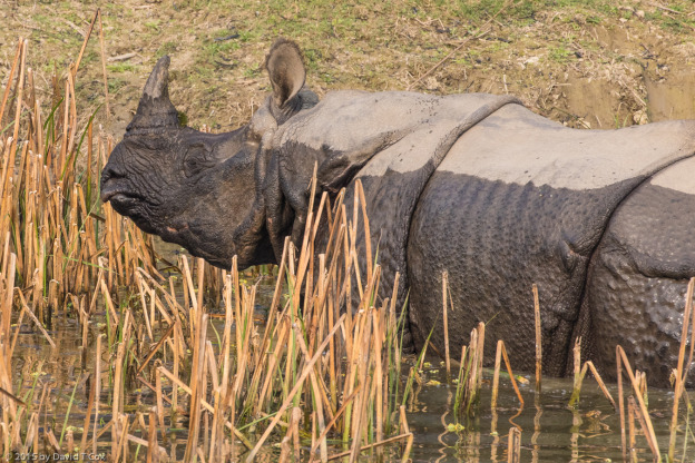
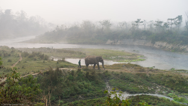
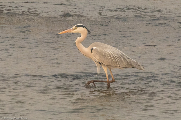
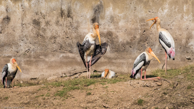
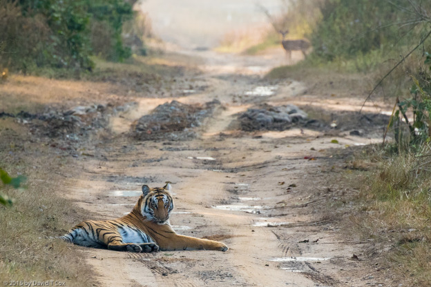
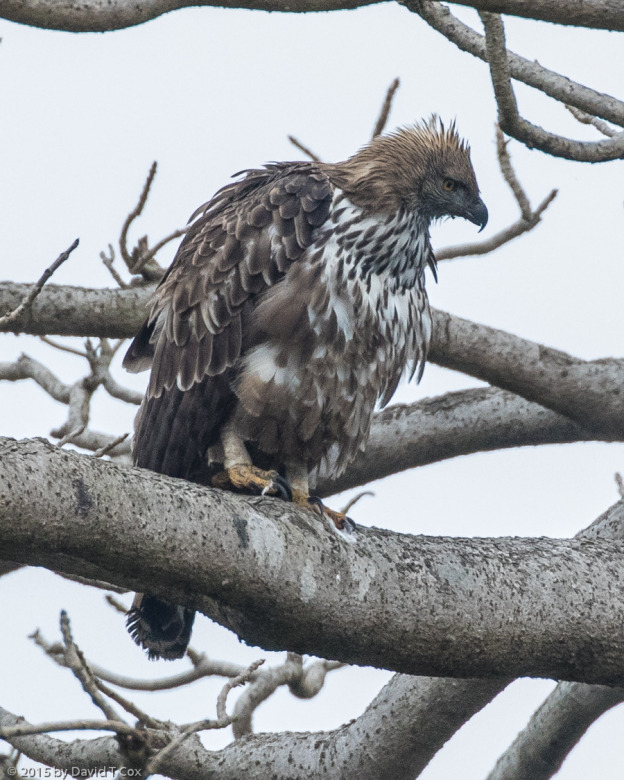
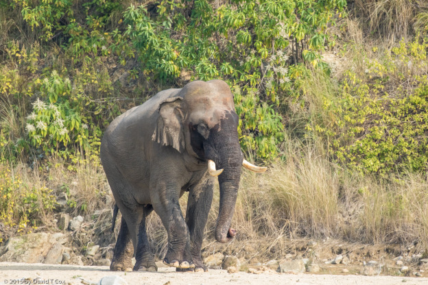
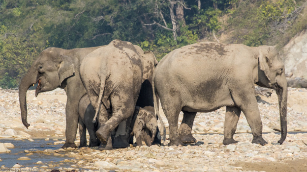
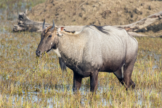
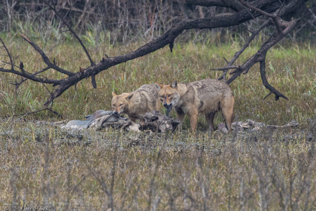
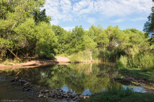
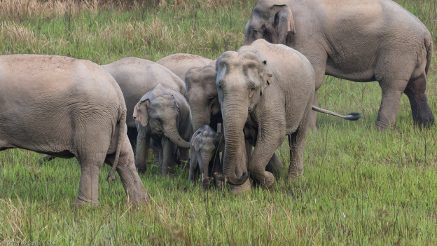
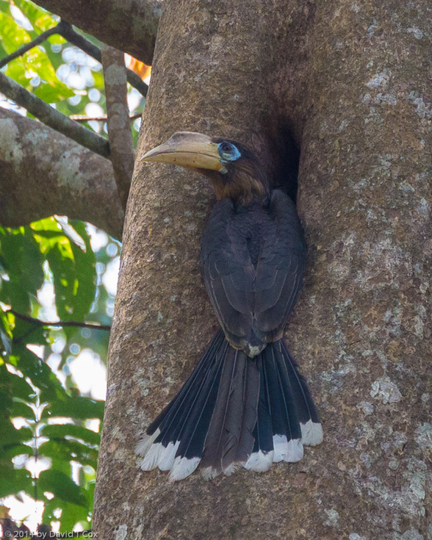
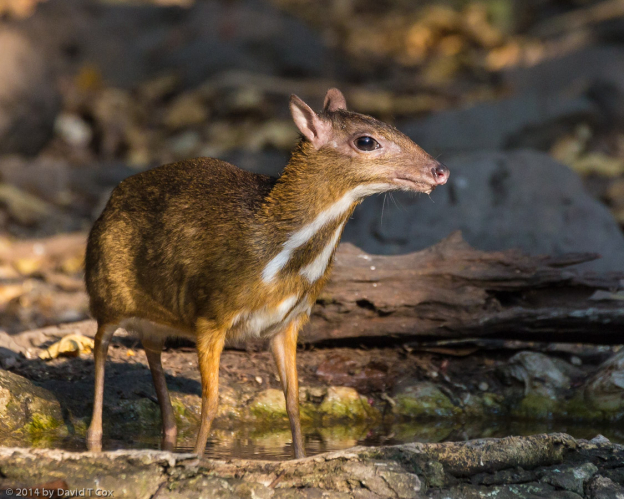
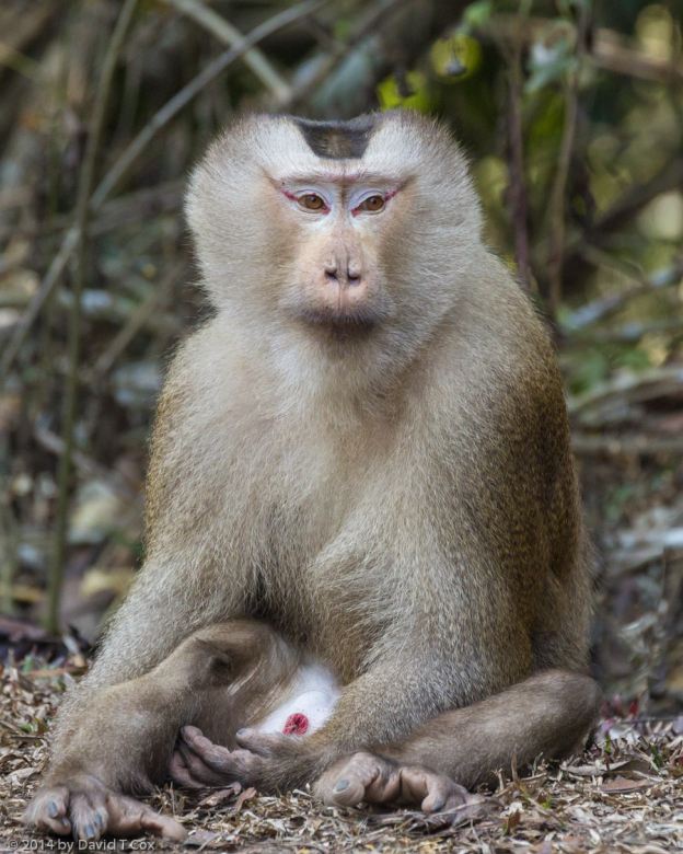
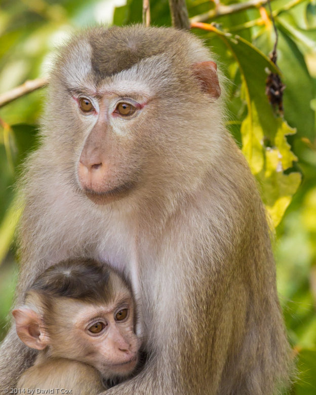
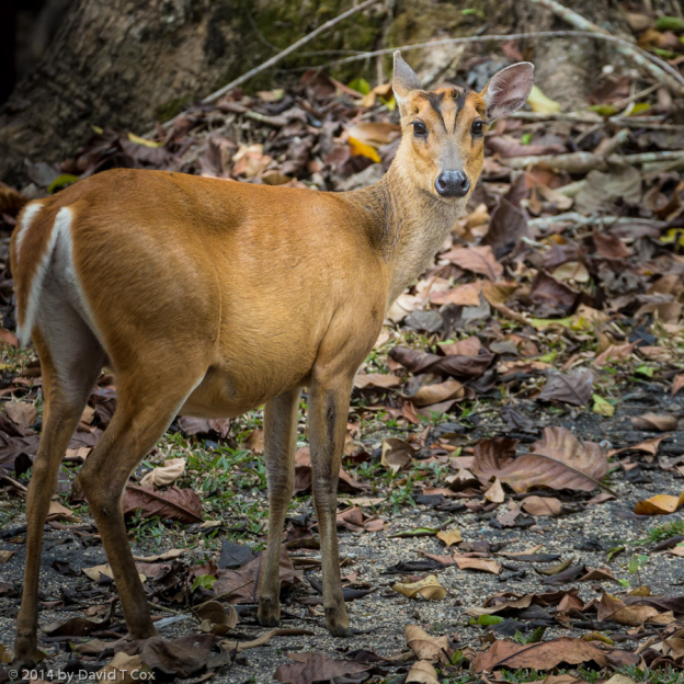
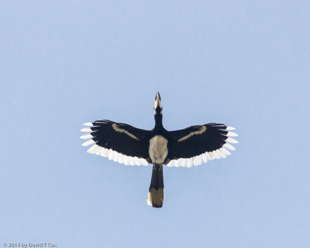
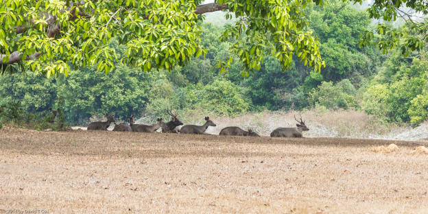
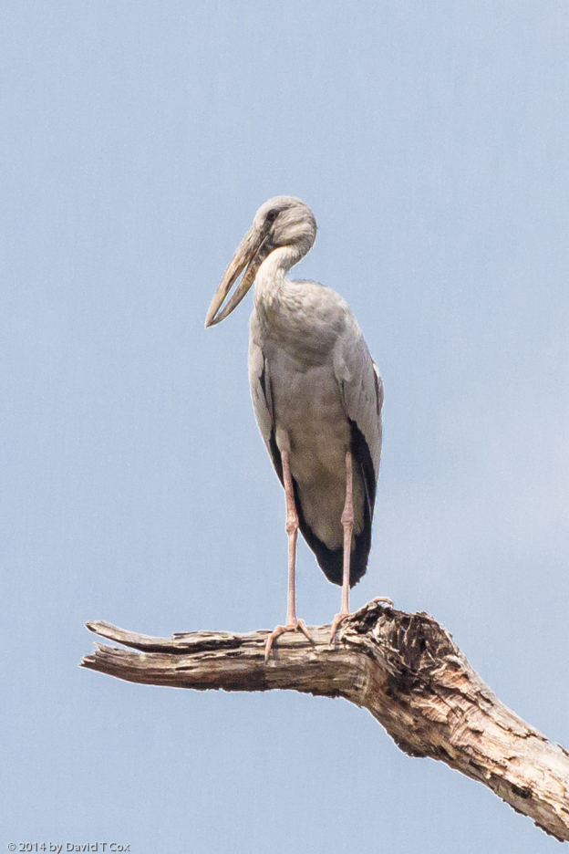
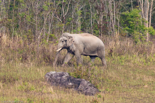
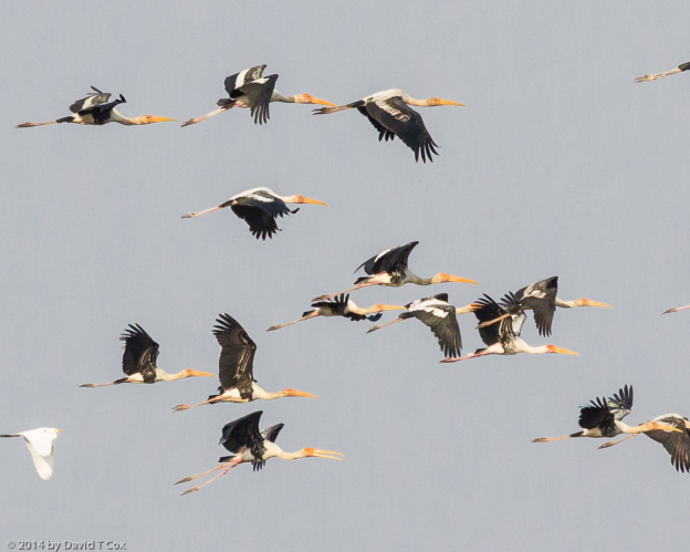
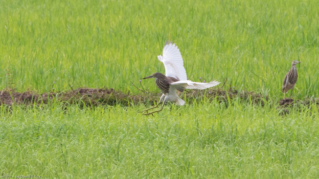
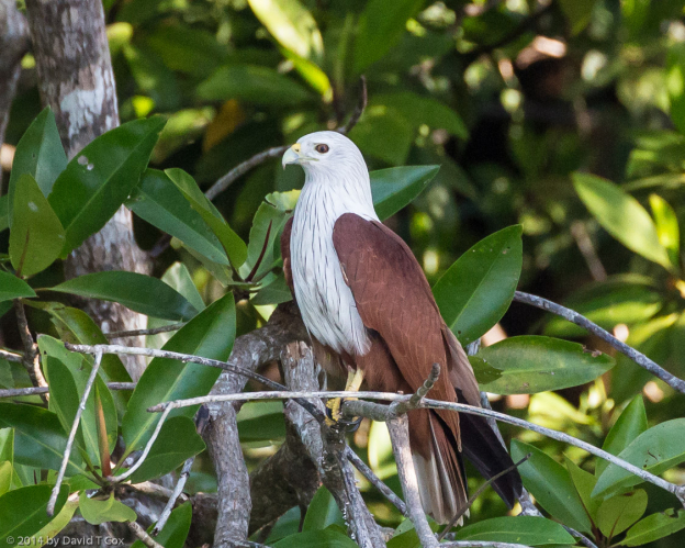
From Pokhara I drove down a steep river gorge into the southern lowlands of Nepal to the Chitwan National Park, another World Heritage Site.  I had visited here 33 years ago, and wanted to return for its famous Greater One-horned Rhinoceros, which have been critically endangered for decades (the population was under 600 in 1975, but now has been brought back to around 3,000).  It is the world’s largest rhino, with heavy skin folds appearing as armored plating.  The first afternoon, I watched three rhinos from my 4th floor veranda as they grazed – one crossing the Rapti River to enter the Park – about 1 km downstream.  I had one early morning elephant ride into the park, but it was marred by my being paired with a family of 3 Nepalese who carried on a conversation non-stop for the first hour.  I  finally requested their silence so we could hear the jungle sounds (at the location for boarding the elephants is a large sign stating “do not talk”, among other admonitions).  The mornings seem always to have a very heavy fog, making photography all but impossible.  I took one 5 hour private jeep ride in the afternoon, with a good private bird guide, and though the birding was a little thin, we were rewarded with one excellent encounter with a large male rhino taking a water-mud bath.   When it lifted its head out of the water, the wounds on its chin made clear it had been sparring with others – the guide noted it was the beginning of breeding season and the males were all fighting.  I also finally got a decent photo opportunity for the seldom seen Hog Deer.  Another highlight was to view nesting Lesser Adjutants, an ugly and endangered stork, related to the Marabou Storks of Africa (see photo for a face only a mother could love).

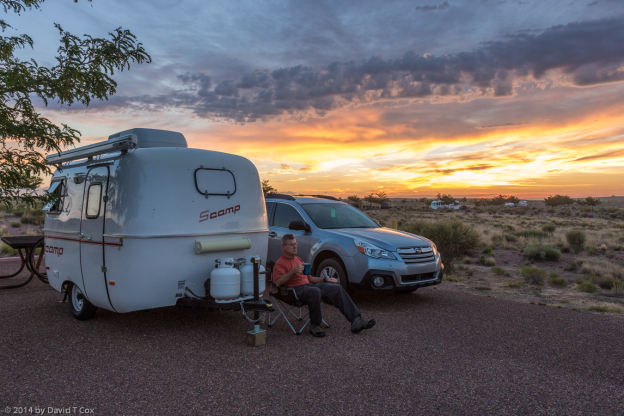
As an aside, in the interior of Corbett National Park, and here at Chitwan, where there is no refrigeration and the electricity may run half the time, making cold beer unavailable, I have been drinking a Nepalese dark “oak-aged” Rum which I find far more palatable than the local whiskey.  Even here in Nepal I find the Indian food very good.  Tomorrow I fly back to India, to Kolkata for a couple of days, and from there up to Assam in the far northeast to join my Canadian friend Ken Pease and his wife; we will visit the Kaziranga National Park and then head south to central India.  Later.  Dave
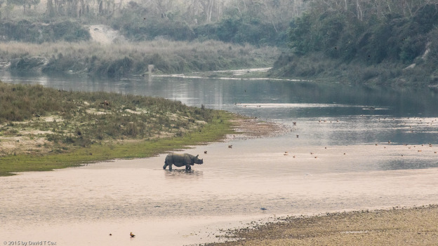
 

Report On Jaipur, Sariska NP & Corbett NP, India, Feb. 7, 2015

Since my last posting, I have visited the more famous tourist spots of Jaipur, in Rajasthan, as well as the small National Park of Sariska, and the first of the great Indian National Parks and Tiger Reserves, Corbett, in the Himalayan foothills.

First Jaipur:  I traveled to the “Pink City” where I spent just a couple of days, as I have visited it before, although many years ago.  My favorite site before, and still, is the Amer Palace sitting within the outside confines of the great Amer Fortress, about 10 kilometers from Jaipur.  This was the capital of the leading Rajput clan from the 11th to the 18th century.  The setting is still one of the most dramatic in India.  Within Jaipur, of course the Hawa Mahal (Wind Palace) must be visited just for the exterior view, one of India’s most memorable after the Taj, and the City Palace where the Maharaja of Rajasthan still resides.  Beside it is the Jantar Mantar, one of the many great 18th century observatories built by the Maharaja Jai Singh, with its giant calibrated and extremely accurate stone instruments for tracking all planetary positions (for astrological as opposed to astronomical purposes).

From Jaipur I traveled to the little visited Sariska National Park, with its few tigers, but abundant other wildlife.  I was situated in a small hotel with a dirt road running right along the Park’s western boundary, and spent one entire day walking along paths just outside and within the Park.  Of the larger wildlife, I was constantly surrounded by the Nilghai (Bluebull), the second largest antelope in the world.  One large male, who was very close to me, kept issuing alarm calls as he could not spot me, and was troubled by a Rufous Treepie sitting on its ear trying to pick ticks from the ear canal (see photo).  Within the Park, on safari ride with a customarily rowdy group from Australia (I think I was able to give better than I got – 3 months of practice a few years ago in the Outback trained me well), I finally got decently close to both the Bar-headed geese and the Painted Storks, both of which avoided me at Keoladeo.

From Sariska I traveled to Delhi, where I spent the night before the long drive up to the Jim Corbett National Park and Tiger Reserve in the Himalayan foothills.  The park is named for the great white hunter, Jim Corbett, who, in the early 20th century, tracked and killed more man-eating tigers and leopards than any other person.  He also spent some years in Africa as a “great white hunter”, and perhaps is the most famous of the genre in history.  In childhood I grew up reading his books telling the many tales of the different man-eating tigers he had tracked and dispatched;  these stories created lifetime memories and sometimes nightmares for a boy growing up in tiger infested jungles.  In his later years, towards the mid-century, he turned preservationist, as have so many famous hunters, and is credited with pushing for the creation of wildlife reserves; the Corbett National Park is the first and still largest of the many Indian tiger reserves now dedicated to the preservation of the endangered species.

My first day in Corbett I spent traveling to the very heart of the huge preserve to stay at the jungle camp of Dhikala, by Ramganga River and Lake.  Here is the heart of tiger-land, teeming with wildlife and birds.  It takes about 3 hours of jeep trail driving within the park just to reach the camp; I had hoped to spend at least 3 days here, but could only book one long day (and night).  From entry to exit of the park, in just over a 24 hour period, I spend 11 hours on private safari.  AND, did I mention I saw TIGER – TWICE, first in the afternoon ride, and again the next morning.  This was my first sighting of live tiger in the wild since some views of late night road-crossings in boyhood.

The first tiger was resting in the middle of the jeep track, with the setting sun in the background, and a herd of Spotted Deer just up the trail warily watching the tiger.  The tiger finally sauntered off in the general direction of the deer, and then into the jungle.  We moved the jeep up, and within 10 minutes the tiger reappeared from the edge of the jungle within just 20 meters of the jeep.  I must say, being alone in the back of an open jeep, with just the driver, and a tiger within a few bounds is exhilarating, and affected me more than the lions of Africa.  The following morning I again saw a tiger crossing a trail, perhaps the same tiger.  The central area around Dhikala also had a large number of other animals, including the endangered Gharial (Gavial) crocodiles, of which I previously wrote; they have been reintroduced into the Ramganga River and Lake, and seem to be doing well, but can only be spotted at great distance, together with the mugger crocodiles which are fairly common in the Indian jungle rivers.

My next three days at Corbett had been booked by the agency at an expensive resort, which, it turns out, is a destination resort for Indian families and conferences.  This “resort” turned out to be 23 kilometers of single track jeep trail away from the central town (and away from Park gates and the highway).  That 23 kilometers turned into 1 hour and 10 minutes of kidney-painful driving, EACH way; this before transfer by jeep from Ramnagar for the 10 to 30 minutes to the various gates to start the safari rides.   I was required the first morning to leave the hotel at 5am to get the 6:30 safari.  After some trouble I was able to rebook into a cheap hotel in the town of Ramnagar which suited me fine for the remaining safari rides.

Anyway, my next safaris all were into the Park, but none went so far into the interior as the great Dhikala site.  However, a great deal of wildlife is visible, including many Asian Elephants (wild, of course), Spotted Deer, the bucks with massive antlers relative to their small size, Sambar, Wild Boar, Great Hornbills, and a good variety of other birds, including 4 species of the brilliant colored  Minivets, the rarely seen Kalij Pheasant, and the impressive Grey-headed Fish Eagle and Changeable Hawk Eagle.   I have included a fairly large selection of wildlife and bird photos with this posting – and did I mention I saw TIGERS.

On a separate note, let me talk a little about forms of bureaucracy in the country which can boggle the mind.  All permits for such things as the Park entries, jeep safaris, all hotel registrations, and many other activities require a time-consuming filling in of forms.  All hotels, even the top tier ones, not only require for registration all passport and all Indian visa details (numbers, dates and places of issue and expiry) but full addresses, telephones, India arrival and departure dates, places just arrived from and next destinations etc. – and these must be hand-filled in, in painstaking detail, in giant ancient style ledger books, with multiple tiny columns into which one must try to fill entire addresses into boxes the size of this word “addresses”.   And then the government form comes – requiring of foreigners again all the same information as filled into the ledger – this government form must be hand filled out in triplicate, by the foreigner, written onto old-fashioned sheet forms with carbon paper used in between the different colored sheets.  Safari bookings require such ledger book detail, then the filling in of the permit paper itself – and on arrival at the Park gates, one again must show the passport and fill out another ledger book.  Nowhere, except at a large Delhi and Agra hotel, have I seen a computerized system.  All restaurants in the large hotels also have a person sitting behind a desk who hand-transfers all one’s order information into a large ledger, and onto separate sheets, which then are taken to the hotel registration desk to be stapled to the room information.  Almost every third-world country I have visited has better systems, including computers, at the more expensive establishments.  I never would have thought India, with its huge technology universities, could be still so completely mired in a form (pun intended) of such outdated record-keeping, mostly dating back to the British Raj of the first half of the 20th century.

I have returned today to Delhi to spend the night before my airport transfer in the morning to fly to Kathmandu for 9 days in Nepal.  As I only rarely have had internet access, even in the fancy “resorts”, I do not know when I again will be able to make a posting.  Later.  Dave


Travel Report on Agra, Keoladeo NP & Ranthambore NP, India, Jan. 30, 2015

Hello everyone.  Again I have been many days without internet access, so am forced to file travelogues less often; more pictures per report for those who may look at the site just to glance at the pics.

I visited a number of sites in Agra, mostly Mughal tombs, but just one so overwhelms all others it demands exclusive prominence – that of course is the Taj Mahal, a World Heritage Site, and considered by many as exhibiting the most beautiful architecture in the modern world, often said to be the 8th wonder of the world after the original 7 of the ancient Greeks.  It is, as you know, the tomb of the favorite wife, Mumtaz Mahal, of Shah Jahan, the fourth of the 5 great Mughals who ruled much of India during the 16th and 17th centuries.  Shah Jahan was later overthrown by his own son, Aurangzeb, and incarcerated for the rest of his life in the Red Fort of Agra, and later buried beside Mumtaz in the Taj.

The building is instantly recognizable by all, but the intricacy of the white marble inlays of Koranic verses on the front and precious stone throughout, together with the carved curtains throughout the interior, simply defies belief that such effort could be expended.  Though it is very large, unlike the pyramids it does not awe with size, but with an apparently perfect form at distance and intricacy close-up, both coupled with the large scale.  I have included 2 pictures, one just a classic view, though it is one of my combination photos which will print to a very large size for a possible wall hanging – it shows the Taj during the very brief 40 minute period in mid-afternoon when the fog just cleared sufficiently for the sun to briefly brighten the view.  The second shows a section of the interior carved curtained marble walls, inlaid with semi-precious stones, which surround the cenotaphs themselves.

From Agra I traveled by private car and driver to Bharatpur, a small town alongside the world famous World Heritage site of Keoladeo National Park, the best known and best of bird parks in India.  It was once flood plain owned by the Maharaja of Bharatpur who built a dam and annually flooded the area in the mid 18th century.  This created lakes and marshes which for over two centuries attracted over 350 species of birds, many migratory from the northern tundra and parts of China and Russia.  I was able to locate and hire a couple of different expert bird guides, and spent 2 full days within the park by foot and bicycle rickshaw exploring the 12 kilometers of road and trails.  I especially enjoyed the Yellow-footed Green Pigeon flocks, and the brilliantly colored Spot-billed Ducks, as well as the large numbers of mammals including Sambar (aka Swamp Deer), Spotted Deer (aka Cheetal), Nilghai (aka Blue Bull), wild boar, Jungle Cat (aka Swamp Cat) and Indian Jackals (these jackals are much larger than those in Africa and very much resemble Timber Wolves – see picture) (Sorry for all the aka’s, but for those interested, many of the Indian animals and birds have gone by multiple names in the recent past, and may be known by many under only one of the many names).

From Bharatpur I traveled to Ranthambore National Park, which lies within another previous Maharaja’s private lands, and covers hundreds of square kilometers of heavily jungled and mountainess countryside.  It is one of the best known and most successful of India’s efforts to save the tiger; the park has doubled the number of resident tigers to almost 50, and some of its tigers have been relocated to other parks where the species went extinct through mostly habitat loss and poaching for illegal trade to China (where it should be noted all rhino horn and most elephant tusks also illegally go, threatening 2 of the 3 species survival).

Unfortunately, the hotel booked for me by the agency again did not meet minimal expectations.  It was an attempt to copy the great tent safari camps of Africa, with included bathroom; however, tents with openings with broken and non-functioning zippers, with no heat during very cold weather, and mostly with only 10 liter hot water heaters, which are rated to just fill the plastic buckets provided in the bath area so one may use a cup to douse oneself with warm water in an effort to bathe, was not my idea of a pleasant 4 day stay.  I did not bathe for 3 days, as the weather remained foggy and very cold – on the 4th day sunshine minimally heated the tent, and by ordering delivery to my tent of a second plastic bucket of hot water, a bath was accomplished.

The park itself is an impressive area of dry jungle covering steep hilltops and large valley floors, with several small rivers and seepages providing year-round water.  It is filled with two types of antelope and two types of deer, both common to India, the Indian Gazelle (Chinkara), the Nilghai (Blue Bull), the Spotted Deer (Cheetal) and the large Sambar (Swamp Deer).  These all exist in large numbers which, along with the habitat, supports the population of almost 50 tigers and about 90 leopards.  Unfortunately, sightings of the big cats is exceedingly rare, as both are nocturnal and all safaris into the park are daytime.  The Park is so popular with tourists now, including huge numbers of Indians, that the government, which controls all ingress and egress, allows only a limited number of ranger led jeeps and trucks into 10 different zones which are somewhat allocated randomly.  The experience is cheapened by the sheer number of jeeps and trucks always converging on the same spots, the loud discussions between the jeep rangers and drivers, and the constant feeling that all other wildlife is just to be briefly glanced at while the rangers try to show their prowess at looking for tiger tracks and discussing the most recent sightings (always the spot where the jeeps converge for the next 2 days, as if being close to where someone recently saw a big cat will somehow make our experience richer).  Pretty much daily there would be a report of a tiger sighting; even if true, with some 80 jeeps and a similar number of trucks permitted inside the Park each morning, and again each evening, I figure the odds of being in a group to spot a tiger is somewhere in the range of 1 or 2 in 100.

I was going to visit the famous and huge Ranthambore Fort, perched on top a huge mountain inside the park, but learned locally that within just over an hour’s drive of Ranthambore was one of the Chambal River Gharial Sanctuary areas.  Gharials, aka Gavials, are very large fish eating crocodiles (as large as Nile Crocodiles), recognizable by their very long narrow snouts.  At the top end of the male’s snout lies a huge bulbous knob.  There are fewer than 250 Gharials in the wild remaining in the world today – this definitely puts them in the critically endangered category, and likely to go extinct in the near future.  I hired a private diesel jeep and driver for the short but difficult ride to the river.  Along the river are no towns, and just 2 very small tent camps, though no one was staying there.  I had my hotel call to pre-arrange a boatman and guide at the river.  We took an hour and half ride around the junction of two other rivers into the Chambal River, which is the only river in India with remaining Gharials (the other lies in Nepal).  The local population counts just 26, including young – I was able to photograph 13, including one of the 2 large males.  It was sobering to then realize that within a 40 minute period I had witnessed and recorded over 5% of the entire population of Gharials remaining  in the world.  I saw no evidence that other tourists visit often – it is not advertised, and is certainly not easy to get to.  We also saw a number of Muggers, large crocodiles while more closely resemble the Saltwater Crocs of Asia, but with much broader snouts (which somewhat resemble American Aligators); the Muggers are infamous for filling the rivers of India 100 years ago, and killing a great deal of livestock and occasional humans.

I have somewhat re-arranged the next portion of my trip.  I was to travel to Udaipur after Ranthambore, but after looking at the extremely long drive times each way, I cancelled the Udaipur leg, and arrived in Jaipur 2 days early.  From here I have added a new small National Park, Sariska, to my itinerary.  I will report on these in the next installment.

Indian food remains excellent – definitely better generally here than what is served in the hundreds of Indian restaurants that now fill most cities in the US.  I have pretty much settled on drinking Kingfisher lager beer (what is here labeled “heavy” beer is somewhat akin to an overly sweet malty light stout, and not good to my tastes).  As the hotels charge exhorbitant prices for beer, I am in the habit of having my driver pick up the beer and keep it in a cooler in the back of the car so I can pop a couple of cold bottles each evening.

Till later, Dave


Report from Delhi, Varanasi, Sarnath, Khajuraho & Orchha, India Jan. 18, 2015

On Jan. 6 my flight left Tucson, arriving in Delhi Jan. 8 at 1:30 am.  Without much thought, I had booked my first 4 nights hotel for the 8th through the 12th, missing the fact I was arriving at the hotel in the wee hours of the morning on what for the hotel was the night of the 7th.  They found me a small room in the hotel next door which served for my first few hours rest.

The airport arrival was somewhat memorable; this time of year all of north India is shrouded in heavy fog at night and sometimes all morning.  The newspaper the next morning stated that over 50 flights had been unable to land that night.  On my British Air flight, half an hour before landing, the pilot announced to all passengers that all electronic devices of any type must be turned off, as we would be making a long approach, landing entirely by instruments, as visibility due to fog was effectively zero – he quickly added that we were not to worry.  That final admonition was not followed by most of us.

For those of you reading this who do not know or remember, India is where I grew up, from ages 3 to 17.  My parents lived in Maharashtra State (the old Bombay State) in central India, and I spent 9 months of most years 1,000 miles south in a boarding school in south India.  I last visited India in 1982, so 33 years have intervened.  I will spend close to 3 months on this visit, almost all pre-arranged.  The second 6 weeks of the trip I will be joined by my old boarding school room mate and best friend from long ago years, together with his wife (Ken and Anna) – and the last week we will travel to the town of our old boarding school where we will meet up with 7 more old class mates.  In the interval, I will travel much of northern India and Nepal, meeting my friends in late February in Assam.

Delhi was cold and foggy pretty much the whole four days, with some moderate clearing in the afternoons.  My first full day I spent hours in the wonderful National Museum, which is not much visited by tourists.  This is the repository of many of the great works of the Harappan Civilization (also known as the Indus Valley or Mohenjo-Daro civilization) –  considered one of the 3 earliest civilizations of humanity – most of the ceramics and bronzes date from the 28th – 21st centuries BC, though the ruins and civilization date back much further.  What really surprised me was to find 3 of the most interesting bronzes (see picture of rhinoceros) to be from a site in Maharashtra, the state I grew up in – I certainly had not realized the Harappan civilization in the 21st century BC extended into central India.  The museum also contained a room of artifacts of the great Mauryan Dynasty of the 4th and 3rd centuries BC, which greatest ruler was King Ashoka, who turned to Buddhism and probably ensured the lasting reach of that great belief system.  The remaining rooms contained wonderful stone carvings of gods and religious themes from the Shunga Dynasty of the 2nd C BC through the last 2,200 years.  I have included a handful of photos to give a sense of the artifacts.  A long walk through this museum, as with the Egyptian Museum of Cairo, conveys better than most other archaeology museums on earth the great antiquity of mankind’s settlements.

My third day I, unfortunately, got a good case of food poisoning, apparently from the little tandoori restaurant nearby which displayed its roasted fowl hanging unrefrigerated in the window, and spent the day unpleasantly in bed.  This gave me just one day to try a number of the major tourist sites, all of which I last visited 33 years ago.  With the perpetual foggy weather, great photos were not generally in the cards.  I hired a private car and driver, and visited just 4 sites.  First was the Red Fort and nearby Jama Masjid Mosque, both built by Shaw Jahan – who also built the Taj Majal and Agra Fort.  We then traveled to south Delhi to the famous Qutb Complex, the first of the 7 cities of Delhi, built in the 11th century;  its MInar Pillar rises over 230 feet and is covered with Koranic verses – an early wonder of India.   I read that a later historian lamented it presents a hint to the modern eye more of a factory chimney, something that smoke should be emerging from – I think this is unnecessarily unkind.  Finally I visited Humayun’s Tomb, a Mughal predecessor to Jahan’s Taj – the overall form of Mughal  garden tombs is well represented here.

On Monday I flew to Varanasi.   This is where my agency-pre-booked trip commenced, and it was a most unfortunate start.  Without going into many details, suffice it to say the hotel was not just unsatisfactory but completely unacceptable in every way, including cleanliness, bed covers, hot water, food service, staffing and access.   Being festival time prevented my private car for two days from getting closer than 1 km from the hotel, and as I had limited time, changing hotels would have prevented sight-seeing.  This unfortunate situation cast quite a pall over my stay and left me fairly depressed.

I did a sunrise boat on the Ganges River, visiting all the ghats from south to north.  Varanasi (aka Benares) is the holiest city of the Hindus, with its ghats (wide stone stairways descending from the banks into the river and lined with temples) filled in the morning hours with sadhus (holy men) and all manner of bathing and worshiping men and women, along with cows, goats and, of course, tourists.  The city is perhaps the most ancient living city on earth, with passageways and sections said to date back 4,000 years.  The heavy fog prevented any kind of sunrise photography.  I did get some decent photos of the colorful people doing there morning ablutions from the ghats.  The river water is not just dirty from the multitudes of pilgrims and residents who daily bathe in the holy water, and from the endless and countless remains of the dead being scattered into the river after cremation on the holy banks, but also apparently from a number of factories upstream which permit heavy metals to pollute the waters.  Still, I understand that most Hindus believe it is purified and safe for bathing and even consumption due to its holiness.  On the southern and northern ghats are crematoriums, the famous “burning ghats”, where countless Hindu dead are cremated in the open upon the banks of the river, the remains to be scattered into the river, believed by the devout to end the cycle of necessary reincarnations.  Indeed, thousand of men and women travel to Varanasi in their old age, to live out their final years alone perhaps begging in temples along the ghats, so that they may die and be cremated in this holy place.

The second day we drove north of Varanasi to Sarnath, the site where Buddha gave his first discourse upon becoming fully enlightened.  The archaeological ruins date from the 3rd century BC, when the Mauryan King Ashoka built the Ashoka Pillar here, with the famous 4 headed lion, now the symbol of India.  The site is headquarters for an amalgamation of three great religious traditions, Hindu, Buddhist and Jain, and the construction of monasteries and temples reflecting all three belief systems continued here for 1,800 years.  It still is a holy site for all three religions, and draws pilgrims from all over the world.  The head of the Ashoka Pillar, which stands in the site’s museum, is alone worth the visit – unfortunately no photographs are allowed in the museum – I don’t understand why, as the National and other museums permit photos, and indeed do quite well financially by charging double the foreigner entrance charges for a permit to use a camera.  An interesting aside – I do not think I previously appreciated the fact that the Buddha, upon seeking and ultimately achieving enlightenment, realized the all important principal which requires releasing all attachments to worldly goods and all forms of emotional and other ties and commitments, for it is from these attachments that all fear and desire arises, which prevents enlightenment;  therefore, as his first step to enlightenment, the Gautama Buddha fully and permanently abandoned his young wife and newborn infant child.

From Varanasi,  on Thursday, my driver and I did the very long journey to Khajuraho;  the highways in India always are very slow, but on this route, practically the entire road system is undergoing years of renovation.  We drove straight for 11 hours averaging barely 20 miles per hour.  Khajuraho, a World Heritage Site, contains the complex of famous Hindu temples built by the Chandella Dynasty in the 10th and 11th centuries.  The temples are monumental and inspiring from a distance, but it is up close that the revelation emerges for their real reason for fame.  The outer walls and basements are covered in fully three-dimensional panel friezes, carved into the tan colored sandstone – the intricacy is staggering.  It seems every god and goddess in the Hindu pantheon is represented hundreds of times in an unbelievable array of scenes.  The temples also are infamous for their stark portrayal of very explicit sexual scenes – all forms and manner of intercourse positions, oral sex, masturbation, sodomy and bestiality.  The meaning of these portrayals is debated and simply not understood.  My Rough Guide book, though, did provide me with some wonderful quotes displaying the British Victorian view of the temples upon discovery in the mid-19th century.  The first systematic survey undertaken by Sir Alexander Cunningham concluded the sculptures to be “highly indecent and most of them disgustingly obscene.”  Any wonder that todays guides trek around with their tour groups to point out each and every instance of these most indecent panels.

Yesterday we drove the short distance from Khajuraho to Orchha, a medieval ghost city of the Mughal Bundela Dynasty, with mostly 15th and 16th century palaces and buildings spread over a few kilometers within hardwood jungle along a river bank.  It is somewhat eerie to walk along the abandoned pathways meeting derelict building after building standing crumbling in the countryside.  The flowering shrubs attracted numbers of the tiny but brilliant Purple Sunbirds, the Asian answer to America’s hummingbirds.  At the entrance I photographed a number of primates hanging around the walls.  Although the Rhesus Macaques (Rhesus Monkeys) and the Grey Langurs (Hanuman Monkeys) both are common Indian residents, in the forests and around towns and temples, I never have seen them interacting together.  The dominant males occasionally displayed aggression toward males of the other species, posturing for position on a favorite stone outcrop, but I never saw actual contact.  The small current village of Orchha contained a traditional market square set beside the largest Chandelan temple ruins and the brightly painted modern temple.  It presented wonderful opportunities for photos of street vendor transactions, and two grand wedding processions with drummers and dancers.

I have been eating nothing but Indian food, of course.  Generally very good.  Alcohol is sometimes a bit of a problem to procure.  The large hotels tend to serve it, but for exorbitant prices.  Some towns have small liquor stores where at least beer and cheap whiskey can be purchased.  More than an occasional shot of the cheap whisky does not sit well with me.  Orchha does not permit any alcohol sales in the town; my driver yesterday found a black-market dealer from whom I purchased 2 bottles of the mysteriously named “Vasco 50000 Super Strong Beer” – not particularly good, but preferable to the Indian whiskey, and to the Indian wine which I have not tried, as the cheapest bottle runs $15.  I may try wine soon, despite the price.  Generally I have found the lager Kingfisher to be an ok beer if it can be purchased.

Outside of my hotel in Delhi, I have had internet access only once, at the hotel in Khajuraho, and had to pay $4 a day for that.  So although I write this report on the 18th, I am not sure when I will be able to upload it and photos to my website.

From Orchha, we travel tomorrow to Agra, where I will pick up a new driver to take me onward into Rajasthan.  Later.  Dave

Brief Report on Mesa Verde, Crow Canyon & El Morro Rock Art, Aug. 16, 2014

Hello all.  After a month on the road around 4-corners, I have returned home to a hot and stormy Tucson – on Thursday afternoon, in less than 30 minutes, we had a huge rainfall just over the few blocks around my house.  An official local rainfall meter just blocks away showed over 3/4 of an inch.  May not seem like much to some of you, but that is 10% of our annual rainfall, in half an hour.

Since my last posting I visited just 3 new sites of some interest, so have little to report and few pictures.  I have visited Mesa Verde National Park many times in the past, and it remains one of the most fascinating accessible areas for viewing Anasazi archaeological sites, including many remarkable late Puebloan III period cliff dwellings.  This trip I just made one quick pass to hike into the main petroglyph site in Mesa Verde.  Not much – just one single panel with a number of zoomorphic petroglyphs which modern Hopi elders (descendants of the Anasazi) claim to represent the various clan symbols of the people who  lived on Mesa Verde 8-14 centuries ago.

From Cortez I spent one long day driving down into north-central New Mexico, including some 50 miles round trip of washboard dirt roads, to the Crow Canyon, a side canyon to the Largo Wash.  The area currently is BLM land, and covered with operating oil and gas well pumps, but from 1600-1750 was part of Dinetah, the traditional home to the Navajo.  The canyon is known for perhaps the best existing Navajo rock art from the period of Navajo occupation.   Although “known” and discussed online, the actual visitors to the site are few; in the sign-in logs, I found no more than 5 visits per month registered within the recent past.  Some moderate hiking is required to get to the various panels.  The rock art all consists of petroglyphs, most on sandstone with a reddish patina, making for rather colorful figures.

My last full day, I stayed in Gallup, and visited the El Morro National Monument and the Zuni Reservation.  El Morro is a large sandstone bluff outcropping and mesa in north western New Mexico.  It is unusual in that at the base of one of the cliffs is a perennial spring which feeds a small pool  of water.  This of course has attracted travelers probably for millennia.  The mesa top has the ruins of two separate and very large pueblos of the Anasazi (in this case ancestors of the Zuni).  Atsinna Pueblo, the larger of the two, contained over 800 rooms around 1200.  Very little archaeological work has been done at the ruins.  Around the base of the bluffs, the lower cliff faces are covered with the “graffiti” of centuries.  Higher on the walls are petroglyphs of the Anasazi, but below them (reachable from todays ground level) are hundreds of inscriptions left by travelers and explorers, the earliest of which was left in 1605 by the first Spanish “governor,” Oñate,  who set up camp here in the late 1500s.  Hundreds of Spanish inscriptions follow for the next 200 years.  The first English inscription was left in 1849, and misspelled the word “inscription” by leaving out the “r”.  A much earlier and lengthy Spanish inscription originally described the subject as a “Christian gentleman”, but subsequently had the word “gentleman” (caballero in Spanish) scratched out – no telling why, but a copy of the inscription made in 1849 showed the “correction” already made.  Interesting, and tough to make changes when authoring in sandstone.  Later. Dave

Canyon de Chelly, Monument Valley, Betatakin Cliff Dwelling & San Juan River Petroglyphs, Aug. 6, 2014

Hello everyone.   Since last I wrote from the Petrified Forest and Homolovi, I have re-visited 3 areas in northern Arizona and one in southern Utah,  all unified both by their stunning monumental bluffs and canyons and by their having served, around a millennia ago, as homelands to the Ancestral Puebloans (“Anasazi”).  All are within or bounded by the Navajo Reservation.

Canyon de Chelly (along with the adjoining Canyon del Muerto), a US National Monument, provides one of the most stunning visual treats in the US; the second largest canyon system in Arizona (after the Grand Canyon), the walls rise as sheer cliffs to increasing heights as one travels up from the mouths of the canyons, until reaching close to 1,000 feet above the canyon floors.   A small number of Navajo live in relative primitive conditions within the canyons, and the great cavities (“alcoves”) formed within the lower sandstone walls contain the ruins of many ancient Anasazi pueblos and cliff dwellings, most dating to the 10th to 13th centuries.  One can drive to various overlooks above the canyon walls, and one trail exists providing hiking access into the canyon at the White House Ruins.

In years past one could drive into the canyons with a suitable 4-wheel drive vehicle, and a Navajo guide authorized by both the US Park Service and the Navajo Nation; one also could join a tour from the historic Thunderbird Lodge, riding on rock-hard seats on top an open-air Korean War vintage weapon carrier with locked 6-wheel drive.  Both methods permitted exploring the canyon floors for many miles.  The Park Service has recently turned over most admission rights to the Navajo Nation, along with control of the campgrounds and lease of the historic Thunderbird Lodge facility (now renamed “Sacred Canyon Lodge”); the only deep access into the canyons is now by tour with 1 of 10 private Navajo individual businesses with tour jeeps.  No provision is made for solo travelers or small groups to join others, and no central booking is permitted.  One simply must make private arrangements with an operator, picked at random from a telephone listing.  The going price is $440 for a day tour.  Very unfortunate, in my view.  I wished to travel into the canyon for a couple of days to photograph rock art.  The price and randomness of calling an unseen operator deterred me.  Fortunately I have traveled into both canyons in the past.

I stayed for 2 nights in the Cottonwood Campground, and photographed extensively from the rim overlooks, as well as hiking down the White House Ruins trail.  It seems impossible to describe in any realistic sense the wonder of the views, so I will let the pictures included below serve – including the White House Ruins and the iconic Spider Rock formation.

From Canyon de Chelly I drove up to 4-corners and back around to Monument Valley, the famous movie location for a number of John Wayne (director John Ford) movies, among many others.  The area was “discovered” for Hollywood by the Gouldings, who built a trading post there, just on the Utah side, in the early 20th century.  I stayed for 3 days at the Gouldings RV park.  Of interest, it turned out to be the height of “foreign tourist” season – the RV park was always full by mid-day, and 90% of the RVs were the “rental van” type.  This contrasts to most touristed areas, where the majority of RVs are the large owner occupied types.  In the restaurants, here and later in Bluff, I was told almost all the August tourists in the southwest are French – July produces a more balanced flavor from all over Europe.  Interesting – I never knew that.  Either way, summer tourism in the southwest is international tourism.

From Gouldings I traveled into Monument Valley, as well as a couple of partial day trips south to the Navajo National Monument, the site of the best preserved cliff dwellings in the country, Keet Seel and Betatakin.  I previously have hiked the 17 mile trip to Keet Seel, walking through quicksand and climbing over 1,200 feet of elevation change, but my newly discovered start of hip osteoarthritis has probably ended such jaunts.  I did hike down a newly created 3 mile trail (600 foot drop, mostly down stairs, with the inevitable return trip), to the impressive Anasazi cliff dwelling of Betatakin, which housed around 120 people in the 13th century.  The cliff dwelling alcove is also visible from an overlook from the rim above.

To properly see the “monuments” of Monument Valley, one must drive around a 13 mile rutted single track dirt road which winds down and around the most impressive view points.  I have recently been emphasizing super-sized composite images in my photography (very briefly this involves first taking multiple moderate telephoto shots to provide full coverage of the same scenic area one would ordinarily wish to cover with a single wide angle lens shot – then using special software and proper technique to “stitch” together the multiple images into a single composite, often a very “wide angle” image.  These images can be printed to huge sizes containing more resolution than is visible to the naked eye without magnification).  I have taken dozens of such images at all my stops, but Monument Valley provided the perfect opportunity for many such shots.  I include copies of these in the pictures below, but of course, the full size and resolution cannot be seen as the “online” shots are of necessity very considerably downsized.

From Monument Valley 4 days ago I drove up to Bluff, Utah, which sits on the San Juan River.  In my prior visits here I have found this to be the center of some of the most spectacular and prolific ancient petroglyph panels anywhere.  I concentrated getting large panel photo shots on the amazing Sand Island Petroglyph panels.  One large panel always has intrigued me, and this time I was able to study it more extensively by getting a detailed composite photo of the entire panel, and then scrutinizing the photo.  I have included it below under the caption “Sheep Hunt Panel”.  It is easily observed, seen by thousands, but I have not found a write-up on this panel.  It appears to me to have had all the individual images created at the same time, and by the same or related artists, and very much seems to form a single very large active scene or mural.  If this is true, it is quite rare if not  unique.  The panel in the photo is probably about 12 feet high by 25 feet long.   On the left half a great herd of bighorn sheep flow away from the center; to the far left side a group of apparently jumping men with arms held wide seem to be startling the sheep to stop.   Four bow hunters populate the scene, one shown hitting a sheep with his arrow.  At the far top left a small group of sheep stand around a great antlered mule deer, and a single bow hunter.  Two sets of tracks follow the sheep path, one the cloven hooves of a sheep, the other apparently a person’s footprints.  On the right side, facing right, are no fewer than 6 Kokopeli images, standing among various other figures and sheep.  To their right, a small group of sheep cluster around what to me appears to be a “bighorn sheep Kokopeli”, a most unusual figure.  Among the Kokopeli are 4 or more “helmets”, possibly Katsina images.  Also present scattered throughout are bird images, and several of what I call “frog-men” images.  Between the flowing sheep and the Kokopelis stands a large oddly shaped humanoid with feathers on the head and hair coiled at the ears, holding perhaps a club.  All in all, a fascinating panel, and supremely so if, indeed, it is a single mural.

During my limited online research for information on the Sheep Hunt Panel, I stumbled across a very recent publication – 2011 – by a southern Arizona archaeologist and a northern Arizona language professor, “authenticating” 2 mammoth petroglyphs in the Upper Sand Island Petroglyph panels.  This is quite stunning to me.  I am not aware of any genuine zoomorphic or anthropomorphic petroglyphs of this antiquity in the Americas.  Mammoths would have been extinct from southern Utah by about 11,000 years ago (just about the time most archaeologists agree man first migrated to the continent).  American petroglyphs which are determined to be even 6,000 to 9,000 years old consist generally of just deep grooves, pits, and sometimes more complex lines.  Of course, the problem with all petroglyphs is they are very nearly impossible to date.  Perhaps some more complex shapes, including zoomorphs and anthropomorphs, really are 10,000 years old, but have been considered more recent.  The referenced petroglyphs are astonishing because, if indeed they display mammoths, the dating is secure (no other contacts with pachyderms until recent history, and these petroglyphs safely are determined not recent).  I spent a day looking for the site with no luck.  Asking around town, I got the area narrowed to a few hundred meters along the middle of the Upper Sand Island bluffs, but still no luck.  The published article credited a local Bluff artist with “discovery” of one of the petroglyphs which he then showed to one of the authors.  With the help of the owner of my RV Park I managed to locate this artist, Joe Pachak, and got a better account of the location and landmarks to look for.  Tuesday at dawn I again returned to the long bluff face along the river, and after half an hour, found the spot.  I have included a photo of both animals.  “Mammoth #1” (so numbered in the publication), shows the animal facing left, together with the superposition on its right haunch of what obviously is a bison.  The two animals together are about 3 feet long.  Although the bison appears to be the work of a different artist, and appears less weathered, if the first is indeed a mammoth, the bison probably would be the giant extinct species also of the late ice age.  Mammoth #2, which is just under 2 feet long, also is facing left.  Mr. Pachak showed me photos claiming to show more bison near the same panel, although I cannot yet make them out.  The two mammoth figures are about 8 feet apart on a panel in a line with some other indecipherable figures between.  The panel sits about 16 feet above a rock bench which itself is about 25 feet above the Sand Island floor.  The authors claim from a geologist report that the panel is located at what probably was the ground level during the last of the ice age.   I am  at just over 50% confidence level the two animals are mammoths, but the authors claim a much higher degree of confidence.  An extremely exciting rock art find.

Yesterday I drove the short distance over to Cortez in the southwest corner of Colorado.  For the first time in 3 ½  weeks the nights are cool – I left Tucson in part to escape some heat, but have been surprised at how warm the evenings have remained through all of north-eastern Arizona and into Utah.   I am taking a day or two of down time to catch up on some correspondence, including this post.  I then expect to visit the Crow Canyon Archaeological Center just outside of town which apparently did the rock art survey work on the Sand Island site discussed above.  I may find someone there to discuss with me the “Sheep Hunt Panel”.  Later.  Dave


On the road in the Arizona 4-Corners Region, July 27, 2014

Hello all. I last posted a travelogue while traveling in Cambodia and Thailand last winter. I spent several months over Spring in Tucson taking care of house issues, and then exploring some medical issues. I became bored and decided to pack up the little Scamp RV and head north towards the 4-corners. I have been on the road almost 2 weeks and have traveled less than 200 miles, as the crow flies (but have put over a 1,000 miles on the odometer). With no very specific destinations in mind, and no time constraints whatsoever, I find more and more to do at each stop and so extend my stays day by day.
Two weeks ago I drove north to Cottonwood, AZ which sits on the pretty little Verde River – it is a very green valley belt running between high country with the mountains of Prescott to the south, and the Mogollon Rim to the north. I stayed for the second time in the attractive Arizona State Park called Dead Horse Ranch; back in the early 1900s the family that bought the land looked at a number of properties, and when they asked their kids which they liked best, they responded “the one with the dead horse”, and so the name stuck – indeed, the family required Arizona to keep the name as a condition to receipt of the gift of the property for a state park.
Every morning at sun-up I walked for several miles down along the river, a very small but permanent flow through a huge river channel from the occasional violent flooding. The channel is filled with dead logs and young cottonwood trees, and the much higher banks are lined with ancient cottonwoods. The first day I found a barn owl nest in a hole in a cottonwood; a number of mornings the young fledgling would come up and sit sleeping in the early morning on the edge of the nest hole. I only saw a parent once, very briefly. Further down river I found a Cooper’s hawk nest with 2 fledglings which were trying their wings every day, with short hopping flights from branch to branch of a dead tree next to the nest. My real goal was to find and photograph river otters, which the park rangers saw occasionally; I spotted their footprints twice but had no luck finding them. My lack of success spilled over into two pretty lame attempts at fishing for the reputed large mouth bass and catfish in the three lagoons in the park. The rangers assured me the lagoons were full of fish, because that is mostly where the illusive river otters came to feed. As usual, the only things grabbing my hooks were the weeds and sticks at the bottom of the lakes.
While in the Verde Valley I spent half a day re-visiting Montezuma’s Castle (a national Monument), one of the better preserved and most scenic of the smaller Puebloan cliff dwellings in the southwest. It was constructed by the Sinaguan peoples around the late 12th century. I also spent a day driving northwest of Sedona to two other Sinaguan Pueblos from the same period. Both are located at the base of red-rock cliffs at sites which used to have water seeps. Palatki, which is not open to “Pink Jeep” tours from Sedona, is the more interesting site with several alcoves of good rock art, including some archaic period geometric petroglyphs, many Sinaguan petroglyphs, some pictographs (one of which astonished me, as it appears almost certainly to be an archaic “Barrier Canyon style”, which I am not aware is supposed to be this far south), and more recent charcoal pictographs done by the Apaches and Yavapai which include people riding horses (horses were not seen here until just before 1800 when the Spanish made brief trips into the valley). A few miles away the ruins of Honanki, which not only permit “Pink Jeep” tours from Sedona, but are in part maintained by the Pink Jeep tours people, are slightly more dramatic, but include much less rock art. During the day the site sometimes seems overrun with tour groups, and the very rough dirt roads into the site are constantly under clouds of dust from the tourist laden pink jeeps.
The camp site next to mine at the Dead Horse St Pk had a pitched tent, but I never saw anyone at the site for 2 days. The third evening, a truck pulled up, and I met Rudy Soto, newly hired as a tribal policeman by the Yavapai-Apache Reservation, located just down the Verde Valley. Rudy is Apache, looks like George Clooney, has a child with his Finnish wife (currently in Finland), and has just moved up from Tucson, not yet deciding where to buy a house, and so camping out the first few weeks. We spent a couple of late afternoons chatting over beer. It was interesting talking to him about his work, as I was just half way through reading my second Tony Hillerman mystery novel about Navajo police work. Rudy intends on earning his detective badge, and eventually moving up to the 4-corners high country for work.
After 6 days in the Verde Valley I hauled my Scamp down the valley and up onto the Mogollon Rim to Winslow (which still has a city park with a statue honoring “Standin’ on a corner in Winslow Arizona”, the Eagle’s song); I stayed in another Arizona Park just outside of town called Homolovi, the site and name of a number of Puebloan Indian ruins of the Anasazi (Ancestral Puebloans) from about 800 to 1300. I had visited the ruins before, which are not particularly interesting from a tourist perspective, but a number of good rock art sites are in the area.
After perusing a masters thesis written by Sally Love in the 1980s, which studied the rock art of the area, I spent several days hiking and locating some of the better art. It was all Ancestral Puebloan art, and the ruins are mentioned prominently in the oral histories of 10 of the Hopi Indian clans as ancestral lands. Much of the rock art is thought to be iconographic representations of ancestral forms of the Hopi katsinas (aka kachinas, which are sort of supernatural spirits which guide aspects of life), and so is quite different from other Anasazi petroglyphs I have seen. Of particular interest to me was locating a related Puebloan site called the Cottonwood Creek Pueblo; it had been studied years earlier, but now is located on almost inaccessible land some miles east of the 4 Homolovi sites. With permission from one, I hiked across 2 rancher’s barren land along the route of old Hwy 66 out to the Cottonwood Creek, and beyond found the bluffs which held the ruins of the old pueblo on top. Below the ruins, along the top cliff edges of the bluff, are many large “panels” of smooth sandstone rock faces with dark patinas from aging; Upon many of these panels the ancients created their petroglyphs. It was a very tiring and hot day, but fascinating to locate many of the petroglyph panels which may not have been seen since the 1980s when Ms. Cole did her research.
Last Wednesday I drove just 35 miles east to Holbrook, and am staying now in a small private RV camp on the north edge of town. I was able to meet Mike Odell, who has worked for the Holbrook City water and parks for many years, and helped get the town to purchase property to the north which includes a large Anasazi petroglyph field around high bluffs. Mike spent over 4 hours giving me a private tour of the site, locating many petroglyph panels I probably never could have found by myself; again a number of the panels had extraordinary figures. I gave Mike a complete set of the photos I took for possible future use as the town tries to develop the site for limited tourism (the town just received a $100,000 grant for such development – much of which will be used to fence and protect the site from ever increasing vandalism – a sad problem besetting any number of rock art sites as they become better known).
I have spent the last two days visiting the Petrified Forest (and Painted Desert) National Park; several days ago I called and spent some time on the telephone with Bill Reitze, the resident archaeologist for the Park, discussing the location of some wilderness rock art. The first day I hiked north of the south entrance to find a number of rather hard to get to petroglyph panels – the hike to the area was not difficult, but climbing the boulder fields up 50 degree soft pack sediment was not an easy task. Many of the best panels were hidden on the back sides of huge boulders near the top of the bluff face. Yesterday I drove the whole park, taking scenic panorama photos, and visited the two easy to get to petroglyph sites at Puerco Pueblo ruins, and Newspaper Rock.
Most of my dining this trip has been just evening meals (occasional breakfasts at Denny’s); I seldom eat during the day as I am often out in the middle of nowhere. Other than the usual fast-food joints, most sit-down restaurants in the three towns I have camped near serve mostly Tex-Mex food. I love Mexican food, but it gets a little old after several weeks. The majority of customers at the restaurants in Winslow and Holbrook have been Navajo and Hopi families who live just off the reservations.
Tomorrow, the next day, or whenever I get around to it, I expect to haul myself on northeast to Chinle on the Navajo Reservation, where I want to spend some time revisiting Canyon de Chelly and Canyon del Muerto. Till later. Dave

Report On Ayutthaya & Kaeng Krachan NP, Thailand, Mar. 11, 2014

Hello all.  I last wrote from Pak Chong on Feb. 27, where I was employing private guides to visit the Khao Yai National Park, photographing birds and wildlife.  I spent several more days in Pak Chong, and my final day in the park proved very successful; I was able to get a number of new bird species including the Orange-headed Thrush, Black-throated Laughingthrush and Blue-winged Leafbird, as well as good encounters with a pair of Coral-billed Ground Cuckoos; I saw Pileated Gibbons at a great distance (they are endangered and extremely rare to see), and finally spent a half hour photographing a large family group of Asian elephants with a number of juveniles and two babies.

On Sunday a week ago I traveled by train to Ayutthaya – where a modern town surrounds the ancient island created by special channeling of two rivers.  The island is 3 to 4 kilometers on each side, and much of the western half holds the remains of the ancient Ayutthaya, the former Thai capital of Siam (the country since the 1950s is known as Thailand).   Ancient Ayutthaya was founded in 1351 by King Ramathibodi I and remained the Thai capital for over 400 years until 1767, when the Burmese captured and ravaged the city.  Subsequently the capital was moved to present day Bangkok.  Many of the ancient temples, wats and palace buildings remain, and are remarkable sights – most of the sites are archaeological ruins which may be visited, but several of the wats still are in use and have been continuously used by Buddhist monks since the 14th century.

My first day I visited the various ruins located roughly toward the center of the island; the best way to get around is by bicycle, so I rented one (real clunkers, but with large tires, and ok saddles, but terrible brakes – fortunately no hills, and little speed, so brakes were largely unnecessary).  Early morning found me at Wat Phra Mahathat, built in the 14th century – photogenic brick chedis and countless stone seated Buddhas, all headless (except for one which has been repaired).  The image most representative of this temple (and perhaps the most photographed in Ayutthaya) is a lone Buddha stone head, now completely ingrown within the intertwining roots of a bodhi tree (see image below).  Just north of this Wat lie the ruins of Wat Ratburana, built in 1424 by King Boromraja II in honor of his two elder brothers, who fought each other on elephant-back, dueling for succession to the throne, managing to kill each other.  There I was most fortunate to locate and photograph a Spotted Owlet along with the ruins.

During the terrific heat of mid-day I visited the Wat Phra Si Sanphet, built in 1448 by King Boromatrailokanat (I can only pronounce the name after my afternoon beers); this is the best of the Ayutthayan temples with its massive triple chedi buildings, each housing the ashes of a different king.  The site also used to house the Phra Si Sanphet – a 16 meter high  bronze Buddha, constructed in 1503, completely covered in gold – The Burmese, when they sacked the city, broke the bronze into pieces and fired them to melt and extract all the gold.  Just to the south is the Viharn Phra Mongkol Bopit built in the 20th century to house a 12.5 meter high bronze Buddha which was cast in the 15th century and had stood outside unprotected for 500 years.  Here and in all the nearby active wats the locals pay homage to the smaller stone and bronze Buddha statues by purchasing small stamp-sized gold leaf on paper backs, which they then press onto the outer surface of the statues.  The statues thus eventually become completely covered in a thin layer of gold.

My second day I hired a private tuk tuk in order to visit ruins around the perimeter of the island (the tuk tuks in Ayutthaya are different than all other tuk tuks in Thailand, which in turn are very different than in Cambodia, in that the Ayutthaya tuk tuks have enclosed front cabs over the forward wheel, and are steered with a steering wheel rather than the motorcycle type handlebars).  Wat Chai Watthanaram  to the west, constructed in 1630, late in the Ayutthaya period, is built in the impressive Khmer style of Angkor, and being harder to get to is much less visited by tourists.  Wat Yai Chai Mongkol to the east was established by King Ramathibodi I in 1357, and parts are still active today.  Around the perimeter walls of the chedi are hundreds of seated stone Buddha statues which all are draped in bright orange garb – a real visual treat.

Last Wednesday I made a long day of travel, by train to Bangkok and then onward south by train to get to Hua Hin, in the north of the Thai peninsula.  The train from Ayutthaya left at 5:40 in the morning, and originated there rather than passing through.  I was somewhat confused as the train was empty upon arrival at the station, and there were not nearly enough people to fill it.  As we traveled I noted the relative lack of seats, and the long rows of handholds from the ceiling.  The use became obvious an hour later as we were half way to central Bangkok, when the train quickly filled to overflowing capacity.   Gradually all passengers detrained, and the train was once again close to empty when we hit the Banglamphu Train station.  It was the early morning commuter train from the north. 

From Hua Hin I was transported to Samarn Bird Camp at the entrance to the Kaeng Krachan National Park, considered by some to be the best birding site in Thailand.  I had been able to make arrangements for private transport and guide inside Krang Krachan.  It is the largest Park in Thailand, and covers a heavily rain-forested mountain region which continues unbroken across the border into Myanmar.  Much of the forest is broadleaf with huge clumps of bamboo, and a number of small streams flow through where often the butterflies gather at damp clays for the mineral content.  As with Khao Yai, it is home not just to spectacular birds, but also to tiger, leopard, Asian elephant, gaur, Asian black bear along with many deer, primate and smaller mammal species.  I spent 4 days there and was rewarded with many new and spectacular bird and mammal sightings once again.  I met a delightful young European university biology student (Ariel) spending his 3 week spring vacation touring for birds in Thailand and Cambodia; his family breeds pheasants, and he had spent time working in Cambodia and knew the birds well.  He joined me and shared the cost on the guided outings I had arranged, and turned out to be as helpful as the guide in finding and identifying birds.  We spent two long days in the park, up and down the very steep mountainsides, and part of a third day at a blind set up over water just outside the park.  Among the memorable sightings were both Great Hornbill and Tickell’s Brown Hornbill feeding their mates at their nest holes in giant trees; Orange-breasted Leafbird, Streaked Spiderhunter, Red-bearded Bee-Eater, Silver-breasted Broadbill, Greater Necklaced Laughingthrush and Orange-breasted Trogon.  We also had numerous encounters with the Dusky Langur monkeys, as well as seeing White-handed Gibbons, a number of squirrel species including the truly huge Black Giant Squirrel, and the diminutive Mouse Deer. 

On Sunday I returned to Bangkok and am passing my final two days at the New Siam Riverside Hotel, continuing work on the huge number of photos I have taken the last week and a half. I have found a nice little Indian restaurant where I often eat dinner.  Tomorrow I head to the airport for the grueling 26 hour flight back to Tucson, and so close out this trip.  Later. Dave

Report on Wat Doi Suthep, Bangkok & Khao Yai NP, Thailand, Feb. 27, 2014

Hello all.  I last wrote from Chiang Mai where I had fun doing local birding with my high school classmate from India, David Bosch.  David and his wife Leslie threw a dinner party for friends, inviting me, at a fine Italian restaurant their last day before they moved back to Oman.  It was great fun; I am sorry I could not have arrived earlier, or David stayed longer, in Chiang Mai as we had a wonderful time together.  After his departure I continued trying to make arrangements to visit Doi Inthanon National Park, but finally gave up after both being unsuccessful at arranging to hire local mountain tribal guides, and being quoted very expensive arrangements to hire private car and driver for two nights (I found it is not recommended to self drive a rental car without an international drivers license).  I did hire car and driver to visit the Wat Doi Suthep atop the mountain to the west of Chiang Mai, doing birding along the way.  The Wat is very holy among Buddhists, a 14th century site founded where a sacred relic was carried by the King’s white elephant, which supposedly climbed the mountain, trumpeted and turned around 3 times, then lay down and died, indicating the spot for the holy shrine to house the relic.

I had hoped to travel by train (sleeper car) from Chiang Mai to Bangkok, but found everything was booked for more than a week in advance, so finally just flew (no problems with last minute flights).  In Bangkok I elected to stay in the Banglamphu district, which lies in the crook of the Chao Phraya River, on the “island” which was the Thai capital from the 18th century on, and is the most popular area for tourists as it is close to all major sites of interest.  Bangkok really has no central district or “downtown”, and is a very traffic congested city.  Walking is much easier than in downtown Phnom Penh, but is hot, and taxis are cheap.  I stayed first in the New Siam Riverside Hotel (reasonably nice) but moved the next day to the New Siam II; same owners, almost same rooms, half the price.  Both hotel’s staff, and waiters at the tourist restaurants which were densely packed in the area, seemed harried and often slightly rude to customers – recalling to me memories of Panama’s unpleasantness, but with a different feel.  I certainly was not charmed by Bangkok, nor made to feel welcome.  Very different than Chiang Mai (and very different than Pak Chong, where I currently am housed).  In both hotels I requested and got a top floor room with balcony which looked out into the tops of giant trees full of interesting birds.  I got several nice bird photos from my rooms, including the Black-naped Oriole, Peaceful Dove, White-throated Fantail and two seriously battling Coppersmith Barbets.

I spent one day visiting the Grand Palace and Royal Wat Phra Kaeo – both with spectacular gold painted shrines and statuary.  The Wat is most holy with the famous “Emerald Buddha”, a two foot high Buddha carved from jade (sadly not emerald), which was discovered in the 15th century when lightning cracked open a burial vault in northern Thailand, and reputedly originally was made by the Gods in India.  After a trip to Laos for years, it was recaptured and brought to Bangkok by the King in 1779, and now sits on a 30 foot pillar in the major hall in the Wat.  The statue wears “clothing”, which three times a year is changed by the King in a ceremony.  Photos are not permitted inside, but interestingly, an open window in the front permits a view of the Buddha from outside, where people gather to try to take pictures at a distance (I used my “birding” lens to capture the image included below).

Around the interior perimeter of the Wat is a gallery with the walls covered with paintings of the scenes from the Ramayana (as with the Royal Wat in Phnom Penh, and with the bas relief images at Angkor Wat); these painting are extremely fine in detail, and are periodically retouched, so always look new.  All deities are painted in gold.

I was not in the mood for more time in Bangkok, so decided to head to Pak Chong, a little town with only one enticing feature; it sits just 30 kilometers from the interior of the Khao Yai National Park, which is the premier park in Thailand for large animals, as well as a huge number of rare birds (it was the first Thai Park, and is a World Heritage Site).  I bought a train ticket on Sunday, the day before I traveled, having visited the train station to see how easy it would be to navigate by train (very easy).   Monday I barely made it to the train station.  The first three taxis I tried to take from the hotel refused service.  I could not understand why.  The fourth took me, and we quickly were tied up in horrendous traffic, which all was being funneled the wrong way.  My driver went around a barricade after seeing several motorcycles doing same, and within blocks we came to a complete barricading of the street – dead-ending us at a major cross street which was filled with overturned cars and barricades and ashes from fires, but no people.  Apparently a major protest had been routed the night before.  The taxi was stuck, and kindly hailed a motorcyclist for me (and did not charge me for the time on the meter).  From there, holding my large bag between me and the driver, and with my day-pack on my back, we went over the sidewalk, through the barricades and down the now deserted street full of overturned cars, through a number of alleys, and finally back onto regular streets and timely to the train station.

I love travel by train.  Too few countries still have good rail systems – I enjoy Morocco and Spain in part because of the ease of rail travel.  The final approach to Pak Chong was a climb into the foothills with wild broadleaf forest all around us.  Pak Chong is a hot, steamy commercial town, with no tourist infrastructure inside the town (resorts which cater mostly to weekenders from Bangkok are dense on the road between the town and the Park).  I found the one recommended hotel, the Rim Tarn Inn, which is very nice with large rooms, wood floors, AC, fridge, flat-screen TV, good Wi-Fi, and all the amenities for a very decent price, and none of the rushed rudeness of the capital.

Khao Yai National Park, just south of town, covers a system of low mountains, rising at their highest to 4,400 feet; at lower elevations the trees are deciduous with huge clumps of giant bamboo – above 2,000 feet the forest is much denser with evergreen trees, many pushing the canopy to well over 120 feet.  The park is a famous refuge for wild Asian elephants, gaur (giant buffalo), endangered dholes (wild Asian red dogs), sambar (elk-like giant swamp deer), muntjac (aka barking deer), tiger, Asian black bear, pig-tailed macaques and two species of gibbons, as well as a number of smaller mammals.  It has over 300 species of birds, many very rare, and is the best place in Asia for hornbills, with 4 different species.  I am spending a week here.

I had phoned ahead from Bangkok and arranged a guide in Pak Chong for visiting the Park.  As I arrived a day earlier than originally planned, my guide was tied up my first day, but got me one of his drivers to transport me for the day into the Park.  A few kilometers inside the Park the road was blocked by a massive bull elephant tearing down tree branches.  We waited for maybe 10 minutes before the elephant decided to amble on down the road past us, which seemed to terrify my driver, who sped around him.  I later found out, from an elephant photographer who has lived by the park for the last 23 years, that this particular elephant, to which he gave the name “Dinglu” (he recognized the elephant from my pictures), was known to occasionally walk over and straddle stopped cars, severely damaging them, although he apparently had never hurt people.  I was able to photograph several new bird species, including the very hard-to-see Thick-billed Green Pigeon, as well as a number of mammals, including  sambar, muntjac and pig-tailed macaques.  Yesterday my guide, Jay, picked me up at 6 and we spent over 10 hours in the Park.  I was able to photograph almost 30 species of birds – 10 new species for me – including the extremely rare Coral-billed Ground Cuckoo, the magnificent Great Hornbill and the flashing little Mugimaki Flycatcher. 

One often can hear the high-pitched hooting and trilling of the White-handed Gibbons, but the sound carries far in the mountains, and sighting them is difficult.  About mid-day we were starting a short trek into the woods, when we were interrupted by Gibbon hoots not too far from the road.  We worked our way a few hundred meters into the dense forest to a small stream, and in the high trees on the other side was a small family of Gibbons, two pale and two dark adults and a youngster.  They were feeding on fruits and slowly making their way across the stream and back the way we had come.  It was simply amazing to watch them move through the branches; these are the primates that move like the mythical Tarzan.  They do giant swings with their forearms through the branches, and even greater swings up and down using vines.  As I moved through the forest, a large adult often would stop overhead, and I had several good opportunities for relatively close photography.  We did not hear the much rarer Pileated Gibbons, but will make a concerted effort to find them on Friday.

During the day we spotted 3 of the four species of hornbills, including the very rarely seen Brown Hornbill; sadly I was not able to get any decent photos of the Brown, but did of the Great Hornbill, and one overhead shot of the Oriental Pied Hornbill.  At a river near the campgrounds we spotted a fully grown Water Monitor Lizard – about 6 feet long – slowly swimming down stream.  At one juncture it went into a dead-end river branch, and I waited on the other side to get a photo when it had to climb over a low embankment back to the stream.   At the end of the day we got to see a second bull elephant briefly emerge from the dense woods across a grassy opening.

I intend to spend a few more days here, and then travel to Ayuthaya, the ancient capital of Thailand.  Later.  Dave

Angkor Temples – Follow-up & Chiang Mai, 14th C Northern Thailand Capital

Hello all.  I wrote a week and a half ago reporting on my initial visits to the great temples of Angkor.  I spent another 3 full days visiting additional temples, and revisiting Ta Prohm and Angkor Wat.  I will not further review the Angkor history, which I briefly discussed in the last report, but I have added a number of additional photos.  My last day to visit I went back to Angkor Wat, the most famous of the temples (and almost the most recent), to focus on the bas reliefs.  The temple proper has columned porches extending entirely around all sides.  These run about 200 meters on a side, and the floors are raised about 5 feet above ground level. Running along the outside of the porches are large stone columns every few feet to support the roof.  The wall inside the columns is smooth stone, constructed without mortar and with most joints invisible.  From about 2 feet to 9 feet above the floor the stone walls are completely covered with bas reliefs of very fine detail.  The reliefs each scroll about 80 meters, two per temple side, and are called “galleries”.  So, in all, there are 8 galleries, with over 600 meters (6 football fields) total distance of scrolling bas reliefs.  Each gallery displays a story from one of the ancient Hindu scriptures.  Over half deal with famous mythic wars, and all concern the Hindu deities and demons.

The sheer scale of the galleries is astonishing, and almost defies belief that so much detail could be carved on such a massive scale.  My two favorite galleries were the South Gallery – East Section, referred to as the “Heaven and Hell” Gallery, and the West Gallery – North Section, which displays the Battle of Lanka between Rama and Ravana from the Ramayana.  The Heaven and Hell Gallery scrolls three separate levels; the bottom 2 feet (again 80 meters long) displays scenes depicting Hell, with the damned being tortured and eaten by wild animals; the center section displays the dead on earth moving toward the center of the Gallery where judgment on their souls is made, and they either ascend upward or are cruelly cast downward; the top level displays some sort of heavenly afterlife.  The Battle of Lanka Gallery displays thousands of soldiers, demons, deities and various beasts of burden, along with carts and chariots, one army coming from the left end, and the other from the right, with the major conflict displayed near the center of the Gallery.  I spent some hours slowly reviewing all 8 galleries, looking for certain key scenes mentioned in the guide books, and taking photos.  The only downside commenced toward mid-morning, when the large tour hordes arrived, and one needed to fight through the narrow porch with large groups surrounding the major scenes as their guides droned on about the religious aspects.  Most tour groups were Chinese.

I have included a number of Gallery scenes; the photos generally are close-ups of small sections of the bas reliefs, and I have digitally enhanced the contrast in order for the detail to be visible.  The naked eye has little trouble making out all the fine detail, but the photos tend to go flat.

On February 13 I flew from Siem Reap, Cambodia to Bangkok, Thailand, followed immediately by a flight to Chiang Mai in the northern foothills.  I originally was going to start in Bangkok, but I have been in contact with a school friend from my own ancient past, when we attended boarding school together in Kodaikanal, South India.  David Bosch and his spouse, Leslie, have lived part time for a few years in Chiang Mai, but were planning on returning to their home in Oman before I was scheduled to travel to Thailand.  Their travel was postponed for a week, and so I accelerated my travel to Chiang Mai in order to spend some time with David. 

David and Leslie have taken me to dinner twice, and David and I have spent two days now birding (discussed below).  Prior to the birding, I spent one day visiting the Old City of Chiang Mai.  The city was founded at the end of the 13th century, and today the Old City still lies entirely within a square moat, which runs just over a mile on each side.  A few portions of the old brick city walls have been restored at the northern corners.  At the middle of each side was a gate into the old city (now, a number of streets cross the moat), the most famous being the Eastern Gate, now named the Tha Pae Gate.  Within the Old City, regulations prohibit any structure over 4 stories; most of the streets are winding and very narrow.  Around the Tha Pae Gate is the older, most touristy part of the Old Town.  Within the walled city lie a number of old Wats, Buddhist temples.  The most famous, oldest and most interesting is the Wat Phra Singh, where lie the ashes of the city’s founding King Kam Fu, and several Lanna architectural style 14th and 15th century wooden buildings.  This is not an archaeological site or ruins, but a continuously functioning Buddhist Wat, with training of young Buddhist monks continuing.  Most interesting to me was the old temple with a number of bronze and one jade statue of Buddha, as well as completely life-like reproductions of 7 revered past senior monks.   When I say life-like, I mean I simply could not tell they were not living people, even upon close inspection, but for the fact they did not blink, breathe or move.  They are seated, facing outward, below the Buddha images, and I do not know how they were made – even the soles of the feet show individual blemishes from walking barefoot. (I have read rumors of Tibetan monks in deep meditation able to slow their hearts and breathing so as to appear to no longer be living; I hope these were not examples, as I took some close-up pictures).

I am in staying in the Raming Lodge, outside the moat just a couple of blocks south of the Tha Pae Gate.  It costs more than I usually pay, but once again I found myself in a town with most mid-range accommodation full.  My room is pretty decent, with all amenities,  and a good buffet breakfast (omelet station) included, as the hotel  upgraded me to a junior suite for the price of a regular room.  Interestingly, or unfortunately – would depend upon the observer’s mood, the street outside the hotel, for a block in each direction, does not contain the little local restaurants as first appearances suggested during the lunch hour; rather, probably a dozen establishments, all serving some food, mainly exist as “girly” bars, where one can come in the evening to shoot pool  and drink beer with the accompaniment of provocatively dressed young “ladies.”  Between the girly bars are a number of nice antique shops, and several old book stores – all rather a strange mix, and not really detracting from the neighborhood, as long as one realizes it is necessary to walk at least a block before trying any restaurant in the evening.

The day before yesterday, David and I went to Wat Umong, well west of the Old City, which Wat sits within a large forested park-like plot.  We spent about 4 hours birding, and were rewarded with Grey-headed Canary Flycatchers, two species of wagtails, a babbling group of White-crested Laughingthrushes, and a Greater Racket-tailed Drongo.  Yesterday David had arranged a day’s outing with Marie, an avid birder, who has lived her for some 9 years.  She took  us out to the Agriculture Research Property of the University of Chiang Mai, and the entrance to the Doi Suthep-Pui National Park, where I picked up 17 species new for me; these included 2 species each of barbets, bulbuls and shrikes as well as the Red-wattled Lapwing, the White-breasted Waterhen and the Drongo Cuckoo.  Although we tried for decent photos, as I am finding so common in Southeast Asia, the birds do not cooperate, and will not allow approaches nearly as close as in most other parts of the world.  This is due, apparently, to the fact most birds have been continuously hunted, for food, cage birds, temple birds, or other reasons, and do not sit for reasonably close photo opportunities.  It was a tiring, but good day. 

I am uncertain of my future plans here in Thailand.  All professional bird guides in Chiang Mai are booked into the future, and I do not have access to easy transportation to get into some of the better Mountain Parks where the birding is supposed to be good.  I will do some more research on those issues.  I hope to travel eventually from Chiang Mai to Bangkok, assuming the political turmoil has not increased.  I will try to take the train, which is supposed to be quite good on this route.  Later.  Dave

Temples of Angkor & Birds of Ang Trapaeng Thmor Wetlands, Cambodia, Feb. 6, 2014

Hello all.  I last wrote a week ago upon reaching Siem Reap, which lies in the central western part of Cambodia.  Siem Reap is just a few kilometers south of the ancient capital of what became known as Angkor, and the seat of power during the Angkorian Empire (800-1200AD) and the subsequent fragmentation and decline of the culture (1200-1500AD).  It also lies just to the north of the northwestern edge of Tonle Sap Lake and a great area of wetlands to the west, prime area for a number of endangered birds.

Siem Reap is the tourist capital of Cambodia – no other town even compares.  In its heart, near the old market called Psar Chas, some of the “restaurant” streets may have 15 restaurants per block, and many streets have as many as 8 mid-range and cheap hotels or guesthouses per block.  It seems a majority include the word “Angkor” somewhere in the name, and so become confusingly impossible to identify.  Around the perimeter of the old town are dozens of upper mid-level hotels.  On the main boulevards heading north towards Angkor, and the highway heading  towards Phnom Penh, are literally dozens of gigantic, 3 to 4 story, world-class 5 star hotels, each with hundreds of rooms and with acres of manicured land surrounding them.  I had called ahead from Kompong Thom the day before arrival to reserve a room, as it is high-tourist season.  Although my travel guides said obtaining rooms was not a problem, I called 5 hotels before finding one with one remaining room available.  That guesthouse was fine, but on my fourth day, as I had not specifically told them how long I was staying, they informed me they had booked the room for someone else – they did this after I was in the room for 3 days, without telling me.  Turns out Siem Reap was seeing a record number of tourists this year,  Chinese New Year was January 30, and Chinese tour groups literally have filled Siem Reap for the last two weeks of January and still are filling the town.  Non-tour group travelers are simply not finding rooms.  I walked to 13 hotels on January 31 before finding 1 lone room; that room was terrible – curling linoleum floor, tiny, no hot water, overpriced, etc. – and they required me to pay for two days in advance to get the room (which I was happy to do to avoid sleeping on the street).  The next day, thinking the Chinese New Year week and weekend had passed, I ventured forth for the second time looking for a room;  Another 5 full hotels and then I found the perfect spot at the “Our Best Western Guesthouse” (they’ve covered over the name on the outdoor sign – I assume there has been trouble with use of the name).  The guesthouse is owned by an Australian, and I simply cannot believe the value.  I have a large double room, spotless new tile, beautiful built-in furniture with hidden fridge, cable, Wi-Fi, AC, large bathroom with tub and hot water (no shower curtain so the floor gets wet), highly rated restaurant by Trip Advisor, for $15 a night – I have not found a better deal in the world.

Last Thursday I booked an all-day excursion with a fellow traveler I met at Sam Veasna Center, a highly rated company founded to help preserve the surrounding wetlands and encourage sustainable tourism for the endangered birds and wildlife (it utilizes the local villagers to act as rangers, guides, boatmen etc. such that their livelihood becomes based upon preserving the wildlife).  Two great preserves sit at the northwest of Tonle Sap Lake; Prek Toal, a UNESCO Biosphere site, with rare shorebirds such as the Spot-billed Pelican and Greater Adjutant Stork, and Ang Trapaeng Thmor Wetlands Preserve west of the lake where we spent 13 hours.  We saw perhaps 70 Saras Cranes, countless Painted Storks, a Black Baza, the extremely endangered Eld’s Deer, and 14 other new, for me, species of birds.  Unfortunately for photos, almost all birds (and deer) were at spotting scope distances, so not conducive to the capture of the type of wildlife images to which I aspire.  Still – a terrific outing, albeit rather expensive by my standards.  I still hope to find someone to share the cost of a trip to Prek Toal; alone it would set me back well over $300 for the day.

The temples and ruins of the Angkor Empire are spread over roughly a large square area of 20 by 20 kilometers, with Siem Reap being located at the southwest corner.  Almost the entire area is protected as a National Park, and decent narrow paved roads lead by the 20 or so major temple sites, with countless other temples accessible along dirt roads or by hiking trails.  The entire Angkor Park temple system is a UNESCO World Heritage Site.  Day entrance passes cost $20, but multi-day passes are available.  I bought a 7-day pass for $60, good for any 7 days in a 1 month period.  This is good for as many temples as one can visit during 7 days; I have now used 4 of those days, and visited 14 sites, several of which I intend to return to a second time.  I have traveled to the sites by tuk tuk, using the same driver, David, each day.  When exiting some of the larger sites, the parking areas for the tuk tuks are massive, and all tuk tuks look basically identical, with the drivers normally sleeping in the back until their ride returns.  As I usually exited the larger sites on the opposite side of entrance (to avoid a couple of kilometers backtracking), finding the tuk tuk was a problem.  The first day, after Angkor Thom, I spent 20 minutes unable to find my tuk tuk, and finally had to sit at a vendor’s shack to buy a cold drink, and call the hotel to in turn call my tuk tuk driver and tell him where I was.  My driver now knows to find me when I exit.

The most famous temple, of course, is Angkor Wat, built by Suryavarman II around 1150, it is just a 15 minute tuk tuk ride to the north of Siem Reap.  Although not my favorite, it is easy to appreciate its claim to fame.  First, the sheer staggering size;  The entire outer perimeter measures almost a mile on each side, with a 200 meter wide moat enclosing the entirety.  The moat is crossed at the western side by a huge stone causeway.  Inside the moat a 9 foot stone wall (all is constructed of huge carved blocks of stone, without mortar) completely encircles the site.  Inside the wall today is mostly jungle – I do not know what filled the site originally.  A long causeway stretches eastward from the wall about half a kilometer to the inner walls which surround the temple proper, the part usually seen in photographs.  This interior temple proper, constructed of huge carved and fitted blocks of sandstone, covers just over 10 acres (4 hectares), and contains the famous towers surrounded by hundreds of meters of galleries (raised, roofed stone porches running the entire perimeter).  The columns and walls of the interior temples are covered with etchings of “apsaras” (dancing women) and floral designs, and high reliefs of “devatas” (standing female divinities dressed in jewelry and the Khmer “sampot”, a skirt), and “dvarapalas” (male guardians at entrances).  The gallery walls, hundreds of meters of them, are completely covered in bas reliefs, 8 foot high scrolling displays of various Hindu stories from the Ramayana and Bhagavata, among others – mostly huge battle scenes with hundreds of fighting men, gods in all incarnations, elephants, horses, mythical beasts and demons, etc.  Actually, a few of the scenes are more domestic or commercial representing, apparently, certain trade with the Chinese and others.  (Although it claims bragging rights as the largest religious structure on earth,  Angkor Wat’s measurements to achieve that claim include the entire square mile, while the temple proper “only” covers 10 acres; The ruins of the massive Karnak Temple in Luxor, Egypt, if you consider it all one temple, is over 4 times the size of the temple proper of Angkor Wat).

Angkor Thom, to the north of Angkor Wat, was an entire walled city, with the roughly square layout enclosed by massive walls 3 kilometers on a side.  It was built by Jayavarman VII around 1180, at the end of the Angkorian Empire period.  The entrance ways, before passing  through massive gates, pass across moats on broad causeways, lined on both sides by giant stone figures, lined in a row, all holding a giant naga (cobra), which forms a hundred meter railing.  Inside the ruined city lie 3 great temples: the contemporaneous (very late Angkorian) state temple Bayon, the first temple mostly dedicated to Buddhism; the earlier Baphuon Temple (ca. 1060 by Udyadityavarman); and, earlier still, the relatively small Phimeanakas Temple(by Suryavarman I).  Between the latter two was the king’s palace (Jayavarman VII), all of wood which has not survived.  Set before is the massive (about 350 meters long) raised Elephant Terrace, upon which the king presumably sat, built upon huge stone walls “supported” by life-size reliefs of elephants and massive Garudas (Hindu eagle god).  I enjoyed the overall impression of Bayon over that of Angkor Wat; Bayon was the state temple at the heart of Angkor Thom, and is the temple easily recognizable by its dozens of towers, each with the massive 4 stone faces looking to the 4 cardinal directions (One report says there are 230 faces).  The faces possibly represent Lokesvara, a bodhisattva of Buddha, as this was the first state temple dedicated in part to Buddhism.   Others note the similarity of the faces to those on other statues of the king, Jayavarman VII.

About 15 kilometers to the east of Siem Reap lie the Rolous Temples, the earliest Angkorian temples in Angkor, built by Indravarman I around 879 to 881 AD.  The major Rolous temples are in three separate groups, Preah Ko, Bakong and Lolei.  All temple towers are constructed of brick, as were the Chenla era (7th century),  and early Angkor era, temples at Sambor Prei Kuk I last reported on.  The outer walls contained the earliest devatas and dvarapalas carved in sandstone (earlier ones at Sambor Prei Kuk were of brick), set into niches in the brick tower exterior.  Also, intricately carved sandstone was used for the door jambs and lintels; the door jambs contain some of the finest Sanskrit inscriptions, lasting now over 1,100 years.   The sandstone construction of later Angkor temples, which permitted such detailed reliefs throughout the surfaces, apparently did not begin until some hundred years later.  Another early temple complex of brick, Prasat Kravan, constructed about 921AD to the northeast of Rolous, has inside two of the towers marvelous brick reliefs of Vishnu and Parvati, Hindu deities.

Far to the north of most temple groups lies the structure known as Banteay Srei, built, not by a king, but by a dignitary, a King’s advisor, relatively early in the Angkorian period, around 967AD.  It is a small set of structures by Angkor standards, but contains myriad of the most beautiful 3-D reliefs in a rose colored sandstone.  The “devatas”, although among the earliest created, include some of the best sculptures in Angkor, with amazing facial expressions.  The many lintels and pediments above the multiple entrances are simply covered in intricate scenes of Hindu battles, myths, deities, demons, and marvelous images of giant snakes devouring elephant demons or lion demons who in turn are devouring something else.  See representative photos below. 

I was fortunate to leave Siem Reap before sunup to arrive early, not only for good light, but because I arrived about an hour before the hordes of tour buses full of Chinese arrived.  By the time I left, I judged 250 people already were walking to the ruins, which at best might permit 40 people to visit at a time if they wished to be able to see reliefs and take pictures; 100 people at a time might squish into the narrow spaces where one is permitted to walk around the structures, but allow no viewing space.  As we were driving away, we were passed by 10 more full-size tour buses and dozens of smaller vans and tuk tuks (perhaps another 400 tourists).  There simply is no way that number of people ever could visit the small site unless they were prepared to wait hours to enter. 

The entire Angkor Park mostly is broadleaf forest, with canopies over 100 feet.  High in the trees are the Greater Racket-tail Drongos and Red-breasted Parakeets.  One of the interesting creatures commonly encountered are the troupes of Crab-eating Macaques; these often come out of the forest to the edge of the roads as the tourists and vendor’s kids love to feed them.  This time of year most of-age females have relatively new-born clinging to them.  Very cute and photogenic.

I have visited a number of temples other than those mentioned, but will stop with the details which are of  interest to few but myself (I have visited Ta Prohm, famous for its almost complete takeover by giant kapok trees whose roots have demolished the walls, but today are entwined to hold them together from further collapse.)  I intend to spend one of my remaining 3 pass-days visiting some additional temples, and the final two pass-days re-visiting Angkor Wat, Bayon and Ta Prohm to investigate further details.  I also intend to visit the Angkor Museum here in town. 

Restaurants certainly are plentiful.  I have been mostly eating at the smaller low-price native places with Khmer food – lots of rice and noodle dishes.  I have sampled 4 of the roughly 8 Indian restaurants I have passed on the streets, and find them generally good, although expensive by Khmer standards.  I still am able to find beer for 50 cents a bottle or can, and so enjoy my late afternoon rest with book and pipe.

In roughly a week I expect to try to fly to Bangkok to start the Thai portion of my trip, protests permitting.  Later.  Dave

Reporting on Cai Rang Floating Market, Vietnam & Sambor Prei Kuk, Cambodia, Jan. 30 2013

Hello all.  I last reported from Can Tho, Vietnam, but had not yet visited the great Floating Market.  Cai Rang, on a channel of the Mekong River, boasts the largest floating market in the Mekong Delta.  I had hired a boatman and large boat for the 40 minute trip upriver, and left Can Tho before 6 in the morning.  Just as the sun was rising we arrived in Cai Rang where the floating market was in full swing.  Large and small boats clogged the eastern side of the river for a stretch of over a kilometer.  Morning mist and smoke from fires and boat engines made the air blue. Most of the larger boats, within each of which a family lived, carried just a single type of produce, using a tall wooden pole to the top of which was affixed a sample as advertisement.  Medium and small boats carried a variety of products.  Most boats were motorized with the 12 to 15 foot shaft propellers, but the smallest were mostly propelled by a set of oars operated by a standing person.  Small tea, coffee and snack boats shot back and forth within the melee offering their wares.  Most of the tour boats did not arrive until later in the morning, so the initial overall scene was one of just intense commercial activity.  We passed from end to end through the market twice, and I stood on the prow of our boat taking photos and video from a fairly high vantage point.  (As other tourists arrived, most had come by land and then hired the small boats at the nearby bridge; these required the tourists to remain seated near water-level, where I fear they often felt they were being run over by the larger boats, ours included.) The overall experience was a rather stunning visual and audio smorgasbord.  Video gives a much better feel for the experience; I took a number of HD video clips, but unfortunately have found them far too large to permit uploading to my website.  I need to find an alternative way to make them available, or learn to reduce the file size.  I have included a number of still photos below.

Near Cai Rang we visited a rice noodle factory.  A simple, ancient, but fascinating process.  Imagine a large clay oven – at one side a large bin into which was fed rice husks which dribbled down an hour-glass type funnel into a fire pit within the oven.  On top were two openings over which were attached a porous fabric.  A rice paste was ladled over the fabric and spread evenly, then covered for a minute or so with a bamboo “hat”, while paste was ladled on the other fabric.  When the “hat” was lifted, the thin paste had formed a translucent gelatin layer which was removed by using a large bamboo “whisk,” to which the gelatin clung.  The two foot diameter gelatin layers were placed on long bamboo frames for sun drying.  Once dried, the now hard rice disks were fed into a machine like a paper-shredder, which cut the disks into long narrow strips.  A person seated below the “shredder” collected the strips, folded them and stacked the rice noodles for packaging and sale.

Back in Can Tho, the street along the river north of the market was completely filled with flower stalls for the Chinese New Year.  The lunar New Year day is actually today, but the celebration goes for the entire week.  Yellow flowers and large imitation red fire-crackers, everywhere for sale, mark the occasion.  The streets in Vietnam generally are filled with traffic – but very few cars or tuk tuks.  Practically all transport is by motorbike and scooters.  As in Phnom Penh, walking the streets is a somewhat risky business.  The traffic does not stay in lanes or even the roadways.  I was pleased to find a Can Tho locally brewed beer, Phong Dinh (the historic name of Can Tho), which was very decent and sold in 450ml (pint) bottles for 45 cents in most restaurants.

Language often was a barrier in Vietnam.  Few people, even in mid-range hotels and restaurants, spoke any English, and most of those who spoke a little had such trouble with pronunciation that communication proved very difficult.  I found it sometimes easier to resort to a form of universal sign language for basic communication, but when trying to find directions or get information on boats and guides, I simply could not get comprehension even as to what I was asking.  This may be less of a problem in Saigon and Hanoi, but I suspect many tourists would find it easier to travel the Mekong Delta with a tour and guide organized from home (again, I warn against taking any of the Mekong Delta tours offered from Cambodia or within the Mekong – they consistently get horrid reviews).

From Can Tho I traveled by bus back to Chau Doc, where I stayed another night, and then the next morning an early departure by Hung Chau Speedboat up the Mekong River to Phnom Penh, Cambodia.  The border crossing is just a few kilometers up-river from Chau Doc.  For some reason it took our boat (about 35 people) an hour and quarter to have our paperwork cleared for leaving Vietnam.  At the Cambodian side of the border I had a little trouble – the immigration officer stated I did not have 3 clean “visa pages” left in my passport, and so could not enter.  Of course, subsequently, it proved that payment of $10 took care of any problem with insufficient visa pages (the problem had been exacerbated by the fact that Cambodia (now two entries) and Vietnam, each, took an entire page for the visa, and then another page for entry and exit stamps.  I now hope I don’t have a real issue with Thailand, though I still have a free visa page.

The speedboat trip was pleasant, as we consistently stayed near one shore or the other and so had good sightseeing on the way.  It took just under 6 hours for the journey, with arrival at the main boat dock in Phnom Penh, which was walking distance from the hotel I wished to try.  I stayed at the Paragon (I had tried to book this originally from the US, but their online booking did not work, nor did their message page nor email – never a good sign, but I had visually checked the hotel and rooms earlier).  This is the only mid-priced hotel on the main river walk; the room wasn’t much, but the balcony sits right over the river and provides the most wonderful views for my evening sunset beers.  The following day I traveled on by bus from Phnom Penh to Kompong Thom, to the northeast of Lake Tonle Sap.  As we left the bus station in Phnom Penh, we had to pass through the edge of a huge garment worker’s demonstration occurring not far from Wat Phnom and the main market.  I snapped a couple of pictures from the bus window; thankfully, the bus turned and routed around the demonstration.  The main highway in Cambodia runs from the capital, through Kompong Thom and on to Siem Reap.  The longer half, to Kompong Thom, is now mostly dug up and under construction.  The ride was terribly slow and dusty, taking a couple hours longer than promised.  A third of the way into the trip we were halted by military for half and hour with no explanation, and then coming the other way a long procession of police and military escorting a black limousine with Cambodian flag; the King passed us.  Half way through the trip I got a couple of new passengers seated in the seat beside me – a young village woman with a sickly infant.  The infant didn’t cry, but constantly struggled and grabbed my clothes and hairs on my arm.  The mother kept feeding him formula and rice and sundry foods.  During the second half of this stage the infant threw-up several mouthfuls onto my seat and pants.  After struggling to clean this mess up, the mother grabbed a plastic bag, and used it to herself throw-up for the remainder of the journey.  I was really pleased when I could depart the bus in Kompong Thom, even though they dropped me off a rather far dirty walk from my hotel.

Kompong Thom is a small, dusty town, with just one real hotel, the Arunras, where I stayed for a couple of nights for $15 (it was fine, with a balcony, AC, barely working fridge, non-working TV and hot water for one of the two showers I took, as well as blaring truck horns on the passing highway throughout the night).  The reason to stay in Kompong Thom is that it is within easy striking distance for a day trip to the ruins of Sambor Prei Kuk.  On Tuesday I traveled by tuk tuk the 32 kilometers to the site; the first half of this trip was along the busy highway, but the second half was a very dusty dirt road.  As the occasional vehicle or truck passed us I kept my camera equipment covered, and learned I still can hold my breath as long as I used to as a boy – over two minutes.  Sambor Prei Kuk was the original capital for the Chenla era Cambodian kings.  Cambodia’s ancient history consists of just 3 named periods, though surprising little really is known of the first two.  The first named period was the Funan, named for a coastal location written of by Chinese traders, starting in the 1st century and lasting through the mid-6th century; no construction ruins exist for this period, though some artifacts are in museums. 

In the late 6th century, a former northern subsidiary of Funan, Chenla, gained independence, and quickly became the power in the area as all reference to Funan ceased.  Chenla’s capital and main center was just north-east of today’s Kompong Thom, where a number of brick temples were constructed in groups within vast double-walled compounds, known now as Sambor Prei Kuk.  Most of the temples, built in the early 7th century, are the oldest remaining structures in Cambodia, and by some considered the most important archaeologically in the country.  Subsequently, the first king of Angkor, Jayavarmin II, built a central temple in Sambor Prei Kuk, as he in 802 moved the capital to what today is Angkor (from this date the Angkorian period is considered to begin). 

Little visited by tourists, the temples of Sambor Prei Kuk, all dedicated to Hindu deities, lie within virgin dry-forest with an abundant bird-life. The north and south groups of temples, and most outlying temples, were built during the 7th century, the early Chenla Period.  Just the middle grouping of temples was built later, at the start of the Angkorian Period in the early 9th century.  The Chenla temples are built with specific groupings of various temple types, with towers and pools within square double-walled compounds.  All main temple construction is brick; the stairs, lintels and some columns are of intricately carved black stone.  Parts of the compound walls of the Chenla Southern Group contain unique circular carvings of unknown significance, although one clearly shows a kneeling monkey before some being.  The outer walls of some of the octagonal towers of the Chenla era temples have carvings of “flying palaces”, abodes of Hindu deities, held aloft by tiny winged horses and “cherubs”.  The Central Temple Group, of the very early Angkorian Period, has its central temple tower guarded on both sides of its stairs by stone feathered lions (now reproductions as the originals have been removed to museums).

Back in Kompong Thom I detoured to several giant mahogany trees near the river where a large colony of Lyle’s Flying Foxes (giant fruit bats) roost during the day in the tree tops.  On Wednesday I took a minivan bus onward to Siem Reap; this was the first travel I have taken in the last month that actually arrived very close to the time promised.   To do this, the van driver drove like the devil himself was chasing us.  I do not know how the tires nor suspension survived, as the driver took us over all manner of pot holes at huge speed.

I had phoned 5 different mid-priced hotels in Siem Reap the day before arrival, and all were booked for the weekend (it is Chinese New Year), so I finally settled on a much cheaper guesthouse, the Angkor Friendship Inn, located near Psar Chas, the old market on the river, and the most active part of town.  Siem Reap is the main destination for my entire trip; this is the base for visiting some 400 square kilometers of the very center of the Angkorian Empire; for a period from 800 to about 1300 many of the kings built massive temple complexes, the most famous of which is Angkor Wat, just kilometers north and east of Siem Reap.  I intend to spend the next 12 days or so based here, visiting dozens of temple complexes, as well as some famous birding sanctuaries around the Tonle Sap Lake. I already have arranged a 5am pickup tomorrow for the first of the birding expeditions, hopefully to see endangered Sarus Cranes and Elder’s Deer, among others.

Until Later, Dave


Reporting from Can Tho, Vietnam, Jan. 23, 2014

Hello all.  I last reported from Kampot, Cambodia.  I stayed in Kampot another day, and got to witness a wedding march past my hotel during breakfast.  I revisited the Popokvil Falls in Bokor National Park where I finally had some luck finding interesting birds.  My luck held.  I arranged for transportation via a driver and motorbike, the only options in this neck of the woods.  Almost all the motorbikes are 125cc, most Hondas with a few other brands mixed in.  LIttle power, but they often are carrying four persons, sometimes all adults, are used to pull trailers, and tie huge loads on the backs – all-purpose machines.  I rode on the back with my camera gear (I could have rented just a bike, but decided against it with my limited riding experience).  First problem was 25 minutes into the ride when we approached the first gate at the base of the Bokor Mountain Park; there the guards insisted that I must have a helmet (which was not originally made available to me).  The driver had to return to town to get one, while I waited with the guards.  The rule only applies to foreigners – all drivers must have helmets, but passengers need not – unless they are foreigners.  Almost as strange is the law that prohibits headlights during the daytime (headlights during the day are reserved for the King’s entourage and dignitaries).  Headlights are not required at night, however.

On the way up the mountain I was fortunate to see a great hornbill fly overhead.  Unfortunately I could not get a picture, and never saw one again.  At the waterfall I did get to see the birds I had recorded the previous time, plus several new ones, and got a few nice photos which are included.

On Monday I traveled by minivan from Kampot to the border of Vietnam, where we had to cross on foot, but had little trouble with paperwork.  Our minivan then transported us onward to Ha Tien.  I was promised by both my hotel, and the travel agency that sold the ticket, that it would take 4 hours from Kampot to Chau Doc, my original first destination.  Upon arrival after 2 ½ hours at the change-over point in Ha Tien, I was informed by the agency that the bus to Chau Doc took 3 hours, and didn’t leave for another 1 ½ hours.  I asked if I could instead travel the next morning, which was permitted, and so spent the afternoon in Ha Tien.  Nothing remarkable to report, although all the sights and smells of my first Vietnamese fish market were close to overwhelming.  The river walk was nice, and I stayed at the hotel which was the transport transfer station, the Hai Phuong, which surprised me with a large clean tiled room with AC, minifridge, TV, balcony etc. for $15 for the night.  The next morning I was transferred to the bus station where I and 6 other tourists boarded what turned out to be the “bus from hell” (see my previous report on the “hotel owner from hell” in Phnom Penh – perhaps he owned the bus).  Brief description: the small, old, smelly, hot bus took half an hour getting out of town as it waited, away from the bus station in the sun, trying to fill all seats.  It loaded my bag on top with a dozen leaking huge styrofoam containers filled with fish and ice, which pleasantly drained down around the buses open windows.  Inside we ultimately packed some 27 people into a bus built for 16, along with bags of smelling, leaking shellfish, which flooded the floor with wet fishy water – upon which my backpack was placed.  We had just one live chicken, but a number of dead ones (cleaned).  We wound up taking a road twice the distance as the direct route to Chau Doc, but through more populated areas for pick-ups and drop-offs.  The crowning glory was when the bus stopped, 4 ½ hours into the 3 hour trip, in a sunny field on a dirt patch, with a number of grim motorcycle drivers outside; the bus driver, female conductor, outside drivers and even some local passengers insisted we were now in Chau Doc, and all us foreigners must get off and get transport from the drivers.  I had seen the Chau Doc map, and knew there was a large bus station at the edge of town, and we definitely were not there.  We 7 tourists ultimately refused to get off the bus, as no local passengers were departing, and ultimately were transported onward to the actual bus station, some 10 minutes further on.  It all was one more ploy to try to get us to pay exorbitant payments in the middle of no-where to get on into town, and presumably then to get taken to some of the dreadful hotels I noted on Trip-Advisor which exist to make life miserable for tourists who buy the cheap Mekong Delta tours (these are sold by a number of agencies in Cambodia and Vietnam, and as near as I have been able to determine, ALL should be avoided – buy a real tour from Saigon, an all-inclusive Vietnam tour, or travel on your own with caution).

Chau Doc was lovely, on a relative basis, after the bus trip.  It has a nice river walk, and I again found a wonderful hotel, with even more amenities than the one in Ha Tien, for $15 per night.  It also had the best receptionist, who spoke wonderful English, and arranged my morning private boat and English speaking guide to visit my first floating market.  What most people come to the Mekong Delta area to visit are the colorful floating markets.  Many people actually live on floating houses, on boats, and on stilt houses over the rivers and canals.  I was told the markets on land required payment to the police for space (I could not understand if this was considered rent or bribes), whereas the floating river markets are free commerce, unregulated.  Large numbers of boats gather in the middle of the slow-moving channels of the Mekong River, each boat usually specializing in one type of produce, and the people come in boats of all sizes to bargain and buy.  The Chau Doc floating market is small, but the boats are fascinating.  Each boat had a long pole at the front upon which it tied the particular produce it was selling.  I also visited a “fish farm”, which was a floating house on the river with a large cage running the length of the house built beneath it in the river.  In the cage two species of fish were raised, thousands of them, and the tourists could feed them food pellets, which when sprinkled on the water would attract the fish into an incredible splashing feeding frenzy.  Finally, I visited a Cham village, built on stilt houses, which my English speaking receptionist described as a “minority” village; the Cham are an indigenous people, today practicing Islam.

The on-shore market sells the fish, as well as all manner of exotic fruits.  Along with fresh fish, dried fish and salted fish, are long rows of stalls selling all manner of pickled fish piled into steep mounds in yellow plastic basins.  The all female vendors enjoyed “baiting” me, trying to get me to taste the rather disgusting looking and smelly, slimy, gelatinous masses, while I was taking photos,  and apparently were making jokes at my expense; all in good fun and amusing.

From Chau Doc I finally got a real first class bus, which never completely filled, stopped only at a handful of real bus stations, had cold AC, and traveled from Chau Doc to Can Tho in only half an hour over the promised 3 hours.  Can Tho is the largest city in, and the cultural center of, the Mekong Delta.  Here I am staying in a more upscale hotel, the Saigon Can Tho.  “Upscale” means that it has exactly the same amenities as my other hotels, but with larger bathroom with a tub with shower curtain so you don’t wet the entire bathroom floor with your shower, better furniture, an elevator, and costs more than twice as much.  Still, a nice deal for $35; I had to bargain that price down from the initial quote at just under twice that.  It does have an ok buffet breakfast included.  I should mention that one amenity I have had in almost all my hotels, because I always look for it, is outside balconies overlooking interesting streets or markets.  There is nothing quite so relaxing after a day of travel or touring than to sit outside on a balcony as the sun sets, read a sci fi book, drink cold local beer and smoke my pipe, amid the noise and colors of the local location, whatever it is. 

The Saigon Hotel also has an internal travel agency that quoted me 3 times the price I paid in Chau Doc to rent a private boat to visit sites on the Mekong and the famous Cai Rang floating market.  Today I went directly to the river docks to start inquiring re trips to the floating market.  I soon was accosted by a boatman who spoke a little broken English, assuring me he could provide me transport for a much better price than any agency (and of course this almost always is true if you can avoid the middlemen).  I tried to tie down an understanding with the boatman, but our language barrier was producing real problems.  Then a guide from Ho Chi Min City happened on the pier, and helped translate for us.  I confirmed a deal for tomorrow to take me to the Cai Rang floating market (the largest and most famous on the Mekong Delta), which included me giving him a down payment of 100,000 dong (to assure him I would show up tomorrow at 6am and not leave him without a customer), and I had a picture of me taken with the boatman showing me giving him the 100,000 note (to act as a receipt);  I also took a picture of his boat’s id. 

All seemed rather silly  (though recommended by the guide), as the 100,000, although a lot to him, is just under $5 US, and I then promptly hired the boatman for an immediate 1 ½ hour tour around the main island dividing channels of the Mekong River near Can Tho, and so already developed some rapport with him.  On this tour we went under the almost 2 kilometer suspension bridge which spans the Mekong, and so connects southern Vietnam with the rest of the country to the north.  I was much impressed with the size of the Mekong here, some 90 kilometers from the sea.  It seems well over a mile wide, and relatively deep; and this is the dry season.  In the Cham village in Chau Doc they had a stone stilt holding up a corner of a house which was marked in paint with the high water mark for each of the past 20 years – the highest flooding was in 2000 when the water went a foot above the stilt houses’ floors, and at least 15 feet higher than the current river height.

We stopped on the island between the two channels of the Mekong and I visited an orchard where they grow trees with the fruit they call the man (sounds like mong), which looks something like small red bell peppers growing in clusters on trees, but tastes between an apple and a pear. So many of the market fruits here are exotic.   The orchard kept some sad looking monkeys in cages, but seemed to feed them well.  Monkeys have such picturesque expressions, almost human, up close. 

After visiting the Cai Rang floating market and some other river sights tomorrow, I intend to return to Chau Doc, and from there to take a boat up the Mekong back into Cambodia, where I will start heading toward Angkor in the north-west part of the country, which really is the ultimate reason for this trip.  Later, Dave

Reporting from Kampot, Cambodia, Jan. 18, 2014

I last reported 11 days ago from Phnom Penh after visiting the Silver Pagoda and Wat Phnom.  Since, I have traveled first to Sihanoukville and then to Kampot, both on the southern coast.  Before leaving Phnom Penh I spent a couple of mornings trying to photograph birds in the park around Wat Phnom, and spent several hours at the National Museum which houses mostly stone sculpture of the Khmer culture, pre-Angkorian (100-800 AD) and Angkorian Empire (800-1300 AD) periods.  Many of the monuments are quite massive.  Most represent the various Hindu deities and avatars, which until very late in the Angkorian Period was the religion practiced – adopted, of course, from India.  Around the end of the 13th century, at the beginning of the end of the Angkorian Period, Buddhism was more formally adopted and, ultimately, became the religion practiced to this day, although Hindu deities still abound everywhere.  The museum, unfortunately, does not permit photos of most of the artifacts it houses, apparently because that would cut into the sale of its expensive photo guide to the museum’s major pieces.  I was permitted to photograph one of the masterpieces, a huge statue of Garuda, the Hindu hawk-eagle god.  Artifacts other than the huge stone monuments apparently were looted during the time of the Khmer Rouge.

On Thursday I hired a tuk tuk, the small covered carriages pulled by small motorcycles, to spend an all-day out-of-town visit to two Angkorian temple sites south of Phnom Penh.  The ride through the heart of the capital, and then south on the pot-holed highway was first-rate for visuals of the country, but for the kidneys horrifically uncomfortable – the suspension was pretty much non-existent.    The first temple, Ta Prohm at Tonle Bati, was built by King Jayavarman VII around the end of the 13th C;  it is dedicated to the Hindu God Vishnu (Jayavarnan was the king who later turned to Buddhism, converting the countries’ religious practices), and is a decent, but small, example of Angkorian Temple construction.  Some small girls selling flowers, to be presented to the gods in the temples, pretty much followed me for two hours, just sort of staying out of most of my pictures.  The attendants who clean and sweep the site are a constant presence when one enters any of the temples, insistently trying to get permission to light a candle or incense for your benefit, as an offer of worship to the now standing Buddha statues inside – of course, they are not being pious – just another angle for a baksheesh. 

From Ta Prohm we continued south another hour to the earlier hilltop temple of Phnom Chisor built by Suryavarman I very early in the 11th C.  Transport stops at the base of the mountain, which rises all alone 380 feet from the flat plain.  The climb to the top is up a steadily ascending concrete trail, plus an additional 412 steps (my guidebook counted them – I did not).  The day was hot and sunny, and the climb, with a 25lb pack with all camera gear, was not pleasant.  The ruins sit beside a current Buddhist monastery with many very young boys lounging around in hammocks attired in their orange garments.  The general site was unfortunately littered with trash; mostly plastic bottles and bags.  I would have thought that being a monastery, surrounding the holy ruins, and having numerous young acolytes, perhaps someone higher up would have thought it fit to try to keep the place clean.  Guess not.  Many of the main structures inside the site walls were built of brick rather than stone.  Where massive stones were used, the stones were carved to fit together, without mortar, as in the ancient construction of the Hittites (Turkey) and the more recent Inca (Peru).

From Phnom Penh, on Sunday, I traveled by bus to Sihanoukville, on the southern coast of Cambodia.  It is a port city built just within the past 50 years to avoid the necessity of all sea commerce having to pass down the Mekong through Vietnam.  Sihanoukville has a number of relatively pretty beaches, but almost all suffer from trash strewn everywhere.  It appears to be a destination for many foreigners seeking cheaper versions of Thailand’s coast, and offers many boat trips for scuba diving and snorkeling around neighboring islands.  I stayed at a mid-priced western style hotel, the Coolabah, with a nice pool and room.  The little restaurants lining the two roads down to the beaches competed fiercely for business; almost all advertised 50 cent mugs of beer, and most dishes were in the $2 to $4 range.  The food was nothing to brag about, but decent Khmer food.  At two different places I loved what they simply call vegetable curry, which was cut up veggies in a sweet-hot coconut milk curry.  Delicious.

I traveled to Sihanoukville to visit the much-written about Ream National Park just a few kilometers outside of town.  The Park includes broad-leaf jungle on its forested hills, extensive mangrove networks and shallow tropical ocean.  I assumed this would be one of the ideal places to do bird and wildlife photography, and paid for the necessary private Park Ranger private guides, and private boat for a long trip on the water through the mangroves, as well as a total of 5 hours walking the broad-leaf jungle.  All this on top of two round-trips by tuk tuk to the Park from Sihanoukville.  I really was astonished at the paucity of visible life on the waterways.  Saw one troupe of monkeys deep in the mangroves, but only 4 species of birds, 3 of them relatively common on multiple continents.  The forests and edges of villages provided perhaps a total of 9 species, again half of them common to many continents.  This disappointment came on top of the fact the Park Rangers were utterly ignorant of the wildlife.  They knew the generic egret with no idea we saw a total of 3 different species (which I tried to  explain to them, apparently without success). They knew also the generic heron, swallow and kingfisher; that pretty much summed it up.  No idea what any of the small forest birds were.  By far the most common bird outside the mangroves is the ever-present yellow-vented bulbul, and I finally was able to teach this bird to the guide where he actually started to recognize it, calling it the yellow bulbul (he could not understand the vented part).  However, he promptly applied the name to two other mid-size bird species, as well as identifying the bee-eaters as kingfishers and swifts as swallows. I hoped the guide might at least know the common mammals in the park – and asked re the monkey species we saw; The ranger promptly identified them as the “big” monkeys – they had 2 kinds of monkeys in the Park – “big” and “small” monkeys.  You get my drift.

The trip to the Park each day was interesting; from Sihanoukville I hired a tuk tuk for the day, using the same driver on 3 different days.  His name was Rambo.  He was recommended by my hotel, so basically honest, but invariably trying to get me to “sightsee” just a little off our planned agenda so he could inflate the agreed upon charge.  I have found by and large the Cambodians extremely honest; I have not seen outright dishonesty among the tuk tuk drivers,  but it is the one obvious spot where tourists will be “taken for a ride” with respect to the prices.  The drivers in tourist areas, as with meterless taxis everywhere on earth, try to get away with whatever price they can.

Much of the countryside is flat, and even now in the dry season is partially flooded.  This is where wet rice farming is done.  Although this is not the growing season for rice, everywhere the domestic water buffalos can be seen wallowing in the muddy fields. 

From Sihanoukville I traveled yesterday by minivan to Kampot, just a short hop east down the coast.  The promised 2 hour trip in private van, which is what the service promised, is now just a memory of the promise.  After loading all the tourist passengers who had bought advanced tickets, the van spent the next hour picking up and dropping off packages around the hills of Sihanoukville.  45 minutes after I had been picked up, we were back at a location I recognized as just 5 minutes from where we had started.  Then the van went into wait mode at several locations in and around the town until it had packed in many more local residents standing in the front before finally, and slowly, proceeding to Kampot.

I am staying in an old hotel in the colonial French quarter, the Bokor Mtn Lodge.  One guide book calls it very old but “charismatic” – I’m not sure what that means, but accept it as sounding about right.  It has just 6 rooms, and is situated on the large river through town which empties into the Prek Kampot Bay just south of town.  Kampot is pretty, with many 100 year old French houses on the River area around my hotel.  Yesterday I took a group tour up into the Bokor Mountains, about 1,100 meters (3,600 ft.) above the plains.  Most of the Bokor Mountain range is a national park, but immediately at the top of the road are the ruins of a 1920-1950 French hill-station built in the cooler jungles at elevation.  Reminds me much of perhaps Chikalda where I went to the first grade in hills in central India.  Many buildings are now ruins, covered in a pretty red lichen coating.  Again, I was looking for birds, and finally found a few interesting ones at the Popokvil Waterfalls where we stopped for lunch. Especially nice was getting decent photos of a Mustached Barbet, a beautiful green bird with brilliant blue, red and yellow on the head. I may try to get a private ride back up the mountain another day to spend more time birding that area.  Included in the tour was a sunset cruise up the Teuk Chhou (Kampot Bay) River, flowing out of the Bokor Mountains.  We watched the sun setting over the Bokor Mountains and the fishing boats returning for the evening – a number of birds flew at distance overhead.

Before leaving Sihanoukville, I visited the Vietnamese Consulate and obtained a visa for Vietnam.  The southern-most land border with Vietnam is just an hour from Kampot, and in a few days I thought I would travel across the border here, and then head a couple hours north to the Mekong Delta region.  I expect to spend a few days visiting the floating cities and markets of the Delta, before returning to Cambodia (Phnom Penh) by boat up the Mekong.

Until later.  Dave

Reporting from Phnom Penh, Cambodia, Jan. 7, 2014

Hello all.  I left my home in Tucson 5am Jan 1 and arrived at the hotel in Phnom Penh close to midnight Jan 2 – 29 hours of actual travel plus crossing 10 time zones.  Because I traveled West, with the sun, the entire trip occurred in one very very long day (crossing the international dateline accounts for the date change;  grueling sitting in an aircraft seat that long.  Otherwise no problems with the journey or luggage.

Tucson had definitely passed into its very “cool” range in the weeks before I left ( I would say “cold”, but morning frost doesn’t really compare to the reports from the rest of the country), so the very muggy warm air of Cambodia really hit me the first few days.  I have done a fair amount of walking in the last 3 days, South around the Royal Palace and along the Mekong River, and North to Wat Phnom, the shrine on a low hill for which Phnom Penh is named.  The main part of the city of interest to tourists lies on the west banks of the Tonle Sap River where it joins the Mekong River, both running South and then turning Southeast at the junction and passing to the start of the long Mekong Delta, which extends on into Vietnam.

My first hotel, Fancy Guesthouse, which I had arranged online and by email in advance, had a small but decent room, but an owner from Hell.  I won’t go into detail so as to turn this report overly negative, but, as Mr. Phannak had promised by email to assist me with hiring transportation and finding places to visit, I met with him my first full day in town.  What a mistake.  Within 30 minutes he was berating me for my inability to speak English (he was having some difficulty), and advising he had never met such an ignorant tourist (I was unsure what to see or where exactly I wished to stop with a private car for the day).  He told me to go read my guidebook before I spoke with him about private tours or transport.  Thereafter he alternatively ignored me or berated me.  As I had reserved the room for 5 days, and he had my credit card number, I was very concerned, and could not eat or sleep that night; fortunately his sister let me check out the next morning.  In her broken English I believe she was apologetic, trying to  explain that her brother, the owner, had some problems dealing with customers.  I’ll say –  it was more than a problem – must have been some mental instability.  (later I read the negative reports on TripAdvisor; all about the same problem – run-ins with Mr. Phannak).

I moved just two blocks west to the Royal Guesthouse, an accommodation apparently aimed directly at backpackers, but with mostly private rooms, most with baths.  I took one of their most expensive double rooms at the top, a large tiled room with old fashioned furnishings and with balcony, AC, TV, Wi-Fi, huge bath with tub and shower, and mini-fridge ($20 per day).  More importantly the members of the family, which owns the hotel, all are especially helpful in arranging all forms of public or private tours, transport all over the country and to Vietnam.  I found that their posted prices for private car with driver for the day, both in and out of town, were significantly cheaper than my owner from hell had reported – and, of course – the private transport is completely at your disposal.  I feel now like I have moved from purgatory to nirvana; in reality I simply am back to what is normal.

Upon arrival, one of my first chores was purchase of a local sim card for a local telephone number.  The woman in the shop I was sent to spoke almost no English, but called out her cute little girl, maybe 7 or 8, who spoke very decent English and took over the transaction.  She even added time to my sim card on my phone.  I watched but had no idea how to navigate through the Android system as she did.  I had my photo taken together with the charming sales-rep (see below).

In my first 2 “tourist” mode days I have visited a number of sites, including the old city market which occupies 2 square blocks of city streets in the heart of the city.  The stalls sell all manner of colorful fruit and still living catfish trying to swim around the metal trays in which they are confined.  Wat Phnom, on a hill to the north, is a Buddhist Pagoda.  It is exceptional from the outside, set atop a tree covered hill.  The interior is remarkable, with the many versions of the Buddha and the ceiling and wall panels covered in murals.  The grounds of the Royal Palace to the south contain many colorful buildings and gardens, best appreciated by the pictures posted below.  The main structure is the Throne Room, with its gilded throne and long entrance way.  A small museum contains dozens of very large gold and silver ornaments.  The grounds just to the south of the Royal Palace are occupied by the Silver Pagoda where the King may worship.  The Silver Pagoda itself is so named because its floor is made entirely of silver tiles each weighing over 2 pounds.  The tiles number over 5,300, so around 12,000 lbs of silver was employed just for the floor.  Inside are numerous Buddha images, made of various semi-precious stone, silver and gold.  Quite impressive.  The grounds and gardens are filled with monuments and stone chedis.  Most amazing and interesting to me are the verandas completely surrounding the grounds; the distance around is 2/3 kilometer – and the walls are completely covered in 8 foot high murals displaying intricate scenes setting out the entire Hindu epic of the Ramayana.  The murals were painted in 1903, and unfortunately have suffered damage in a number of places, but are strikingly beautiful where well preserved.

Evidence of the Cambodian garment worker’s labor strikes can be seen in the groups of armed military stationed at various city points.  I read that three demonstrators where shot 2 days ago in the south of the city.  A German I spoke with was told by the military to get out of a park, as he encountered a demonstration just by Wat Phnom 3 days ago.  I can only hope the demonstrations do not further escalate to more violence.  Of course I also have been following the political upheaval in Bangkok, where I journey in a month.  Neither the Cambodian nor Thai uprisings had hit the news I read when I planned this trip and purchased tickets 7 weeks ago.

Food here generally is very good, with a terrific variety of restaurants.  Already I have tried Khmer (the Cambodians are Khmer), Chinese, Western and Indian.  Yesterday noon I stopped early in at a little hole named “David’s Homemade Noodles”; I was the only one there at the time.  I ordered, of course, fried noodles with pork.  As I was drinking cold water at an outside table, waiting for the food, a young man came out to a setup on the sidewalk and started working a huge dough-like lump, just like I used to work hot taffee.  He beat the dough then stretched it to full arm spread – then repeated countless times.  Finally he started powdering the dough with flour as he stretched it, then folded and stretched, repeating until – voila – he had a huge mass of 4 foot long noodles.  A portion of these he dumped briefly into a huge container of boiling water, then drained and plopped them into a searing wok together with veggies and pork.  There was my meal, made from scratch before my eyes.  It was very good; cost me $2.50.

As to drinks, really surprising – I like the local beer, mostly buying Angkor (60 cents in stores); amusingly, the Angkor beer is often sold right beside Anchor beer – I pointed this out to one store owner, but he didn’t see the irony as he pronounced the name “Anchor” as “an-chore”.  Bottled water is exciting to open.  The plastic bottles are quite flimsy.  The bottles all are filled to overflowing before being capped and sealed.  As one is required to firmly grip the bottle while twisting the plastic cap to break the seal, when the seal breaks, several tablespoons of water come gushing out of the bottle.  At restaurant tables this means either a wet lap or water on the chicken tikka dish in front of you.  In the hotel room it means a wet floor.  I am working diligently on a solution that does not involve holding the bottle over a sink.  I will report later on my findings.

More challenging than opening bottled water is navigating many of the downtown streets.  Finding my way around is relatively easy, but getting from point A to B on foot, without being run down, is challenging.  Central streets are filled with a few cars, a few bicycles and pedal-powered 3-wheel carts, more than a few tuk tuks (I’ll describe them later) and countless motorcycles, all moving in never-ending waves.  The few stoplights and stop signs I have encountered appear simply advisory, or for the timid;  all intersections are a confusing dance of vehicles simultaneously threading around and through each other at right angles.  One might advise a pedestrian to stay strictly on the sidewalk, and avoid intersections.  Many sidewalks, however, are not used for pedestrians in the heart of the city; practically every square foot of many sidewalks has been converted into mechanic’s shops, where huge engines are broken down, furniture manufacture sites with smelly staining chemicals, motorcycle parking 3 and 4 deep,  vendor stalls and cook kitchens for street side eating (remember my homemade noodles). Motorcycles pass slower vehicles by passing around the edges of the street, narrowly dodging objects sticking into the street.  A pedestrian, insistent on trying to traverse the city on foot,  must therefore walk down the street, and must dart quickly around parked vehicles and rubbish after carefully checking for oncoming traffic.  Most natives simply hire the tuk tuks or motos and so meld into the traffic.

The hire of transport around the city comes in 4 flavors; the cheapest and most numerous being “motos” (motorcycles); as many as three people hop on behind the driver (I heard they may not transport more than 1 foreign tourist per moto).  Cost $1 to $2 anywhere in town.  Much more comfortable are the tuk tuks.  When I first read of them, I assumed they were the same as the motor trike transport I have encountered in many other places – 3-wheel tricycles powered by motors, with the driver in front, and a covered seated compartment in back.  But tuk tuks in fact are simply motorcycles with a small metal platform attached over the back seat with a hitch to which is attached an actual covered 2 wheel trailer.  These are woefully underpowered when full of people or luggage, but much more comfortable than motos; cost is about twice that of a moto –  $2 to $4 anywhere in the city.  Regular car taxis are also available, but more expensive (they can be relatively cheaply hired by the day either for in city tours or day trips out of town).  The final form of transport, used apparently now only by tour groups, are “cylos” – 3 wheel pedal powered tricycles.  Completely unlike the rickshaws of India, these have the driver on the single wheel in  the back, with the low passenger seat over two wheels in  the front.  One sees entire tour groups being pedaled in long processions from major sights; normally all the drivers wear bright green vests, I assume so that they can recognize the group and more easily stay together.  I would not want to be seated almost at ground level, at the front of the vehicle, approaching the horrific intersections.

The electric power grid is a wonder to behold.  Never have I seen such a mess.  At street corners the poles are simply covered with hundreds of different wires, coming in and going out to multiple points; between poles, something like 100 different gauge wires dangle in loose aggregations, many apparently broken.  Wires snake to dozens of points on the face of every building.  No view of the sky from a central city intersections does not pass through cascades of black wires.  It would be utterly impossible to follow any particular wire more than a block – no way to follow it through the point of attachment to a pole.  See the picture below for a better image.  Yet, I have not seen a power fluctuation in the last 6 days, so somehow electricity is reliably transported.

A few more initial observations:  Cambodia currency is the Riel, but the US dollar is used by everyone as well.  The exchange rate is relatively constant at $1 to 4,000 Riel.  In Phnom Penh I have found all transactions can be made in dollars, with the Riel used for change under a dollar.  No coins are used or accepted.  So if you pay for a $3.60 purchase with a $10 bill, you would get change of a $5 and $1 bill plus a R1,000, a R500 and a R100 Riel bills (each R1,000 is worth 25cents).  Amazingly, many cash registers actualy compute the change showing dollars down to the $1 level and then Riels for the change below a dollar.  Bottom line, my wallet no longer will hold all the bills, but oh, how wonderful to have no coins dragging the pants down.

On long walks up by the docks on the Tonle Sap River, I found groups of younger kids, naked, playing by sliding on the slimy mud down city drainage channels into the mud/water at the river bank.  A part of me was disgusted at the filth, but a small part wanted to join as the boys and girls were screaming with delight as they tried to stay standing while going down the chute.  Above the young kids, teenagers sat on the river walls behind a building, completely inebriated as they inhaled something from plastic bags.

As I have confined myself so far to the central city, with few birds, I have not yet tried bird photography.  I hope to now start some short explorations outside the city, and will report on that soon. Until later.  Dave